Ararat Township, Susquehanna County, Pennsylvania

Last updated

Ararat
Burnwood Station (38834418305).jpg
Near Burnwood
Map of Susquehanna County Pennsylvania highlighting Ararat Township.PNG
Location of Ararat Township in Susquehanna County
USA Pennsylvania location map.svg
Red pog.svg
Ararat
Location of Ararat Township in Pennsylvania
Coordinates: 41°48′27″N75°30′56″W / 41.80750°N 75.51556°W / 41.80750; -75.51556
CountryUnited States
State Pennsylvania
County Susquehanna
Settled1810
Incorporated1852
Area
[1]
  Total19.22 sq mi (49.79 km2)
  Land18.58 sq mi (48.12 km2)
  Water0.65 sq mi (1.67 km2)
Population
 (2020) [2]
  Total526 Decrease2.svg
  Estimate 
(2021) [2]
524
  Density28.69/sq mi (11.08/km2)
Time zone UTC-5 (EST)
  Summer (DST) UTC-4 (EDT)
Zip Code
18465
Area code 570

Ararat Township is a township in Susquehanna County, Pennsylvania, United States. The population was 526 at the 2020 census. [2]

Contents

History

Ararat Township was formed in 1852 from portions of Herrick, Thompson, and Gibson Twps. [3] The Ararat Summit Station was a stop on the Jefferson Branch of the Erie Railroad. [4]

Geography

According to the United States Census Bureau, the township has a total area of 19.25 square miles (49.9 km2), of which 18.6 square miles (48 km2) is land and 0.65 square miles (1.7 km2) (3.38%) is water.

Communities

The following villages are located in Ararat Township:

Demographics

Historical population
CensusPop.Note
2010 563
2020 526−6.6%
2021 (est.)524 [2] −0.4%
U.S. Decennial Census [9]

2000 census

At the 2000 census there were 531 people, 218 households, and 151 families living in the township. The population density was 28.0 people per square mile (10.8 people/km2). There were 452 housing units at an average density of 23.9 per square mile (9.2/km2). The racial makeup of the township was 98.49% White, 0.19% African American, 0.38% Asian, 0.19% from other races, and 0.75% from two or more races. Hispanic or Latino of any race were 0.38%. [10]

Of the 218 households 27.1% had children under the age of 18 living with them, 61.0% were married couples living together, 3.7% had a female householder with no husband present, and 30.7% were non-families. 25.2% of households were one person and 11.9% were one person aged 65 or older. The average household size was 2.44 and the average family size was 2.91.

The age distribution was 22.4% under the age of 18, 6.8% from 18 to 24, 24.9% from 25 to 44, 29.0% from 45 to 64, and 16.9% 65 or older. The median age was 43 years. For every 100 females there were 110.7 males. For every 100 females age 18 and over, there were 107.0 males.

The median household income was $30,278 and the median family income was $34,063. Males had a median income of $36,429 versus $21,875 for females. The per capita income for the township was $14,793. About 18.6% of families and 22.5% of the population were below the poverty line, including 34.5% of those under age 18 and 13.3% of those age 65 or over.

2010 census

As of the census [11] of 2010, there were 563 people, 246 households, and 155 families living in the township. The population density was 30.3 people per square mile (11.7 people/km2). There were 478 housing units at an average density of 25.7 per square mile (9.9/km2). The racial makeup of the township was 98.3% White, 0.4% African American, 0.4% American Indian, 0.2% Asian, 0.5% from other races, and 0.2% from two or more races. Hispanic or Latino of any race were 1.8% of the population.

Of the 246 households 25.2% had children under the age of 18 living with them, 54.1% were married couples living together, 5.7% had a female householder with no husband present, and 37% were non-families. 30.5% of households were one person and 15% were one person aged 65 or older. The average household size was 2.29 and the average family size was 2.85.

The age distribution was 19.9% under the age of 18, 60.9% from 18 to 64, and 19.2% 65 or older. The median age was 46 years.

The median household income was $52,639 and the median family income was $57,857. Males had a median income of $32,500 versus $27,813 for females. The per capita income for the township was $21,389. About 7.8% of families and 15.1% of the population were below the poverty line, including 14.7% of those under age 18 and 12.5% of those age 65 or over.

Related Research Articles

<span class="mw-page-title-main">Wilmot Township, Bradford County, Pennsylvania</span> Township in Pennsylvania, United States

Wilmot Township is a township in Bradford County, Pennsylvania. It is part of Northeastern Pennsylvania. The population was 1,204 at the 2010 census.

<span class="mw-page-title-main">Halifax Township, Dauphin County, Pennsylvania</span> Township in Pennsylvania, United States

Halifax Township is a township in Dauphin County, Pennsylvania, United States. The population was 3,336 at the 2020 census.

<span class="mw-page-title-main">Reed Township, Dauphin County, Pennsylvania</span> Township in Pennsylvania, United States

Reed Township is a township in Dauphin County, Pennsylvania, United States. The population was 229 at the 2020 census, a decline from the figure of 239 tabulated in 2010.

<span class="mw-page-title-main">West Hempfield Township, Lancaster County, Pennsylvania</span> Township in Pennsylvania, United States

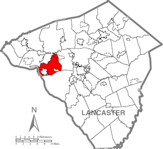
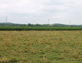
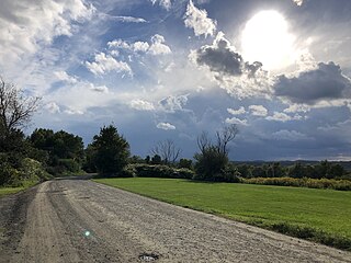
West Hempfield Township is a township in west central Lancaster County, Pennsylvania, United States. The population was 17,061 at the 2020 census.

<span class="mw-page-title-main">Bridgewater Township, Susquehanna County, Pennsylvania</span> Township in Pennsylvania, United States

Bridgewater Township is a township in Susquehanna County, Pennsylvania, United States. The population was 2,582 at the 2020 census, but is now estimated to be 2,754.

<span class="mw-page-title-main">Brooklyn Township, Susquehanna County, Pennsylvania</span> Township in Pennsylvania, United States

Brooklyn Township is a township in Susquehanna County, Pennsylvania, United States. The population was 793 at the 2020 census.

<span class="mw-page-title-main">Choconut Township, Susquehanna County, Pennsylvania</span> Township in Pennsylvania, United States

Choconut Township is a township in Susquehanna County, Pennsylvania, United States. The population was 684 at the 2020 census.

<span class="mw-page-title-main">Forest Lake Township, Susquehanna County, Pennsylvania</span> Township in Pennsylvania, United States

Forest Lake Township is a township in Susquehanna County, Pennsylvania, United States. The population was 1,121 as of the 2020 census.

<span class="mw-page-title-main">Franklin Township, Susquehanna County, Pennsylvania</span> Township in Pennsylvania, United States

Franklin Township is a township in Susquehanna County, Pennsylvania, United States. The population was 833 at the 2020 census. Salt Springs State Park, a Pennsylvania state park, is in Franklin Township.

<span class="mw-page-title-main">Gibson Township, Susquehanna County, Pennsylvania</span> Township in Pennsylvania, United States

Gibson Township is a township in Susquehanna County, Pennsylvania, United States. The population was 1,011 at the 2020 census.

<span class="mw-page-title-main">Jackson Township, Susquehanna County, Pennsylvania</span> Township in Pennsylvania, United States

Jackson Township is a township in Susquehanna County, Pennsylvania, United States. The population was 857 at the 2020 census. Children living in the township are served by the schools in the Blue Ridge School District, including Blue Ridge High School.

<span class="mw-page-title-main">Lathrop Township, Susquehanna County, Pennsylvania</span> Township in Pennsylvania, United States

Lathrop Township is a township in Susquehanna County, Pennsylvania, United States. The population was 771 at the 2020 census.

<span class="mw-page-title-main">Lenox Township, Susquehanna County, Pennsylvania</span> Township in Pennsylvania, United States

Lenox Township is a township in Susquehanna County, Pennsylvania, United States. The population was 1,598 at the 2020 census.

<span class="mw-page-title-main">Middletown Township, Susquehanna County, Pennsylvania</span> Township in Pennsylvania, United States

Middletown Township is a township in Susquehanna County, Pennsylvania, United States. The population was 283 at the 2020 census.

<span class="mw-page-title-main">New Milford Township, Susquehanna County, Pennsylvania</span> Township in Pennsylvania, United States

New Milford Township is a township in Susquehanna County, Pennsylvania, United States. The population was 1,797 at the 2020 census. Children living in New Milford Township are served by the schools in the Blue Ridge School District, including Blue Ridge High School.

<span class="mw-page-title-main">Oakland Township, Susquehanna County, Pennsylvania</span> Township in Pennsylvania, United States

Oakland Township is a township in Susquehanna County, Pennsylvania, United States. The population was 492 at the 2020 census.

<span class="mw-page-title-main">Silver Lake Township, Susquehanna County, Pennsylvania</span> Township in Pennsylvania, United States

Silver Lake Township is a township in Susquehanna County, Pennsylvania, United States. The population was 1,525 at the 2020 census. The village of Brackney is in the township.

<span class="mw-page-title-main">Springville Township, Susquehanna County, Pennsylvania</span> Township in Pennsylvania, United States

Springville Township is a township in Susquehanna County, Pennsylvania, United States that was formed during the April Session in 1814. The population was 1,469 at the 2020 census.

<span class="mw-page-title-main">Thompson Township, Susquehanna County, Pennsylvania</span> Township in Pennsylvania, United States

Thompson Township is a township in Susquehanna County, Pennsylvania, United States. The population was 440 at the 2020 census.

<span class="mw-page-title-main">Chanceford Township, York County, Pennsylvania</span> Township in Pennsylvania, United States

Chanceford Township is a township located in the southeastern portion of York County, Pennsylvania, United States. The population was 5,935 at the 2020 census. The township is home to several campsites, Allegro Vineyards, and Apollo Park. The Mason-Dixon Trail runs through the township, and it borders the Susquehanna River on the east.

References

  1. "2016 U.S. Gazetteer Files". United States Census Bureau. Retrieved August 14, 2017.
  2. 1 2 3 4 Bureau, US Census. "City and Town Population Totals: 2020—2021". Census.gov. US Census Bureau. Retrieved August 5, 2022.
  3. "Township Incorporations, 1790 to 1853". Susquehanna County Historical Society. Archived from the original on June 23, 2015. Retrieved February 12, 2016.
  4. "County Information". Susquehanna County Historical Society. Retrieved February 12, 2016.
  5. 1 2 3 "ARARAT: SECOND CLASS TOWNSHIP MAP" (PDF). Pennsylvania Department of Transportation. Commonwealth of Pennsylvania. November 4, 1999. Retrieved November 20, 2014.[ permanent dead link ]
  6. "Ararat". Geographic Names Information System . United States Geological Survey, United States Department of the Interior. August 2, 1979. Retrieved November 20, 2014.
  7. "Burnwood". Geographic Names Information System . United States Geological Survey, United States Department of the Interior. August 2, 1979. Retrieved November 20, 2014.
  8. "East Ararat". Geographic Names Information System . United States Geological Survey, United States Department of the Interior. August 2, 1979. Retrieved November 20, 2014.
  9. "Census of Population and Housing". Census.gov. Retrieved June 4, 2016.
  10. "U.S. Census website". United States Census Bureau . Retrieved 2008-01-31.
  11. "U.S. Census website". United States Census Bureau . Retrieved 2011-05-14.