Cheltenham Township, Pennsylvania

Last updated

Cheltenham Township
Home rule municipality
First Class Township
Wall house front.JPG
Richard Wall house in Elkins Park, the second-oldest house in Pennsylvania
Flag of Cheltenham Township, Pennsylvania.png
Cheltenham PA township seal.svg
Nickname: 
Cheltenhood
Motto(s): 
"Salubritas et Eruditio"
(Health and Education)
Cheltenham Township Montgomery County.png
Location of Cheltenham Township in Montgomery County, Pennsylvania
Coordinates: 40°04′00″N75°06′59″W / 40.06667°N 75.11639°W / 40.06667; -75.11639
CountryUnited States
StatePennsylvania
County
Founded
First Class Township
Home Rule Municipality
  • March 22, 1682
  • 1900
  • 1976
Area
[1]
  Total9.03 sq mi (23.4 km2)
  Land9.03 sq mi (23.4 km2)
  Water0.00 sq mi (0.0 km2)
Elevation
157 ft (48 m)
Population
 (2020) [2]
  Total37,452
  Density4,100/sq mi (1,600/km2)
Time zone UTC-5 (Eastern Standard Time)
  Summer (DST) UTC-4 (Eastern Daylight Time)
Area code(s) 215, 267 and 445
FIPS code 42-091-12968
Sister city Cheltenham, United Kingdom
Commissioners
  • Morton J. Simon Jr.
  • Daniel B. Norris
  • Irv Brockington
  • Baron B. Holland
  • Brad M. Pransky
  • Ann L. Rappoport
  • J. Andrew Sharkey
Website www.cheltenhamtownship.org

Cheltenham Township is a home rule municipality and Township of the First Class located in the southeast corner of Montgomery County, Pennsylvania, United States. It borders Philadelphia to the south and east, Abington Township and Jenkintown to the north, and Springfield Township to the west.

Contents

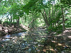
Cheltenham was founded in 1682, and its early history was defined by mills, which used Tookany Creek to power gristmills, manufacture shovels, hammers, and spades, and later carpentry products such as doors, window frames, and shutters. The development of regional railroads in the early 19th century helped power the American Industrial Revolution, connecting heavy industry factories in Philadelphia with the steel mills and other mining and heavy manufacturing industries in the Lehigh Valley to its north.

In the late 19th and early 20th centuries, Cheltenham transitioned to a community of wealthy industrial and merchant Philadelphians, who built large estates in what was still rural land. The 20th century and Great Depression established Cheltenham as one of Philadelphia's inner ring and streetcar suburbs, and attracted high density housing construction that continued into the postwar years and the 21st century. The Reading Railroad tracks in Cheltenham Township were electrified in 1931, which offered faster passenger service. In 1983, following the Reading Railroad's acquisition by Conrail, the rail lines became part of the heavily-traveled SEPTA Main Line.

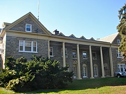
In the 21st century, historic homes and buildings designed by Frank Furness, Horace Trumbauer, and Frank Lloyd Wright coexist with split level, twin, row, and other forms of high-density housing, along with parks, arboretums, recreational and educational facilities, tree-lined streets, and commercial corridors.

History

Tookany Creek in Cheltenham Township contributed to the township's industrialization in the 18th century. TookanyCreek.JPG
Tookany Creek in Cheltenham Township contributed to the township's industrialization in the 18th century.
Soldiers at Camp William Penn, c. 1897 Twenty-sixth United States Colored Volunteer Infantry, massed. Camp William Penn, Pennsylvania., ca. 1897 - ca. 1897 - NARA - 533126.tif
Soldiers at Camp William Penn, c.1897
Lynnewood Hall, the former residence Peter A.B. Widener, designed by Horace Trumbauer LynnewoodHall front.jpg
Lynnewood Hall, the former residence Peter A.B. Widener, designed by Horace Trumbauer

17th century

Cheltenham was established in 1682 as part of Philadelphia County by 15 Quakers from Cheltenham, England, including Richard Wall and Tobias Leech, who purchased 4,070 acres (1,650 ha) of land from William Penn. [3] [4] Upon creation of Montgomery County in 1784, Cheltenham became the smallest township in the new county.

Cheltenham Township's 15 original founders were: [5]

NameLand SizeDate given
John West200 acres (81 ha)June 29, 1682
Nehemiah Mitchell210 acres (85 ha)July 1, 1682
John Day210 acres (85 ha)August 5, 1682
William Brown500 acres (200 ha)September 10, 1683
Everard Bolton100 acres (40 ha)September 10, 1683
John Ashmead250 acres (100 ha)September 10, 1683
Tobias Leech150 acres (61 ha)
200 acres (81 ha)
September 10, 1683
September 10, 1683
Richard Wall Sr.100 acres (40 ha)
200 acres (81 ha)
May 2, 1683
September 10, 1683
Richard Wall Jr.100 acres (40 ha)September 10, 1683
Patrick Robinson200 acres (81 ha)November 5, 1683
John Russell300 acres (120 ha)November 5, 1683
William Frampton500 acres (200 ha)January 13, 1683
Mary Jefferson300 acres (120 ha)January 13, 1683
Thomas Phillips300 acres (120 ha)June 13, 1683
Humphrey Morrey 260 acres (110 ha)May 23, 1683
Total area4,070 acres (1,650 ha)

Cheltenham was fueled by the development of various mills along Tookany Creek. Communities and villages grew around these mills and formed what is now modern Cheltenham neighborhoods. The first gristmill was built by Richard Dungworth in 1690. After changing ownership several times, the Rowland family eventually made the mill the second-largest producer of shovels in the United States. The site was demolished in 1929. [6]

18th century

The U.S. Colored Troops 3rd Regiment were the first to be trained at Camp William Penn. It is tradition that soldiers have a grand parade before leaving for war, but Philadelphia was partially a racist community at that time and the government believed that a parade might cause a riot, so it was cancelled. The leader of the Camp (Colonel Louis Wagner) was furious and made sure the next regiment to come through would have a parade. [7]

19th century

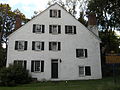
In the late 19th century, Cheltenham established itself as one of the most prominent communities in the Philadelphia area. Railroad tycoon Jay Cooke was one of the first to build his mansion in Cheltenham. His 200-acre estate was eventually converted to a school in 1883 and was later demolished. John Wanamaker built his mansion Lindenhurst, which was destroyed by a fire in 1907. His second Lindenhurst was destroyed by another fire in 1944. Henry Breyer Jr. eventually bought the land from Wanamaker.

Other notable mansions built include Abraham Barker's "Lyndon," Cyrus H. K. Curtis's "Curtis Hall," George Horace Lorimer's "Belgrame," and John B. Stetson's "Idro." Perhaps the most famous mansions that still stand to this day are the prominent Widener family mansion Lynnewood Hall, the Elkins Estate which was home to William Elkins, and Grey Towers Castle which was home to William Welsh Harrison. The latter is a National Historic Landmark and was designed by famed architect Horace Trumbauer, who designed many buildings and homes in Cheltenham. [8]

CheltTwp 18.JPG
Cheltenhamtownship 02.JPG
Valley Rd, Melrose Park PA.JPG
Cheltenham's housing stock is very diverse with rowhouses and townhouses along Cheltenham Avenue and old historic neighborhoods as well.

As the Gilded Age ended and the Great Depression hit the country, many of the estates and mansions were destroyed and made way for the building of houses in their place. Many of the communities that were formed in the early stages of Cheltenham remained, and still exist to this day.

As the 20th century progressed, many people moved out of the city and into the first community over the city line, Cheltenham. With the population increase, the township's identity evolved from being largely a community of prominent Philadelphians and their mansions to several distinct communities. One of the major groups to come to Cheltenham was Koreans. The original Koreatown was located in the Olney section of Philadelphia, but eventually was moved north to Logan. Large pockets of Koreans were eventually established in Cheltenham, and also in Upper Darby Township and West Philadelphia. [9]

Other immigrants migrated to Cheltenham, making it one of the most diverse municipalities in the Delaware Valley. By the 2000 census, Cheltenham Township was one of two municipalities in Montgomery County that had a non-white population exceeding 20 percent; the other was Norristown. [10]

Cheltenham and other early communities in the Philadelphia area, including Upper Darby Township, Haverford, Lower Merion, and Jenkintown have retained their distinct identities while being surrounded by suburbia over the middle to late part of the twentieth century.

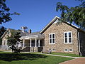
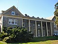
Cheltenham and Lower Merion are of the few townships in Montgomery County who had a large population prior to the postwar population boom and thus whose majority of houses, communities, and streets have remained virtually unchanged since the early 20th century. Cheltenham has 13 listings on the National Register of Historic Places, the most of any municipality in Montgomery County. Cheltenham became a township of the first class in 1900. In 1976, it passed a home rule charter that took effect in 1977.

Cheltenham was the former home of Cradle of Liberty Council Breyer Training Area. Henry W. Breyer Jr. used property formerly owned by Cheltenham resident John Wanamaker. It closed in 1990 and is now the home of Salus University.

Cheltenham was named a Preserve America community, a U.S. government program established to preserve historic communities throughout the United States. [11]

It is also a Tree City USA member, a program dedicated to forestry management.

In 2013, Cheltenham Township was named a "Classic Town of Greater Philadelphia," for being "one of the most diverse, unique, and livable communities in our region" and "truly at the center of it all." [12]

Books

There are at least four books about Cheltenham Township's history:

Unincorporated districts

Cheltenham Township has ten districts: Glenside, Laverock, Edge Hill, Wyncote, Cedarbrook, Chelten Hills, La Mott, Elkins Park, Melrose Park, and Cheltenham Village.

Township seal

The seal of Cheltenham was adopted from the seal of the namesake and sister city, Cheltenham, England. It appears on all formal documents, resolutions, proclamations, and all legal records or documents. The pigeon on top of a blue sphere represents the founding of the fountain spa which made Cheltenham famous. They are placed above a wreath of Oak leaves. The two books represent Education, in particular, the Pates Grammar School and the Cheltenham College. The silver cross in the middle represents religion. The two pigeons represent the flock that would gather at the spas. Finally, the Oak tree represents the many Oak trees that line the streets of Cheltenham and promenades. [13]

Geography

The Cheltenham Township Municipal Building on Old York Road Breyer Old York Montco PA.jpg
The Cheltenham Township Municipal Building on Old York Road

Cheltenham is a residential township in the southeasternmost part of Montgomery County, which is in Southeastern Pennsylvania (locally known as the Delaware Valley). It is one of seven municipalities in Montgomery County that borders Philadelphia and is 5 miles (8.0 km) northeast of the Center City. It also borders Abington Township and Jenkintown on the north side and Springfield Township on the west side.

According to the U.S. Census Bureau, the township has a total area of 9.0 square miles (23 km2), all land. The area consists of rolling hills and also features a few streams flowing through it, most notably the Tookany Creek. The highest elevation is 411 feet (125 m), at the intersection of Sunset and Lindley Roads. The lowest elevation is 63 feet (19 m), in the southeasternmost part of the township, where Tookany Creek flows into Philadelphia. It includes the census-designated places of Arcadia University, Glenside, and Wyncote. Other communities include Cheltenham, Elkins Park, Melrose Park, La Mott and Laverock, Edge Hill, and Cedarbrook. All of the communities form a border with Philadelphia along Cheltenham Avenue.

Communities in Cheltenham

PlaceTypeAreaPopulationDensityZip Code
Arcadia University CDP0.057 square miles (0.15 km2)59510,438.619038
Cheltenham (Cheltenham Village)CDP0.43 square miles (1.1 km2)4,8105,70519012
Elkins Park CDP2.1 square miles (5.4 km2)9,2604,63019027
Glenside CDP1.3 square miles (3.4 km2)8,3846,449.219038
La Mott Unincorporated community0.261 square miles (0.68 km2)355413,616.719027
Melrose Park Unincorporated community0.660 square miles (1.71 km2)3,0064,554.519027
Wyncote CDP0.8 square miles (2.1 km2)3,0443,80519095

Edge Hill, Laverock, and Cedarbrook's exact populations and land area are uncertain.

Demographics

The home of Cyrus H. K. Curtis, a longtime Cheltenham resident Curtis residence.jpg
The home of Cyrus H. K. Curtis, a longtime Cheltenham resident
The grave of Hall of Fame Philadelphia Athletics manager Connie Mack in Holy Sepulchre Cemetery ConnieMackGrave.JPG
The grave of Hall of Fame Philadelphia Athletics manager Connie Mack in Holy Sepulchre Cemetery

As of the 2010 census, Cheltenham Township was 56.6% White, 32.8% Black or African-American, 0.2% Native American, 7.7% Asian, and 2.5% were two or more races. 3.9% of the population were of Hispanic or Latino ancestry. The median income for a family in Cheltenham in the 2010 Census was $72,584. [14]

In 2020, the median income for a family in Cheltenham was $129,338 and for a married couple family it was $146,884 [15] vs $123,768 and $139,871 respectively for Montgomery County as a whole. [16]

According to the 2010 Census, 30.4% of the townships households had children under the age of 18 living with them, 53.4% were headed by married couples living together, 10.6% had a female householder with no husband present, and 32.8% were non-families. 27.6% of all households were made up of individuals, and 12.5% had someone living alone who was 65 years of age or older. The average household size was 2.47 and the average family size was 3.05. The age distribution was 22.8% under 18, 8.5% from 18 to 24, 25.9% from 25 to 44, 24.1% from 45 to 64, and 18.6% who were 65 or older. The median age was 40 years. For every 100 females, there were 86.3 males. For every 100 females age 18 and over, there were 81.0 males.

In 2020, the median income for a household in the township was $96,136, [17] up from $61,713 in 2010.

In 2010, males had a median income of $50,564 versus $36,439 for females. The per capita income for the township in 2010 was $31,424 (~$42,170 in 2022). About 3.0% of families and 8.4% of the population were below the poverty line, including 6.5% of those under age 18 and 3.2% of those age 65 or over.

Weather

Cheltenham is located on the borderline of the humid subtropical climate (Cfa) and the hot-summer humid continental climate (Dfa) zones. As with most Northeast townships, Cheltenham has four distinct seasons. Summers are warm and have occasional heat waves. Autumn is cool and comfortable. Winters are cold, most days hovering around the freezing mark with nights dipping to the teens. Spring is pleasant with often not too much precipitation. The hardiness zone is 7a.

The largest snowstorm as of late was in 2010, when the first storm came on February 5–6 and nearly 30 inches (76 cm) of snow fell. Just two days later, a second storm came and dropped another 20 inches (51 cm).

Climate data for Elkins Park, Cheltenham Township
MonthJanFebMarAprMayJunJulAugSepOctNovDecYear
Mean daily maximum °F (°C)38
(3)
42
(6)
50
(10)
62
(17)
72
(22)
81
(27)
85
(29)
84
(29)
77
(25)
65
(18)
54
(12)
43
(6)
63
(17)
Mean daily minimum °F (°C)21
(−6)
24
(−4)
32
(0)
41
(5)
51
(11)
62
(17)
67
(19)
65
(18)
56
(13)
43
(6)
34
(1)
23
(−5)
43
(6)
Average precipitation inches (mm)3.44
(87)
3.01
(76)
4.32
(110)
4.12
(105)
4.37
(111)
4.60
(117)
5.05
(128)
3.98
(101)
4.58
(116)
3.82
(97)
3.92
(100)
4.23
(107)
49.44
(1,255)
Source: The Weather Channel [20]
Climate data for Cheltenham (Elevation: 125 ft (38 m)) 1981 - 2010 Averages
MonthJanFebMarAprMayJunJulAugSepOctNovDecYear
Mean daily maximum °F (°C)40.6
(4.8)
43.9
(6.6)
52.0
(11.1)
63.3
(17.4)
73.0
(22.8)
82.3
(27.9)
86.3
(30.2)
84.9
(29.4)
78.0
(25.6)
66.7
(19.3)
55.9
(13.3)
44.9
(7.2)
64.4
(18.0)
Daily mean °F (°C)33.2
(0.7)
35.9
(2.2)
43.2
(6.2)
53.7
(12.1)
63.2
(17.3)
72.8
(22.7)
77.3
(25.2)
76.0
(24.4)
68.8
(20.4)
57.3
(14.1)
47.5
(8.6)
37.7
(3.2)
55.6
(13.1)
Mean daily minimum °F (°C)25.8
(−3.4)
27.8
(−2.3)
34.3
(1.3)
44.0
(6.7)
53.4
(11.9)
63.2
(17.3)
68.4
(20.2)
67.1
(19.5)
59.6
(15.3)
48.0
(8.9)
39.2
(4.0)
30.4
(−0.9)
46.9
(8.3)
Average precipitation inches (mm)3.46
(88)
2.77
(70)
4.10
(104)
3.92
(100)
4.15
(105)
4.12
(105)
4.96
(126)
4.24
(108)
4.29
(109)
3.71
(94)
3.52
(89)
3.92
(100)
47.16
(1,198)
Average relative humidity (%)65.561.657.357.261.463.565.066.968.067.966.566.664.0
Average dew point °F (°C)22.9
(−5.1)
24.0
(−4.4)
29.1
(−1.6)
38.9
(3.8)
49.7
(9.8)
59.7
(15.4)
64.6
(18.1)
64.2
(17.9)
57.8
(14.3)
46.8
(8.2)
36.9
(2.7)
27.6
(−2.4)
43.6
(6.4)
Source: PRISM [21]

Politics and government

Presidential elections results [22]
Year Republican Democratic
2020 13.9% 3,20185.3%19,635
2016 13.9% 2,92882.8%17,501
2012 18.1% 3,78380.9%16,873
2008 19.3% 4,04380.0%16,728
2004 22.7% 4,69077.0%15,866
2000 22.0% 4,10676.0%14,169
1996 23.2% 4,04070.1%12,190
1992 24.3% 4,72365.0%12,624

Cheltenham Township does not have a mayor. Rather it is governed by a Board of Commissioners, who are elected one from each of the township's seven wards for a four-year term. A President of the Board is elected by these commissioners for a one-year term to serve as the head of the government. Daniel B. Norris is the current Board President. A school board is in charge of the school district.

The township is in the Fourth Congressional District (represented by Rep. Madeleine Dean), and Pennsylvania's 154th Representative District (represented by Rep. Napoleon Nelson). It is also in Pennsylvania's 4th Senatorial District (represented by Sen. Arthur L. Haywood III).

Cheltenham is currently a very Democratic heavy community, winning by large margins in each of the past six presidential elections. The only municipality in Montgomery County in the 2012 election that had a higher Democratic voting percentage was Norristown's 82.99%, compared to Cheltenham's 80.85%. [23]

Cheltenham is one of only seven Townships in Pennsylvania, and of 29 municipalities in the entire state, to prohibit discrimination on the basis of sexual orientation and gender identity by executive order. [24]

Commissioners

The following is a table of the current commissioners of Cheltenham Township along with their Wards and the areas of the township they serve:

NameWardArea Served
Matthew Areman1 Glenside and Edgehill
Baron B. Holland2 Laverock, Cedarbrook, west Wyncote and Curtis Hills
Brad M. Pransky3 La Mott, west Elkins Park and Wyncote
Ann L. Rappoport4Lynnewood Gardens, north Wyncote, west Elkins Park and east Glenside
Daniel B. Norris5 Melrose Park
Mitchell Zygmund-Felt6 Elkins Park
Irv Brockington7 Cheltenham Village, Rowland Park and Oak Lane Manor

Education

Cheltenham High School, established in 1884 Chsfront2.jpg
Cheltenham High School, established in 1884

The Cheltenham Township School District serves the township. There are seven public schools and a number of private schools. Public schools include Cheltenham Elementary School (k-4), Myers Elementary School (k-4), Glenside Elementary School (k-4), Wyncote Elementary School (k-4), Elkins Park School (5–6), Cedarbrook Middle School (7–8), and Cheltenham High School (9–12).
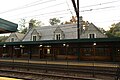
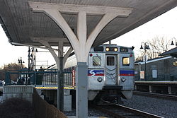
Bishop McDevitt High School (9–12) under the jurisdiction of the Roman Catholic Archdiocese of Philadelphia, was a private Catholic high school open from 1958 until its closure in 2021. Other current day private schools include Wyncote Academy, Perelman Jewish Day School, Ancillae-Assumpta Academy, Presentation B.V.M. School and Gospel of Grace Christian School.

The section of Elkins Park in Cheltenham is the former home of Tyler School of Art, a conceptual fine-arts school that is part of Temple University. Cheltenham is also home to Arcadia University (formerly known as Beaver College), Salus University (formerly known as The Pennsylvania College of Optometry), Westminster Theological Seminary, Gratz College and Reconstructionist Rabbinical College, the only seminary affiliated with Reconstructionist Judaism. Cheltenham was also the former home of the Oak Lane Day School for 44 years until it moved to its current home in Blue Bell.

Infrastructure

Transportation

Glenside Station Glensidestation2.JPG
Glenside Station
Melrose Park Station SEPTA Melrose Park Station.jpg
Melrose Park Station
Jenkintown-Wyncote Station Jenkintown Platform.JPG
Jenkintown-Wyncote Station
SEPTA Buses waiting on the docks at the Cheltenham-Ogontz Bus Loop CheltTwp 22.JPG
SEPTA Buses waiting on the docks at the Cheltenham-Ogontz Bus Loop
Cheltenham-Ogontz Bus Loop waiting area CheltTwp 27.JPG
Cheltenham-Ogontz Bus Loop waiting area
Elkins Park Fire Company Engine 3 in 1997 Elkins Park Fire Company Engine 3.jpg
Elkins Park Fire Company Engine 3 in 1997

Regional Rail

Cheltenham is a major thoroughfare for SEPTA Regional Rail. All trains going north of Center City (with the exception of the Trenton Line) pass through Cheltenham. This includes the Airport Line, Lansdale/Doylestown Line, West Trenton Line, Warminster Line and the Fox Chase Line. Following Cheltenham, many of the lines split to their respective destinations, which makes Cheltenham stations some of the busiest in Montgomery County. The stations carry the names of the neighborhoods in which they are located: Elkins Park, Glenside, and Melrose Park. Jenkintown-Wyncote and Cheltenham straddle the township's border.

StationLinesZoneBus ConnectionsWeekday Boardings (2013)
Cheltenham 270, 18, 24368
Elkins Park 228587
Jenkintown-Wyncote 3771655
Melrose Park 228505
Glenside 322, 771230

Buses

Cheltenham is served by many SEPTA City Division buses. Many of the buses originate at the Cheltenham-Ogontz Bus Loop, which is located at the northwest corner of the intersection of Ogontz Avenue (Pennsylvania Route 309) and Cheltenham Avenue. The loop is across the street from Greenleaf at Cheltenham, which attracts many shoppers from North Philadelphia. Several other buses run throughout other major streets in the township, as well as residential streets. The following routes are in Cheltenham:

Cheltenham ranked in the top three municipalities in Montgomery County for percentage of population who uses Bus/Trolley and Regional Rail. [26]

In addition, Cheltenham Township partners with the Montgomery County-sponsored Suburban Transit Network, Inc. (TransNet) to subsidize free transportation for residents ages 65 and older anywhere in the Township on Mondays through Fridays from 9 am to 3:30 pm.

As of 2016 Taiwanese airline EVA Air provides a private bus service to and from John F. Kennedy International Airport in New York City for customers based in the Philadelphia area. It stops in Cheltenham. [27]

Roads

PA 309 northbound at PA Route 152 in Cheltenham Township 2022-10-11 13 25 34 View north along Pennsylvania State Route 309 (Fort Washington Expressway) from the overpass for Pennsylvania State Route 152 (Easton Road) in Cheltenham Township, Montgomery County, Pennsylvania.jpg
PA 309 northbound at PA Route 152 in Cheltenham Township

As of 2019, there were 124.14 miles (199.78 km) of public roads in Cheltenham Township, of which 26.93 miles (43.34 km) were maintained by the Pennsylvania Department of Transportation (PennDOT) and 97.21 miles (156.44 km) were maintained by the township. [28]

There are several major roads in Cheltenham Township. Cheltenham Avenue is a major roadway and is an easy access point to many of the other roadways like Pennsylvania Route 611 and Pennsylvania Route 309. It is also the border between Cheltenham Township, Montgomery County, Pennsylvania and the City of Philadelphia, Philadelphia County, Pennsylvania. Cheltenham Avenue ends on the westside at Paper Mill Road in Wyndmoor, Pennsylvania which is part of Springfield Township. Pennsylvania Route 73 is one of the major roadways in Cheltenham Township, known as 'Church Road' and 'Township Line Road' because it is the border line between Cheltenham and Abington Townships. Pennsylvania Route 309 starts in Cheltenham Township and serves as a major highway. It goes through multiple counties and ends up in PA 29 in Monroe Township in Wyoming County. Pennsylvania Route 152 starts in Cheltenham Township and is known as 'Limekiln Pike.' It ends on the north end of Pennsylvania Route 309 in Telford. Pennsylvania Route 611 starts in Philadelphia and runs through Cheltenham Township as Old York Road. It is the main access road to Willow Grove in Abington and Upper Moreland Townships.

Many of the roads in Philadelphia continue into Cheltenham such as Old York Road, Willow Grove Avenue, Limekiln Pike, Ogontz Avenue, Washington Lane, 12th Street, Oak Lane, Oak Lane Road, 2nd Street, Hasbrook Avenue, Cottman Avenue, Central Avenue, Ryers Avenue and Church Road.

Cheltenham was one of several communities in Pennsylvania to make the United States Main Street Program. Locations receiving this honor were:

  • Glenside – Easton Road from Arcadia University north to Mt. Carmel Avenue, and Glenside Avenue between Limekiln Pike and Keswick Avenue, and Rices Mill Road and Glenside Avenue.
  • Cheltenham Village – Central and Ryers Avenues between Cottman Avenue and Old Soldiers Road, and Cottman Avenue between Hasbrook Avenue and the Church Road vicinity.
  • East Cheltenham Avenue – East Cheltenham Avenue from the SEPTA train tracks to Bell Mawr Road.
  • Elkins Park East – High School Road and Montgomery Avenue area.
  • Elkins Park West – Old York Road between Township Line Road and Chelten Hills Drive, and Church Road between Brookside Road and the train tracks.

Fire services

The Cheltenham Township Fire Department consists of five all volunteer fire companies.

Police

The Cheltenham Police Department was founded in 1903. In 2008, the department responded to over 25,000 calls. With 73 full-time sworn officers in 2016, the department is the third largest in Montgomery County. [29]

In 2016, a member of canine unit, Odie, was the top-ranked explosives detection dog in the United States. [30]

Libraries

Cheltenham Township has four libraries, which are the East Cheltenham Free Library, Elkins Park Free Library, La Mott Free Library, and the Glenside Free library.

Notable people

Michael Brecker Brecker @ jazz for kerry.jpg
Michael Brecker
Cyrus H. K. Curtis Cyrus Curtis 001.jpg
Cyrus H. K. Curtis
Reggie Jackson George Steinbrenner s life work 13july2010 000120 Reggie Jackson signs with the Yankees.jpg
Reggie Jackson
Mark Levin Mark Levin.jpg
Mark Levin
Lil Dicky Lil Dicky Performing at SXSW.jpg
Lil Dicky
William Lukens Elkins William Lukens Elkins.jpg
William Lukens Elkins
Lucretia Mott Lucretia Mott at the National Portrait Gallery IMG 4403.JPG
Lucretia Mott
Benjamin Netanyahu Benjamin Netanyahu portrait.jpg
Benjamin Netanyahu
Wallace Triplett Wallace Triplett - 1950 Bowman.jpg
Wallace Triplett
John Wanamaker John Wanamaker.jpg
John Wanamaker

Fictional residents

Miscellaneous

Cheltenham, England

Cheltenham is officially twinned with their namesake, Cheltenham, England.

Points of interest

Site nameImageLocationYear BuiltComment
1 Curtis Arboretum Curtis Hall I.JPG 1250 West Church Road1937Former home of Cyrus H. K. Curtis
2 Camptown Historic District Camptown Historic District, Cheltenham PA 03.JPG La Mott1860sMajor Stop on Underground Railroad, Housed Camp William Penn
3 Grey Towers Castle Grey Towers Castle, Southern Side 01.JPG Glenside1893Now part of Arcadia University
4 Milmoral Milmoral.JPG 1150 Church Road1905Adjacent to Curtis Arboretum
5 Wall House Wall House.jpg Wall Park Drive, Elkins Park1682Oldest House in Pennsylvania, 2nd Oldest Building in Pennsylvania
6 Beth Sholom Synagogue Beth Sholom.jpg 8231 Old York Road1954Only Synagogue ever designed by famed architect Frank Lloyd Wright
7 St. Paul's Episcopal Church St Pauls Elkins Park PA.jpg Old York Road1861Conceived and designed by Cheltenham resident Jay Cooke with later additions by Horace Trumbauer
8 Rowland House Rowland House, Cheltenham PA 04.JPG 300 Ashbourne Road1774Also known as the Shovel Shop
9 Glenside Memorial Hall Glenside Memorial Hall Montco PA.jpg 185 South Keswick Avenue1926Built to Honor World War I Veterans, now honors all Veterans
10 Elkins Railroad Station ElkinsParkStation.JPG 7879 Spring Avenue1898Originally Built by the Reading Railroad
11 George K. Heller School Cheltenham Center for the Arts 01.JPG 439 Ashbourne Road1883Now the Cheltenham Arts Center
12 Henry West Breyer Sr. House Breyer Old York Montco PA.jpg 8230 Old York Road1915Now the Cheltenham Township Building
13 Wyncote Historic District Wycote homes.JPG Wyncote1896Many homes designed by famed local architect, Frank Furness. The district contains 178 contributing properties.
14 Jenkintown-Wyncote Station Jtown station.jpg Wyncote1872Originally built by the North Pennsylvania Railroad, part of the Wyncote Historic District

Pennsylvania Historic Site

Other points of interest

See also

Related Research Articles

<span class="mw-page-title-main">Montgomery County, Pennsylvania</span> County in Pennsylvania, United States

Montgomery County, colloquially referred to as Montco, is a county in the Commonwealth of Pennsylvania. As of the 2020 census, the population of the county was 856,553, making it the third-most populous county in Pennsylvania after Philadelphia and Allegheny counties.

<span class="mw-page-title-main">Abington Township, Montgomery County, Pennsylvania</span> Township in Pennsylvania, United States

Abington Township is a township in Montgomery County, Pennsylvania, United States. It is adjacent to Philadelphia's northern fringe. The population was 58,502 as of the 2020 census, making it the second most populous township in Montgomery County after Lower Merion Township. The population density is 3603.3 per square mile (1,377/km2), making it the second most densely populated township in Montgomery County after Cheltenham Township.

<span class="mw-page-title-main">Glenside, Pennsylvania</span> Place in Pennsylvania, United States

Glenside is a census-designated place (CDP) located in Cheltenham Township and Abington Township in Montgomery County, Pennsylvania, United States. It borders Northwest Philadelphia. The population was 7,737 at the 2020 census on a land area of 1.3 square miles.

<span class="mw-page-title-main">Jenkintown, Pennsylvania</span> Borough in Pennsylvania, United States

Jenkintown is a borough in Montgomery County, Pennsylvania. It is approximately 10 miles (16 km) north of Center City Philadelphia.

<span class="mw-page-title-main">Wyncote, Pennsylvania</span> Place in Pennsylvania, United States

Wyncote is a census-designated place (CDP) in Cheltenham Township, Montgomery County, Pennsylvania, United States. It borders the northwestern and northeastern section of Philadelphia. Wyncote is located 11 miles from Center City Philadelphia at the southeasternmost tip of Montgomery County. The Jenkintown-Wyncote SEPTA station is the fifth busiest regional rail station in the SEPTA system.

Lawncrest is a neighborhood in the "Near" (lower) Northeast Philadelphia, Pennsylvania. The name is an amalgam of Lawndale and Crescentville, the two primary communities that make up the neighborhood. The Philadelphia Inquirer does not consider Lawncrest to be a neighborhood.

<span class="mw-page-title-main">Elkins Park, Pennsylvania</span> Unincorporated community in Montgomery County, Pennsylvania, United States

Elkins Park is an unincorporated community in Montgomery County, Pennsylvania, United States. It is split between Cheltenham and Abington Townships in the northern suburbs outside of Philadelphia, which it borders along Cheltenham Avenue roughly 7 miles (11 km) from Center City. The community is four station stops from Center City on Septa Regional Rail. It was listed as a census-designated place prior to the 2020 census.

<span class="mw-page-title-main">Fern Rock, Philadelphia</span> Neighborhood of Philadelphia in Pennsylvania, United States

Fern Rock is a neighborhood in the upper North Philadelphia section of Philadelphia, Pennsylvania, United States, bounded by Olney to the east, Ogontz to the west, Logan to the south, and East Oak Lane to the north. It is approximately situated between Broad Street, Tabor Road, 7th Street, Godfrey Avenue and Fisher Park. Fern Rock borders Ogontz at Broad Street, Logan at Olney Avenue, East Oak Lane at Godfrey Avenue, and Olney at the train tracks.

<span class="mw-page-title-main">West Oak Lane, Philadelphia</span> Neighborhood of Philadelphia in Pennsylvania, United States

West Oak Lane is a neighborhood in Northwest Philadelphia, Pennsylvania, United States. The neighborhood was developed primarily between the early 1920s and late 1930s, with the areas near to Cedarbrook constructed after World War II. At the northeast corner of Limekiln Pike and Washington Lane was the site of the Cedar Park Inn, a historic tavern built in the early 19th century, which was torn down sometime after 1931 as the neighborhood was being fully developed.

<span class="mw-page-title-main">Elkins Park station</span>

Elkins Park station is a SEPTA Regional Rail station located in the Elkins Park neighborhood of Cheltenham Township in Montgomery County, Pennsylvania. The station building is listed on the National Register of Historic Places for its notable architecture. The station is located at the intersection of Park Avenue and Spring Avenue. Elkins Park station is served by the Warminster Line, West Trenton Line, and Lansdale/Doylestown Line.

<span class="mw-page-title-main">Logan, Philadelphia</span> Neighborhood of Philadelphia in Pennsylvania, United States

Logan is a neighborhood in the upper North Philadelphia section of the city of Philadelphia, in the U.S. state of Pennsylvania. The majority of the neighborhood falls within the 19141 zip code, but some of it falls within 19140. The neighborhood is sometimes confused with the Olney neighborhood of Philadelphia. Olney Avenue extends from both the Olney and Logan neighborhoods of the city. The Olney Transportation Center is located in Logan.

<span class="mw-page-title-main">Olney Transportation Center</span> Rapid transit station in Philadelphia

The Olney Transportation Center, also called Olney Terminal, is a SEPTA bus and subway station in Philadelphia, Pennsylvania. It is located at the intersection of Broad Street and Olney Avenue in the Logan neighborhood of Northwest Philadelphia. It is a major bus terminal as well as the last subway stop on the Broad Street Line before the Fern Rock Transportation Center terminus.

Bristol Township was a township that was located in Philadelphia County, Pennsylvania, United States. The township ceased to exist and was incorporated into the City of Philadelphia following the passage of the Act of Consolidation, 1854. It is the modern day Olney-Oak Lane Planning Analysis Section, though with a slight difference in the southern border. It is in present-day North Philadelphia, although Olney-Oak Lane is sometimes considered to be separate from North Philadelphia entirely because of their unique architecture, culture and differing patterns of development.

<span class="mw-page-title-main">Cheltenham Township School District</span> School district in Pennsylvania

The Cheltenham Township School District is a public school district serving Cheltenham Township in Montgomery County, Pennsylvania. The district is one of the 500 public school districts of Pennsylvania. The District encompasses approximately 9 square miles (23 km2). According to 2020 federal census data, it serves a resident population of 37,452.

<span class="mw-page-title-main">Pennsylvania Route 232</span> State highway in Pennsylvania, US

Pennsylvania Route 232 (PA 232) is a 25.2-mile-long (40.6 km) state highway located in southeastern Pennsylvania. The southern terminus of the route is at U.S. Route 1 (US 1)/US 13 at the Oxford Circle in Philadelphia. The northern terminus is at PA 32 in the borough of New Hope, Bucks County, on the banks of the Delaware River. The route passes through the urban areas of Northeast Philadelphia as Oxford Avenue, serving the Lawncrest, Burholme, and Fox Chase neighborhoods. Upon entering Montgomery County, PA 232 becomes Huntingdon Pike and through suburban areas, serving the communities of Rockledge, Huntingdon Valley, and Bryn Athyn. The route passes through more suburban development in Bucks County as Second Street Pike, running through Southampton and Richboro. In Wrightstown Township, PA 232 enters rural areas and becomes Windy Bush Road as it heads north to New Hope.

<span class="mw-page-title-main">Pennsylvania Route 73</span> State highway in Pennsylvania, US

Pennsylvania Route 73 (PA 73) is a 62.32-mile (100.29 km) long east–west state highway in southeastern Pennsylvania. It runs from PA 61 near Leesport southeast to the New Jersey state line on the Tacony–Palmyra Bridge over the Delaware River in Philadelphia, where the road continues south as New Jersey Route 73. The route passes through rural areas of Berks County, crossing U.S. Route 222 (US 222) in Maiden Creek before heading southeast through Oley and Boyertown. PA 73 continues into Montgomery County and intersects PA 100 in Gilbertsville and PA 29 in Schwenksville before it heads into the northwest suburbs of Philadelphia. The route passes through Skippack and intersects US 202 in Center Square, PA 309 in Springfield Township, and PA 611 near Jenkintown. PA 73 continues through Northeast Philadelphia on Cottman Avenue, crossing US 1 and US 13 before coming to an interchange with Interstate 95 (I-95) near the Tacony–Palmyra Bridge.

<span class="mw-page-title-main">Pennsylvania Route 152</span> State highway in Pennsylvania, US

Pennsylvania Route 152 (PA 152) is a 25.3-mile-long (40.7 km) state highway located in the U.S. state of Pennsylvania. The route travels north–south from an interchange with PA 309 located in the Cedarbrook neighborhood of Cheltenham Township in Montgomery County north to another interchange with PA 309 located northeast of Telford in Bucks County. PA 152 is known as Limekiln Pike for most of its length. From the southern terminus, the route passes through suburban areas to the north of Philadelphia, serving Dresher, Maple Glen, and Chalfont. North of Chalfont, PA 152 runs through rural suburbs of Philadelphia before reaching Silverdale. Past here, the road continues northwest through Perkasie, where it turns southwest and passes through Sellersville before reaching its northern terminus.

<span class="mw-page-title-main">Lawndale, Philadelphia</span> Neighborhood of Philadelphia in Philadelphia County, Pennsylvania, United States

Lawndale is a neighborhood in Northeast Philadelphia, Pennsylvania, United States. It is located near Rising Sun and Oxford avenues and is south of Cottman Avenue.

<span class="mw-page-title-main">SEPTA Route 6</span>

SEPTA's Trolley Route 6, also known as the Ogontz Avenue Line is a former streetcar line and current bus route, operated by SEPTA in Philadelphia, Pennsylvania.

Cheltenham Avenue is a major east-west road in Philadelphia and its suburbs. It is served by SEPTA bus routes, trolleys, regional rail, and subway. Cheltenham Avenue is an unsigned quadrant route in Montgomery County. It serves as the border between Springfield and Cheltenham townships. A section of the road along the Philadelphia border with Cheltenham Township is part of PA Route 309.

References

  1. "2016 U.S. Gazetteer Files". United States Census Bureau. Retrieved August 14, 2017.
  2. 1 2 "2020 US Census Cheltenham Township" . Retrieved March 8, 2022.
  3. Jones, Arthur Hosking. Cheltenham Township. A Sociological Analysis of a Residential Suburb. Philadelphia: University of Pennsylvania Press. 1940. 173 pages.
  4. Anonymous. "A Brief History of Cheltenham Township". Accessed January 7, 2006.
  5. "Founders of Cheltenham". Historic-lamott-pa.com. Archived from the original on November 13, 2013. Retrieved December 5, 2013.
  6. Early history
  7. "Camp Willian Penn - United States Colored Troops". www.usct.org. Archived from the original on July 15, 2007. Retrieved January 11, 2022.
  8. Estate development
  9. Dynamics of Ethnic Identity: Three Asian American Communities in Philadelphia
  10. "Delaware Valley diversity". Archived from the original on January 12, 2014. Retrieved January 12, 2014.
  11. "Preserve America". Preserveamerica.gov. March 16, 2009. Retrieved December 5, 2013.
  12. "Classic Towns". Classic Towns. Archived from the original on December 2, 2013. Retrieved December 5, 2013.
  13. "History of Township Seal". Cheltenhamtownship.org. Retrieved December 5, 2013.
  14. 2010 Montco Census Information
  15. "Explore Census Data". data.census.gov. Retrieved February 3, 2023.
  16. "Explore Census Data". data.census.gov. Retrieved February 3, 2023.
  17. "Explore Census Data". data.census.gov. Retrieved February 3, 2023.
  18. https://www.census.gov/quickfacts/table/PST045215/4209112968 [ dead link ]
  19. "Census 2020".
  20. "Average Weather for Elkins Park, PA – Temperature and Precipitation". Weather.com. October 29, 2013. Retrieved December 5, 2013.
  21. "PRISM Climate Group, Oregon State University" . Retrieved August 9, 2019.
  22. "Montgomery County Election Results". Montgomery County, Pennsylvania. Retrieved January 16, 2017.
  23. 2012 Election Results
  24. "Cheltenham Township Ordinance No. 2237-12". Cheltenham Township. February 15, 2012. Archived from the original on September 23, 2015. Retrieved July 25, 2012.
  25. "SEPTA rapid transit report" (PDF). Archived from the original (PDF) on May 24, 2013. Retrieved January 18, 2014.
  26. Montco Transportation
  27. "Service to Connect PA & NJ." EVA Air. Retrieved on February 29, 2016.
  28. "Cheltenham Township map" (PDF). PennDOT. Retrieved March 10, 2023.
  29. "About Us". Cheltenham Township. Retrieved November 3, 2016.
  30. "USPCA 2016 National Detector Dog Trials - Philadelphia" (PDF). United States Police Canine Association. Retrieved November 3, 2016.
  31. Russ, Valerie (July 12, 2021). "Dr. David Chomsky, a cardiologist who made house calls, dies at 86". Archived from the original on July 12, 2021. Retrieved July 13, 2021.
  32. Naedele, Walter F. "Stuart F. Feldman, prime Constitution Center supporter" The Philadelphia Inquirer , July 17, 2010. Accessed July 22, 2010.
  33. "Ron Perelman". Philly.com. November 20, 2013. Retrieved December 5, 2013.
  34. Kurl, Rachel (March 14, 2016). "Scare Tactics Pay off for Cheltenham's Dan Trachtenberg". Jewish Exponent. Retrieved January 24, 2020.
  35. "The Inheritance". Mad Men. Season 2. Episode 10. AMC.
  36. 'Til Death, January 1, 2000, retrieved January 15, 2016
  37. The In Crowd filming locations
Preceded by Bordering communities
of Philadelphia
Succeeded by