Fox Chase, Philadelphia

Last updated
Fox Chase
Fox Chase Farm.JPG
Street map of Philadelphia and surrounding area.png
Red pog.svg
Fox Chase
Coordinates: 40°04′52″N75°04′52″W / 40.081°N 75.081°W / 40.081; -75.081
Country Flag of the United States.svg  United States of America
State Flag of Pennsylvania.svg  Pennsylvania
County Flag of Philadelphia, Pennsylvania.svg Philadelphia
Neighborhood Flag of Philadelphia, Pennsylvania.svg  Philadelphia
Incorporated1854
Area
  Total7.3 km2 (2.83 sq mi)
Population
 (2010)
  Total20,069
  Density2,700/km2 (7,100/sq mi)
Area code(s) 215, 267, and 445

Fox Chase is a neighborhood in the lower Northeast section of Philadelphia, Pennsylvania, United States.

Contents

History

The exterior of the Old Fox Chase Hotel, long a familiar landmark at the bending intersection of Oxford Avenue and Pine Road, near Rhawn. The hotel, built in 1705, developed a thriving stagecoach business with the opening of the Fox Chase and Huntingdon Turnpike in 1848. Before 1870, it was owned by Elijah Hoffman, who operated it for many years. The hotel was sold and razed in 1940 to make way for a gasoline station. Fox Chase Hotel.jpg
The exterior of the Old Fox Chase Hotel, long a familiar landmark at the bending intersection of Oxford Avenue and Pine Road, near Rhawn. The hotel, built in 1705, developed a thriving stagecoach business with the opening of the Fox Chase and Huntingdon Turnpike in 1848. Before 1870, it was owned by Elijah Hoffman, who operated it for many years. The hotel was sold and razed in 1940 to make way for a gasoline station.

Fox Chase was historically part of Lower Dublin Township, also known as Dublin Township, a defunct township located in Philadelphia County, Pennsylvania. The township ceased to exist and was incorporated into the City of Philadelphia following the passage of the Act of Consolidation, 1854.

Philadelphia's elite once flocked to opulent vacation homes built in the lush fringes bordering the city. The area's character changed with the arrival of the railroad in 1876. Many of Philadelphia's aristocracy began to discover the attractiveness of suburban living, and built mansions here, using the railroad for convenient transport into the city.

Knowlton Mansion Knowlton.JPG
Knowlton Mansion

Fox Chase was the setting for one of America's longest running cold cases. In February 1957, the battered body of a small boy was found in a cardboard box off in the woods off Susquehanna Road. Investigators were mystified and were unable to determine his identity. Nicknamed "The Boy in the Box", "America's Unknown Child", and sometimes "The Fox Chase Boy", his case remains open. [1] He was identified as Joseph Augustus Zarelli in 2022. [2]

Location and surrounding areas

The Fox Chase section is located on the border with Montgomery County and there is an active and cooperative business community that crosses the county line into Rockledge and Huntingdon Valley.

Pennypack Park in Fox Chase PennypackFoxChase.jpg
Pennypack Park in Fox Chase

One of many parks located within Fox Chase is Pennypack Park. It is composed of woodlands, meadows and wetlands. The banks of the Pennypack Creek runs through the park from Pine Road in Fox Chase all the way to the Delaware River. The area also includes playgrounds, hiking and bike trails as well as bridle paths for horseback riding. The Pennypack Environmental Center on Verree Road is also located within the neighborhood. Many historic structures are still intact throughout Fox Chase. The Verree House on Verree Road was the site of a raid by British troops during the American Revolutionary War. [3] The trained eye can rediscover abandoned railroad grades, remnants of early mills, mill races and other reminders that generations of mankind have gathered in the "Green Heart" of Northeast Philadelphia.

Fox Chase Farm seen from Pine Road FarmFoxChase.jpg
Fox Chase Farm seen from Pine Road

Fox Chase Farm is one of the few remaining active farms in Philadelphia County and is used extensively by the School District of Philadelphia. It began in 1683 as a land grant from William Penn to Lord Stanley and then passed to the McVeigh family for over 100 years. Later, the Wistar family developed it into a self-sufficient farm until it became a Gentlemen's Farm owned by two farmers, Lorimer and Butler. Friends of Fox Chase Farm, an all-volunteer group, currently assists in maintaining and preserving this pastoral treasure for present and future generations.

William Rhawn, president of the National Bank of the Republic in 1879, built a summer residence here. To design the project, he chose architect Frank Furness, whose work was synonymous with the mansions and public buildings of the Gilded Age. The banker's country estate includes a carriage house and gatekeeper's house. He called the estate “Knowlton” because it resembled the estate in England of Rhawn's wife's great-grandfather, John Knowles. It has since been converted into a catering establishment.

Ryerss Mansion Ryerss Victorian Mansion in Burholme Park in the Fox Chase neighborhood of Philadelphia, Pennsylvania LCCN2011633355.tif
Ryerss Mansion

Ryerss Mansion is also located in Fox Chase. [4] The house was built by merchant Joseph Waln Ryerss in 1859 and dramatically overlooks Burholme Park, one of the highest vistas in Philadelphia. The mansion is home to a massive and eccentric collection of artifacts and antiquities from around the world, collected during the Ryerss family's extensive travels and exotic sojourns, from Europe, to Africa, to the Far East.

Among the historic properties located in this neighborhood are: [5]

Demographics

The median age is 36.6 years for males and 39.0 years for females. Married couples made up 40.3 percent of the neighborhood's population. The neighborhood was 80.37 Caucasian, 8.63 percent African American, 4.75 percent Asian, 2.58 percent mixed race, .07 percent Native Hawaiian and 3.6 percent other race.

The median household income for Fox Chase was $54,870 in 2011, compared with $34,207 for Philadelphia as a whole. The population below the poverty level in Fox Chase was 10 percent, compared with 28.4 percent for Philadelphia. [6]

Business

The largest employer of Fox Chase is the internationally known Fox Chase Cancer Center, a unique facility that merges cancer research with the treatment of cancer. Its researchers have won Nobel Prizes for their contributions.

Transportation

Fox Chase SEPTA station Fox Chase SEPTA station.jpg
Fox Chase SEPTA station

Public transportation is provided by several SEPTA bus routes and the Fox Chase Line regional rail service which terminates near Rhawn Street and Oxford Avenue.

Education

Public libraries

The Fox Chase Branch of the Philadelphia Free Library is located at 501 Rhawn St. at Jeanes Street. [7]

Schools

Fox Chase Elementary School a.k.a. Fox Chase Academics Plus School is a public elementary school of the School District of Philadelphia. [8] Located at 500 Rhawn St. near the library, it serves children grades K to 5.

Students move on to Baldi Middle School, [9] and George Washington High School. [10]

Saint Cecilia is a Roman Catholic School, from grades pre-k to 8. Saint Cecilia's is a part of the Archdiocese of Philadelphia. Saint Cecilia School and church is located on 535 Rhawn St.

Houses of worship

Fox Chase United Methodist Church, Loney & Fillmore Streets ChurchFoxChase.jpg
Fox Chase United Methodist Church, Loney & Fillmore Streets
St. Stephen Orthodox Cathedral, Verree Road St. Stephen Orthodox Cathedral - Philadelphia 02.jpg
St. Stephen Orthodox Cathedral, Verree Road

Location

Fox Chase's boundaries are:

See also

Related Research Articles

<span class="mw-page-title-main">Rockledge, Pennsylvania</span> Borough in Pennsylvania, United States

Rockledge is a borough in Montgomery County, Pennsylvania, United States. The population was 2,638 as of the 2020 census. Rockledge is surrounded by Abington Township and the city of Philadelphia, and shares a ZIP code with Jenkintown.

<span class="mw-page-title-main">Northeast Philadelphia</span> Neighborhood of Philadelphia in Philadelphia, Pennsylvania, United States

Northeast Philadelphia, nicknamed Northeast Philly, the Northeast and the Great Northeast, is a section of Philadelphia, Pennsylvania. According to the 2000 census, Northeast Philadelphia has a population of between 300,000 and 450,000, depending on how the area is defined. The Northeast is known as being home to a large working class Irish American population, but it is also home to Polish, German, Jewish, Russian, African American, Brazilian, Puerto Rican, Dominican, Guatemalan, Ukrainian, Indian, Chinese, and Vietnamese neighborhoods.

Roosevelt Boulevard, officially named the Theodore Roosevelt Memorial Boulevard and often referred to, chiefly by local Philadelphians, simply as "the Boulevard," is a major traffic artery through North and Northeast Philadelphia. The road begins at Interstate 76 in Fairmount Park, running as a freeway also known as the Roosevelt Boulevard Extension or the Roosevelt Expressway through North Philadelphia, then transitioning into a twelve-lane boulevard that forms the spine of Northeast Philadelphia to its end at the city line.

<span class="mw-page-title-main">Holmesburg, Philadelphia</span> Neighborhood of Philadelphia, Pennsylvania, US

Holmesburg began as a Village within Lower Dublin Township, Pennsylvania. It is now a neighborhood in the Northeast section of Philadelphia, Pennsylvania, United States. Holmesburg was named in Honor of Surveyor General of Pennsylvania Thomas Holme, who was a cartographer.

<span class="mw-page-title-main">Fox Chase station</span> SEPTA Regional Rail station

Fox Chase station is a SEPTA Regional Rail station in Philadelphia, Pennsylvania. Located near the intersection of Rhawn Street and Rockwell Avenue in the Fox Chase neighborhood, it is the current terminus of the Fox Chase Line. Fox Chase station, which has the largest number of parking spaces of any on the line (342), is the closest regional rail stop to Philadelphia's Fox Chase and Bustleton areas, and to Rockledge and Huntingdon Valley in Montgomery County. It is also the closest station to the Fox Chase Cancer Center, which is a National Cancer Institute designated Comprehensive Cancer Center.

<span class="mw-page-title-main">Rhawnhurst, Philadelphia</span> Neighborhood of Philadelphia, USA

Rhawnhurst is a residential neighborhood in the Northeast section of Philadelphia, Pennsylvania, United States, named for George and William Rhawn by area real estate developers. Roughly bordered by Cottman Avenue to the south, Pennway Street to the west, the Pennypack Creek to the north, and Roosevelt Boulevard to the east, Rhawnhurst encompasses ZIP codes 19152 and part of ZIP code 19111. The geographic center of Rhawnhurst is at the intersection of Castor Avenue and Rhawn Street.

<span class="mw-page-title-main">Burholme, Philadelphia</span> Neighborhood of Philadelphia in Pennsylvania, United States

Burholme is a neighborhood in the Northeast section of Philadelphia, Pennsylvania, United States.

<span class="mw-page-title-main">Bustleton, Philadelphia</span> Neighborhood of Philadelphia in Philadelphia County, Pennsylvania, United States

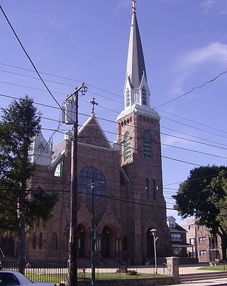
The Bustleton section of Northeast Philadelphia, United States is located in the Far Northeast, north of Rhawnhurst and Fox Chase and south of Somerton; sitting between Roosevelt Boulevard to the east, the city boundary to the west, Red Lion Road to the north, and Pennypack Park to the south, it is centered at the intersection of Grant Avenue and Bustleton Avenue (PA-532) and is completely included in the 19115 postal ZIP code.

Ashton-Woodenbridge is a neighborhood in Northeast Philadelphia, in the U.S. state of Pennsylvania. It is located on the eastern side of the far northeast, in the vicinity of Northeast Philadelphia Airport, including Wooden Bridge Run west to Academy Gardens, and south to Pennypack Park. Originally farm land, it was part of the holdings of Thomas Holme, surveyor for Philadelphia's founder, William Penn. The area was part of one of the original townships, Lower Dublin Township, until the 1854 Act of Consolidation incorporated it into the City of Philadelphia.

<span class="mw-page-title-main">Pennypack Creek</span>

Pennypack Creek is a 22.6-mile-long (36.4 km) creek in southeastern Pennsylvania in the United States. It runs southeast through lower Bucks County, eastern Montgomery County and the northeast section of Philadelphia, before emptying into the Delaware River.

<span class="mw-page-title-main">Somerton, Philadelphia</span> Neighborhood in Philadelphia, Pennsylvania, United States

Somerton is a neighborhood in the Far Northeast section of Philadelphia, Pennsylvania, United States. The neighborhood is bounded by Red Lion Road on the south, Roosevelt Boulevard on the east, East County Line Road and Poquessing Creek on the north, and the Philadelphia County / Montgomery County line on the west. Somerton is adjacent to the Philadelphia neighborhoods of Bustleton, Normandy, and Byberry, the townships of Bensalem and Lower Southampton in Bucks County, and Lower Moreland Township in Montgomery County. The area is home to a large and fast-growing foreign-born population, most notably of Russian, Ukrainian, Indian, and Central Asian immigrants.

<span class="mw-page-title-main">Knowlton Mansion</span> Historic house in Pennsylvania, United States

Knowlton Mansion, also known as the Rhawn Residence, is an historic mansion that is located in the Fox Chase neighborhood of Philadelphia, Pennsylvania, United States.

<span class="mw-page-title-main">Pennypack Park</span>

Pennypack Park is a municipal park, part of the Philadelphia Parks & Recreation system located in Northeast Philadelphia in the U.S. state of Pennsylvania. Established in 1905 by ordinance of the City of Philadelphia, it includes about 1,600 acres (6 km2) of woodlands, meadows and wetlands. The Pennypack Creek runs through the park from Pine Road to the Delaware River. The park has playgrounds, hiking and bike trails, and bridle paths for horseback riding. An adjunct to the park is the Pennypack Environmental Center on Verree Road.

<span class="mw-page-title-main">Burholme Park</span>

Burholme Park is a public park in the Burholme neighborhood of Philadelphia. The park and the Robert W. Ryerss Museum and Library was a gift of the last descendant of the Ryerss family, prominent Philadelphians. Robert W. Ryerss died on Feb. 18, 1895 at age 65, leaving his estate to Mary Reed, his wife of eight months and the head housekeeper of the Ryerss Mansion for 27 years. He left everything to her on the condition that upon her death the best part of his land and much of his estate would be left to the “People of Philadelphia, forever” as a museum and public lending library. Mary Reed Ryerss spent the rest of her life traveling around the world collecting objects for the museum and planning for the library and park.

<span class="mw-page-title-main">Pennsylvania Route 232</span> State highway in Pennsylvania, US

Pennsylvania Route 232 (PA 232) is a 25.2-mile-long (40.6 km) state highway located in southeastern Pennsylvania. The southern terminus of the route is at U.S. Route 1 (US 1)/US 13 at the Oxford Circle in Philadelphia. The northern terminus is at PA 32 in the borough of New Hope, Bucks County, on the banks of the Delaware River. The route passes through the urban areas of Northeast Philadelphia as Oxford Avenue, serving the Lawncrest, Burholme, and Fox Chase neighborhoods. Upon entering Montgomery County, PA 232 becomes Huntingdon Pike and through suburban areas, serving the communities of Rockledge, Huntingdon Valley, and Bryn Athyn. The route passes through more suburban development in Bucks County as Second Street Pike, running through Southampton and Richboro. In Wrightstown Township, PA 232 enters rural areas and becomes Windy Bush Road as it heads north to New Hope.

<span class="mw-page-title-main">Huntingdon Valley, Pennsylvania</span> Village in Pennsylvania, United States

Huntingdon Valley is a village, as well as a suburban mailing address located in Lower Moreland Township, Upper Moreland Township and Abington Township all in Montgomery County, and in small sections of Upper Southampton Township and Lower Southampton Township in Bucks County, Pennsylvania, United States, bordering the Fox Chase, Bustleton, and Somerton sections of Philadelphia.

Ryers is a neighborhood in Northeast Philadelphia, Pennsylvania, United States. It is bounded by Cottman Avenue on the southwest and Fillmore Street on the northwest. Both of these highways separate Philadelphia from Cheltenham and Rockledge, Montgomery County.

<span class="mw-page-title-main">Ryerss Mansion</span> Historic house in Pennsylvania, United States

The Ryerss Mansion, also known as the Burholme Mansion, is an historic, American mansion that is located in the Fox Chase neighborhood of Philadelphia, Pennsylvania.

Winchester Park is a neighborhood in Far Northeast Philadelphia, Pennsylvania, United States. It is located in the vicinity of Pennypack Park, north and west of Holmesburg.

<span class="mw-page-title-main">Pennypack Trail</span> Multi-use trail in Southeast Pennsylvania

The Pennypack Trail is a rail trail located in eastern Montgomery County, Pennsylvania in the United States. The trail runs 6.2 miles (10.0 km) from Rockledge north to the County Line Road border with Bucks County in Huntingdon Valley along the former alignment of SEPTA's Fox Chase-Newtown Line. The trail is maintained by the Montgomery County Division of Parks, Trails, & Historic Sites.

References

  1. "Vidocq Society Believes They Are Close To Figuring Out 'The Boy In The Box' In 61-Year-Old Philly Cold Case". 11 November 2020. Retrieved 25 September 2021.
  2. "Philadelphia Police identify the "Boy in the Box" after 65 years". 8 December 2022.
  3. "Historical Northeast Philadelphia".
  4. "Inside Northeast Philly's Temple Of Ryerss". Hidden City Philadelphia. 19 September 2017.
  5. "Look Up! 19th Century rural retreats in Northeast Philly". WHYY.
  6. "Fox Chase, Philadelphia, PA". city-data.com. Retrieved January 12, 2015.
  7. "Fox Chase Branch." Free Library of Philadelphia . Retrieved on November 7, 2008.
  8. "Fox Chase Elementary School Geographic Boundaries Archived 2016-12-11 at the Wayback Machine ." School District of Philadelphia. Retrieved on December 11, 2016.
  9. "C. C. A. Baldi Middle School Geographic Boundaries Archived 2016-03-04 at the Wayback Machine ." School District of Philadelphia. Retrieved on December 11, 2016.
  10. "George Washington High School Geographic Boundaries Archived 2016-03-04 at the Wayback Machine ." School District of Philadelphia. Retrieved on December 11, 2016.