The neighborhood gets its name from Overbrook station, where the tracks run "over the brook" of Mill Creek, one of two creeks that run thorough the neighborhood. Mill Creek enters a culvert in Montgomery County close to the station and flows underground through the center of the neighborhood and beyond before emptying into the Schuylkill River. Indian Creek runs primarily above ground through Morris Park before emptying into Cobbs Creek.[3]
History
The land that would become Overbrook, along with the rest of Philadelphia, made up part of the vast Northeastern coastal forests inhabited by the Lenape people. European settlers moved inland from the Delaware River in the 17th century,[3] including Welsh settlers who acquired land in the areas west of Philadelphia in the 1680s, establishing farms and mills. Several large farms owned by Welsh farmers in the Western Liberties would later become the neighborhood of Overbrook.[4]
The first residential development in the Overbrook area was the construction of the planned suburb of Overbrook Farms from the 1890s through the 1920s. In 1892, the investment bank Drexel & Company, led by Anthony Joseph Drexel, began buying up agricultural land near Overbrook station. Working with the architects Herman Wendell and Walter Bassett Smith, they began the construction of what was billed as a "suburb deluxe" for middle to upper-class families hoping to leave the city. The neighborhood had its own water system, steam heat (from the Overbrook Steam Heat Company), and electricity (from the Overbrook Electric Company), and was well connected to the city with trains running every half hour.[7][8] Overbrook Farms was designated a "historic district" in 2019 by the Philadelphia Historical Commission.[9]
Overbrook developed in various stages between 1900 and 1960. The dominant housing type is the row house, present in a wide variety of styles. Built during the early twentieth century when trolley lines were allowing middle-class Philadelphians to move out from more crowded row house communities, Overbrook was a community of choice at that time. Outside of Overbrook Farms, most of the houses in the Overbrook area date from between 1915 and 1930, when the Great Depression halted new construction nationally and locally.
In addition to rowhouses, there are a number of twin (semi-detached) houses. These semi-detached homes have two or three floors and typically are over 2,000 square feet (190m2) in size. Prime examples of typical Overbrook twin houses are along Wynnewood Road from Haverford Avenue to Malvern Avenue, North 64th Street between Lansdowne and Lebanon Avenues, or Nassau Road between North 61st and 63rd Streets. There are very few detached single-family homes in Overbrook. Single homes typically pre-date the construction of most of Overbrook's housing or came into existence on select lots after the construction of most of the rowhouses and twin houses. For example, one will see a few single-family homes on Wynnewood Road near Columbia Avenue. A large stone home remains this intersection. This home once sat on acres of land that the owner(s) sold off to developers who then constructed twin houses and rowhouses. The vast majority of the single-family, detached homes in the Overbrook area are in the Overbrook Farms neighborhood.
Demographics
Demographic information for ZIP Code 19151 covers Overbrook and Morris Park as well as parts of Carroll Park.[10] This ZIP Code as a whole is sometimes referred to as Overbrook.[11] Major trends identified in 2011 were an increase in the African American population and a drop in the White population from 1990 to 2010, a change which took place primarily in the 1990s.[11]
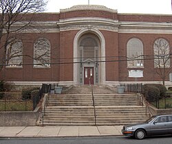
Lewis C. Cassidy School/Academics Plus School, 6523 Lansdowne Avenue, Philadelphia, Pennsylvania 19151, listed on the National Register of Historic Places[13]
Our Lady of Lourdes Catholic School and Church – 63rd and Lancaster, historic grade school attended by actor Will Smith[14]
↑ Puckett, John L. "Overbrook". West Philadelphia Collaborative History. UPenn GSE. Retrieved July 30, 2024.
↑ Rea, S.M.; Miller, J. "Map of Blockley Township, by Rea and Miller". West Philadelphia Community History Center. University of Pennsylvania University Archives and Records Center. Retrieved July 30, 2024.
This page is based on this Wikipedia article Text is available under the CC BY-SA 4.0 license; additional terms may apply. Images, videos and audio are available under their respective licenses.