Saunders Park | |
---|---|
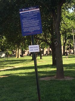
Saunders Park Green near Powelton Village | |
Coordinates: Coordinates: 39°57′32″N75°11′56″W / 39.959°N 75.199°W | |
Country | |
State | Pennsylvania |
County | Philadelphia County |
City | Philadelphia |
Area code(s) | 215, 267 and 445 |
Saunders Park is a neighborhood in the West Philadelphia section of Philadelphia, Pennsylvania. It is bounded by Powelton Avenue, 38th Street, Lancaster Avenue, and 40th Street. It is west of Powelton Village and north of Spruce Hill.
It is named for the park at the northeast corner of 39th and Powelton Avenue. The Penn Presbyterian Medical Center is next to the park.
Saunders Park is often considered to be a part of West Powelton , which extends out to 42nd Street.
The neighborhood has participated in planning for its future with the Delaware Valley Regional Planning Commission. The report of that plan is available here.
This Philadelphia County, Pennsylvania state location article is a stub. You can help Wikipedia by expanding it. |
Powelton Village is a neighborhood of mostly Victorian, mostly twin homes in the West Philadelphia section of the United States city of Philadelphia, Pennsylvania. It is a national historic district that is part of University City. It extends north from Market Street to Spring Garden Street, east to 32nd Street, west to 40th and Spring Garden Streets, and to 44th and Market Streets.
University City is the easternmost portion of West Philadelphia, encompassing several Philadelphia universities. It is situated directly across the Schuylkill River from Center City.
Cedar Park is a neighborhood of Philadelphia, Pennsylvania. Located in the larger West Philadelphia neighborhood, it stretches north to Larchwood Ave., south to Kingsessing Ave., east to 46th Street, and west to 52nd Street.
Overbrook is a neighborhood northwest of West Philadelphia, Philadelphia, in the U.S. state of Pennsylvania. The area's housing ranges from large, old homes to rowhouses to 3- and 4-story apartment buildings.
Mantua is a neighborhood in the West Philadelphia section of Philadelphia, Pennsylvania. It is located north of Spring Garden Street, east of 40th Street, south of Mantua Avenue, and west of 31st Street. The neighborhood's northern and western reaches are predominantly working-class and African American, although its southern border with Powelton Village has seen recent gentrification and an influx of Drexel University and University of Pennsylvania student renters.
Strawberry Mansion is a neighborhood in the United States city of Philadelphia, Pennsylvania, located east of Fairmount Park in North Philadelphia. The neighborhood is bounded by 33rd Street to the west, 29th Street to the east, Lehigh Avenue to the north, and Oxford Street to the south. As of the 2000 census, the neighborhood had a population of 22,562. It is often associated with the historic house of the same name, Historic Strawberry Mansion, located adjacent to the neighborhood and generally thought to be the source of the community's name.
West Oak Lane is a neighborhood in the Uptown section of Philadelphia. The neighborhood was developed primarily between the early 1920s and late 1930s, with the areas near to Cedarbrook constructed after World War II. At the northeast corner of Limekiln Pike and Washington Lane was the site of the Cedar Park Inn, a historic tavern built in the early 19th century, which was torn down sometime after 1931 as the neighborhood was being fully developed.
Cobbs Creek is a neighborhood located in the West Philadelphia section of Philadelphia, Pennsylvania, United States. Cobbs Creek is generally bounded by Market Street to the north, Baltimore Avenue to the south, 52nd Street to the east, and Cobbs Creek Parkway to the west. It is often locally referred to as "The Southside", in reference to its location to the south of Market Street and above the Baltimore Avenue border of Southwest Philadelphia, as well as a neighborhood distinction used by local street gangs in the area during the 1960s and 1970s.
Black Bottom was a predominantly African American and poor neighborhood in West Philadelphia, Pennsylvania which was mostly razed for urban renewal in the 1960s.
Schuylkill is a neighborhood in the South Philadelphia region of Philadelphia, Pennsylvania. It has many different names and has also been called Graduate Hospital (G-Ho) and Southwest Center City. Schuylkill is part of the 19146 postal code, which lies on the west side of Broad Street as far as 25th Street, where the Point Breeze neighborhood starts, and from the north side of Washington Avenue up to South Street.
Overbrook Farms is a neighborhood on the western edge of the West Philadelphia section of Philadelphia, Pennsylvania, United States. It is roughly bounded by City Avenue, 58th Street, Woodbine Avenue, and 66th Street at Morris Park. The neighborhood is bisected by Lancaster Avenue and the original Pennsylvania Railroad "main line". Today the rail line is used by both Amtrak passenger service and SEPTA's commuter Paoli/Thorndale Line.
Marconi Plaza is an urban park square located in South Philadelphia, Philadelphia, Pennsylvania. The Plaza was named to recognize the 20th Century cultural identity in Philadelphia of the surrounding Italian-American enclave neighborhood and became the designation location of the annual Columbus Day Parade.
Pennsport is a neighborhood in the South Philadelphia section of Philadelphia, Pennsylvania, United States.
U.S. Route 13 is a U.S. highway running from Fayetteville, North Carolina north to Morrisville, Pennsylvania. The route runs for 49.33 mi (79.39 km) through the Philadelphia metropolitan area in the U.S. state of Pennsylvania. The route enters the state from Delaware in Marcus Hook, Delaware County. It continues in a northeasterly direction through Delaware County, passing through the city of Chester before heading through suburban areas along Chester Pike to Darby. US 13 enters the city of Philadelphia on Baltimore Avenue and runs through West Philadelphia to University City, where it turns north along several city streets before heading east across the Schuylkill River along Girard Avenue. The route turns north and heads to North Philadelphia, where it runs northeast along Hunting Park Avenue. US 13 becomes concurrent with US 1 on Roosevelt Boulevard, continuing into Northeast Philadelphia. US 13 splits southeast on one-way streets before heading northeast out of the city on Frankford Avenue. The route continues into Bucks County as Bristol Pike, heading northeast to Bristol, where it turns into a divided highway. US 13 becomes a freeway in Tullytown and continues north to its terminus at US 1 near Morrisville. US 13 roughly parallels Interstate 95 (I-95) through its course in Pennsylvania.
Route 38 is a bus and former streetcar route operated by the Southeastern Pennsylvania Transportation Authority (SEPTA) in Philadelphia, Pennsylvania, United States.
East Passyunk Crossing is a South Philadelphia neighborhood. Its location is considered to be from Tasker Street to Snyder Avenue, Broad Street to 6th Street.
Carroll Park is a neighborhood in West Philadelphia. Its boundaries are Lansdowne Avenue to the north, West Girard Avenue to the south, North 63rd Street to the west, and North 52nd Street to the east. Along major streets of the neighborhood, the Carroll Park Community Council, Inc. has placed banners that say “Carroll Park: Where our neighbors become friends.” The 10 trolley runs along Lansdowne Avenue and the 15 trolley runs along Girard Avenue. There is a park by the name of Carroll Park between North 59th and North 58th Streets and West Thompson Street and West Girard Avenue. Carroll Park’s residents are primarily working-class and lower-income African-Americans.
Willis Gaylord Hale was a late-19th century architect who worked primarily in Philadelphia, Pennsylvania. His flamboyant, highly-ornate style was popular in the 1880s and 1890s, but quickly fell out of fashion in the 20th century.
Haverford North is a neighborhood in the West Philadelphia section of Philadelphia, Pennsylvania. It is located north of Haverford Avenue, east of 44th Street, south and west of Lancaster Avenue, and west of 40th Street. The neighborhood borders Mantua, Dunlap, and Powelton Village according to google maps.