Grays Ferry, Philadelphia

Last updated
Grays Ferry
Grays Rec Center.JPG
Street map of Philadelphia and surrounding area.png
Red pog.svg
Grays Ferry
Coordinates: 39°56′13″N75°11′38″W / 39.936808°N 75.193934°W / 39.936808; -75.193934
CountryFlag of the United States.svg  United States
State Pennsylvania
County Philadelphia
City Philadelphia
Area code(s) 215, 267 and 445

Grays Ferry, also known as Gray's Ferry, is a neighborhood in South Philadelphia, Pennsylvania, United States, bounded (roughly) by 25th Street on the east, the Schuylkill River on the west, Vare Avenue on the south, and Grays Ferry Avenue on the north. [1] The section of this neighborhood west of 34th Street is also known as Forgotten Bottom. [2] Grays Ferry shares borders with Southwest Center City to the North, Point Breeze to the East, and Girard Estate to the South. Gray’s Ferry is across from where Mill Creek debouches at about 43rd street. Historically, Grays Ferry was one of the largest enclaves of Irish Americans in the city, [3] and while there are still many Irish left, it is now home to a significant African American population.

Contents

History

The Floating Bridge across the Schuylkill River at Gray's Ferry was originally built by the British during their 1777-78 occupation of Philadelphia. This was the primary entrance to the city for travelers from the south until it was replaced by a permanent bridge in 1838. The Old Floating Bridge Across the Schuylkill drawing.jpg
The Floating Bridge across the Schuylkill River at Gray's Ferry was originally built by the British during their 1777-78 occupation of Philadelphia. This was the primary entrance to the city for travelers from the south until it was replaced by a permanent bridge in 1838.

The area developed near an important crossing of the Schuylkill River. In the 18th century, Gray's Ferry was the southernmost of three ferries that crossed the Schuylkill River to Philadelphia. The neighborhood's namesake ferry originally belonged to a Benjamin Chambers in the 17th century. By 1747 George Gray had taken over the ferry, and established the nearby Gray's Inn and Gray's Garden, which were popular in the 1790s. [2] [4] The river is now spanned by the Gray's Ferry Bridge and several rail bridges. [5]

Before the Act of Consolidation, 1854, this neighborhood was part of Moyamensing Township. Moyamensing was chartered by the Dutch governor Alexander d'Hinoyossa, and in 1684, William Penn confirmed the title. [6]

This neighborhood was once the site of the Schuylkill Arsenal.

The James Alcorn School, Charles Y. Audenried Junior High School, Grays Road Recreation Center, James McCann Foundation, University Avenue Bridge, and Anthony Wayne School are listed on the National Register of Historic Places. [7]

Demographics

Education

Audenried High School CY Audenreid HS Philly.JPG
Audenried High School
James Alcorn School elementary Alcorn School Philly.JPG
James Alcorn School elementary
Alcorn's middle school building (formerly King of Peace School) King of Peace School (now Alcorn ES) 4.jpg
Alcorn's middle school building (formerly King of Peace School)
St. Gabriel School St. Gabriel School Grays Ferry.jpg
St. Gabriel School

Residents are in the School District of Philadelphia. Most of Grays Ferry is zoned to Alcorn K-8 and Audenried High School. Some parts are zoned to Delaplaine McDaniel School (K-8) and South Philadelphia High School. Some parts in the southeast are zoned to Stephen Girard Elementary, E. H. Vare Middle, and Audenried High. [9] [10] [11]

Anthony Wayne School is a former school in Grays Ferry.

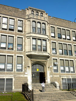
The Roman Catholic Archdiocese of Philadelphia operated King of Peace School until its 1999 closure; it and another school consolidated with St. Gabriel School to form Our Lady of the Angels School (at St. Gabriel). [12] In 2012 the former King of Peace building began to be uses for Alcorn's middle school classes. [13] The Diocese formerly operated St. Gabriel School until it became an Independence Mission School in 2012 (an action which at the time prevented its closure), and then closed completely in 2021. St. Thomas Aquinas School was to take the majority of St. Gabriel students. [14]

Tasker Homes and Greater Grays Ferry Estates

The Tasker Homes (also known as the Tasker Housing Project) were located at 29th and Morris Streets and visible from the Schuylkill Expressway. [15] Originally, the housing project had 1,100 units and followed the city's general model of high-density, low-income housing. [15]

During Mayor John Street's administration, the Philadelphia Housing Authority declared certain higher density housing as blighted, demolishing it and replacing with lower density, townhome-style public housing. In 2004, the Tasker Homes were demolished and replaced with the Greater Grays Ferry Estates. [16] The new townhomes have increased tensions between working-class residents and occupants of Section 8 housing within the neighborhood. The reasons most often cited are memories of the problems with Tasker Homes.

Racial tension

Over the years, the neighborhood has seen numerous instances of racial violence.[ citation needed ] The Irish Catholics living in the neighborhood's modest row homes clashed with African Americans living in the demolished Tasker Homes and newly built Greater Grays Ferry Estates.[ citation needed ] There have been riots and beatings and, sometimes, killings. Tensions peaked in 1997 when Nation of Islam leader Louis Farrakhan threatened to join marchers to protest racial violence, but spoke at a church rally in a compromise negotiated by Mayor Ed Rendell. [17]

In 1998 there were two separate community organizations that were dominated by each race: Grays Ferry West among black people and Grays Ferry Community Council among white people. [18]

As the housing market has boomed in Philadelphia, the neighborhood has begun to see some resurgence. Where the former housing projects intersect with the neighborhood, a group of neighbors have started turning an empty lot into a new park at 30th and Oakford, and the area is beginning to see a trickle of young professionals overflowing from the nearby Graduate Hospital area. [ citation needed ]

See also

Related Research Articles

<span class="mw-page-title-main">Kingsessing, Philadelphia</span> Neighborhood of Philadelphia in Pennsylvania, United States

Kingsessing is a neighborhood in the Southwest section of Philadelphia, Pennsylvania, United States. On the west side of the Schuylkill River, it is next to the neighborhoods of Cedar Park, Southwest Schuylkill, and Mount Moriah, as well as the borough of Yeadon in Delaware County. It is roughly bounded by 53rd Street to the northeast, Baltimore Avenue to the northwest, Cobbs Creek and 60th Street to the southwest, and Woodland Avenue to the southeast.

<span class="mw-page-title-main">South Philadelphia</span> Neighborhood of Philadelphia, Pennsylvania

South Philadelphia, nicknamed South Philly, is the section of Philadelphia bounded by South Street to the north, the Delaware River to the east and south, and the Schuylkill River to the west. A diverse working-class community of many neighborhoods, South Philadelphia is well-known for its large Italian-American population, but it also contains large Asian American, Irish-American, African-American, and Latino populations.

<span class="mw-page-title-main">West Philadelphia</span> Neighborhood of Philadelphia, Pennsylvania

West Philadelphia, nicknamed West Philly, is a section of the city of Philadelphia. Although there are no officially defined boundaries, it is generally considered to reach from the western shore of the Schuylkill River, to City Avenue to the northwest, Cobbs Creek to the southwest, and the SEPTA Media/Wawa Line to the south. An alternate definition includes all city land west of the Schuylkill; this would also include Southwest Philadelphia and its neighborhoods. The eastern side of West Philadelphia is also known as University City.

<span class="mw-page-title-main">Strawberry Mansion, Philadelphia</span> Neighborhood of Philadelphia in Pennsylvania, United States

Strawberry Mansion is a neighborhood in the U.S. city of Philadelphia, Pennsylvania, located east of Fairmount Park in North Philadelphia. The neighborhood is bounded by 33rd Street to the west, 29th Street to the east, Lehigh Avenue to the north, and Oxford Street to the south. As of the 2000 census, the neighborhood had a population of 22,562. It is often associated with the historic house of the same name, Historic Strawberry Mansion, located adjacent to the neighborhood and generally thought to be the source of the community's name.

<span class="mw-page-title-main">Southwest Center City Philadelphia</span> Neighborhood of Philadelphia in Philadelphia, Pennsylvania

Southwest Center City (SWCC), also known as Graduate Hospital, is a neighborhood that is located in South Philadelphia, Pennsylvania, United States, bordering Center City Philadelphia. The neighborhood is bordered on the north by South Street, on the south by Washington Avenue, on the west by the Schuylkill River, and on the east by Broad Street.

<span class="mw-page-title-main">Point Breeze, Philadelphia</span> Neighborhood of Philadelphia in Pennsylvania, United States

Point Breeze is a multicultural neighborhood in South Philadelphia in Philadelphia, Pennsylvania, United States. It is bounded by 25th Street to the west, Washington Avenue to the north, 18th Street to the east, and Moore Street to the south. Southwest Center City lies to its north. Passyunk Square and East Passyunk Crossing lie to its east. Point Breeze is separated from Grays Ferry to the west by a CSX railway viaduct over 25th Street.

<span class="mw-page-title-main">Southwark, Philadelphia</span> Former District in Pennsylvania, United States

Southwark was originally the Southwark District, a colonial-era municipality in Philadelphia County, Pennsylvania, United States. Today, it is a neighborhood in the South Philadelphia section of Philadelphia, Pennsylvania. Because of its location south of the early Philadelphia, the name was adopted in allusion to the borough of Southwark in the county of London, England, just south of the city of London.

<span class="mw-page-title-main">Moyamensing, Philadelphia</span> Former Township in Pennsylvania, United States

Moyamensing is an area of Philadelphia established as a Moyamensing Township during British colonial rule on the fast land of the Neck, lying between Passyunk and Wicaco. It was incorporated into Philadelphia County, Pennsylvania, United States and today encompasses several neighborhoods along the Moyamensing Avenue corridor in the South Philadelphia section of Philadelphia.

<span class="mw-page-title-main">Southwest Philadelphia</span> Neighborhood of Philadelphia in Philadelphia, Pennsylvania

Southwest Philadelphia is a section of Philadelphia, Pennsylvania, United States. The section can be described as extending from the western side of the Schuylkill River to the city line, with the SEPTA. The northern border is defined by the Philadelphia City Planning Commission as east from the city line along Baltimore Avenue moving south along 51st Street to Springfield Ave. It follows the train tracks until 49th Street. From 49th and Kingsessing Ave the line moves east along Kingsessing Ave. The line then moves south along 46th St to Paschall Ave where it jogs to join Grays Ferry where the line runs to the Schuylkill River.

<span class="mw-page-title-main">Pennsport</span> Neighborhood of Philadelphia in Pennsylvania, United States

Pennsport is a neighborhood in the South Philadelphia section of Philadelphia, Pennsylvania, United States.

<span class="mw-page-title-main">Devil's Pocket</span> Neighborhood of Philadelphia in Pennsylvania, United States

Devil's Pocket is a small neighborhood in the South Philadelphia section of Philadelphia, Pennsylvania, United States. The neighborhood, bordered by Christian and Taney streets, Grays Ferry Avenue, and the Naval Square development, consists of rowhouses tucked near an industrial landscape near the Schuylkill River. A historically Irish-American neighborhood, Devil’s Pocket has seen real estate development and gentrification in recent years, including a major expansion of the Children’s Hospital of Philadelphia.

<span class="mw-page-title-main">South Philadelphia High School</span> Public secondary school in Philadelphia, Pennsylvania, United States

South Philadelphia High School is a public secondary high school located in the Lower Moyamensing neighborhood of South Philadelphia, at the intersection of Broad Street and Snyder Avenue.

<span class="mw-page-title-main">Whitman, Philadelphia</span> Neighborhood of Philadelphia, Pennsylvania

Whitman is a neighborhood in the South Philadelphia section of Philadelphia, Pennsylvania, United States. It is bounded on the west by Sixth Street, on the east by Front Street, on the south by Bigler Street, and on the north by Snyder Avenue. The name "Whitman" was adopted when the nearby Walt Whitman Bridge was being constructed in the 1950s. In 2015, Whitman and nearby South Philadelphia neighborhoods were named by Philadelphia Magazine as one of the safest and most family-friendly neighborhoods in Philadelphia.

<span class="mw-page-title-main">West Passyunk</span> Neighborhood of Philadelphia in Pennsylvania, United States

West Passyunk is a neighborhood in South Philadelphia, Pennsylvania, United States. It is bounded by Mifflin Street to the north, West Passyunk Avenue to the south, South 18th Street to east, and South 25th Street to the west. It is served by the 1st Police District, located at 24th and Wolf Streets.

The Food Trust is a nonprofit organization. It was founded in 1992 by Duane Perry in Philadelphia, Pennsylvania. The current executive director is Yael Lehmann. The goal of the organization is to improve the health of children and adults by providing better nutrition. The Food Trust works with neighborhoods, schools, grocers, farmers and policymakers to implement a comprehensive approach to improved food access that combines nutrition education and greater availability of affordable, healthy food. It is currently operating 25 farmer's markets in the Philadelphia region. The markets accept SNAP/food stamps, Farmers’ Market Nutrition Program vouchers and Philly Food Bucks. The Food Trust is funded by private foundations, government grants, and individual donors.

<span class="mw-page-title-main">Naval Square, Philadelphia</span> Neighborhood of Philadelphia in Philadelphia County, Pennsylvania, United States

Naval Square is a gated community within the Graduate Hospital neighborhood of Philadelphia that served as the first United States Naval Academy from 1834 to 1845, when the Naval Academy formed in Annapolis. It continued as a retirement home for sailors and marines and was called the Naval Home until 1976, when the facility was relocated to Mississippi.

<span class="mw-page-title-main">Odunde Festival</span> Street festival catering to African-American interests and the African Diaspora

The Odunde Festival is a one-day festival and mostly a street market catered to African-American interests and the African diaspora. It is derived from the tradition of the Yoruba people of Nigeria in celebration of the new year according to the Yoruba calendar or Kọ́jọ́dá, which usually falls on the first moon of June (Òkudù) on the Gregorian calendar. It is centered at the intersection of Grays Ferry Avenue and South Street in the U.S. city of Philadelphia, Pennsylvania.

<span class="mw-page-title-main">Universal Audenried Charter High School</span> Public high school in Philadelphia, Pennsylvania, United States

Universal Audenried Charter High School , formerly Charles Y. Audenried High School, is a high school servicing the Grays Ferry area of Philadelphia. The school was originally located at the Charles Y. Audenried Junior High School but was rebuilt in 2008. It was previously directly operated by the School District of Philadelphia. It is still a part of the district's system, and some South Philadelphia residences are assigned to Audenried.

Lois Fernandez was a political and cultural activist, best known for founding the Odunde Festival in Philadelphia, Pennsylvania. The festival celebrates African and African-American heritage. It has continued for more than forty years, expanding from one block long to a dozen, and drawing as many as 500,000 people to South Philadelphia.

References

  1. "SCETI > PB > Grays Ferry Redevelopment Area Plan Box , Folder , Item : page 10". sceti.library.upenn.edu. Retrieved 2021-02-15.
  2. 1 2 The, Anne-Mei (2008). In death's waiting room: living and dying with dementia in a multicultural society. Amsterdam University Press. ISBN   978-90-485-0107-6. OCLC   302106079.
  3. "Global Philadelphia". Global Philadelphia Association. Retrieved February 2, 2015.
  4. Revolution, Daughters of the American (1902). Report. U.S. Government Printing Office.
  5. "Philadelphia History: Early Railroad Transportation". www.ushistory.org. Retrieved 2021-02-15.
  6. "Incorporated District, Boroughs, and Townships in the County of Philadelphia, 1854". www.ushistory.org. Retrieved 2021-02-15.
  7. "National Register Information System". National Register of Historic Places . National Park Service. July 9, 2010.
  8. "Citypaper.net". www.citypaper.net. Retrieved 2021-02-15.
  9. "School Finder". School District of Philadelphia.
  10. "School District Catchments and Related Schools". School District of Philadelphia.
  11. PDF maps as of 2012:
    "James Alcorn Elementary School Geographic Boundaries" (PDF). School District of Philadelphia. Archived from the original (PDF) on 2012-03-13. Retrieved 2023-12-31. (not the same as the boundary as of 2023)
    "Delaplaine McDaniel Elementary School Geographic Boundaries" (PDF). School District of Philadelphia. Archived from the original (PDF) on 2012-03-13. Retrieved 2023-12-31.
    "South Philadelphia High School Geographic Boundaries" (PDF). School District of Philadelphia. Archived from the original (PDF) on 2012-03-13. Retrieved 2023-12-31.
  12. O'Reilly, David (1999-05-25). "7 schools preparing to close". The Philadelphia Inquirer . Philadelphia. p. A10. - Clipping at Newspapers.com.
  13. Myers, Joseph (2012-09-06). "James Alcorn Middle Years Academy to open Friday". South Philly Review . Retrieved 2023-12-29.
  14. Zimmaro, Mark (2012-09-06). "St. Gabe's school in Grays Ferry to close after 113 years". South Philly Review . Retrieved 2023-12-29.
  15. 1 2 "Citypaper.net". www.citypaper.net. Retrieved 2021-02-15.
  16. City of Philadelphia: Neighborhood Transformation Initiative
  17. Janofsky, Michael (1997-04-15). "Philadelphia Mayor Joins Farrakhan to Calm Ethnic Tensions (Published 1997)". The New York Times. ISSN   0362-4331 . Retrieved 2021-02-15.
  18. O'Reilly, David; Cipriano, Ralph (1998-06-07). "Priest tries to heal deep Grays Ferry wounds". Philadelphia Inquirer . Philadelphia. pp. B1, B4. - Clipping of first and of second page at Newspapers.com.