
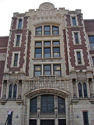
Germantown is an area in Northwest Philadelphia, Pennsylvania. Founded by Palatine, Quaker, and Mennonite families in 1683 as an independent borough, it was absorbed into Philadelphia in 1854. The area, which is about six miles northwest from the city center, now consists of two neighborhoods: 'Germantown' and 'East Germantown'.

Hunting Park is a neighborhood in the North Philadelphia section of the United States city of Philadelphia, Pennsylvania.

Strawberry Mansion is a neighborhood in the U.S. city of Philadelphia, Pennsylvania, located east of Fairmount Park in North Philadelphia. The neighborhood is bounded by 33rd Street to the west, 29th Street to the east, Lehigh Avenue to the north, and Oxford Street to the south. As of the 2000 census, the neighborhood had a population of 22,562. It is often associated with the historic house of the same name, Historic Strawberry Mansion, located adjacent to the neighborhood and generally thought to be the source of the community's name.

Kensington is a neighborhood in Philadelphia that belongs to Lower Northeast. As with all neighborhoods in the city, the lack of any official designation means the boundaries of the area vary between sources over time and are disputed among locals. Kensington, as most long-term residents view it, refers generally to the area consisting of Kensington, East Kensington, West Kensington, and Harrowgate. The adjacent Fairhill and Norris Square neighborhoods are more separate but may be included in Kensington; Fishtown and South (Olde) Kensington were historically included. The most conservative boundaries of the neighborhood, shown in the map below, are Front Street and 5th Street to the west, the Amtrak train tracks to the North, Trenton Avenue, the Trenton Avenue train tracks, and Frankford Avenue to the east, and Cecil B. Moore Avenue to the south.

North Philadelphia, nicknamed North Philly, is a section of Philadelphia, Pennsylvania. It is immediately north of Center City. Though the full extent of the region is somewhat vague, "North Philadelphia" is regarded as everything north of either Vine Street or Spring Garden Street, between Northwest Philadelphia and Northeast Philadelphia. It is bordered to the north by Olney Ave along Broad Street, Spring Garden Street to the south, 35th Street to the west and Adams Avenue to the east. The Philadelphia Police Department patrols five districts located within North Philadelphia: the 22nd, 25th, 26th, 35th and 39th districts. There are thirteen ZIP codes for North Philadelphia: 19120, 19121, 19122, 19123, 19125, 19126, 19130, 19132, 19133, 19134, 19137, 19140 and 19141.

Olney is a neighborhood in the North Philadelphia section of Philadelphia. It is roughly bounded by Roosevelt Boulevard to the south, Tacony Creek to the east, Godfrey Avenue to the north, and the railroad right-of-way west of 7th Street to the west.

Mount Airy is a neighborhood of Northwest Philadelphia in the U.S. state of Pennsylvania.
West Oak Lane is a neighborhood in Northwest Philadelphia, Pennsylvania, United States. The neighborhood was developed primarily between the early 1920s and late 1930s, with the areas near to Cedarbrook constructed after World War II. At the northeast corner of Limekiln Pike and Washington Lane was the site of the Cedar Park Inn, a historic tavern built in the early 19th century, which was torn down sometime after 1931 as the neighborhood was being fully developed.

East Falls is a neighborhood in Lower Northwest, Philadelphia, Pennsylvania, United States. It lies on the east bank of the "Falls of the Schuylkill," cataracts submerged in 1822 by the Schuylkill Canal and Fairmount Water Works projects. East Falls sits next to the Germantown, Roxborough, Allegheny West, and the Nicetown-Tioga neighborhoods. Wissahickon Valley Park separates it from Manayunk, Philadelphia.

Wayne Junction station is a SEPTA Regional Rail junction station located at 4481 Wayne Avenue, extending along Windrim Avenue to Germantown Avenue. The station is located in the Nicetown neighborhood of Philadelphia. Wayne Junction serves as a multi-modal transfer point between six of SEPTA's regional rail lines as well as three major transit routes – the Route 75 Trackless Trolley and the Route 23 and 53 bus lines. The station served more than 321,000 riders annually in 2018.
Franklinville is a neighborhood of North Philadelphia, Pennsylvania, United States. According to the City Planning Commission, the boundaries of Franklinville are roughly a triangle bounded by West Sedgley Avenue, North Broad Street, and West Hunting Park Avenue.
Logan is a neighborhood in the upper North Philadelphia section of the city of Philadelphia, in the U.S. state of Pennsylvania. The majority of the neighborhood falls within the 19141 zip code, but some of it falls within 19140. The neighborhood is sometimes confused with the Olney neighborhood of Philadelphia. Olney Avenue extends from both the Olney and Logan neighborhoods of the city. The Olney Transportation Center is located in Logan.

Fairhill is a neighborhood on the east side of the North Philadelphia section of Philadelphia, Pennsylvania, United States. Fairhill is bordered by Front Street to the east, Germantown Avenue to the west, Allegheny Avenue to the north, and Cumberland Street to the south. The neighborhood serves as the center of the Hispanic community of Philadelphia, and is known for its "El Centro de Oro" commercial strip along North 5th Street. Fairhill is adjacent to Harrowgate and West Kensington to the east, Hartranft to the south, Glenwood to the west, and Hunting Park to the north.

Juniata is a working class, predominantly Hispanic and Caucasian neighborhood in North Philadelphia, which is a section of the city of Philadelphia, Pennsylvania, United States. Juniata is located south of the Juniata Golf Club in Tacony Creek Park. It is bordered to the east by Frankford, to the west by Feltonville, and to the south by Harrowgate and Port Richmond. The neighborhood is bordered by G Street to the west, Juniata Park to the north, Tacony Creek to the east, and by SEPTA rail tracks to the south. Juniata shares the ZIP code of 19124 with the nearby neighborhood of Frankford.

At the 2010 census, there were 1,526,006 people, 590,071 households, and 352,272 families residing in the consolidated city-county of Philadelphia, Pennsylvania. The population density was 4,337.3/km2 (11,233.6/mi2). There were 661,958 housing units at an average density of 1,891.9/km2 (4,900.1/mi2).

Nicetown–Tioga is a neighborhood in the North Philadelphia section of the city of Philadelphia, in the U.S. state of Pennsylvania. It comprises two smaller, older neighborhoods, Nicetown and Tioga, although the distinction between the two is rarely emphasized today. The name "Nicetown" is often simply used to refer to any part of Nicetown–Tioga.
Upper North Philadelphia is a section of Philadelphia that is immediately north of Lower North Philadelphia, and can be described as an area that has a "...large and rapidly growing Puerto Rican population".

Philadelphia has the second largest Puerto Rican community outside of Puerto Rico after New York City. As of the 2010 U.S. Census, an estimated 121,643 Puerto Ricans were living in Philadelphia, up from 91,527 in 2000. Recent 2017 estimates by the U.S. Census Bureau put the number of Puerto Ricans living in Philadelphia at 134,934. In 2019, estimates put the number of Puerto Ricans at 146,153. Many Puerto Ricans in the Philadelphia area have engaged in circular migration in which they spend periods of time living in Philadelphia and periods of time living in Puerto Rico.
Germantown Pike is a historic road in Pennsylvania that opened in 1687, running from Philadelphia northwest to Collegeville. The road is particularly notable for the "imposing mansions" that existed in the Germantown neighborhood in Philadelphia. The road was left in ruins after the British destroyed it in the Revolutionary War during the 1777 Battle of Germantown, and was not rebuilt until 1809. Portions of Germantown Pike were signed as U.S. Route 422 (US 422) before the latter was rerouted along a freeway alignment to King of Prussia.

