The Junction Railroad was a railroad created in 1860 to connect lines west of downtown Philadelphia, Pennsylvania, and allow north-south traffic through the metropolitan area for the first time. The railroad consisted of 3.56 miles of double track and 5.3 miles of sidings. It owned no locomotives or rolling stock. The line connected the Philadelphia and Reading Rail Road line at the west end of the Columbia Bridge over the Schuylkill River, crossed the Pennsylvania Railroad line, ran parallel to Market Street, and turned south to connect with the Philadelphia, Wilmington and Baltimore Railroad at Gray's Ferry.

The Baltimore and Potomac Railroad (B&P) operated from Baltimore, Maryland, southwest to Washington, D.C., from 1872 to 1902. Controlled by the Pennsylvania Railroad, it was the second railroad company to connect the nation's capital to the Northeastern States, and competed with the older Baltimore & Ohio Railroad.

The Schuylkill Expressway, locally known as "the Schuylkill", is a freeway through southern Montgomery County and the city of Philadelphia. It is the easternmost segment of Interstate 76 (I-76) in the U.S. state of Pennsylvania. It extends from the Valley Forge interchange of the Pennsylvania Turnpike in King of Prussia, paralleling its namesake Schuylkill River for most of the route, southeast to the Walt Whitman Bridge over the Delaware River in South Philadelphia. It serves as the primary corridor into Philadelphia from points west. Maintenance and planning for most of the highway are administered through Pennsylvania Department of Transportation (PennDOT) District 6, with the Delaware River Port Authority (DRPA) maintaining the approach to the Walt Whitman Bridge.

The Keystone Corridor is a 349-mile (562 km) railroad corridor between Philadelphia and Pittsburgh, Pennsylvania, that consists of two rail lines: Amtrak and SEPTA's Philadelphia-to-Harrisburg main line, which hosts SEPTA's Paoli/Thorndale Line commuter rail service, and Amtrak's Keystone and Pennsylvanian inter-city trains; and the Norfolk Southern Pittsburgh Line. The corridor was originally the Main Line of the Pennsylvania Railroad.

The West Philadelphia Elevated, also known as the High Line or Philadelphia High Line, is a railroad viaduct in the western part of Philadelphia, Pennsylvania. The 8,140-foot (2,480 m) structure spans the railway lines of 30th Street Station, parallel to the main track of the station, in a north-south direction. The 1,045-foot (319 m) approach made of brick arches is the longest brick bridge and probably the longest brick building in the United States.

The Trenton Subdivision is a railroad line owned by CSX Transportation in the U.S. states of Pennsylvania and New Jersey. The line runs from CP NICE in Philadelphia, Pennsylvania, northeast to Port Reading Junction in Manville, New Jersey, along a former Reading Company line.

The Harrisburg Line is a rail line owned and operated by the Norfolk Southern Railway (NS) in the U.S. state of Pennsylvania. The line runs from Philadelphia west to Harrisburg.
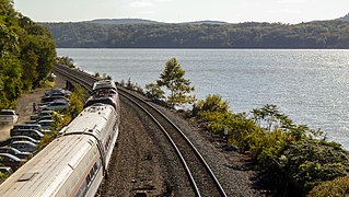
The Amtrak Hudson Line, also known as the CSX Hudson Subdivision, is a railroad line owned by CSX Transportation and leased by Amtrak in the U.S. state of New York. The line runs from Poughkeepsie north along the east shore of the Hudson River to Rensselaer and northwest to Hoffmans via Albany and Schenectady along a former New York Central Railroad line. From its south end, CSX has trackage rights south to New York City along the Metro-North Railroad's Hudson Line. The Hudson Line junctions the Castleton Subdivision in Stuyvesant, Amtrak's Post Road Branch in Rensselaer and the Carman Subdivision in Schenectady. Its northwest end is at a merge with the Mohawk Subdivision. The entirety of the line overlaps with the Empire Corridor, one of Amtrak and the Federal Railroad Administration's candidate lines for future high-speed rail.
The Rochester Subdivision is a railroad line owned by CSX Transportation in the U.S. state of New York. The line runs from Solvay, New York, west to Churchville, New York, along the former New York Central Railroad water level route. At its east end, west of downtown Syracuse, New York, the line continues west from the Syracuse Terminal Subdivision at Control Point (CP)-296. It intersects the West Shore Subdivision, which provides a southern bypass of Rochester, at Fairport (CP-359) and Churchville (CP-382). At its west end in Churchville the line becomes the Buffalo Terminal Subdivision.

The Lurgan Branch is a railroad line owned and operated by the Norfolk Southern Railway in the U.S. states of Pennsylvania and Maryland. The line is part of the NS Harrisburg Division and runs from Harrisburg, Pennsylvania southwest to Hagerstown, Maryland along former Reading Company and Pennsylvania Railroad lines. Its northeast end is at a junction with the Harrisburg Line, Pittsburgh Line, Royalton Branch, and Amtrak's Keystone Corridor ; its southwest end is at the beginning of the Hagerstown District. At Lemoyne it intersects the Enola Branch.
The Buffalo Line is a railroad line owned by the Norfolk Southern Railway in the U.S. states of New York and Pennsylvania. The line runs from Buffalo, New York southeast to Rockville, Pennsylvania near Harrisburg, Pennsylvania along a former Pennsylvania Railroad line. Its north end is at Seneca Yard in Buffalo, with no direct access to the Lake Erie district, and its south end is at the Pittsburgh Line at Rockville. The line is operated by the Buffalo and Pittsburgh Railroad between Buffalo and Machias, New York, the Western New York and Pennsylvania Railroad between Machias and Driftwood, Pennsylvania, and the Norfolk Southern Railway between Driftwood and Rockville.
The Dayton District is a railroad line owned and operated by the Norfolk Southern Railway in the U.S. state of Ohio. The line runs from Columbus southwest to Cincinnati along former Pennsylvania Railroad and New York Central Railroad lines. Its east end is at or near the Columbus District, Sandusky District, and West Virginia Secondary; its south end is in Ivorydale, where it meets the Indiana and Ohio Railway's Midland Subdivision, and just past that in Winton Place, where it meets CSX Transportation's Cincinnati Terminal Subdivision. Along the way, it junctions the New Castle District at Evendale.
The Lincoln Secondary is a railroad line owned and operated by Conrail in the U.S. state of Michigan as part of its Conrail Shared Assets Operations.
The Conemaugh Line is a rail line owned and operated by the Norfolk Southern Railway in the U.S. state of Pennsylvania. The line runs from Conpit Junction, Pennsylvania northwest and southwest to Pittsburgh, following the Conemaugh, Kiskiminetas, and Allegheny rivers, on the former main line of the Conemaugh Branch of the Pennsylvania Railroad (PRR). At its east end, it merges with the Pittsburgh Line; its west end is where it merges with the Fort Wayne Line at the northwestern tip of Allegheny Commons Park. The line was used by the PRR as a low-grade alternate to its main line, which is now part of Norfolk Southern's Pittsburgh Line, in the Pittsburgh area.

The Main Line of the Pennsylvania Railroad was a rail line in Pennsylvania connecting Philadelphia with Pittsburgh via Harrisburg. The rail line was split into two rail lines, and now all of its right-of-way is a cross-state corridor, composed of Amtrak's Philadelphia to Harrisburg Main Line and the Norfolk Southern Railway's Pittsburgh Line.
The Delaware Extension was a rail line owned and operated by the Pennsylvania Railroad in Philadelphia, Pennsylvania.

52nd Street is a closed train station that was located at the intersection of North 52nd Street & Merion Avenue in the West Philadelphia section of Philadelphia, Pennsylvania, United States. It was built by the Pennsylvania Railroad (PRR) at the junction of its Main Line and its Schuylkill Branch. Today, these lines are the SEPTA Regional Rail Paoli/Thorndale Line and Cynwyd Line, respectively.
The Landover Subdivision is a railroad line owned and operated by CSX Transportation. It runs from the Anacostia section of Washington, D.C., to Landover, Maryland, serving as a freight train bypass of Washington Union Station.

Zoo Junction is a junction on Amtrak's Northeast Corridor in Philadelphia, Pennsylvania, where the Northeast Corridor meets the Keystone Corridor, previously known as the Pennsylvania Railroad's main line.

The Trenton Cutoff is a 48-mile (77 km) rail corridor in the U.S. state of Pennsylvania that runs from Morrisville to Glenloch. Today used by Norfolk Southern, it consists of two rail lines: the Morrisville Line, which runs between Morrisville and Ernest, and the Dale Secondary between Ernest and Glenloch.
