Mayfair, Philadelphia

Last updated
Mayfair
Mayfair.JPG
The intersection of Frankford and Cottman Avenues in Mayfair
Street map of Philadelphia and surrounding area.png
Red pog.svg
Mayfair
Coordinates: 40°01′59″N75°02′02″W / 40.033°N 75.034°W / 40.033; -75.034
CountryFlag of the United States.svg  United States
State Pennsylvania
County Philadelphia County
City Philadelphia
Area code(s) 215, 267 and 445

Mayfair is a neighborhood in lower Northeast Philadelphia, Pennsylvania, United States, centered on the intersection of Cottman and Frankford Avenues. [1] It is bordered by Tacony and Wissinoming to the south and east, Holmesburg to the east, Pennypack Park to the north, and Oxford Circle and Rhawnhurst to the west. [2] Mayfair is historically home to a large Irish American population, but more recently has seen accelerated growth of Asian American population [3]

Contents

The street borders are the north side of Harbison Avenue to the south. The eastern border is the west side of Frankford Avenue. The east side of Roosevelt Boulevard is the border to the west. It also borders the west side of Frankford Avenue, from Harbison Avenue up to Cottman Avenue but both sides of Frankford Avenue from Cottman Avenue to Sheffield Avenue. It borders on the west side of Rhawn street at the intersection of Frankford and Rhawn. Mayfair borders the Holmesburg neighborhood to the north and east, but the borders between that neighborhood are not clearly defined and often disputed, as are the borders with other surrounding neighborhoods.[ citation needed ]

History

Mayfair Diner Mayfairdiner01.jpg
Mayfair Diner

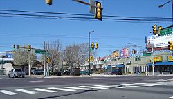
Before development in the 1920s, Mayfair was essentially farmland and home to The Edwin Forrest Home for Children (near present-day Frankford and Shelmire Avenue) and The Oxford and Lower Dublin Poor House (west of present-day Rowland and Sheffield Aves). First established in 1929, Mayfair came to fruition in the years following World War II as a community that provided fresher and more spacious living in an urban environment.[ citation needed ] It was constructed over farmland surrounded by the established neighborhoods of Tacony, Holmesburg and Fox Chase. Mayfair featured several groundbreaking concepts for city dwellers: bigger rowhouses with yards in the front and parking garages in the back. The automobile became the primary mode of transportation and shopping retail centers became available close to home, as shopping districts developed along Roosevelt Boulevard and Cottman Avenue. Development also served to connect the surrounding neighborhoods of the Northeast that had previously been isolated. Development in Mayfair was a forerunner to American suburbanization, an early part of the population shift from the inner city to its outer regions.[ citation needed ]

Education

Residents are zoned to the School District of Philadelphia.

The Ethan Allen School and Edwin Forrest School are listed on the National Register of Historic Places. [4] Mayfair Elementary School is also in Mayfair.

Ethan Allen and Mayfair elementary are K-8 schools, while Edwin Forrest-zoned students go onto Austin Meehan Middle. [5] Students zoned to Austin Meehan, Ethan Allen, and Mayfair are also zoned to Abraham Lincoln High School. [6]

Lincoln High was originally scheduled to be named Mayfair High School, but opposition from other neighborhoods meant that the school was instead named after Abraham Lincoln. Mayfair residents had a negative reception to this change. In 1949 the school's cornerstone was laid. Mayfair Elementary School also opened in 1949. [7]

Population

As of the 2010 census, the tracts covering most of Mayfair [8] had a population of 38,202 people, 56% White, 19% African American, 16% Hispanic, 8% Asian, 2% Two or more races, and 2% Other and mostly in owner-occupied rowhouses. [9]

Mayfair is widely known for its association with Irish-American culture. During the 2000 census, 14,682 people noted Irish ancestry, including 11,100 who claimed it as their primary ancestry. Other claimed ancestries of note were German (7,069), Italian (6,067), Polish (3,512), and English (2,442). [10] Like most of the city's Northeast, since 2000, the area has seen an increase in immigrants from Russia as well as an increase in non-European immigrants and non-European Americans, with the integration of immigrants from various Asian countries, Arabs, Blacks and Hispanic Americans in the communities. Mayfair uses the ZIP codes 19136, 19149 and 19152.

Notes

  1. Philadelphia Neighborhoods and Place Names, L-P, Finkel, Kenneth. Philadelphia Almanac and Citizens' Manual. Library Company of Philadelphia. (via Philadelphia City Archives)
  2. The street borders are Harbison to the south, Frankford Avenue to the east, Roosevelt Boulevard to the west. It also Borders Cottman Avenue on the west side of Frankford Avenue, but on both sides of Frankford Avenue from Cottman Avenue to Sheffield Avenue. It borders the Holmesburg neighborhood to the north and east, but the borders between that neighborhood are not clearly defined and often disputed, as are borders with some other surrounding neighborhoods. Philadelphia NIS NeighborhoodBase Archived 2001-07-13 at the Wayback Machine , University of Pennsylvania's Cartographic Modeling Lab.
  3. , Niche Mayfair Demographics and Statistics.
  4. "National Register Information System". National Register of Historic Places . National Park Service. July 9, 2010.
  5. "Edwin Forrest Elementary School Geographic Boundaries Archived 2016-03-03 at the Wayback Machine ." School District of Philadelphia. Retrieved on December 10, 2016.
  6. "High School Directory Fall 2017 Admissions" (Archive). School District of Philadelphia. p. 42/70. Retrieved on December 10, 2016.
  7. Loftus, John (2015-01-28). "Changes in the classroom". Northeast Times . Archived from the original on 2015-08-01. Retrieved 2016-12-10.{{cite news}}: CS1 maint: bot: original URL status unknown (link)
  8. Philadelphia County, 2010 Census Tracts 315 [ permanent dead link ], 316 [ permanent dead link ], 330 [ permanent dead link ], 331 [ permanent dead link ], 332 [ permanent dead link ]
  9. American Census U.S. Census website – Decennial Census Data Set – Census 20Summary File 1: tables P3, H14
  10. American Census Factfinder – Decennial Census Data Set – Census 2000 Summary File 3: tables PCT16, 17, 18.

Related Research Articles

<span class="mw-page-title-main">Northeast Philadelphia</span> Neighborhood of Philadelphia in Philadelphia, Pennsylvania, United States

Northeast Philadelphia, nicknamed Northeast Philly, the Northeast and the Great Northeast, is a section of Philadelphia, Pennsylvania. According to the 2000 census, Northeast Philadelphia has a population of between 300,000 and 450,000, depending on how the area is defined. Beginning in the 1980s, many of the Northeast's working class children graduated from college and settled in suburbs, especially nearby Bucks County. The Northeast is known as being home to a large working class Irish American population, but it is also home to Polish, German, Jewish, Italian, African American, Portuguese, Brazilian, Russian, Puerto Rican, Dominican, Ukrainian, Indian, Chinese, and Vietnamese neighborhoods.

<span class="mw-page-title-main">Frankford, Philadelphia</span> Former Borough in Pennsylvania, United States

Frankford is a neighborhood in the Northeast section of Philadelphia situated about six miles (10 km) northeast of Center City. Although its borders are vaguely defined, the neighborhood is bounded roughly by the original course of Frankford Creek on the south to Castor Avenue on the northwest and southwest, to Cheltenham Avenue on the north, and to Aramingo Avenue and I-95 on the east. [source: GoogleMaps] Adjacent neighborhoods are Bridesburg, Juniata, Northwood, Summerdale, and Wissinoming.

Roosevelt Boulevard, officially named the Theodore Roosevelt Memorial Boulevard and often referred to, chiefly by local Philadelphians, simply as "the Boulevard," is a major traffic artery through North and Northeast Philadelphia. The road begins at Interstate 76 in Fairmount Park, running as a freeway also known as the Roosevelt Boulevard Extension or the Roosevelt Expressway through North Philadelphia, then transitioning into a twelve-lane divided highway that forms the spine of Northeast Philadelphia to its end at the city line.

<span class="mw-page-title-main">Holmesburg, Philadelphia</span> Neighborhood of Philadelphia, Pennsylvania, US

Holmesburg began as a Village within Lower Dublin Township, Pennsylvania. It is now a neighborhood in the Northeast section of Philadelphia, Pennsylvania, United States. Holmesburg was named in Honor of Surveyor General of Pennsylvania Thomas Holme, who was a cartographer.

<span class="mw-page-title-main">Rhawnhurst, Philadelphia</span> Neighborhood of Philadelphia, USA

Rhawnhurst is a residential neighborhood in the Northeast section of Philadelphia, Pennsylvania, United States, named for George and William Rhawn by area real estate developers. Roughly bordered by Cottman Avenue to the south, Pennway Street to the west, the Pennypack Creek to the north, and Roosevelt Boulevard to the east, Rhawnhurst encompasses ZIP codes 19152 and part of ZIP code 19111. The geographic center of Rhawnhurst is at the intersection of Castor Avenue and Rhawn Street.

<span class="mw-page-title-main">Pennypack Creek</span>

Pennypack Creek is a 22.6-mile-long (36.4 km) creek in southeastern Pennsylvania in the United States. It runs southeast through lower Bucks County, eastern Montgomery County and the northeast section of Philadelphia, before emptying into the Delaware River.

<span class="mw-page-title-main">Bridesburg, Philadelphia</span> Former Borough in Pennsylvania, United States

Bridesburg is the northernmost neighborhood in the River Wards section of Philadelphia, Pennsylvania, United States. Bridesburg is an historically German and Irish community, with a significant community of Polish immigrants who arrived mostly in the early- to mid-twentieth century. The community is home to two Catholic churches: All Saints Church, designed by Edwin Forrest Durang, built in 1889; and Saint John Cantius Church, built in 1898 in Polish Cathedral style.

<span class="mw-page-title-main">Frankford Creek</span> River in Pennsylvania, United States

Frankford Creek is a minor tributary of the Delaware River in southeast Pennsylvania. It derived its name from the nearby town of Frankford, Philadelphia County. The stream originates as Tookany Creek at Hill Crest in Cheltenham Township and meanders eastward, then southeastward, throughout Cheltenham Township, until a sharp bend near the Philadelphia border at Lawncrest, where the place names Toxony and Tookany were used in historic times; the stream is still known as Tookany Creek in this region, where it flows southwest. Turning south into Philadelphia at the crotch of Philadelphia's V-shaped border, the creek is called Tacony Creek; from here southward, it is considered the informal boundary separating Northeast Philadelphia from the rest of the city. The Philadelphia neighborhoods of Olney and Feltonville lie on the western side of the stream in this area while Northwood, Lawncrest, Summerdale, and Frankford lie on the eastern side. It continues to be called the Tacony at least until the smaller Wingohocking Creek merges with it in Juniata Park, within the city-owned golf course. Beyond Castor Avenue it is known as Frankford Creek until the stream's confluence with the Delaware River in the Bridesburg neighborhood of Philadelphia. The section of stream known as Frankford Creek is 3.1 miles (5.0 km) long, and the upstream section known as Tacony Creek, from Hill Crest, is 11.1 miles (17.9 km) long.

<span class="mw-page-title-main">Tacony, Philadelphia</span> Neighborhood of Philadelphia in Philadelphia County, Pennsylvania, United States

Tacony is a historic neighborhood in Northeast Philadelphia, United States, approximately 8 miles (13 km) from downtown Philadelphia. It is bounded by the east side of Frankford Avenue on the northwest, the south side of Cottman Avenue on the northeast, the north side of Robbins Street on the southwest, and the Delaware River and Interstate 95 on the southeast.

<span class="mw-page-title-main">Juniata, Philadelphia</span> Neighborhood of Philadelphia in Philadelphia County, Pennsylvania, United States

Juniata is a working class, predominantly Hispanic and Caucasian neighborhood in North Philadelphia, which is a section of the city of Philadelphia, Pennsylvania, United States. Juniata is located south of the Juniata Golf Club in Tacony Creek Park. It is bordered to the east by Frankford, to the west by Feltonville, and to the south by Harrowgate and Port Richmond. The neighborhood is bordered by G Street to the west, Juniata Park to the north, Tacony Creek to the east, and by SEPTA rail tracks to the south. Juniata shares the ZIP code of 19124 with the nearby neighborhood of Frankford.

<span class="mw-page-title-main">Oxford Circle, Philadelphia</span> Neighborhood of Philadelphia in Philadelphia County, Pennsylvania, United States

Oxford Circle is a neighborhood in the lower Northeast section of Philadelphia, Pennsylvania, United States. Its namesake is the much used traffic circle at Roosevelt Boulevard and Oxford Avenue. The Oxford Circle neighborhood has traditionally included the areas up to Rhawnhurst and Mayfair but does not really have a fixed boundary, other than in publications about Philadelphia which are of a public relations or informational nature.

Wissinoming is a neighborhood in the Near Northeast section of Philadelphia, United States. It was the site of locomotive builder Matthias Baldwin's estate "Wissinoming", which was located near Tacony and Van Kirk Streets. The current Wissinoming is bordered by Mayfair on the west and Tacony on the north, Bridesburg on the south, I-95 and the Delaware River on the east, and Frankford on the southwest. Wissinoming has two ZIP codes: 19124 and 19135. Physical boundaries are: Levick Street on the north, Bridge Street on the south, I-95 and the Delaware River on the east, and Frankford Avenue on the west.

<span class="mw-page-title-main">Pennsylvania Route 73</span> State highway in Pennsylvania, US

Pennsylvania Route 73 (PA 73) is a 62.32-mile (100.29 km) long east–west state highway in southeastern Pennsylvania. It runs from PA 61 near Leesport southeast to the New Jersey state line on the Tacony–Palmyra Bridge over the Delaware River in Philadelphia, where the road continues south as New Jersey Route 73. The route passes through rural areas of Berks County, crossing U.S. Route 222 (US 222) in Maiden Creek before heading southeast through Oley and Boyertown. PA 73 continues into Montgomery County and intersects PA 100 in Gilbertsville and PA 29 in Schwenksville before it heads into the northwest suburbs of Philadelphia. The route passes through Skippack and intersects US 202 in Center Square, PA 309 in Springfield Township, and PA 611 near Jenkintown. PA 73 continues through Northeast Philadelphia on Cottman Avenue, crossing US 1 and US 13 before coming to an interchange with Interstate 95 (I-95) near the Tacony–Palmyra Bridge.

<span class="mw-page-title-main">U.S. Route 1 in Pennsylvania</span> Highway in Pennsylvania

U.S. Route 1 (US 1) is a major north–south U.S. Route, extending from Key West, Florida, in the south to Fort Kent, Maine, at the Canada–United States border in the north. In the U.S. state of Pennsylvania, US 1 runs for 81 miles (130 km) from the Maryland state line near Nottingham northeast to the New Jersey state line at the Delaware River in Morrisville, through the southeastern portion of the state. The route runs southwest to northeast and serves as a major arterial road through the city of Philadelphia and for many of the suburbs in the Delaware Valley metropolitan area. South of Philadelphia, the road mostly follows the alignment of the Baltimore Pike. Within Philadelphia, it mostly follows Roosevelt Boulevard. North of Philadelphia, US 1 parallels the route of the Lincoln Highway. Several portions of US 1 in Pennsylvania are freeways, including from near the Maryland state line to Kennett Square, the bypass of Media, the concurrency with Interstate 76 and the Roosevelt Expressway in Philadelphia, and between Bensalem Township and the New Jersey state line.

<span class="mw-page-title-main">Castor Gardens, Philadelphia</span> Neighborhood of Northeast Philadelphia

Castor Gardens is a neighborhood in the lower Northeast section of Philadelphia, Pennsylvania, United States. Castor Gardens' borders are not clearly defined, but it exists in the vicinity of Castor Avenue and Cottman Avenue. It is also near Roosevelt Boulevard. The neighborhood can either be entered from the south, by taking the Oxford Circle exit of Roosevelt Boulevard, or from the north, by taking the Cottman Avenue exit. Adjacent neighborhoods are Mayfair, Lawndale, Burholme, Oxford Circle, and Rhawnhurst.

<span class="mw-page-title-main">Abraham Lincoln High School (Philadelphia)</span> Public high school in Philadelphia, Pennsylvania, United States

Abraham Lincoln High School, a public school located in the Mayfair section of Northeast Philadelphia, Pennsylvania. Its main entrance is located at Ryan and Rowland Avenues. The principal is Jack Nelson.

<span class="mw-page-title-main">U.S. Route 13 in Pennsylvania</span> Highway in Pennsylvania

U.S. Route 13 (US 13) is a United States Numbered Highway running from Fayetteville, North Carolina, north to Morrisville, Pennsylvania. The route runs for 49.359 miles (79.436 km) through the Delaware Valley in the U.S. state of Pennsylvania. The route enters the state from Delaware in Marcus Hook, Delaware County. It continues northeast through Delaware County, passing through the city of Chester before heading through suburban areas along Chester Pike to Darby. US 13 enters the city of Philadelphia on Baltimore Avenue and runs through West Philadelphia to University City, where it turns north along several city streets before heading east across the Schuylkill River along Girard Avenue. The route turns north and heads to North Philadelphia, where it runs northeast along Hunting Park Avenue. US 13 becomes concurrent with US 1 on Roosevelt Boulevard, continuing into Northeast Philadelphia. US 13 splits southeast on a one-way pair of streets before heading northeast out of the city on Frankford Avenue. The route continues into Bucks County as Bristol Pike, heading northeast to Bristol, where it turns into a divided highway. US 13 becomes a freeway in Tullytown and continues north to its terminus at US 1 in Falls Township, near Morrisville. US 13 roughly parallels Interstate 95 (I-95) through its course in Pennsylvania.

<span class="mw-page-title-main">SEPTA Route 56</span>

SEPTA's Trolley Route 56, the Erie and Torresdale Avenues Line, is a former streetcar line that is now served by bus. It is operated by the Southeastern Pennsylvania Transportation Authority (SEPTA) in Philadelphia, Pennsylvania, United States. The line runs between the Tioga and Tacony neighborhoods primarily along Erie Avenue and Torresdale Avenue. Route 56 was one of three "suspended" by the SEPTA board effective June 12, 1992. The two others, Routes 15 and 23, were then also operated by buses as of the same year; however, the Route 15 Trolley has since been restored back to trolley as of September 5, 2005.

<span class="mw-page-title-main">SEPTA Route 66</span>

SEPTA Route 66 is a trackless trolley route in Northeast Philadelphia, Pennsylvania, United States. It connects the Market–Frankford Line at the Frankford Transportation Center to Wissinoming, Mayfair, Holmesburg, and Torresdale along Frankford Avenue, which is US 13 and includes the historic, colonial Frankford Avenue Bridge.