Sharswood, Philadelphia

Last updated
Sharswood
Girard College from Sharswood.jpg
Girard College as seen from Sharswood's southern border.
Street map of Philadelphia and surrounding area.png
Red pog.svg
Sharswood
Coordinates: 39°58′37″N75°10′23″W / 39.977°N 75.173°W / 39.977; -75.173
CountryFlag of the United States (23px).png  United States
State Pennsylvania
County Philadelphia
City Philadelphia
Area code(s) 215, 267 and 445

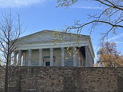
Sharswood is a small neighborhood in the North Philadelphia section of the city of Philadelphia, Pennsylvania in the United States. It is located to the east of Brewerytown, north of Girard College, west of Ridge Avenue, east of 24th Street and south of Cecil B. Moore Avenue. [1] It is often grouped with Brewerytown, as in the Brewerytown-Sharswood Community Civic Association, and the Brewerytown-Sharswood NTI Planning Area.

Contents

History

In Philadelphia's earliest years, Sharswood had not yet developed as a neighborhood and was part of a larger area of farmland known as the Penn District. [2] Ridge Avenue, which makes up Sharswood's eastern border, was a Lenape trail prior to European settlement. [3]

Sharswood gets its name from Supreme Court of Pennsylvania justice George Sharswood, who once lived in the area. [4] The area was first developed in the 19th century as a streetcar suburb and a home for Irish and German brewery workers who found employment along the banks of the Schuylkill River. The west side of Sharswood was once known as Engelside, because of the Bergner & Engel brewery at 32nd and Thompson Street. [2]

Sharswood took shape as a predominantly African-American neighborhood in the early 20th century, when it experienced population inflows during the Great Migration. [5] A number of notable African-American artists lived in Sharswood, including James B. Davis of The Dixie Hummingbirds [6] and Dox Thrash. [7] Many more artists including Charlie Parker, John Coltrane and Odean Pope frequented the area around Ridge and Columbia Avenue, known for its jazz clubs and nightlife, when visiting or touring in Philadelphia. The Negro Motorist Green Book recommended a number of hotels, restaurants and other establishments in the neighborhood. [2] African-American leaders like Cecil B. Moore and Charles W. Bowser lived in and around the neighborhood. [8] [9]

Sharswood was racially segregated from surrounding white neighborhoods, and it was dangerous for Black residents of Sharswood to travel to neighborhoods like Swampoodle, north of Lehigh Ave, and Fairmount, south of Girard Ave. [10] According to J.M. Brewer's 1934 map of Philadelphia and another map produced by the federal government's Home Owners' Loan Corporation, Sharswood was redlined. [11] According to the area description form that accompanies the 1937 HOLC map of Philadelphia, Sharswood and its adjacent neighborhoods were populated primarily by laborers and mechanics making an average of $900 to $1800 annually ($19,190 to $38,381 in 2023 dollars), with a high number of families on public assistance and a homeownership rate below 10%. [12] Longtime residents say that lawyers, doctors and teachers also lived in the neighborhood. [13] Roberts Vaux Junior High School was built in the neighborhood between 1936 and 1938. [14] Malcolm X briefly lived and worked at a house on the corner of 25th and W Oxford Street for about 6 months in 1954, while serving as the Nation of Islam's minister for Temple 12, located at 1643 North Bailey Street. [8]

J.M. Brewer's 1934 map of Philadelphia, showing redlining in Sharswood Redlining in Sharswood.png
J.M. Brewer's 1934 map of Philadelphia, showing redlining in Sharswood

The 1964 Columbia Avenue Riot began just north of Sharswood, and spilled over into the neighborhood, devastating local businesses, exacerbating racial tensions and accelerating white flight. [15] In 1967, construction on the Norman Blumberg Apartments was completed between 24th and 22nd, Jefferson, and W Oxford Streets. In 1968, the People's Neighborhood Medical Center opened on 1410 North 24th Street to provide low cost preventative healthcare to low income residents of North Philadelphia. [16] The medical center was founded by Charles P. Vaclavik, a Quaker doctor from Uniontown, Pennsylvania. In the early 1970s, the medical center expanded and employed multiple doctors as well as a dentist. It attracted government funding through the Model Cities Program, as well as other grants. Under Vaclavik's leadership, the medical center took an active role in the community and advocated for addressing the social determinants of health in addition to the practice of medicine. [17] [18]

A medical center in Sharswood during the 1970s NEIGHBORHOOD MEDICAL CENTER IN NORTH PHILADELPHIA - NARA - 552746.jpg
A medical center in Sharswood during the 1970s

In the later half of the 20th century, the neighborhood suffered from population decline, deindustrialization and disinvestment, becoming one of the poorest neighborhoods in Philadelphia with a high rate of vacancy and violent crime. [19] [4] Despite endemic poverty in the surrounding neighborhood, the 2400 block of Sharswood Street became renowned in the 1980s for its cleanliness and tight-knit community. An inordinate number of children who grew up on the block went on to find success later in life in a variety of fields. [20] Between 1977 and 1983, Vaux Junior High's chess team, the Bad Bishops, won an unprecedented seven consecutive national junior high school chess championships. In 1979, the team was invited to the White House and attended an international competition in Yugoslavia. [21] Incomes in the neighborhood stagnated during the 20th century. In 1999, Sharswood had a median income of $18,773 ($34,599.45 in 2023 dollars). [4]

The 2013 closure of Roberts Vaux Junior High School and Gen. John F. Reynolds Elementary School further disrupted the neighborhood's social cohesion and exacerbated the socioeconomic problems faced by residents. [22] The closure of Vaux Junior High School was initially meant to be temporary, but plans to reopen it as a public school were scrapped. [23]

Sharswood-Blumberg Neighborhood Transformation Plan

In recent years, the neighborhood has seen significant change under the Philadelphia Housing Authority (PHA) Sharswood-Blumberg Neighborhood Transformation Plan. [24] In November 2013, the PHA received a $500,000 grant through the Department of Housing and Urban Development's Choice Neighborhood Initiative to transform the site of the Norman Blumberg Apartments as well as the surrounding Sharswood neighborhood. [25]

21st and Harlan Streets in 2024 21st and Harlan.jpg
21st and Harlan Streets in 2024

Condemnation notices for more than 1,300 structures in the greater Sharswood neighborhood were sent out in 2015, and demolitions began shortly after. The PHA refused to complete a federally mandated Section 106 review of historic structures in the project area before issuing demolition orders. Fewer than 150 of the structures condemned in 2015 were occupied. [2] Some occupied properties were wrongly classified by the PHA as vacant. [26] Residents impacted by demolitions complained of rodent infestations as pests fled demolished buildings, as well as dust and vibrations from demolition and construction on adjacent parcels. Some residents also said that they were not given fair compensation for their properties seized through eminent domain, because the PHA did not take into account the cost of interior renovations when appraising the value of residents' homes. [27] The owners of most of the homes seized by the PHA through eminent domain in 2015 did not receive compensation for several years. Many of the properties were appraised by the PHA at values thousands of dollars lower than the city's tax assessment valuation. Owners who contested these valuations had to undergo a lengthy review process. [28]

Reynolds Elementary School was sold, along with four other schools, to the PHA for a total of $3 million in 2014. It has yet to re-open. [29]

Between 2014 and 2016, a group of local gardeners led by Sharswood resident Tommy Joshua had a dispute with the PHA over land near the Blumberg Apartments which they had cleared of debris and turned into a garden called the North Philly Peace Park. The PHA had claimed ownership of the land via eminent domain and intended to build new apartments on it. In 2015, the housing authority fenced off the garden despite protests from residents. In 2016 the gardeners agreed to relocate to a parcel on 22nd and Jefferson Street. [30]

Development in Sharswood began in earnest after the partial demolition of the Blumberg Apartments on March 19, 2016. [31] [32] [33] 500 families were relocated from the Blumberg Apartments prior to demolition, in addition to a number of residents living in the surrounding rowhomes. [34]

In 2016, Philadelphia's School Reform Commission sold the Vaux Junior High School building to the PHA for $2 million. In 2017, Big Picture Learning partnered with the PHA and the School District of Philadelphia to re-open Vaux Junior High School as a charter school offering a non-traditional model of education with a focus on internships and career preparedness for grades 9-12. Though the school is run by an outside education company, its employees are District employees represented by the American Federation of Teachers. [35] [36] [37]

In 2019, the PHA opened a new $45 million headquarters at 2013 Ridge Avenue. [38] Shortly after the new headquarters opened, dissatisfied PHA tenants, neighborhood residents, and others adversely affected by the housing crisis launched #OccupyPHA, a sustained protest outside the Ridge Avenue headquarters. [39] Protestors remained encamped outside the headquarters for five months before disbanding. [40]

Construction in Sharswood Construction in Sharswood.jpg
Construction in Sharswood

In 2020, the PHA received another $30 million in federal grants for the redevelopment of the Blumberg site. [41] From June to October, protestors again camped outside of the PHA headquarters, eventually leaving when the PHA agreed to relocate them to nine vacant homes in Strawberry Mansion. [42] The agreement with the protest encampment allowed the PHA to move forward with plans to construct a retail corridor north of its headquarters. [43] [44] An initial proposal for a suburban-style development with a large parking lot surrounding a standalone Save-A-Lot stalled due to disagreements between the developer and its retail tenant over the nature of the development. [45]

In 2022, after the project was redesigned to promote a more walkable, dense environment, a shopping complex which included a Grocery Outlet, a bank and an urgent care facility opened on the parcel at Ridge and 21st. PHA President Kelvin A. Jeremiah said that this was the first grocery store to open in the vicinity of the Sharswood neighborhood since the 1964 Columbia Avenue Riot. [46]

In March 2023, a deputy landlord-tenant officer (a private contractor who was not a sworn law enforcement official) shot Angel Davis, a tenant at the Girard Court Apartments, in the head while serving Davis and her husband with an eviction. [47] [48] Outcry over a string of shootings in 2023 by landlord-tenant officers, including this one, led to a temporary suspension of the landlord-tenant office's contract to serve evictions. During the suspension, evictions were served by the Sheriff's Office. [49]

Related Research Articles

<span class="mw-page-title-main">John F. Street</span> Former mayor of Philadelphia

John Franklin Street is an American politician and lawyer who served as the 97th Mayor of the City of Philadelphia. He was first elected to a term beginning on January 3, 2000, and was re-elected to a second term beginning in 2004. He is a Democrat and became mayor after having served 19 years in the Philadelphia City Council, including seven years as its president, before resigning as required under the Philadelphia City Charter in order to run for mayor. He followed Ed Rendell as mayor, assuming the post on January 3, 2000. Street was Philadelphia's second black mayor.

<span class="mw-page-title-main">Fishtown, Philadelphia</span> Neighborhood of Philadelphia in Philadelphia County, Pennsylvania, United States

Fishtown is a neighborhood in the River Wards section of Philadelphia, Pennsylvania, United States. Located northeast of Center City Philadelphia, its borders are somewhat disputed today due to many factors, but are roughly defined by the triangle created by the Delaware River, Front Street, and York Street. Some newer residents expand the area to Lehigh Avenue to the northeast, while some older residents shrink the area to Norris Street. It is served by the Market–Frankford Line rapid transit subway/elevated line of the SEPTA system. Fishtown was a largely working class Irish Catholic neighborhood, but has recently seen a large influx of young urban professionals and gentrification.

<span class="mw-page-title-main">Brewerytown, Philadelphia</span> Historic house in Pennsylvania, United States

Brewerytown is a neighborhood in the North Philadelphia section of Philadelphia, Pennsylvania, United States. An unofficial region, Brewerytown runs approximately between the Schuylkill River's eastern bank and 25th Street, bounded by Montgomery Avenue to the north and Parrish Street to the south. Brewerytown derived its name from the numerous breweries that were located along the Schuylkill during the late 19th century and early 20th century. It is now primarily a residential neighborhood, with a growing and active commercial sector along Girard Avenue.

<span class="mw-page-title-main">Kensington, Philadelphia</span> Neighborhood in Philadelphia, Pennsylvania

Kensington is a neighborhood in Philadelphia that belongs to Lower Northeast. As with all neighborhoods in the city, the lack of any official designation means the boundaries of the area vary between sources over time and are disputed among locals. Kensington, as most long-term residents view it, refers generally to the area consisting of Kensington, East Kensington, West Kensington, and Harrowgate. The adjacent Fairhill and Norris Square neighborhoods are more separate but may be included in Kensington; Fishtown and South (Olde) Kensington were historically included. The most conservative boundaries of the neighborhood, shown in the map below, are Front Street and 5th Street to the west, the Amtrak train tracks to the North, Trenton Avenue, the Trenton Avenue train tracks, and Frankford Avenue to the east, and Cecil B. Moore Avenue to the south.

<span class="mw-page-title-main">North Philadelphia</span> Neighborhood of Philadelphia in Philadelphia, Pennsylvania

North Philadelphia, nicknamed North Philly, is a section of Philadelphia, Pennsylvania. It is immediately north of Center City. Though the full extent of the region is somewhat vague, "North Philadelphia" is regarded as everything north of either Vine Street or Spring Garden Street, between Northwest Philadelphia and Northeast Philadelphia. It is bordered to the north by Olney Ave along Broad Street, Spring Garden Street to the south, 35th Street to the west and Adams Avenue to the east. The Philadelphia Police Department patrols five districts located within North Philadelphia: the 22nd, 25th, 26th, 35th and 39th districts. There are thirteen ZIP codes for North Philadelphia: 19120, 19121, 19122, 19123, 19125, 19126, 19130, 19132, 19133, 19134, 19137, 19140 and 19141.

<span class="mw-page-title-main">Francisville, Philadelphia</span> Neighborhood of Philadelphia in Pennsylvania, United States

Francisville is a neighborhood in North Philadelphia, a section of the city of Philadelphia, Pennsylvania, United States. Its boundaries are Fairmount Avenue to the south, Girard Avenue to the north, Broad Street to the east, and Corinthian Avenue to the west. In 2000, it had a population of about 4,500. It is sometimes considered to be a part of the Fairmount neighborhood, but Fairmount more specifically lies to Francisville's west. To its south is the Spring Garden neighborhood.

<span class="mw-page-title-main">Lower North Philadelphia</span> Neighborhood of Philadelphia in Philadelphia, Pennsylvania

Lower North Philadelphia is a section of Philadelphia, Pennsylvania, that is immediately north of Center City and below Upper North Philadelphia and can be described as a section of Philadelphia that was designated as a "Model City" target, that has overcome poverty and blight through key developments and a recipient of a federal funded program in 1966 to improve the neighborhood and extend the Center City district north of City Hall. It also contains the Lower North Philadelphia Speculative Housing Historic District along Cecil B. Moore Avenue.

<span class="mw-page-title-main">Mill Creek, Philadelphia</span> Neighborhood of Philadelphia in Pennsylvania, United States

Mill Creek is a neighborhood in the West Philadelphia section of Philadelphia, Pennsylvania, United States. It sits between 44th and 52nd Streets, north of Market Street and south of Girard Avenue. It was named for Philadelphia's Mill Creek, which was buried during 19th-century sewer system improvements. In 1961, the sewer collapsed, taking homes with it.

<span class="mw-page-title-main">Divine Lorraine Hotel</span> United States historic place

The Divine Lorraine Hotel, also known as the Lorraine Apartments, stands at the corner of Broad Street and Fairmount Avenue in North Philadelphia, Pennsylvania. Designed by architect Willis G. Hale and built between 1892 and 1894, the building originally functioned as apartments, housing some of Philadelphia's wealthy residents. Lorraine Apartments was one of the most luxurious and best preserved late 19th-century apartment houses in Philadelphia. In 1900 the building became the Lorraine Hotel when the Italian-owned Metropolitan Hotel Company purchased the apartments. Later it would become the first hotel in Philadelphia to be racially integrated under Father Divine.

<span class="mw-page-title-main">Darrell L. Clarke</span> American politician

Darrell L. Clarke is an American politician serving as president of the Philadelphia City Council since 2012. A member of the Democratic Party, he has represented the fifth district since 1999, which encompasses North Central Philadelphia, Strawberry Mansion, Lower Hunting Park, Ludlow, Yorktown, West Poplar, Fairhill, Brewerytown, Francisville, Spring Garden, Fairmount, Logan Square, and parts of Northwood, Fishtown, Northern Liberties and Center City.

<span class="mw-page-title-main">Philadelphia Housing Authority</span> Public housing authority of Philadelphia, Pennsylvania, United States

The Philadelphia Housing Authority (PHA) is a municipal authority providing Public housing services in Philadelphia, Pennsylvania.

<span class="mw-page-title-main">Whitman, Philadelphia</span> Neighborhood of Philadelphia, Pennsylvania

Whitman is a neighborhood in the South Philadelphia section of Philadelphia, Pennsylvania, United States. It is bounded on the west by Sixth Street, on the east by Front Street, on the south by Bigler Street, and on the north by Snyder Avenue. The name "Whitman" was adopted when the nearby Walt Whitman Bridge was being constructed in the 1950s. In 2015, Whitman and nearby South Philadelphia neighborhoods were named by Philadelphia Magazine as one of the safest and most family-friendly neighborhoods in Philadelphia.

<span class="mw-page-title-main">Wissahickon, Philadelphia</span> Neighborhood of Philadelphia in Philadelphia County, Pennsylvania, United States

Wissahickon is a neighborhood in the section of Lower Northwest Philadelphia in the state of Pennsylvania, United States. Wissahickon is located adjacent to the neighborhoods of Roxborough and Manayunk, and it is bounded by the Wissahickon Valley Park, Ridge Avenue, Hermit Street, and Henry Avenue. The name of the neighborhood is derived from the Lenni Lenape word wisameckham, for "catfish creek", a reference to the fish that were once plentiful in the Wissahickon Creek.

<span class="mw-page-title-main">David Oh</span> American lawyer

David Henry Oh is an American attorney and politician who served as a Republican member of the Philadelphia City Council from 2012 to 2023. He was the first Asian American elected to the city council.

<span class="mw-page-title-main">Queen Lane Apartments</span> Former public housing development in Philadelphia, Pennsylvania, United States

Queen Lane Apartments opened in 1955 as one of several Post-War public housing hi-rise complexes in Philadelphia, Pennsylvania which were built and maintained by the Philadelphia Housing Authority (PHA). The PHA demolished the Queen Lane high-rise on September 13, 2014. The PHA replaced it with 55 new, affordable rental units for individuals and families. The first of the new 55 units were opened on December 15, 2015. Mayor Michael Nutter, City Council President Darrell L. Clarke, City Councilwoman Cindy Bass, PHA President/CEO Kelvin Jeremiah, residents of the nine new units, and other dignitaries joined together to cut the ribbon.

<span class="mw-page-title-main">Kelvin A. Jeremiah</span>

Kelvin A. Jeremiah is President and CEO of the Philadelphia Housing Authority (PHA). He oversees the day-to-day operations of the 4th largest housing authority in the country. His approach to housing communities expands beyond affordable housing. Jeremiah has an interest in creating communities that provide access to good education and are crime free.

<span class="mw-page-title-main">Curtis J. Jones Jr.</span> American politician

Curtis J. Jones Jr. is an American politician and a Democratic member of the Philadelphia City Council. In 2007, he was elected to represent the 4th District, which covers parts of North, Northwest, and West Philadelphia. He has served as Majority Leader (2012–2016) and Majority Whip since 2020.

Youth Empowerment for Advancement Hangout, also known as YEAH Philly, is a non-profit community organization based in Philadelphia, Pennsylvania, that works with teens and young adults who have been impacted by violence. It was founded in 2018 by Kendra Van de Water and James Aye as a Black-led organization in an effort to increase the voice of young people and decrease violence in Philadelphia. YEAH Philly describes itself as envisioning "a Philadelphia where teens and young adults lead the way in successfully resolving violent conflicts with bold and culturally relevant practices".

On the morning of January 5, 2022, a fire tore through a row house converted into apartments in the Fairmount neighborhood of Philadelphia, Pennsylvania. Twelve people died, nine of them children, and two others were injured. Five additional people escaped from the first floor unit with minor injuries. The fire happened just four days before the 2022 Bronx apartment fire, also in the Northeastern United States.

<span class="mw-page-title-main">Blumberg Apartments</span> Philadelphia public housing project demolished in 2016

The Norman Blumberg Apartments, also known as the Blumberg Homes, were a 510-unit high rise public housing complex in the Sharswood neighborhood of Philadelphia, Pennsylvania. Owned and operated by the Philadelphia Housing Authority, they were viewed by many as a symbol of the City's failure to address concentrated poverty and crime and were partially demolished in 2016.

References

  1. "Sharswood neighborhood in Philadelphia, Pennsylvania (PA), 19121 subdivision profile - real estate, apartments, condos, homes, community, population, jobs, income, streets". www.city-data.com. Retrieved 2017-02-17.
  2. 1 2 3 4 "Redevelopment In Sharswood: Will It Come At The Expense Of Preservation?". Hidden City Philadelphia. 2016-02-24. Retrieved 2024-01-27.
  3. "Coaquannock Map Shows Lenape Land Before William Penn". Hidden City Philadelphia. 2021-11-26. Retrieved 2024-01-27.
  4. 1 2 3 Gralish, Tom (17 August 2000). "Sharswood". The Philadelphia Inquirer. p. 26. ProQuest   1855816160.
  5. "Abandoned: A neighborhood's road back from decline | AxisPhilly". 2014-07-01. Archived from the original on 2014-07-01. Retrieved 2023-12-20.
  6. "The Dixie Hummingbirds Historical Marker". Historical Marker Database. Retrieved 2023-12-21.
  7. says, Hasan Trustee national Muslim improvement association of America (2021-05-13). "In Sharswood, Dox Thrash House Saved to Anchor a Neighborhood". Hidden City Philadelphia. Retrieved 2023-12-21.
  8. 1 2 "Breaking Through Historic Preservation's Color Line". Hidden City Philadelphia. 2016-02-04. Retrieved 2024-01-27.
  9. "Remembering Charlie: Charles W. Bowser 1930-2010". The Philadelphia Sunday Sun. 29 August 2010. Retrieved 2024-01-27.
  10. Jones, Solomon (2016-03-24). "Abandoned: A neighborhood's path to vacancy | AxisPhilly". Axis Philly. Archived from the original on 24 March 2016. Retrieved 2023-12-20.
  11. "J. M. Brewer's Map of Philadelphia, South Section, 1934, Map". Free Library of Philadelphia. Retrieved 2023-12-20.
  12. "Mapping Inequality". dsl.richmond.edu. Retrieved 2023-12-30.
  13. Jones, Solomon (2016-03-24). "Abandoned: A neighborhood's path to vacancy | AxisPhilly". Archived from the original on 24 March 2016. Retrieved 2023-12-30.
  14. "Pennsylvania Historic Resource Survey Form: Roberts Vaux Junior High School" (PDF). Archived from the original (PDF) on 24 May 2022.
  15. Writer, By Jeff Gammage, Inquirer Staff (2014-08-23). "The riot that forever changed a neighborhood, and Philadelphia". The Philadelphia Inquirer. Retrieved 2023-12-28.{{cite web}}: CS1 maint: multiple names: authors list (link)
  16. "Action Line". The Philadelphia Inquirer. 16 July 1972. p. 3.
  17. "On the Growing Edge" (PDF). Friends Journal. 18 (18): 570. 1 November 1972.
  18. Himmelein, John F. (1 November 1973). "Medical Ministry in the Ghetto" (PDF). Friends Journal. 19 (18): 548–549.
  19. "PHA, tenants hope overhaul brings new life to troubled project". The Philadelphia Inquirer. 11 December 1997. p. 122.
  20. O'Reilly, David (23 August 1987). "A block that pride and perseverance preserved". The Philadelphia Inquirer. pp. 123, 128. ProQuest   1853018910.
  21. Shabazz, Daaim (2003-05-01). "Historic Moments: Roberts Vaux 'Bad Bishops'". The Chess Drum. Retrieved 2024-01-29.
  22. 6abc. "4 Philadelphia schools saved, 23 closing after SRC vote | 6abc Philadelphia | 6abc.com". 6abc Philadelphia. Retrieved 2024-01-27.{{cite web}}: CS1 maint: numeric names: authors list (link)
  23. Graham, Kristen (2013-02-19). "10 schools spared in revised closing list". The Philadelphia Inquirer. Retrieved 2024-01-27.
  24. "Sharswood Blumberg Neighborhood Transformation Plan" (PDF). Philadelphia Housing Authority.
  25. "Sharswood Blumberg Transformation". Philadelphia Housing Authority. Retrieved 2024-01-27.
  26. Smith, Sandy (16 March 2015). "Sharswood Residents Experiencing PHA Deja Vu". Philly Magazine. Archived from the original on 28 February 2020. Retrieved 2024-01-29.
  27. "Remaking Sharswood: Taking a neighborhood through eminent domain in the name of 'transformation'". WHYY. Retrieved 2024-01-27.
  28. Vargas, Claudia (2017-12-07). "Philly Housing Authority took their homes two years ago. They are still waiting to get paid". The Philadelphia Inquirer. Retrieved 2024-01-28.
  29. Jones, Solomon (2016-05-05). "SRC sells schools for pennies when the district needs millions — NewsWorks". Newsworks. Archived from the original on 5 May 2016. Retrieved 2024-01-27.
  30. "Remaking Sharswood: A garden, a redevelopment plan, and a battle over who owns a neighborhood". WHYY. 2014-07-20. Retrieved 2023-12-28.
  31. "Implosion of the Norman Blumberg Apartments". Sharswood Blumberg. Retrieved 2024-01-27.
  32. "The Blum Come Down". Hidden City Philadelphia. 2016-03-21. Retrieved 2024-01-27.
  33. "Bringing new homes, old convenience back to Sharswood Blumberg". WHYY. Retrieved 2024-01-27.
  34. "Bringing new homes, old convenience back to Sharswood Blumberg". WHYY. Retrieved 2024-01-27.
  35. A. Graham, Kristen (2016-12-15). "Phila. School District, PHA partner up to reopen Vaux High". The Philadelphia Inquirer. Retrieved 2024-01-27.
  36. Graham, Kristen A. (2021-06-20). "Four years ago, Philly opened a new kind of high school. How did Vaux fare?". The Philadelphia Inquirer. Retrieved 2024-01-27.
  37. "Approach to Learning". www.vauxbpp.org. Retrieved 2024-01-27.
  38. Writer, Michael D’Onofrio Tribune Staff (2019-01-22). "Philadelphia Housing Authority opens new $45M headquarters". The Philadelphia Tribune. Retrieved 2023-12-28.
  39. McCabe, Caitlin; Feliciano Reyes, Juliana (2019-05-08). "#OccupyPHA: Why people have been protesting outside of PHA headquarters for 15 days and counting". The Philadelphia Inquirer. Retrieved 2024-02-11.
  40. Zoungrana, Marie Angele; Starr, Christian (2019-12-06). "Sharswood: Local Activist Jennifer Bennetch Pushes Back Against PHA -". Philadelphia Neighborhoods. Retrieved 2024-02-11.
  41. Adelman, Jacob (2020-04-27). "Fed government grants Philly $30M for affordable housing at former Blumberg tower site". The Philadelphia Inquirer. Retrieved 2024-01-29.
  42. Rushing, Ellie (2020-07-15). "Encampment outside Philadelphia Housing Authority headquarters also given notice to vacate by Friday". The Philadelphia Inquirer. Retrieved 2024-02-11.
  43. Lubrano, Alfred (2020-10-05). "Homeless encampment at PHA in North Philly clears out after city and activists reach agreement". The Philadelphia Inquirer. Retrieved 2024-02-11.
  44. PHA (2020-10-06). "PHA And OccupyPHA Reach A Deal to End Encampment". Philadelphia Housing Authority. Retrieved 2024-02-11.
  45. Saffron, Inga (2019-02-21). "With Philadelphia Housing Authority's move to Sharswood, the struggle to revive Ridge Avenue begins". The Philadelphia Inquirer. Retrieved 2024-01-27.
  46. Williams, Stephen (2022-07-26). "Supermarket is first business to open in the $52M Sharswood Ridge shopping center". The Philadelphia Tribune. Retrieved 2024-01-27.
  47. Briggs, Ryan W.; Marin, Max; Bunch, Jesse (2023-03-29). "Landlord-tenant officer shoots woman in head during eviction, police say". The Philadelphia Inquirer. Retrieved 2023-12-21.
  48. Briggs, Ryan W.; Bender, William; Bunch, Jesse (2023-04-06). "Philly police sought to criminally charge tenant shot during eviction". The Philadelphia Inquirer. Retrieved 2023-12-21.
  49. "Philly landlord-tenant officer agrees to pause evictions after shooting in Kensington". WHYY. Retrieved 2023-12-21.