West Pottsgrove Township, Pennsylvania

Last updated
West Pottsgrove Township
High from Grosstown in Stowe.jpg
High Street in Stowe
West Pottsgrove Township Montgomery County.png
Location of West Pottsgrove Township in Montgomery County
Pennsylvania in United States (US48).svg
Location of PA in the United States
Coordinates: 40°15′17″N75°40′42″W / 40.25472°N 75.67833°W / 40.25472; -75.67833
CountryUnited States
StatePennsylvania
County Montgomery
Area
[1]
  Total2.35 sq mi (6.10 km2)
  Land2.32 sq mi (6.02 km2)
  Water0.03 sq mi (0.08 km2)
Elevation
220 ft (70 m)
Population
 (2010)
  Total3,874
  Estimate 
(2016) [2]
3,882
  Density1,670.40/sq mi (644.83/km2)
Time zone UTC-5 (EST)
  Summer (DST) UTC-4 (EDT)
Area code 610
Website https://westpottsgrove.org/

West Pottsgrove Township is a township in Montgomery County, Pennsylvania, United States. The population was 3,874 at the 2010 census.

Contents

Geography

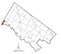
According to the United States Census Bureau, the township has a total area of 2.4 square miles (6.2 km2), of which 2.3 square miles (6.0 km2) is land and 0.1 square miles (0.26 km2), or 2.08%, is water. It is drained by the Schuylkill River, which separates it from Chester County. Its villages include Stowe and Upper Glasgow.

Neighboring municipalities

Transportation

US 422 westbound in West Pottsgrove Township 2022-10-10 10 29 23 View west along U.S. Route 422 (Pottstown Expressway) from the overpass for Grosstown Road in West Pottsgrove Township, Montgomery County, Pennsylvania.jpg
US 422 westbound in West Pottsgrove Township

As of 2018 there were 20.28 miles (32.64 km) of public roads in West Pottsgrove Township, of which 5.96 miles (9.59 km) were maintained by the Pennsylvania Department of Transportation (PennDOT) and 14.32 miles (23.05 km) were maintained by the township. [3]

U.S. Route 422 is the main highway serving West Pottsgrove Township, traversing the southern corner of the township on an east-west alignment. A small section of Pennsylvania Route 100 crosses the eastern corner of the township.

Pottstown Area Rapid Transit (PART) provides bus service to West Pottsgrove Township with the Green and Orange lines providing service to Pottstown. The Green Line serves Stowe while the Green and Orange lines serve the Upland Square shopping center. [4]

Demographics

Historical population
CensusPop.Note
1930 2,400
1940 2,6058.5%
1950 3,00715.4%
1960 3,50116.4%
1970 4,03815.3%
1980 4,2084.2%
1990 3,829−9.0%
2000 3,815−0.4%
2010 3,8741.5%
2020 3,798−2.0%
[5]

As of the 2010 census, the township was 83.7% White, 9.5% Black or African American, 0.3% Native American, 0.6% Asian, and 2.9% were two or more races. 3.3% of the population were of Hispanic or Latino ancestry. [6]

At the 2000 census there were 3,815 people, 1,524 households, and 1,010 families living in the township. The population density was 1,622.0 inhabitants per square mile (626.3/km2). There were 1,606 housing units at an average density of 682.8 per square mile (263.6/km2). The racial makeup of the township was 89.28% White, 7.21% African American, 0.18% Native American, 0.84% Asian, 0.03% Pacific Islander, 0.81% from other races, and 1.65% from two or more races. Hispanic or Latino of any race were 2.18%. [7]

There were 1,524 households, 29.9% had children under the age of 18 living with them, 52.2% were married couples living together, 10.7% had a female householder with no husband present, and 33.7% were non-families. 27.2% of households were made up of individuals, and 9.6% were one person aged 65 or older. The average household size was 2.50 and the average family size was 3.08.

The age distribution was 24.6% under the age of 18, 7.7% from 18 to 24, 32.3% from 25 to 44, 22.0% from 45 to 64, and 13.5% 65 or older. The median age was 36 years. For every 100 females there were 92.9 males. For every 100 females age 18 and over, there were 91.7 males.

The median household income was $42,759 and the median family income was $52,177. Males had a median income of $32,912 versus $28,949 for females. The per capita income for the township was $18,413. About 5.8% of families and 7.7% of the population were below the poverty line, including 8.7% of those under age 18 and 7.3% of those age 65 or over.

Government and politics

West Pottsgrove Township municipal building West Pottsgrove Township.jpg
West Pottsgrove Township municipal building

West Pottsgrove Township is governed by a five-member Board of Commissioners. As of 2022, the Board of Commissioners is composed of: [8]

Presidential elections results [9]
Year Republican Democratic
2020 48.0% 85850.0%888
2016 50.6%76943.0% 669
2012 43.8% 62353.8%764
2008 37.2% 55561.2%912
2004 42.2% 58957.2%799
2000 42.2% 45654.2%585
1996 34.1% 32449.3%468
1992 32.4% 36444.4%498

Related Research Articles

<span class="mw-page-title-main">Amity Township, Berks County, Pennsylvania</span> Township in Pennsylvania, United States

Amity Township is a township in Berks County, Pennsylvania, United States. The population was 13,435 at the 2020 census. Amity Township, especially in the Douglassville area, is seeing growth in development.

<span class="mw-page-title-main">Boyertown, Pennsylvania</span> Borough in Pennsylvania, United States

Boyertown is a borough in Berks County, Pennsylvania, United States. The population was 4,055 at the 2010 census. Boyertown is known for the many painted fiberglass bears that can be found throughout the town and borough.

<span class="mw-page-title-main">Douglass Township, Berks County, Pennsylvania</span> Township in Pennsylvania, United States

Douglass Township is a township in Berks County, Pennsylvania, United States. The population was 3,664 at the 2020 census.

<span class="mw-page-title-main">Earl Township, Berks County, Pennsylvania</span> Township in Pennsylvania, United States

Earl Township is a township in Berks County, Pennsylvania, United States. The population was 3,102 at the 2020 census. Earl Township was named for early German settler Hans Graaf. His surname Graaf means "earl" in English.

<span class="mw-page-title-main">Penn Township, Berks County, Pennsylvania</span> Township in Pennsylvania, United States

Penn Township is a township in Berks County, Pennsylvania, United States. The population was 1,949 at the 2010 census.

<span class="mw-page-title-main">Tilden Township, Pennsylvania</span> Township in Pennsylvania, United States

Tilden Township is a township in Berks County, Pennsylvania, United States. The population was 3,597 at the 2010 census.

<span class="mw-page-title-main">Tulpehocken Township, Pennsylvania</span> Township in Pennsylvania, United States

Tulpehocken Township is a township in Berks County, Pennsylvania, United States. The population was 3,274 at the 2010 census.

<span class="mw-page-title-main">Upper Tulpehocken Township, Pennsylvania</span> Township in Pennsylvania, United States

Upper Tulpehocken Township is a township in Berks County, Pennsylvania, United States. The population was 1,575 at the 2010 census.

<span class="mw-page-title-main">Washington Township, Berks County, Pennsylvania</span> Township in Pennsylvania, United States

Washington Township is a township in eastern Berks County, Pennsylvania, United States. The population was 3,810 at the 2010 census.

<span class="mw-page-title-main">North Coventry Township, Pennsylvania</span> Township in Pennsylvania, United States

North Coventry Township is a township in Chester County, Pennsylvania, United States. The population was 7,866 at the 2010 census.

<span class="mw-page-title-main">Douglass Township, Montgomery County, Pennsylvania</span> Township in Pennsylvania, United States

Douglass Township is a township in Montgomery County, Pennsylvania, United States. The population was 10,195 at the 2010 census.

Halfway House is a census-designated place (CDP) in Montgomery County, Pennsylvania, United States. The population was 2,881 at the 2010 census.

<span class="mw-page-title-main">Limerick Township, Pennsylvania</span> Township in Pennsylvania, United States

Limerick Township is a township in Montgomery County, Pennsylvania, United States.

<span class="mw-page-title-main">Lower Pottsgrove Township, Pennsylvania</span> Township in Pennsylvania, United States

Lower Pottsgrove Township is a township in Montgomery County, Pennsylvania, United States, approximately 30 miles northwest of Philadelphia and 18 miles southeast of Reading, along the Schuylkill River. The population was 12,059 at the 2010 census.

<span class="mw-page-title-main">New Hanover Township, Pennsylvania</span> Township in Pennsylvania, United States

New Hanover Township is a township in Montgomery County, Pennsylvania, United States. The population was 10,939 at the 2010 census.

<span class="mw-page-title-main">Pottstown, Pennsylvania</span> Borough in Pennsylvania, United States

Pottstown is a borough in Montgomery County, Pennsylvania, United States. Pottstown was laid out in 1752–53 and named Pottsgrove in honor of its founder, John Potts. The old name was abandoned at the time of the incorporation as a borough in 1815. In 1888, the limits of the borough were considerably extended. Pottstown is the center of a productive farming and dairying region.

<span class="mw-page-title-main">Sanatoga, Pennsylvania</span> Census-designated place in Pennsylvania, United States

Sanatoga is a community and census-designated place (CDP) that is located in Lower Pottsgrove Township, Montgomery County, Pennsylvania, United States. It is situated immediately east of the borough of Pottstown on U.S. Route 422.

<span class="mw-page-title-main">Stowe, Pennsylvania</span> Census-designated place in Pennsylvania, United States

Stowe is a census-designated place (CDP) in West Pottsgrove Township, Montgomery County, Pennsylvania, United States. The population was 3,695 at the 2010 census. It uses the Pottstown ZIP code of 19464.

<span class="mw-page-title-main">Upper Pottsgrove Township, Pennsylvania</span> Township in Pennsylvania, United States

Upper Pottsgrove Township is a township in Montgomery County, Pennsylvania, United States. The population was 5,315 at the 2010 census.

<span class="mw-page-title-main">Stowe Township, Pennsylvania</span> Township in Pennsylvania, United States

Stowe Township is a township in Allegheny County, Pennsylvania, United States. The population was 6,362 at the 2010 census.

References

  1. "2016 U.S. Gazetteer Files". United States Census Bureau. Retrieved Aug 14, 2017.
  2. "Population and Housing Unit Estimates" . Retrieved June 9, 2017.
  3. "West Pottsgrove Township map" (PDF). PennDOT. Retrieved March 10, 2023.
  4. "Schedule". Pottstown Area Rapid Transit. Retrieved January 20, 2020.
  5. "Census 2020".
  6. Census 2010: Pennsylvania. Usatoday.Com. Retrieved on 2013-07-21.
  7. "U.S. Census website". United States Census Bureau . Retrieved 2008-01-31.
  8. "Board of Commissioners". West Pottsgrove Township. Retrieved January 9, 2022.
  9. "Montco Election Results".