Blue Bell, Pennsylvania

Last updated

Blue Bell
NORMANDY HOMESTEAD, MONTGOMERY COUNTY, PA.jpg
Normandy Farmstead
USA Pennsylvania location map.svg
Red pog.svg
Blue Bell
Location of Blue Bell in Pennsylvania
Usa edcp location map.svg
Red pog.svg
Blue Bell
Blue Bell (the United States)
Coordinates: 40°08′41″N75°16′08″W / 40.14472°N 75.26889°W / 40.14472; -75.26889
CountryUnited States
State Pennsylvania
County Montgomery
Township Whitpain
Area
[1]
  Total5.39 sq mi (13.96 km2)
  Land5.39 sq mi (13.96 km2)
  Water0.00 sq mi (0.00 km2)
Elevation
358 ft (109 m)
Population
 (2020) [2]
  Total6,506
  Density1,207.27/sq mi (466.10/km2)
Time zone UTC-5 (EST)
  Summer (DST) UTC-4 (EDT)
ZIP code
19422
Area codes 215/267/445, 610/484
FIPS code 42-07224

Blue Bell is a census-designated place (CDP) in Whitpain Township, Pennsylvania, United States. As of the 2010 census, its population was 6,067.

Contents

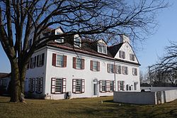
Blue Bell was originally known as Pigeontown, after the large flocks of the now-extinct passenger pigeons that once gathered there. The town was renamed in 1840 after the historically prominent Blue Bell Inn.

Blue Bell is known for its large executive-style mansions, major business parks, community shopping facilities, and small businesses. It is one of the most affluent areas outside the Main Line communities in the Philadelphia area. In July 2005, Money magazine ranked Blue Bell 14th on its list of the "100 Best Places to Live in the United States". [3]

History

Whitpain Public School was added to the National Register of Historic Places in 2006. [4] The “Dutchman” is a well-known historical landmark within the town of Blue Bell.[ citation needed ]

Geography

Blue Bell is located at 40°8′41″N75°16′8″W / 40.14472°N 75.26889°W / 40.14472; -75.26889 (40.144759, -75.268752). [5] According to the United States Census Bureau, the CDP has a total area of 5.4 square miles (14 km2), all land.

While the CDP of Blue Bell proper consists of an area roughly centered upon the namesake Inn, [6] in recent years [ when? ] the name "Blue Bell" has become informally synonymous with the larger surrounding area within the 19422 ZIP code, including the communities of Center Square and Belfry.[ citation needed ]

The boundary between area codes 215/267/445 and 610/484 runs through Blue Bell's center. [7]

Demographics

Historical population
CensusPop.Note
1990 6,091
2000 6,3955.0%
2010 6,067−5.1%
2020 6,5067.2%
[8] [2]

As of the 2000 census, [9] there were 6,395 people, 1,424 households, and 1,827 families residing in the CDP. The population density was 1,183.0 inhabitants per square mile (456.8/km2). There were 2,503 housing units at an average density of 463.0 per square mile (178.8/km2). The racial makeup of the CDP was 90.32% White, 6.52% Asian, 2.42% African American, 0.02% Native American, 0.22% from other races, and 0.50% from two or more races. Hispanic or Latino of any race were 1.14% of the population.

There were 1,434 households, of which 32.0% had children under the age of 18 living with them, 68.2% were married couples living together, 5.7% had a female householder with no husband present, and 24.9% were non-families. 20.8% of all households were made up of individuals, and 8.6% had someone living alone who was 65 years of age or older. The average household size was 2.60 and the average family size was 3.03.

In the CDP, the population was spread out, with 23.8% under the age of 18, 4.7% from 18 to 24, 24.9% from 25 to 44, 29.5% from 45 to 64, and 17.0% who were 65 years of age or older. The median age was 43 years. For every 100 females, there were 94.0 males. For every 100 females age 18 and over, there were 90.2 males.

The median income for a household in the CDP was $106,617, and the median income for a family was $115,541. Males had a median income of $75,462 versus $50,481 for females. The per capita income for the CDP was $43,813. About 1.8% of families and 2.8% of the population were below the poverty line, including 2.1% of those under age 18 and 1.5% of those age 65 or over.

For the population which consists of peoples 25 years and older; 95.6% of residents have a high school diploma or higher, 61.7% have their bachelor's degree or higher, and 23.5% have their graduate or professional degree.[ citation needed ]

Economy

Blue Bell is home to the global headquarters of Unisys, [10] [11] a provider of information technology services and products. Aetna, an insurance provider, also maintains an office in Blue Bell. [12] UniTek Global Services, an international telecommunications, cable and satellite services company, is headquartered in Blue Bell. [13] It is also home to the Montgomery County Community College, Wings Field Airport, Bluestone Country Club, and Blue Bell Country Club, boasting an 18-hole Arnold Palmer Signature golf course.

The most common industries for men in Blue Bell include professional, scientific, and technical services (18%), finance and insurance (10%), health care (7%), real estate and rental and leasing (6%), construction (5%), chemicals (5%), and educational services (4%). The most common industries for women in Blue Bell include professional, scientific and technical services (11%), educational services (11%), finance and insurance (7%), chemicals (5%), real estate and rental and leasing (4%), and accommodation and food services (3%).

The nearest major shopping malls are the Montgomery Mall in North Wales, the Plymouth Meeting Mall in Plymouth Meeting, and the King of Prussia mall in King of Prussia.

Education

Blue Bell is part of the Wissahickon School District which was ranked ninth, in September 2016, by Patch.com's "50 Best Places to Teach in Pennsylvania." [14] There are also two institutions of higher education in Blue Bell, the main campus of Montgomery County Community College and Reformed Episcopal Seminary .

See also

Related Research Articles

<span class="mw-page-title-main">Ugashik, Alaska</span> Census-designated place in Alaska, United States

Ugashik is a census-designated place (CDP) in Lake and Peninsula Borough, Alaska, United States. The population was 4 at the 2020 census, down from 12 in 2010.

<span class="mw-page-title-main">Poplar-Cotton Center, California</span> Census-designated place in California, United States

Poplar-Cotton Center is a census-designated place (CDP) in Tulare County, California, United States. The population was 2,470 at the 2010 census, up from 1,496 at the 2000 census.

<span class="mw-page-title-main">Warm Mineral Springs, Florida</span> Census-designated place in Florida, United States

Warm Mineral Springs is a census-designated place (CDP) in Sarasota County, Florida, United States. The population was 5,061 at the 2010 census. It is part of the Bradenton–Sarasota–Venice Metropolitan Statistical Area.

<span class="mw-page-title-main">Mount Aetna, Maryland</span> CDP in Maryland, United States

Mount Aetna is a census-designated place (CDP) in Washington County, Maryland, United States. The population was 838 at the 2000 census.

<span class="mw-page-title-main">Echelon, New Jersey</span> Populated place in Camden County, New Jersey, US

Echelon is an unincorporated community and census-designated place (CDP) located within Voorhees Township in Camden County, in the U.S. state of New Jersey. As of the 2010 United States Census, the CDP's population was 10,743.

<span class="mw-page-title-main">Claysburg, Pennsylvania</span> Census-designated place in Pennsylvania, United States

Claysburg is a census-designated place (CDP) along Interstate 99 and the Allegheny Front in Blair County, Pennsylvania, United States, situated near the base of Blue Knob. As of the 2020 census, it had a population of 1,291.

<span class="mw-page-title-main">Beaverdale, Pennsylvania</span> Census-designated place in Pennsylvania, United States

Beaverdale is an unincorporated community and census-designated place (CDP) in Cambria County, Pennsylvania, United States. The population was 1,035 at the 2010 census. Prior to that time, the CDP was known as Beaverdale-Lloydell.

<span class="mw-page-title-main">Chesterbrook, Pennsylvania</span> Census-designated place in Pennsylvania, United States

Chesterbrook is a census-designated place (CDP) in Chester County, Pennsylvania, United States. It is located within the Philadelphia metropolitan area and just south of Valley Forge National Historical Park. The population was 4,589 at the 2010 census.

<span class="mw-page-title-main">Buckhorn, Pennsylvania</span> Census-designated place in Pennsylvania, United States

Buckhorn is a census-designated place (CDP) in Columbia County, Pennsylvania, United States. It is part of Northeastern Pennsylvania. The population was 318 at the 2010 census. It is part of the Bloomsburg-Berwick micropolitan area. It uses the Bloomsburg ZIP code of 17815.

Lower Allen is a census-designated place (CDP) in Lower Allen Township in Cumberland County, Pennsylvania, United States. The population was 6,694 at the 2010 census. It is part of the Harrisburg–Carlisle metropolitan statistical area.

<span class="mw-page-title-main">Colonial Park, Pennsylvania</span> Census-designated place in Pennsylvania, United States

Colonial Park is an unincorporated community and census-designated place (CDP) in Lower Paxton Township, Pennsylvania, United States. The population was 13,229 at the 2010 census. It is part of the Harrisburg–Carlisle Metropolitan Statistical Area. It uses the Harrisburg ZIP code of 17109 and hosts a great deal of the area's retail activity, including the Colonial Park Mall.

Campbelltown is an unincorporated community and census-designated place (CDP) in Lebanon County, Pennsylvania, United States. The population was 3,616 at the 2010 census. It is located east of Hershey at the intersection of U.S. Route 322 and Pennsylvania Route 117 and is located in the Harrisburg metropolitan area.

Arlington Heights is a census-designated place (CDP) in Monroe County, Pennsylvania, United States. The population was 6,331 at the 2020 census. One notable location in Arlington Heights is the Stroud Mall.

<span class="mw-page-title-main">Glenside, Pennsylvania</span> Place in Pennsylvania, United States

Glenside is a census-designated place (CDP) located in Cheltenham Township and Abington Township in Montgomery County, Pennsylvania, United States. It borders Northwest Philadelphia. The population was 7,737 at the 2020 census on a land area of 1.3 square miles.

<span class="mw-page-title-main">Harleysville, Pennsylvania</span> Census-designated place in Pennsylvania, United States

Harleysville is a census-designated place (CDP) in Montgomery County, Pennsylvania, United States. It is a suburb of Philadelphia. The population was 9,286 at the 2010 census. It is located mostly within Lower Salford Township and also in Franconia Township. Harleysville was settled by Pennsylvania Dutch in the 18th century and was named after Samuel Harley.

<span class="mw-page-title-main">Kulpsville, Pennsylvania</span> Census-designated place in Pennsylvania, United States

Kulpsville is a census-designated place (CDP) in Montgomery County, Pennsylvania. The population was 8,194 at the 2010 census. It is located in Towamencin Township, which is part of the North Penn Valley region that is centered around the borough of Lansdale. The name is derived from the Kulp family.

<span class="mw-page-title-main">Montgomeryville, Pennsylvania</span> Census-designated place in Pennsylvania, United States

Montgomeryville is a census-designated place (CDP) in Montgomery Township, Montgomery County, Pennsylvania, United States. The population was 12,624 at the 2010 census. According to a 2010 Forbes magazine/Yahoo.com survey, Montgomeryville ranks 5th in America's top 10 affordable suburbs. It is part of the North Penn Valley region that is centered on the borough of Lansdale.

<span class="mw-page-title-main">Whitpain Township, Pennsylvania</span> Township in Pennsylvania, United States

Whitpain Township is a township in Montgomery County, Pennsylvania, United States. Founded in 1701, it has grown to a total population of 18,875 as of the 2010 census.

Friedens is a census-designated place (CDP) that is part of Somerset Township in Somerset County, Pennsylvania, United States. The population was 1,523 at the 2010 census. It is part of the Johnstown, Pennsylvania Metropolitan Statistical Area.

<span class="mw-page-title-main">Hillandale, Maryland</span> Census-designated place in Maryland, United States

Hillandale is an unincorporated area and census-designated place located in Montgomery and Prince George's counties, Maryland, United States. As of the 2020 census, it had a population of 5,774. Hillandale is contained between the Prince George's / Montgomery County line to the east, the Anacostia River to the west, McCeney Avenue to the north, and D.C.'s Capital Beltway to the south. It borders the communities of Adelphi, Avenel, White Oak and Beltsville.

References

  1. "ArcGIS REST Services Directory". United States Census Bureau. Retrieved October 12, 2022.
  2. 1 2 "Census Population API". United States Census Bureau. Retrieved October 12, 2022.
  3. "Best Places to Live 2005". CNN.
  4. "National Register Information System". National Register of Historic Places . National Park Service. July 9, 2010.
  5. "US Gazetteer files: 2010, 2000, and 1990". United States Census Bureau. February 12, 2011. Retrieved April 23, 2011.
  6. "Blue Bell CDP, Pennsylvania - Reference Map - American FactFinder". Archived from the original on May 17, 2007. Retrieved January 27, 2007.
  7. 610/484/835 Area Code Map
  8. "Census 2020".
  9. "U.S. Census website". United States Census Bureau . Retrieved January 31, 2008.
  10. "4th Quarter 2006 [ permanent dead link ]." Unisys. Retrieved on August 24, 2009.
  11. "Blue Bell CDP, Pennsylvania Archived 2007-05-17 at the Wayback Machine ." U.S. Census Bureau. Retrieved on August 24, 2009.
  12. "Directions: Blue Bell -- Aetna". Aetna. 2001–2011. Retrieved November 30, 2011.
  13. "UniTek Global Services Inc. | Connecting the Wired & Wireless Worlds". Archived from the original on April 7, 2014. Retrieved April 3, 2014.
  14. "The 50 Best Places To Teach In Pennsylvania". Patch.com. September 16, 2016. Archived from the original on September 17, 2016. Retrieved February 18, 2021.