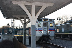
Edge Hill, Pennsylvania

Last updated

Edge Hill
USA Pennsylvania location map.svg
Red pog.svg
Edge Hill
Location of Edge Hill in Pennsylvania
Usa edcp location map.svg
Red pog.svg
Edge Hill
Edge Hill (the United States)
Coordinates: 40°6′12″N75°9′48″W / 40.10333°N 75.16333°W / 40.10333; -75.16333
Country United States
State Pennsylvania
County Montgomery
Township Cheltenham
CommissionerJ. Andrew Sharkey
Elevation
302 ft (92 m)
Time zone UTC-5 (Eastern Standard Time)
  Summer (DST) UTC-4 (Eastern Daylight Time)
ZIP code
19038
Area codes 215, 267 and 445

Edge Hill is an unincorporated community in Cheltenham Township in Montgomery County, Pennsylvania, United States. Edge Hill is located along Pennsylvania Route 152 between Pennsylvania Route 73 and Mount Carmel Avenue. [1]

Edge Hill is a suburb of Philadelphia.

A stone quarry was established in Edge Hill in the 1880s. [2]

Related Research Articles

<span class="mw-page-title-main">Hilltown Township, Pennsylvania</span> Township in Pennsylvania, United States

Hilltown Township is a township in Bucks County, Pennsylvania, United States. The population was 15,029 at the 2010 census. Most of Hilltown is part of Pennridge School District, while a small portion in Line Lexington is part of North Penn School District.

<span class="mw-page-title-main">New Britain Township, Pennsylvania</span> Township in Pennsylvania, United States

New Britain Township is a township in Bucks County, Pennsylvania, United States. The population was 11,070 at the 2010 census.

<span class="mw-page-title-main">Abington Township, Montgomery County, Pennsylvania</span> Township in Pennsylvania, United States

Abington Township is a township in Montgomery County, Pennsylvania, United States. It is adjacent to Philadelphia's northern fringe. The population was 58,502 as of the 2020 census, making it the second most populous township in Montgomery County after Lower Merion Township. The population density is 3603.3 per square mile (1,377/km2), making it the second most densely populated township in Montgomery County after Cheltenham Township.

<span class="mw-page-title-main">Hatfield Township, Pennsylvania</span> Township in Pennsylvania, United States

Hatfield Township is a township in Montgomery County, Pennsylvania, United States. The population was 17,249 at the 2010 census. It is part of the North Penn Valley region which is centered around the borough of Lansdale.

<span class="mw-page-title-main">Horsham, Pennsylvania</span> Census-designated place in Pennsylvania, United States

Horsham is a census-designated place in Horsham Township, Montgomery County, Pennsylvania, United States. The population was 15,193 at the 2020 census. It is home to the Biddle Air National Guard Base at the former site of Naval Air Station Joint Reserve Base Willow Grove.

<span class="mw-page-title-main">Springfield Township, Montgomery County, Pennsylvania</span> Township in Pennsylvania, United States

Springfield Township is a township in Montgomery County, Pennsylvania. The population was 20,993 in 2022 according the Census Bureau. It includes the villages of Wyndmoor, Erdenheim, Flourtown, and Oreland. The communities of Lafayette Hill, Fort Washington, Laverock, North Hills, Miquon, and Glenside are also situated partly inside the Township.

<span class="mw-page-title-main">Whitemarsh Township, Pennsylvania</span> Home rule municipality in Pennsylvania, United States

Whitemarsh Township is a Home rule municipality in Montgomery County, Pennsylvania. It retains its former classification of "Township" in its official name despite being a home rule municipality. The population was 19,707 at the 2020 census. Whitemarsh is adjacent to the neighborhood of Andorra in the Roxborough section of Philadelphia, and is bordered in Montgomery County by Springfield, Upper Dublin, Whitpain, and Plymouth townships, Conshohocken, and the Schuylkill River, which separates it from Lower Merion Township.

<span class="mw-page-title-main">Pennsylvania Route 54</span> State highway in Pennsylvania, US

Pennsylvania Route 54 is a state highway which runs for 82 miles (132 km) in eastern Pennsylvania in the United States.

The North Penn Valley is a region of Philadelphia suburbs and exurbs in Montgomery County, Pennsylvania. It is somewhat congruent with the North Penn School District. It contains the boroughs of North Wales, Lansdale, and Hatfield, as well as the surrounding townships. The area to its west has traditionally been more rural, while the suburbs to its south and east are, on the whole, more affluent and densely populated.

<span class="mw-page-title-main">Bethlehem Pike</span>

Bethlehem Pike is a historic 42.21 mi (67.93 km) long road in the U.S. state of Pennsylvania that connects Philadelphia and Bethlehem, Pennsylvania. It began as a Native American path called the Minsi Trail which developed into a colonial highway called the King's Road in the 1760s. Most of the route later became part of U.S. Route 309, now Pennsylvania Route 309.

<span class="mw-page-title-main">Pennsylvania Route 63</span> 37.4-mile-long (60.2 km) state highway located in Pennsylvania

Pennsylvania Route 63 (PA 63) is a 37.4-mile-long (60.2 km) state highway located in the Philadelphia, Pennsylvania, area. The western terminus of the route is at PA 29 in Green Lane, Montgomery County. The eastern terminus is at Interstate 95 (I-95) in Bensalem Township, Bucks County. PA 63 runs northwest to southeast for most of its length. The route heads through a mix of suburban and rural areas of northern Montgomery County as a two-lane road, passing through Harleysville, before coming to an interchange with I-476 in Kulpsville. From this point, PA 63 continues through predominantly suburban areas of eastern Montgomery County as a two- to four-lane road, passing through Lansdale, Maple Glen, Willow Grove, and Huntingdon Valley. Upon entering Northeast Philadelphia, the route follows Red Lion Road and U.S. Route 1 (US 1) before heading southeast on a freeway called Woodhaven Road to I-95.

<span class="mw-page-title-main">Ardsley, Pennsylvania</span> Unincorporated community in Pennsylvania, United States

Ardsley is an unincorporated community located in Abington Township, as well as Upper Dublin Township, Montgomery County, Pennsylvania, United States. It is a neighbor of Glenside. A large portion of this neighborhood is composed of the historic cemeteries Hillside Cemetery and Ardsley Burial Park. It is the location of the Ardsley SEPTA station.

<span class="mw-page-title-main">Pennsylvania Route 463</span> A 12.9-mile-long (20.8 km) state highway completely in Montgomery County, Pennsylvania

Pennsylvania Route 463 (PA 463) is a 12.9-mile-long (20.8 km) state highway completely in Montgomery County, Pennsylvania. Its western terminus is at PA 63 in Hatfield Township and its eastern terminus is at PA 611 in Horsham. PA 463 runs through the northern suburbs of Philadelphia and passes through the towns of Hatfield, Montgomeryville, and Horsham. The route intersects PA 309, U.S. Route 202 Business, and US 202 in Montgomeryville and PA 152 in Prospectville. Through its length, the route carries the names Forty Foot Road, Broad Street, Main Street, Cowpath Road, and Horsham Road. PA 463 was designated in 1928 and fully paved by 1940. In 2010, a portion of the route in Montgomery Township was widened.

<span class="mw-page-title-main">Pennsylvania Route 152</span> State highway in Pennsylvania, US

Pennsylvania Route 152 (PA 152) is a 25.3-mile-long (40.7 km) state highway located in the U.S. state of Pennsylvania. The route travels north–south from an interchange with PA 309 located in the Cedarbrook neighborhood of Cheltenham Township in Montgomery County north to another interchange with PA 309 located northeast of Telford in Bucks County. PA 152 is known as Limekiln Pike for most of its length. From the southern terminus, the route passes through suburban areas to the north of Philadelphia, serving Dresher, Maple Glen, and Chalfont. North of Chalfont, PA 152 runs through rural suburbs of Philadelphia before reaching Silverdale. Past here, the road continues northwest through Perkasie, where it turns southwest and passes through Sellersville before reaching its northern terminus.

<span class="mw-page-title-main">Pennsylvania Route 563</span> State highway in the U.S. state of Pennsylvania

Pennsylvania Route 563 (PA 563) is a state highway in the U.S. state of Pennsylvania. The route runs 21.15 mi (34.04 km) from PA 63 in Upper Salford Township northeast to PA 412 in Nockamixon Township. The road runs through mostly rural areas in the northern parts of Montgomery and Bucks counties. Along the way, the route passes through the northern part of Perkasie and forms a concurrency with PA 313 in East Rockhill Township. North of here, PA 563 runs through Nockamixon State Park, heading to the northwest of Lake Nockamixon.

The following is a list of former state routes in Pennsylvania. These roads are now either parts of other routes or no longer carry a traffic route number. This list also includes original routes of numbers that were decommissioned and later reactivated in other locations in which most of these are still active today.

<span class="mw-page-title-main">Cedarbrook, Pennsylvania</span> Place in Pennsylvania, United States

Cedarbrook is an unincorporated community in Cheltenham Township in Montgomery County, Pennsylvania, United States. Cedarbrook is located at the intersection of Pennsylvania Route 309 and Greenwood Avenue, just over the city line of Philadelphia. Cedarbrook is home to the Cedarbrook Shopping Center, a major shopping attraction for many Cheltenham Township and North Philadelphia shoppers.

Eureka is an unincorporated community in Pennsylvania, United States on the border of Warrington Township in Bucks County and Montgomery Township in Montgomery County. Eureka is at the intersection of Pennsylvania Route 152 and County Line Road.

Kasiesville is an unincorporated community in Montgomery Township in Franklin County, Pennsylvania, United States. Kasiesville is located on Pennsylvania Route 75, south of Mercersburg and north of the Maryland border.

Germantown Pike is a historic road in Pennsylvania that opened in 1687, running from Philadelphia northwest to Collegeville. The road is particularly notable for the "imposing mansions" that existed in the Germantown neighborhood in Philadelphia. The road was left in ruins after the British destroyed it in the Revolutionary War during the 1777 Battle of Germantown, and was not rebuilt until 1809. Portions of Germantown Pike were signed as U.S. Route 422 (US 422) before the latter was rerouted along a freeway alignment to King of Prussia.

References

  1. Montgomery County, Pennsylvania (Map) (18th ed.). 1"=2000'. ADC Map. 2006. p. 3370. § C4. ISBN   0-87530-775-2.
  2. Herman, Andrew Mark (2005). Eastern Montgomery County Revisited. Arcadia. p. 45.