Narberth, Pennsylvania

Last updated

Borough of Narberth
Narberth post office.jpg
Narberth post office
Flag of Narberth, Pennsylvania.png
Seal of Narberth, Pennsylvania.png
Narberth Montgomery County.png
Location of Narberth in Montgomery County, Pennsylvania
USA Pennsylvania location map.svg
Red pog.svg
Narberth
Location of Narberth in Pennsylvania
Usa edcp location map.svg
Red pog.svg
Narberth
Narberth (the United States)
Coordinates: 40°00′27″N75°15′44″W / 40.00750°N 75.26222°W / 40.00750; -75.26222
CountryUnited States
StatePennsylvania
County Montgomery
Settled1682
Government
  TypeCouncil-manager
  MayorAndrea Deutsch (D)
Area
[1]
  Total0.50 sq mi (1.30 km2)
  Land0.50 sq mi (1.30 km2)
  Water0.00 sq mi (0.00 km2)
Elevation
308 ft (94 m)
Population
 (2020) [2]
  Total4,492
  Density8,930.42/sq mi (3,449.00/km2)
Time zone UTC-5 (EST)
  Summer (DST) UTC-4 (EDT)
ZIP Code
19072
Area codes 610 and 484
FIPS code 42-52664
Website www.narberthborough.com

Narberth is a borough in Montgomery County, Pennsylvania. It is one of many neighborhoods on the historic Philadelphia Main Line. The population was 4,282 at the 2010 census.

Contents

History

Narberth is located on a parcel of land originally deeded to Edward Rees, which later became “Prees” and eventually “Price”, who arrived from Wales in 1682. A portion of this original tract became the 100-acre (0.40 km2) farm of Edward R. Price, who founded Elm as a Quaker-friendly town in 1881. The town name changed to Narberth in 1893, and Narberth was incorporated in 1895. [3] In 1995, the borough celebrated its 100th birthday with a year-long celebration.

The Narbrook Park Historic District was listed on the National Register of Historic Places in 2003. [4]

Demographics

Historical population
CensusPop.Note
1900 847
1910 1,790111.3%
1920 3,704106.9%
1930 4,66926.1%
1940 5,21711.7%
1950 5,4073.6%
1960 5,109−5.5%
1970 5,1510.8%
1980 4,496−12.7%
1990 4,278−4.8%
2000 4,233−1.1%
2010 4,2821.2%
2020 4,4924.9%
[5] [2]

As of the 2010 census, the borough was 90.4% White, 1.9% Black or African American, 4.4% Asian, 0.1% Native Hawaiian, and 2.7% were two or more races. 2.4% of the population were of Hispanic or Latino ancestry. [6]

As of the census [7] of 2000, there were 4,233 people, 1,904 households, and 1,037 families residing in the borough. The population density was 8,571.7 inhabitants per square mile (3,309.6/km2). There were 1,981 housing units at an average density of 4,011.5 per square mile (1,548.8/km2). The racial makeup of the borough was 95.23% White, 1.18% African American, 0.12% Native American, 2.27% Asian, 0.14% from other races, and 1.06% from two or more races. Hispanic or Latino of any race were 1.39% of the population.

There were 1,904 households, out of which 26.3% had children under the age of 18 living with them, 44.9% were married couples living together, 7.8% had a female householder with no husband present, and 45.5% were non-families. 37.2% of all households were made up of individuals, and 10.2% had someone living alone who was 65 years of age or older. The average household size was 2.22 and the average family size was 3.02.

In the borough, the population was spread out, with 22.3% under the age of 18, 5.2% from 18 to 24, 34.9% from 25 to 44, 24.9% from 45 to 64, and 12.7% who were 65 years of age or older. The median age was 39.6 years. [8] For every 100 females there were 85.1 males. For every 100 females age 18 and over, there were 81.0 males.

In 2021, the median estimated income for a household in the borough was $133,475. [8] Males had a median income of $59,076 versus $41,518 for females. The per capita income for the borough was $35,165. About 2.6% of families and 3.4% of the population were below the poverty line, including 2.5% of those under age 18 and 6.4% of those age 65 or over.

The borough has many square blocks of fine old Victorian homes and apartment buildings, and most of its families live north and west of downtown areas, extending north along Montgomery Avenue to North Wynnewood Avenue.

Geography

According to the U.S. Census Bureau, the borough has a total area of 0.5 square miles (1.3 km2), all land.

Narberth is an enclave surrounded by Lower Merion Township, close to the western edge of the city of Philadelphia. It is part of the Philadelphia Main Line, a string of leafy, picturesque suburbs with quaint Welsh names extending west from Philadelphia along the old Pennsylvania Railroad's "main line" from Merion through Ardmore, Bryn Mawr, Villanova, Devon and Wayne among other towns and municipalities. Narberth is unique among those locations in that it is fairly enclosed; no major thoroughfares run through the town, but Montgomery Avenue runs northwest–southeast along the borough's northern border.

Because of its small size, many of Narberth's shopping and recreational facilities are within walking distance of residents' houses. SEPTA's "Main Line" railroad tracks separate North Side from South Side. Narberth is mostly a residential community, with a central business district along Haverford, Narberth, Forrest, and Essex Avenues. The borough is bordered by the towns of Wynnewood, Pennsylvania, Merion, and Penn Valley, Pennsylvania.

Climate

The climate in this area is characterized by hot, humid summers and generally mild to cool winters. According to the Köppen Climate Classification system, Narberth has a humid subtropical climate, abbreviated "Cfa" on climate maps. [9]

Average monthly temperatures range from 32.2 °F in January to 77.2 °F in July. [10]

Shopping and entertainment

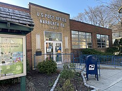
Narberth's business district has a variety of small, generally independent businesses. Some have been there for decades, including The Cheese Company and Real Pizza. [11] Narberth also has an independent movie theater located in its downtown. Many borough businesses belong to the Narberth Business Association, which promotes the town as a shopping destination and also puts on occasional events, including the Spring Sidewalk Sale and the Narberth Dickens Festival. [12]

Recreation

The Borough of Narberth maintains two recreational facilities: The Narberth Playground and the Sabine Avenue Playground. The Narberth Playground has two basketball courts, three tennis courts, a field area, a junior basketball court (once volleyball), and a playground for younger children. The Sabine Avenue Tot Lot, on the grounds of the former Narberth Elementary School, is the smaller of the two and was recently renovated with new playground equipment. In addition, the borough sponsors a Fall soccer program, a Spring baseball program, a Summer basketball program, and many other sports and recreation activities.

Politics and government

Presidential elections results [13]
Year Republican Democratic
2020 14.8% 46684.5%2,666
2016 16.4% 44880.1%2,191
2012 23.9% 62574.9%1,959
2008 23.0% 60875.9%2,009
2004 29.7% 78069.9%1,838
2000 32.1% 75465.0%1,525

Narberth has a city manager form of government with a mayor and a seven-member borough council. The mayor is Andrea Deutsch, a Democrat. The members of Borough Council, all of whom are Democrats, are Fred Bush (president), Cyndi Rickards (vice president), Jean Burock, Ira Winston, Michael Gaudini, Jim Speer, and Mike Salmanson. [14] The Borough Manager is Matt West. The Solicitor is John Walko.

The borough is part of Pennsylvania's Fifth Congressional District (represented by Mary Scanlon). In the US Senate, the Borough is represented by Senator Bob Casey, Jr. (senior senator) and John Fetterman (junior senator). In the Pennsylvania General Assembly, the Borough is part of the 148th State House District (represented by Rep. Mary Jo Daley) and the 17th State Senate District (represented by Sen. Amanda Cappelletti). [15] [16]

Education

Residents of Narberth are served by the Lower Merion School District. Borough children attend either Merion Elementary or Belmont Hills Elementary schools, Bala Cynwyd Middle or Welsh Valley Middle schools, and either Lower Merion High School or Harriton High School. Religious schools in the immediate vicinity include the private Waldron Mercy Academy and Merion Mercy Academy Catholic schools, the parish Saint Margaret's Elementary Catholic School, and Torah Academy in nearby Wynnewood. Nearby private schools include Friends' Central School on City Avenue, the French International School in Bala Cynwyd, Gladwyne Montessori in Gladwyne, the girls schools Agnes Irwin in Rosemont, Baldwin in Bryn Mawr, the boys school The Haverford School in Haverford, and coeducational Episcopal Academy in Newtown Square and Shipley School in Bryn Mawr.

Narberth is close to Saint Joseph's University, which occupies an increasingly large campus in nearby Merion on City Avenue. Haverford College, Bryn Mawr College, Villanova University, Cabrini College, Eastern University, and Rosemont College are nearby to the west, while the University of Pennsylvania, Drexel University, Thomas Jefferson University, Philadelphia University, and Temple University are nearby to the east in the City of Philadelphia.

Transportation

SEPTA commuter rail station at Narberth, PA Narberth, PA SEPTA Train Station.jpg
SEPTA commuter rail station at Narberth, PA

As of 2009 there were 11.06 miles (17.80 km) of public roads in Narberth, of which 0.32 miles (0.51 km) were maintained by the Pennsylvania Department of Transportation (PennDOT) and 10.74 miles (17.28 km) were maintained by the borough. [17]

No numbered highways directly serve Narberth. Main streets traversing the borough include Narberth Avenue, Wynnewood Road and Haverford Avenue. The nearest state highways are Pennsylvania Route 23, U.S. Route 30, U.S. Route 1, and Interstate 76, all traversing the surrounding township of Lower Merion.

Narberth Community Library Narberth library.jpg
Narberth Community Library

The Narberth Train Station, the third stop on SEPTA's Paoli/Thorndale Line to Center City Philadelphia, is located on Haverford Avenue in downtown Narberth. These railroad tracks run through the Philadelphia Main Line, the collective western suburbs of Philadelphia where the railroad westward was originally established. Towns on the lower Main Line adjacent to Narberth include Overbrook, Merion, Wynnewood, Ardmore, Haverford, and Bryn Mawr. The SEPTA Route 105 bus runs along the length of Lancaster Avenue on the Main Line, and the SEPTA Route 44 bus supplements the trains for service between Narberth and Center City Philadelphia. South Wynnewood is served by the SEPTA's Norristown High Speed Line that connects the southern Main Line suburbs with Norristown to the north and west and SEPTA's 69th Street Transportation Center, where there is a connection to the Market–Frankford Line to Center City and beyond into Frankford north of Center City along the Delaware River.

Hospitals

Nearby Wynnewood is also home to one of the three principal teaching hospitals that serve Philadelphia's Main Line. Along with the eponymous Bryn Mawr and Paoli Memorial hospitals, Lankenau Medical Center, on Lancaster Pike (Route 30) in Wynnewood near the Overbrook border, has traditionally been affiliated with either Jefferson or Hahnemann (now Drexel) colleges of medicine and is always (with Bryn Mawr and Paoli) on the list of the nation's top community hospitals. Saunders House, a rehabilitation facility, can be found on Lankenau's premises, as is a large and busy medical office building that is home to many of the private practices of the hospital's attending physicians.

Press

Local events are covered by The Main Line Times and the newer Main Line Life print newspapers.

Notable people

Related Research Articles

<span class="mw-page-title-main">Montgomery County, Pennsylvania</span> County in Pennsylvania, United States

Montgomery County, colloquially referred to as Montco, is a county in the Commonwealth of Pennsylvania. As of the 2020 census, the population of the county was 856,553, making it the third-most populous county in Pennsylvania after Philadelphia and Allegheny counties.

<span class="mw-page-title-main">Bryn Mawr, Pennsylvania</span> Census-designated place in Pennsylvania, United States

Bryn Mawr, is a census-designated place (CDP) located across three townships: Radnor Township and Haverford Township in Delaware County and Lower Merion Township in Montgomery County, Pennsylvania, United States. It is located just west of Philadelphia along Lancaster Avenue, also known as U.S. Route 30.

<span class="mw-page-title-main">Haverford Township, Pennsylvania</span> Place in Pennsylvania

Haverford Township is a home rule municipality township in Delaware County, Pennsylvania, United States. Haverford is named after the town of Haverfordwest in Wales. It is a commuting suburb located due west of Philadelphia and is officially known as the Township of Haverford. Despite being under a home rule charter since 1977, it continues to operate under a Board of Commissioners divided into wards, as do "First Class" townships that are still under the Pennsylvania Township Code. Haverford Township was founded in 1682 and incorporated in 1911.

<span class="mw-page-title-main">Lower Merion Township, Pennsylvania</span> Township in Pennsylvania, United States

Lower Merion Township is a township in Montgomery County, Pennsylvania, United States. It is part of the Philadelphia Main Line. The township's name originates with the county of Merioneth in north Wales. Merioneth is an English-language transcription of the Welsh Meirionnydd.

<span class="mw-page-title-main">Penn Wynne, Pennsylvania</span> Census-designated place in Pennsylvania, United States

Penn Wynne is a census-designated place (CDP) in Montgomery County, Pennsylvania, United States. It is part of Lower Merion Township, and the mailing address is Wynnewood. The population was 5,697 at the 2010 census. It is mainly a residential area. The main arteries are Haverford Road and Manoa Road.

<span class="mw-page-title-main">Ardmore, Pennsylvania</span> Census-designated place in Pennsylvania, United States

Ardmore is an unincorporated community and census-designated place (CDP) spanning the border between Delaware and Montgomery counties in the U.S. state of Pennsylvania. The population was 12,455 at the time of the 2010 census and had risen to 13,566 in the 2020 census.

<span class="mw-page-title-main">Radnor Township, Pennsylvania</span> Township with home rule in Pennsylvania, United States

Radnor Township, often called simply Radnor, is a first class township with home rule status in Delaware County, Pennsylvania, United States.

<span class="mw-page-title-main">Merion Station, Pennsylvania</span> Census-designated place in Pennsylvania, United States

Merion Station, also known as Merion, is an unincorporated community in Montgomery County, Pennsylvania. It borders Philadelphia to its west and is one of the communities that make up the Philadelphia Main Line. Merion Station is part of Lower Merion Township, Montgomery County. The community is known for its grand mansions and for the wealth of its residents.

<span class="mw-page-title-main">Philadelphia Main Line</span> Collection of suburban communities in Pennsylvania, United States

The Philadelphia Main Line, known simply as the Main Line, is an informally delineated historical and social region of suburban Philadelphia, Pennsylvania. Lying along the former Pennsylvania Railroad's once prestigious Main Line, it runs northwest from Center City Philadelphia parallel to Lancaster Avenue, also known as U.S. Route 30.

<span class="mw-page-title-main">Haverford, Pennsylvania</span> Place in Pennsylvania, United States

Haverford is an unincorporated community located in both Haverford Township in Delaware County, Pennsylvania, United States, and Lower Merion Township in Montgomery County, approximately 3 miles (4.8 km) west of Philadelphia. The Pennsylvania Railroad (PRR) opened Haverford Station in 1880 on their Main Line west out of Broad Street Station in Philadelphia. Haverford sits at milepost 9.17.

<span class="mw-page-title-main">Bala Cynwyd, Pennsylvania</span> Census-designated place in Pennsylvania, United States

Bala Cynwyd is a community and census-designated place in Lower Merion Township, Pennsylvania, United States. It is located on the Philadelphia Main Line in Southeastern Pennsylvania and borders the western edge of Philadelphia at U.S. Route 1. The present-day community was originally two separate towns, Bala and Cynwyd, but was united as a singular community largely because the U.S. Post Office, the Bala Cynwyd branch, served both towns using ZIP Code 19004. The combining of the communities gives a total population of 9,285 as of the 2020 census. The community was long known as hyphenated Bala-Cynwyd. Bala and Cynwyd are currently served by separate stations on SEPTA's Cynwyd Line of Regional Rail.

<span class="mw-page-title-main">Radnor, Pennsylvania</span> Locality on the Philadelphia Main Line

Radnor is a community which straddles Montgomery and Delaware Counties, Pennsylvania, United States. It is located approximately 13 miles west of Philadelphia, in the Main Line suburbs. The community was named after Radnor, in Wales.

<span class="mw-page-title-main">Wayne, Pennsylvania</span> Unincorporated community in Delaware County, Pennsylvania, United States

Wayne is an unincorporated community centered in Delaware County, Pennsylvania, United States, on the Main Line, a series of highly affluent Philadelphia suburbs located along the railroad tracks of the Pennsylvania Railroad and one of the wealthiest areas in the nation. While the center of Wayne is in Radnor Township, Wayne extends into both Tredyffrin Township in Chester County and Upper Merion Township in Montgomery County. The center of Wayne was designated the Downtown Wayne Historic District in 2012. Considering the large area served by the Wayne post office, the community may extend slightly into Easttown Township, Chester County, as well.

<span class="mw-page-title-main">Rosemont, Pennsylvania</span> Place in Pennsylvania, United States

Rosemont is a neighborhood and census-designated place that is located in Bryn Mawr, Pennsylvania, United States on the Philadelphia Main Line. Part of Lower Merion Township in Montgomery County, it is best known as the home of Rosemont College. It is the location of the 1894 gothic-revival Anglo-Catholic Church of the Good Shepherd.

<span class="mw-page-title-main">Wynnewood, Pennsylvania</span> Place in Pennsylvania, United States

Wynnewood is a suburban unincorporated community, located west of Philadelphia, straddling Lower Merion Township in Montgomery County, Pennsylvania and Haverford Township in Delaware County, Pennsylvania, United States.

<span class="mw-page-title-main">Villanova, Pennsylvania</span> Village in Pennsylvania

Villanova is a suburb of Philadelphia, Pennsylvania, United States. It straddles Lower Merion Township in Montgomery County and Radnor Township in Delaware County. It is located at the center of the Philadelphia Main Line, a series of Philadelphia suburbs located along the original east–west railroad tracks of the Pennsylvania Railroad. It is served by the SEPTA Paoli/Thorndale Line regional rail train and the Norristown High Speed Line.

<span class="mw-page-title-main">Haverford station (SEPTA Regional Rail)</span>

Haverford station is a SEPTA Regional Rail station in Haverford, Pennsylvania. It is served by most Paoli/Thorndale Line trains with the exception of a few express runs, and is located on Haverford Station Road. The station was originally built by the Pennsylvania Railroad.

<span class="mw-page-title-main">Bryn Mawr station (SEPTA Regional Rail)</span> Train station in Bryn Mawr, Pennsylvania

Bryn Mawr station is a SEPTA Regional Rail station in Bryn Mawr, Pennsylvania. It is located in the western suburbs of Philadelphia at Morris and Bryn Mawr Avenues. It is served by most Paoli/Thorndale Line trains with the exception of a few "limited" and express trains.

<span class="mw-page-title-main">Penn Valley, Pennsylvania</span> Unincorporated community in Pennsylvania, United States

Penn Valley is an unincorporated community located within Lower Merion Township, Pennsylvania, United States. Penn Valley residents share a zip code with Merion, Narberth, or Wynnewood because the community does not have its own post office. However, Penn Valley is a distinct community whose civic association demarcates its boundaries with iconic signs featuring William Penn and a farmhouse in blue or red on white, dating from 1930.

<span class="mw-page-title-main">Addison Hutton</span> American architect

Addison Hutton (1834–1916) was a Philadelphia architect who designed prominent residences in Philadelphia and its suburbs, plus courthouses, hospitals, and libraries, including the Ridgway Library, now Philadelphia High School for the Creative and Performing Arts, and the Historical Society of Pennsylvania. He made major additions to the campuses of Westtown School, George School, Swarthmore College, Bryn Mawr College, Haverford College, and Lehigh University.

References

  1. "ArcGIS REST Services Directory". United States Census Bureau. Retrieved October 12, 2022.
  2. 1 2 "Census Population API". United States Census Bureau. Retrieved October 12, 2022.
  3. "Narberth Business Association: A History of Narberth". www.narberthonline.com. Retrieved December 18, 2022.
  4. "National Register Information System". National Register of Historic Places . National Park Service. July 9, 2010.
  5. "Census 2020". pasdc.hbg.psu.edu. Retrieved December 18, 2022.
  6. [ dead link ]
  7. "U.S. Census website". United States Census Bureau . Retrieved January 31, 2008.
  8. 1 2 "Narberth, Pennsylvania (PA 19066, 19072) profile: Population, maps, real estate, averages, homes, statistics, relocation, travel, jobs, hospitals, schools, crime, moving, houses, news, sex offenders".
  9. "Narberth, Pennsylvania Köppen Climate Classification (Weatherbase)". www.weatherbase.com. Retrieved December 18, 2022.
  10. "PRISM Climate Group at Oregon State University". Prism.oregonstate.edu. Retrieved August 1, 2022.
  11. "Narberth Business Association - Member Directory". www.narberthonline.com. Archived from the original on October 18, 2009.
  12. "Narberth Business Association -- Events Calendar". www.narberthonline.com. Archived from the original on October 17, 2009.
  13. "Montgomery County Election Results". Montgomery County, Pennsylvania. Retrieved January 16, 2017.
  14. "Borough Council". Narberth Borough. June 11, 2016. Retrieved July 18, 2023.
  15. "PA General Assembly". Legis.state.pa.us. Retrieved August 1, 2022.
  16. "Pennsylvania Senators, Representatives, and Congressional District Maps".
  17. "Narberth Borough map" (PDF). PennDOT. Retrieved March 10, 2023.
  18. "Narberth Native Kylie Kelce Joins Husband, Eagles Center Jason Kelce, on Podcast". MONTCO Today. September 8, 2023.