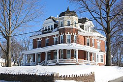
Trooper | |
---|---|
Coordinates: 40°08′56″N75°23′50″W / 40.14889°N 75.39722°W | |
Country | United States |
State | Pennsylvania |
County | Montgomery |
Township | Lower Providence |
Area | |
• Total | 2.4 sq mi (6 km2) |
• Land | 2.4 sq mi (6 km2) |
• Water | 0.0 sq mi (0 km2) |
Elevation | 377 ft (115 m) |
Population (2010) | |
• Total | 5,744 |
• Density | 2,400/sq mi (920/km2) |
Time zone | UTC-5 (EST) |
• Summer (DST) | UTC-4 (EDT) |
ZIP code | 19403 [1] |
Area code | 610 |
Trooper is a census-designated place (CDP) in Lower Providence Township, Montgomery County, Pennsylvania, United States. The population was 5,744 at the 2010 census.
Trooper is located at 40°8′56″N75°23′50″W / 40.14889°N 75.39722°W (40.148845, -75.397170). [2]
According to the United States Census Bureau, the CDP has a total area of 2.4 square miles (6.2 km2), all land.
Census | Pop. | Note | %± |
---|---|---|---|
1990 | 5,137 | — | |
2000 | 6,061 | 18.0% | |
2010 | 5,744 | −5.2% | |
2020 | 5,481 | −4.6% | |
[3] |
As of the 2010 census, the CDP was 86.9% Non-Hispanic White, 2.2% Black or African American, 0.1% Native American and Alaskan Native, 6.8% Asian, 1.0% were Some Other Race, and 1.0% were two or more races. 3.2% of the population were of Hispanic or Latino ancestry. [4]
At the 2000 census there were 6,061 people, 2,056 households, and 1,655 families living in the CDP. The population density was 2,546.9 inhabitants per square mile (983.4/km2). There were 2,107 housing units at an average density of 885.4 per square mile (341.9/km2). The racial makeup of the CDP was 91.80% White, 1.30% African American, 0.23% Native American, 5.63% Asian, 0.18% from other races, and 0.86% from two or more races. Hispanic or Latino of any race were 1.47%. [5]
There were 2,056 households, 42.1% had children under the age of 18 living with them, 70.0% were married couples living together, 6.8% had a female householder with no husband present, and 19.5% were non-families. 16.2% of households were made up of individuals, and 7.2% were one person aged 65 or older. The average household size was 2.95 and the average family size was 3.33.
The age distribution was 29.1% under the age of 18, 5.7% from 18 to 24, 30.5% from 25 to 44, 23.1% from 45 to 64, and 11.5% 65 or older. The median age was 38 years. For every 100 females, there were 98.2 males. For every 100 females age 18 and over, there were 95.2 males.
The median household income was $69,722 and the median family income was $74,154. Males had a median income of $52,263 versus $34,311 for females. The per capita income for the CDP was $27,268. About 3.3% of families and 3.9% of the population were below the poverty line, including 3.7% of those under age 18 and 4.2% of those age 65 or over.
The Methacton School District serves Trooper CDP. [6] Portions of the Trooper CDP are served by Eagleville Elementary School in Eagleville, Woodland Elementary School, and Arrowhead Elementary School. [7]
Skyview Upper Elementary School, Arcola Intermediate School, and Methacton High School serve all parts of the district. Skyview Upper and Arcola Intermediate are in Trooper CDP, [8] [9] and Methacton High is near the Eagleville CDP but not in it. [10]
The Roman Catholic Archdiocese of Philadelphia operates Visitation B.V.M. School in West Norriton Township, [11] near but not in the Trooper census-designated place. [12]
Cashtown-McKnightstown was a census-designated place (CDP) in Franklin Township, Adams County, Pennsylvania. It was the 2000 United States Census area designated by obsolete Census Code 11588 and has been replaced by the CDPs of Cashtown and McKnightstown, which the USGS designated as separate named places on August 30, 2010.
Franklin Township is a township in Adams County, Pennsylvania, United States. The population was 4,676 at the 2020 census.
Orrtanna is a census-designated place (CDP) in Adams County, Pennsylvania, United States. The population was 183 at the 2020 census.
Blanchard is a census-designated place (CDP) in Centre County, Pennsylvania, United States. It is part of the State College, Pennsylvania Metropolitan Statistical Area. The population was 740 at the 2010 census.
Lionville is a census-designated place (CDP) in Uwchlan Township, Chester County, Pennsylvania, United States. The population was 6,189 at the 2010 census. Prior to 2010 the CDP was recorded as Lionville-Marchwood. "Marchwood", however, refers only to the housing development begun in the early 1960s that is located south of the 100-113 intersection.
Drexel Hill is a neighborhood and census-designated place (CDP) located in Upper Darby Township, Pennsylvania, United States. The population was 29,181 at the 2020 census, an increase over 28,043 in 2010, and accounting for over one-third of Upper Darby Township's population.
Mountain Top is an unincorporated area and census-designated place (CDP) in Luzerne County, Pennsylvania, United States. As of the 2010 census, its population was 10,982.
Audubon is a census-designated place (CDP) in Lower Providence Township, Montgomery County, Pennsylvania, United States. It was named for naturalist John James Audubon, who lived there as a young man. The population was 8,433 at the 2010 census.
Collegeville is a borough in Montgomery County, Pennsylvania, a suburb outside of Philadelphia on Perkiomen Creek. Collegeville was incorporated in 1896. It is the location of Ursinus College, which opened in 1869. The population was 5,089 at the 2010 census.
Eagleville is a census-designated place (CDP) in Montgomery County, Pennsylvania, United States. The population was 4,800 at the 2010 census. It is within Lower Providence Township.
East Norriton Township is a township and a census-designated place in Montgomery County, Pennsylvania, United States. The population was 13,590 at the 2010 census. It is served by the Norristown Area School District.
Harleysville is a census-designated place (CDP) in Montgomery County, Pennsylvania, United States. It is a suburb of Philadelphia. The population was 9,286 at the 2010 census. It is located mostly within Lower Salford Township and also in Franconia Township. Harleysville was settled by Pennsylvania Dutch in the 18th century and was named after Samuel Harley.
Lower Pottsgrove Township is a township in Montgomery County, Pennsylvania, United States, approximately 30 miles northwest of Philadelphia and 18 miles southeast of Reading, along the Schuylkill River. The population was 12,059 at the 2010 census.
Lower Providence Township is a township in Montgomery County, Pennsylvania, United States. The township is located approximately 17 miles northwest of Philadelphia. The population was 25,625 at the 2020 census.
Norristown is a municipality with home rule status and the county seat of Montgomery County, Pennsylvania, United States, in the Philadelphia metropolitan area. Located along the Schuylkill River, approximately 6 miles (9.7 km) from Philadelphia, Norristown had a population of 35,748 as of the 2020 census. It is the fourth-most populous municipality in the county and second-most populous borough in Pennsylvania.
Plymouth Meeting is a census-designated place (CDP) that straddles Plymouth and Whitemarsh Townships in Montgomery County, Pennsylvania, United States. The settlement was founded in 1686.
West Norriton Township is a township that is located in Montgomery County, Pennsylvania, United States. It is part of the Norristown Area School District.
Worcester Township is a township in Montgomery County, Pennsylvania, United States. The population was 9,750 at the 2010 census.
The Methacton School District (MSD) is a public school district located in Montgomery County, Pennsylvania, in the Philadelphia metropolitan area. It is headquartered in the Farina Education Center in Worcester Township.
Visitation BVM School - 190 N. Trooper Road, Trooper, PA 19403- The archdiocese states the address as: "190 North Trooper Rd. Norristown PA, 19403" - The school is both outside of the Trooper CDP limits and outside of the Norristown city limits.