West Conshohocken, Pennsylvania

Last updated
Borough of West Conshohocken
West Conshohocken Borough Hall.jpg
West Conshohocken Borough Hall
West Conshohocken Montgomery County.png
Location of West Conshohocken in Montgomery County, Pennsylvania.
USA Pennsylvania location map.svg
Red pog.svg
West Conshohocken
Location of West Conshohocken in Pennsylvania
Usa edcp location map.svg
Red pog.svg
West Conshohocken
West Conshohocken (the United States)
Coordinates: 40°04′10″N75°18′57″W / 40.06944°N 75.31583°W / 40.06944; -75.31583 Coordinates: 40°04′10″N75°18′57″W / 40.06944°N 75.31583°W / 40.06944; -75.31583
CountryUnited States
StatePennsylvania
County Montgomery
Incorporated1874
Government
  TypeCouncil-manager
  MayorDanelle Fournier (D)
Area
[1]
  Total0.88 sq mi (2.29 km2)
  Land0.84 sq mi (2.19 km2)
  Water0.04 sq mi (0.10 km2)
Elevation
144 ft (44 m)
Population
 (2010)
  Total1,320
  Estimate 
(2019) [2]
1,432
  Density1,696.68/sq mi (654.73/km2)
Time zone UTC-5 (EST)
  Summer (DST) UTC-4 (EDT)
ZIP code
19428
Area codes 610 and 484
FIPS code 42-82736
Website https://westconsho.com/

West Conshohocken is a borough in Montgomery County, Pennsylvania, United States. The population was 1,320 at the 2010 census.

Contents

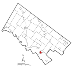
Its sister community is Conshohocken, located across the Schuylkill River. Montgomery County's seat, Norristown, is located approximately two miles north of, and on the opposite side of the river from, West Conshohocken.

History

West Conshohocken Borough was incorporated October 6, 1874 from land taken almost equally from the Townships of Lower and Upper Merion. As a river borough, there existed a large number of mills and other industries utilizing water power. The Dougherty Quarry was a prosperous business, producing stone of superior quality known as Conshohocken or Merion Blue. It was much sought after for public buildings, and was shipped by rail throughout the East before supplies were exhausted in the mid-twentieth century.

Today, with its proximity to highways I-76 and I-476 (Blue Route), this small borough and its sister Conshohocken Borough have experienced moderate office and retail development. West Conshohocken is easily identified by the mid and high-rise commercial development along its waterfront, which in recent years has also spread across the river to Conshohocken's waterfront.

Geography

West Conshohocken is located at 40°4′10″N75°18′57″W / 40.06944°N 75.31583°W / 40.06944; -75.31583 (40.069509, -75.315755). [3]

According to the United States Census Bureau, the borough has a total area of 0.9 square miles (2.3 km2), of which 1.0 square mile (2.6 km2) is land and 0.04 square miles (0.10 km2) (4.49%) is water.

Climate

The climate in this area is characterized by hot, humid summers and generally mild to cool winters. According to the Köppen Climate Classification system, West Conshohocken has a humid subtropical climate, abbreviated "Cfa" on climate maps. [4] Average monthly temperatures range from 32.1° F in January to 76.6° F in July. The local hardiness zone is 7a.

Demographics

Historical population
CensusPop.Note
1880 1,462
1890 1,66614.0%
1900 1,95817.5%
1910 2,20212.5%
1920 2,3315.9%
1930 2,57910.6%
1940 2,464−4.5%
1950 2,4820.7%
1960 2,254−9.2%
1970 2,194−2.7%
1980 1,516−30.9%
1990 1,294−14.6%
2000 1,44611.7%
2010 1,320−8.7%
2020 1,49313.1%
[5]

As of the 2010 census, the borough was 90.1% White, 3.6% Black or African American, 0.5% Native American, 3.3% Asian, and 1.7% were two or more races. 3.6% of the population were of Hispanic or Latino ancestry [6]

At the 2000 census there were 1,446 people, 600 households, and 342 families residing in the borough. The population density was 1,701.4 people per square mile (656.8/km2). There were 633 housing units at an average density of 744.8 per square mile (287.5/km2). The racial makeup of the borough was 93.91% White, 2.84% African American, 0.07% Native American, 1.80% Asian, 0.07% Pacific Islander, 0.21% from other races, and 1.11% from two or more races. Hispanic or Latino of any race were 1.04%. [7]

There were 600 households, 17.5% had children under the age of 18 living with them, 41.7% were married couples living together, 11.5% had a female householder with no husband present, and 43.0% were non-families. 29.0% of households were made up of individuals, and 6.7% were one person aged 65 or older. The average household size was 2.40 and the average family size was 3.01.

In the borough the population was spread out, with 17.6% under the age of 18, 12.6% from 18 to 24, 35.2% from 25 to 44, 22.2% from 45 to 64, and 12.4% 65 or older. The median age was 35 years. For every 100 females there were 102.0 males. For every 100 females age 18 and over, there were 105.0 males.

The median household income was $56,111 and the median family income was $62,708. Males had a median income of $40,833 versus $31,696 for females. The per capita income for the borough was $30,627. About 3.5% of families and 7.3% of the population were below the poverty line, including 8.1% of those under age 18 and 2.7% of those age 65 or over.

Politics and government

Presidential elections results [8]
Year Republican Democratic
2020 33.8% 33564.8%642
2016 36.8% 30457.1%472
2012 43.2% 32555.2%415
2008 41.9% 34057.8%469
2004 42.8% 31256.7%413
2000 37.5% 22060.2%353

West Conshohocken has a city manager form of government with a mayor and a seven-member borough council.

The borough is part of the Fourth Congressional District (represented by Rep. Madeleine Dean), the 149th State House District (represented by Rep. Tim Briggs) and the 17th State Senate District (represented by Sen. Amanda Cappelletti).

Public water is provided by Aqua of PA. Sewer facilities were sold in June 2017 to the Borough of Conshohocken for around $9,500,500.00 (9.5 million) West Conshohocken sewers are now owned and managed by the Conshohocken Authority, and all payments go to Conshohocken. Residential trash pickup is still provided by West Conshohocken. A full-time police force serves the community, but fire protection is provided by a volunteer company, the George Clay Steam Fire Engine and Hose Company Number 1, Station 39. SEPTA bus lines provide access to the Norristown Transportation Center, and bus and rail lines connect the borough to other portions of Montgomery County and Philadelphia.

Transportation

I-76/Schuylkill Expressway eastbound in West Conshohocken 2022-10-09 11 27 47 View east along Interstate 76 (Schuylkill Expressway) from the overpass for Spring Garden Street in West Conshohocken, Montgomery County, Pennsylvania.jpg
I-76/Schuylkill Expressway eastbound in West Conshohocken

As of 2012 there were 11.29 miles (18.17 km) of public roads in West Conshohocken, of which 4.76 miles (7.66 km) were maintained by the Pennsylvania Department of Transportation (PennDOT) and 6.53 miles (10.51 km) were maintained by the borough. [9]

West Conshohocken is the location of one of the major highway junctions of the Philadelphia metropolitan area, that being the interchange of the Schuylkill Expressway (Interstate 76) and "Blue Route" (Interstate 476). Pennsylvania Route 23 also traverses the borough, providing local access.

SEPTA provides Suburban Bus service to West Conshohocken along Route 95, which runs between Gulph Mills and Willow Grove. The Conshohocken station serving SEPTA Regional Rail's Manayunk/Norristown Line is located across the Schuylkill River in Conshohocken. [10]

Education

West Conshohocken pupils are assigned to schools in the Upper Merion Area School District. Residents have access to the Conshohocken Free Library.

Healthcare

The area is served by two hospitals, Einstein Medical Center Montgomery and Suburban Community Hospital.

Companies and organizations

Related Research Articles

<span class="mw-page-title-main">Hamburg, Pennsylvania</span> Borough in Pennsylvania, United States

Hamburg is a borough in Berks County, Pennsylvania, United States. The population was 4,270 at the 2020 census. The town is thought to have been named after Hamburg, Germany, but this is likely to have been a corruption of Bad Homburg.

<span class="mw-page-title-main">Bridgeport, Pennsylvania</span> Borough in Pennsylvania, United States

Bridgeport is a borough in Montgomery County, Pennsylvania, United States, 18 mi (29 km) north of Philadelphia on the Schuylkill River. Former industries included paper, flour, cotton, woolen mills, steel works, and brickyards. Bridgeport is 6 mi (9.7 km) east of Valley Forge, Pennsylvania. In 1777, during the American Revolutionary War, General George Washington and the Continental Army passed through Bridgeport on their way to their winter encampment in Valley Forge. A totsl of 3,097 people lived in Bridgeport in 1900; 3,860 in 1910; and 5,904 in 1940. The population was 4,554 at the 2010 census.

<span class="mw-page-title-main">Conshohocken, Pennsylvania</span> Borough in Pennsylvania, United States

Conshohocken is a borough on the Schuylkill River in Montgomery County, Pennsylvania in suburban Philadelphia. Historically a large mill town and industrial and manufacturing center, after the decline of industry in recent years Conshohocken has developed into a center of riverfront commercial and residential development. In the regional slang, it is sometimes referred to by the colloquial nickname Conshy.

<span class="mw-page-title-main">Limerick Township, Montgomery County, Pennsylvania</span> Township in Pennsylvania, United States

Limerick Township is a township in Montgomery County, Pennsylvania, United States.

<span class="mw-page-title-main">Lower Merion Township, Pennsylvania</span> Township in Pennsylvania, United States

Lower Merion Township is a township in Montgomery County, Pennsylvania. It is part of the Philadelphia Main Line. The township's name originates with the county of Merioneth in north Wales. Merioneth is an English-language transcription of the Welsh Meirionnydd.

<span class="mw-page-title-main">Lower Providence Township, Montgomery County, Pennsylvania</span> Township in Pennsylvania, United States

Lower Providence Township is a township in Montgomery County, Pennsylvania, United States. The township is located approximately 17 miles northwest of Philadelphia. The population was 25,625 at the 2020 census.

<span class="mw-page-title-main">Montgomeryville, Pennsylvania</span> Census-designated place in Pennsylvania, United States

Montgomeryville is a census-designated place (CDP) in Montgomery Township, Montgomery County, Pennsylvania, United States. The population was 12,624 at the 2010 census. According to a 2010 Forbes magazine/Yahoo.com survey, Montgomeryville ranks 5th in America's top 10 affordable suburbs. It is part of the North Penn Valley region that is centered on the borough of Lansdale.

<span class="mw-page-title-main">Narberth, Pennsylvania</span> Borough in Pennsylvania, United States

Narberth is a borough in Montgomery County, Pennsylvania, United States. It is one of many neighborhoods on the historic Philadelphia Main Line. The population was 4,282 at the 2010 census.

<span class="mw-page-title-main">Norristown, Pennsylvania</span> Home rule municipality in Pennsylvania, United States

Norristown is a municipality with home rule status and the county seat of Montgomery County, Pennsylvania, United States, in the Philadelphia metropolitan area. Located along the Schuylkill River, approximately 6 miles (9.7 km) from the Philadelphia city limits, Norristown had a population of 35,748 as of the 2020. It is the fourth most populous municipality in the county and second most populous borough in Pennsylvania.

<span class="mw-page-title-main">Plymouth Township, Montgomery County, Pennsylvania</span> First Class Township with home rule in Pennsylvania, United States

Plymouth Township is a township with home rule status in Montgomery County, Pennsylvania. The township has been governed by a home rule charter since 1976 and is no longer subject to the Pennsylvania Township Code. The population was 16,525 at the 2010 census. It is serviced by the Colonial School District and is home to the Plymouth Meeting Mall.

<span class="mw-page-title-main">Pottstown, Pennsylvania</span> Borough in Pennsylvania, United States

Pottstown is a borough in Montgomery County, Pennsylvania, United States. Pottstown was laid out in 1752–53 and named Pottsgrove in honor of its founder, John Potts. The old name was abandoned at the time of the incorporation as a borough in 1815. In 1888, the limits of the borough were considerably extended. Pottstown is the center of a productive farming and dairying region.

<span class="mw-page-title-main">Royersford, Pennsylvania</span> Borough in Pennsylvania, United States

Royersford is a borough in Montgomery County, Pennsylvania, United States, 32 miles (51 km) northwest of Philadelphia, on the Schuylkill River.

<span class="mw-page-title-main">Skippack Township, Montgomery County, Pennsylvania</span> Township in Pennsylvania, United States

Skippack Township is a township in Montgomery County, Pennsylvania, United States. The population was 13,715 at the 2010 census. This represents a 110.5% increase from the 2000 count of 6,516 residents.

<span class="mw-page-title-main">Trappe, Pennsylvania</span> Borough in Pennsylvania, United States

Trappe is a borough in Montgomery County, Pennsylvania, United States. The population was 3,509 at the 2010 census. Augustus Lutheran Church, built in 1743, is the oldest unchanged Lutheran church building in the United States in continuous use by the same congregation. It has been designated a National Historic Landmark.

<span class="mw-page-title-main">Upper Gwynedd Township, Montgomery County, Pennsylvania</span> Township in Pennsylvania, United States

Upper Gwynedd Township is a township in Montgomery County, Pennsylvania. The population was 15,552 at the time of the 2010 census. North Wales Borough is surrounded by Upper Gwynedd Township on all sides, and many homes and businesses with North Wales addresses are actually in Upper Gwynedd. Many properties with Lansdale addresses are in Upper Gwynedd as well. It is part of the North Penn Valley region that is centered around the borough of Lansdale.

<span class="mw-page-title-main">Upper Providence Township, Montgomery County, Pennsylvania</span> Township in Pennsylvania, United States

Upper Providence Township is a township in Montgomery County, Pennsylvania, United States. As of the 2010 census, the township population was 21,219.

<span class="mw-page-title-main">West Norriton Township, Montgomery County, Pennsylvania</span> Township in Pennsylvania, United States

West Norriton Township is a township in Montgomery County, Pennsylvania, United States. It is part of the Norristown Area School District. The population of the township was 15,663 at the 2010 census.

<span class="mw-page-title-main">Whitemarsh Township, Montgomery County, Pennsylvania</span> Home rule municipality in Pennsylvania, United States

Whitemarsh Township is a Home rule municipality in Montgomery County, Pennsylvania, United States. It retains its former classification of "Township" in its official name despite being a home rule municipality. The population was 17,349 at the 2010 census. Whitemarsh is adjacent to the neighborhood of Andorra in the Roxborough section of Philadelphia, and is bordered in Montgomery County by Springfield, Upper Dublin, Whitpain, and Plymouth townships, and by Conshohocken Borough. It is also bordered by the Schuylkill River, which separates it from Lower Merion Township. Communities within Whitemarsh Township include: Barren Hill; Lafayette Hill; part of Miquon, which straddles Whitemarsh and Springfield townships, Spring Mill; part of Plymouth Meeting ; and part of Fort Washington, some of which is in Whitemarsh, but which is chiefly in Upper Dublin Township.

<span class="mw-page-title-main">Worcester Township, Montgomery County, Pennsylvania</span> Township in Pennsylvania, United States

Worcester Township is a township in Montgomery County, Pennsylvania, United States. The population was 9,750 at the 2010 census. It is pronounced as 'WOR-ses-ter.'

<span class="mw-page-title-main">Telford, Pennsylvania</span> Borough in Pennsylvania, United States

Telford is a borough in Bucks and Montgomery counties in the U.S. state of Pennsylvania. The population was 4,872 at the time of the 2010 census. Of this, 2,665 were in Montgomery County, and 2,207 were in Bucks County.

References

  1. "2019 U.S. Gazetteer Files". United States Census Bureau. Retrieved July 28, 2020.
  2. "Population and Housing Unit Estimates". United States Census Bureau. May 24, 2020. Retrieved May 27, 2020.
  3. "US Gazetteer files: 2010, 2000, and 1990". United States Census Bureau. 2011-02-12. Retrieved 2011-04-23.
  4. Climate Summary for West Conshohocken, Pennsylvania
  5. "Census 2020".
  6. "Census 2010: Pennsylvania".
  7. "U.S. Census website". United States Census Bureau . Retrieved 2008-01-31.
  8. "Montgomery County Election Results". Montgomery County, Pennsylvania. Retrieved January 16, 2017.
  9. "West Conshohocken Borough map" (PDF). PennDOT. Retrieved March 10, 2023.
  10. SEPTA Official Transit & Street Map Suburban (PDF) (Map). SEPTA. Retrieved May 2, 2016.