Lansdale, Pennsylvania

Last updated
Lansdale
PA 63 WB at Green Street Lansdale.jpeg
Main Street in Lansdale
Motto: 
Life in Motion
Lansdale Montgomery County.png
Location of Lansdale in Montgomery County, Pennsylvania
USA Pennsylvania location map.svg
Red pog.svg
Lansdale
Location of Lansdale in Pennsylvania
Usa edcp location map.svg
Red pog.svg
Lansdale
Lansdale (the United States)
Coordinates: 40°14′31″N75°17′03″W / 40.24194°N 75.28417°W / 40.24194; -75.28417
CountryUnited States
StatePennsylvania
County Montgomery
Government
  TypeCouncil-manager
  MayorGarry Herbert
Area
[1]
  Total2.99 sq mi (7.75 km2)
  Land2.99 sq mi (7.75 km2)
  Water0.00 sq mi (0.00 km2)
Elevation
361 ft (110 m)
Population
 (2020) [2]
  Total18,773
  Density6,272.30/sq mi (2,422.12/km2)
Time zone UTC-5 (EST)
  Summer (DST) UTC-4 (EDT)
ZIP Code
19446
Area codes 215, 267 and 445
FIPS code 42-41432
Website www.lansdale.org

Lansdale is a borough in Montgomery County, Pennsylvania, United States. It is a densely-populated commuter town, with many residents traveling daily to Philadelphia using SEPTA Regional Rail's Lansdale/Doylestown Line. In 1900, 2,754 people lived here; in 1910, 3,551; and in 1940, 9,316 people were inhabitants of Lansdale. The population was 18,773 at the 2020 census.

Contents

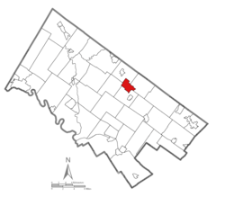
Lansdale is the center of the North Penn Valley, a region which includes the surrounding townships and boroughs. It is located 27 miles (43 km) southeast of Allentown and 21 miles (34 km) north of Philadelphia.

History

Founding

Lansdale Municipal building Lansdale Municipal.jpg
Lansdale Municipal building

The earliest known settlers in Lansdale were members of the Jenkins family. At the peak of its growth, the Jenkins homestead occupied approximately 120 acres of land. The construction of the North Pennsylvania Railroad (later absorbed into the Reading Railroad) during the 1850s contributed to rapid growth and expansion in Lansdale. Employment opportunities generated by the railroad brought settlers, housing, and local businesses to the area.

Borough incorporation

By 1872, Lansdale Borough was officially incorporated and named after Phillip Lansdale Fox, chief surveyor of the North Penn Railroad. By the naming conventions of the time, it should have been called Jenkintown, since the land immediately surrounding the train station was owned by the Jenkins family, but there was already a town by that name along the rail line. [3]

The Jenkins Homestead and Lansdale Silk Hosiery Compy-Interstate Hosiery Mills, Inc. are listed on the National Register of Historic Places. [4]

Kugel ball

The Kugel Ball Kugel Ball in Lansdale.jpg
The Kugel Ball

Lansdale is home to a Kugel ball, which is a 2,200 lb (1,000 kg) dark grey granite sphere supported by a very thin film of water pumped from beneath its base. [5] [6] The Kugel Ball is located in Railroad Plaza, adjacent to the SEPTA Lansdale/Doylestown Line train station in downtown Lansdale. The plaza consists of a bricked patio with benches centered on the Kugel Ball and closes at 11:00 pm. An annual 5k race is held in June, accordingly named the Kugel Ball race, which starts and ends at the actual Kugel Ball in Railroad Plaza.

Hometown heroes

The Lansdale Borough Hometown Heroes Banner Program is a living tribute created for the community to recognize and honor Lansdale Veterans who are serving or are veterans who have served in the United States Armed Forces. [7]

Geography

According to the U.S. Census Bureau, the borough has a total area of 3.1 square miles (8.0 km2), all land. It has a hot-summer humid continental climate (Dfa) and the hardiness zone is 7a. The average monthly temperature ranges from 30.2 °F in January to 74.7 °F in July. [8] The average annual absolute minimum temperature is -0.4 °F. [9]

Demographics

Historical population
CensusPop.Note
1880 798
1890 1,858132.8%
1900 2,75448.2%
1910 3,55128.9%
1920 4,72833.1%
1930 8,37977.2%
1940 9,31611.2%
1950 9,7624.8%
1960 12,61229.2%
1970 18,45146.3%
1980 16,526−10.4%
1990 16,362−1.0%
2000 16,071−1.8%
2010 16,2691.2%
2020 18,77315.4%
Sources: [10] [11] [12] [13] [2]

As of the 2010 census, the borough was 75.9% White, 5.9% Black or African American, 0.2% Native American, 13.3% Asian, 0.1% Native Hawaiian, and 2.7% were two or more races. 4.4% of the population were of Hispanic or Latino ancestry. [14]

Government

Presidential elections results [15]
Year Republican Democratic
2020 32.9% 3,04565.4%6,060
2016 33.9% 2,64360.2%4,697
2012 36.4% 2,57961.7%4,369
2008 35.8% 2,58763.2%4,561
2004 42.0% 2,93457.2%4,000
2000 46.3% 2,65549.6%2,843

Lansdale has a city manager form of government with a mayor and a nine-member borough council. On June 4, 2008, local chiropractor G. Andrew Szekely was appointed by council resolution to serve the remaining 18 months of the term of Mayor Michael DiNunzio. Szekely won a full four-year term in November 2009. The current mayor of Lansdale is Garry Herbert, who was voted into office in January, 2018.

The borough is part of the First Congressional District (represented by Rep. Brian Fitzpatrick), Pennsylvania's 53rd Representative District (represented by Rep. Steve Malagari) and the 24th State Senate District (represented by Sen. Tracy Pennycuick).

Education

The community is a part of the North Penn School District. K-6 public elementary schools in Lansdale include Gwynedd Square Elementary, Knapp Elementary, Oak Park Elementary, Inglewood Elementary, Walton Farm Elementary, and York Avenue Elementary. Penndale Middle School serves grades 7–9. The area public high school is North Penn High School in Towamencin Township.

The borough is also home to Mater Dei Catholic School of the Roman Catholic Archdiocese of Philadelphia. [16] It was formerly home to St. Stanislaus School. In January 2012, the archdiocese announced that St. Rose of Lima School in North Wales would be merging with St. Stanislaus, with students attending classes in Lansdale at St. Stanislaus. [17] The newly combined school was renamed from St. Stanislaus to Mater Dei, Latin for "Mother of God."

Calvary Baptist School is a pre-K-12th grade Christian school. Lansdale area private high schools include Lansdale Catholic High School and Dock Mennonite Academy. Dock is in Towamencin Township.

The DeSales University Lansdale Area Campus was an institute of higher education, with a campus specifically designed for adult students. The campus closed in 2019, with classes moved to the main campus in Center Valley or online. [18]

Media

Lansdale is served by the daily print newspaper The Reporter , owned by the Digital First Media and with a circulation of 16,364 throughout Lansdale, Hatfield, Souderton and Harleysville. [19] [ needs update ] As well as the online news sites North Penn Now and Montgomeryville-Lansdale Patch.

WNPV (1440 AM) was a radio station broadcasting a news/talk/sports format, whose air date began October 17, 1960 and ended April 30, 2020. The station sold off its land, studio and broadcast towers to North Penn School District in July 2020. Its license was donated to Four Rivers Community Broadcasting.

North Penn Television is a television station owned by the North Penn School district that broadcasts the North Penn School District Board of School Directors meetings, along with various events around the school district such as sports games and concerts.

Arts and entertainment

Lansdale hosts a first friday during the warmer months, it includes live music, food trucks, a beer garden, and local events like scavenger hunts or food drives. [20]

Every September Lansdale is home to Bike Night, where thousands of motorcyclists gather. [21]

The Rock Den was a music store that hosted weekly open mic nights and shows. It was located in the former Stuart’s music building that has been home to a music store since the 1940s. [22] Another popular local venue was the Underground at Round Guys.

In 2022, a documentary "Lansdale, Then, Now and Forever" was released about the local music scene. Directed by Jason Zoblin. [23] [24]

Classic Game Junkie opened an arcade in 2022. [25]

Infrastructure

Transportation

PA 63 westbound in Lansdale 2022-10-26 11 19 25 View west along Pennsylvania State Route 63 (Main Street) just west of Church Road in Lansdale, Montgomery County, Pennsylvania.jpg
PA 63 westbound in Lansdale

As of 2010 there were 46.25 miles (74.43 km) of public roads in Lansdale, of which 3.29 miles (5.29 km) were maintained by the Pennsylvania Department of Transportation (PennDOT) and 42.96 miles (69.14 km) were maintained by the borough. [26]

The main east–west street in Lansdale is Main Street (Pennsylvania Route 63), which runs northwest–southeast. The main north–south street is Broad Street, which runs southwest–northeast. Pennsylvania Route 363 begins at PA 63 on the western edge of Lansdale and heads southwest on Valley Forge Road. The Lansdale interchange of the Pennsylvania Turnpike Northeast Extension (Interstate 476) is located to the west of the borough in Towamencin Township and connects to PA 63. [27]

Lansdale station on SEPTA's Lansdale/Doylestown Line Lansdale SEPTA station October 2018.jpeg
Lansdale station on SEPTA's Lansdale/Doylestown Line

Lansdale is served by SEPTA Regional Rail's Lansdale/Doylestown Line via Lansdale station in downtown, the Pennbrook station in the southern part of the borough, and the 9th Street station in the northern part of the borough, with service to Center City Philadelphia and Doylestown along with intermediate points. [28] Three SEPTA Suburban Division bus routes serve Lansdale: the Route 94 connects the southern part of Lansdale with the Montgomery Mall and Chestnut Hill, [29] the Route 96 connects Lansdale with the Norristown Transportation Center in Norristown, [30] and the Route 132 connects the borough with the Montgomery Mall and Telford. [31]

Lansdale is the headquarters of the Pennsylvania Northeastern Railroad, a short-line freight railroad. The Pennsylvania Northeastern Railroad operates the Lansdale Yard in the borough and provides freight rail service out of Lansdale to several points in the northern suburbs of Philadelphia on SEPTA-owned lines. [32] The railroad interchanges with CSX Transportation in Lansdale. [33]

Utilities

Lansdale Electric, owned by the borough, provides electricity to most of Lansdale, [34] with portions of the borough receiving electricity from PECO Energy Company, a subsidiary of Exelon. [35] [36] The borough's electric department purchases its electricity from American Municipal Power. [37] Natural gas in Lansdale is provided by PECO Energy Company. [35] [38] The North Penn Water Authority provides water to Lansdale and some surrounding areas. [39] Sewer service in Lansdale is provided by the borough, which operates a wastewater treatment facility. [40] Trash and recycling collection in Lansdale is provided by contracts with private haulers, although the borough has plans for a single hauler serving all residents. [41] [42]

Health care

Jefferson Health–Abington operates Jefferson Lansdale Hospital, which serves Lansdale and surrounding areas in the North Penn Valley. Jefferson Lansdale Hospital has 140 beds and over 700 employees, including over 300 physicians. Services offered at the hospital include an emergency room, Orthopedic and Spine Institute, Pain Center, Sleep Center, and Wound Care Center. [43] The hospital, which was previously known as North Penn Hospital and later as Central Montgomery Medical Center, was acquired by Abington Memorial Hospital from Universal Health Services in October 2008, with the name changed from Central Montgomery Medical Center to its present name. [44] [45]

Notable people

An episode of the Fox television series Fringe , which aired on September 24, 2009, was set in Lansdale. The scenes that took place in Lansdale were filmed in British Columbia, and the town was depicted as a rural area consisting primarily of corn fields and not as the densely populated suburban town that it actually is. [56]

The beginning of the House season 7 episode "Changes" (May 2, 2011) was set in Lansdale. [57]

Related Research Articles

<span class="mw-page-title-main">Montgomery County, Pennsylvania</span> County in Pennsylvania, United States

Montgomery County, colloquially referred to as Montco, is a county in the Commonwealth of Pennsylvania. As of the 2020 census, the population of the county was 856,553, making it the third-most populous county in Pennsylvania after Philadelphia and Allegheny counties.

<span class="mw-page-title-main">Doylestown, Pennsylvania</span> City in Bucks County, Pennsylvania

Doylestown is a borough in and the county seat of Bucks County, Pennsylvania. As of the 2020 census, the borough population was 8,300.

<span class="mw-page-title-main">Warminster Township, Pennsylvania</span> Township in Pennsylvania, United States

Warminster Township, also referred to as Warminster, is located in Bucks County, Pennsylvania, United States. It was formally established in 1711. The township is 13.7 miles north of Philadelphia and had a population of 33,603 according to the 2020 U.S. census.

<span class="mw-page-title-main">Abington Township, Montgomery County, Pennsylvania</span> Township in Pennsylvania, United States

Abington Township is a township in Montgomery County, Pennsylvania, United States. It is adjacent to Philadelphia's northern fringe. The population was 58,502 as of the 2020 census, making it the second most populous township in Montgomery County after Lower Merion Township. The population density is 3603.3 per square mile (1,377/km2), making it the second most densely populated township in Montgomery County after Cheltenham Township.

<span class="mw-page-title-main">Hatfield, Pennsylvania</span> Borough in Pennsylvania, United States

Hatfield is a borough in Montgomery County, Pennsylvania, United States. The population was 3,290 at the time of the 2010 census. It is part of the North Penn Valley region that is centered around the borough of Lansdale. The borough is surrounded by Hatfield Township.

<span class="mw-page-title-main">Hatfield Township, Pennsylvania</span> Township in Pennsylvania, United States

Hatfield Township is a township in Montgomery County, Pennsylvania, United States. The population was 17,249 at the 2010 census. It is part of the North Penn Valley region which is centered around the borough of Lansdale.

<span class="mw-page-title-main">Horsham Township, Pennsylvania</span> Home rule municipality in Pennsylvania, United States

Horsham Township is a home rule municipality in Montgomery County, Pennsylvania. It is located ten miles north of Center City Philadelphia. The township, incorporated in 1717, is one of the oldest original municipalities in Montgomery County. Although it retains the word "Township" in its official name, it has been governed by a Home Rule Charter since 1975 and is therefore not subject to the Pennsylvania Township Code. The population was 26,564 at the time of the 2020 census.

<span class="mw-page-title-main">Jenkintown, Pennsylvania</span> Borough in Pennsylvania, United States

Jenkintown is a borough in Montgomery County, Pennsylvania. It is approximately 10 miles (16 km) north of Center City Philadelphia.

<span class="mw-page-title-main">North Wales, Pennsylvania</span> Borough in Pennsylvania, United States

North Wales is a borough in Montgomery County, Pennsylvania. It is a suburb of Philadelphia and is one of the three historic population centers that make up the North Penn Valley, which is centered on the borough of Lansdale. It is approximately 27 miles (43 km) north of Center City Philadelphia. The population was 3,426 as of the 2020 census.

<span class="mw-page-title-main">Souderton, Pennsylvania</span> Borough of Pennsylvania, US

Souderton is a borough in Montgomery County, Pennsylvania, United States. The population was 7,246 in 2022 according to the Census Bureau.

<span class="mw-page-title-main">Springfield Township, Montgomery County, Pennsylvania</span> Township in Pennsylvania, United States

Springfield Township is a township in Montgomery County, Pennsylvania. The population was 20,993 in 2022 according the Census Bureau. It includes the villages of Wyndmoor, Erdenheim, Flourtown, and Oreland. The communities of Lafayette Hill, Fort Washington, Laverock, North Hills, Miquon, and Glenside are also situated partly inside the Township.

<span class="mw-page-title-main">Towamencin Township, Pennsylvania</span> Place in Pennsylvania, United States

Towamencin Township is a home rule township in Montgomery County, Pennsylvania, United States. The population was 17,578 at the 2010 census. It is part of the North Penn School District and the North Penn Valley region that is centered around the borough of Lansdale. Towamencin has residential neighborhoods, historic farmhouses, recreational facilities, many schools, and open spaces. The community is a mix of residential, commercial and rural development. The Township is centrally located within Montgomery County with easy access to the Pennsylvania Turnpike’s Northeast Extension.

<span class="mw-page-title-main">Upper Gwynedd Township, Pennsylvania</span> Township in Pennsylvania, United States

Upper Gwynedd Township is a township in Montgomery County, Pennsylvania. The population was 15,552 at the time of the 2010 census. North Wales Borough is surrounded by Upper Gwynedd Township on all sides, and many homes and businesses with North Wales addresses are actually in Upper Gwynedd. Many properties with Lansdale addresses are in Upper Gwynedd as well. It is part of the North Penn Valley region that is centered around the borough of Lansdale.

<span class="mw-page-title-main">Upper Moreland Township, Pennsylvania</span> Township in Pennsylvania, United States

Upper Moreland Township is a township in Montgomery County, Pennsylvania. The population was 24,015 at the 2010 census. Upper Moreland Township is primarily a residential community with distinctive neighborhoods that are complemented by several thriving business, industrial, and commercial districts.

<span class="mw-page-title-main">Willow Grove, Pennsylvania</span> Census-designated place in Pennsylvania, United States

Willow Grove is a census-designated place (CDP) in Montgomery County, Pennsylvania, United States. A community in Philadelphia's northern suburbs, the population was 13,730 at the 2020 census. It is located in Upper Dublin Township, Abington Township and Upper Moreland Township. Willow Grove was once known for Willow Grove Park, an amusement park that was open from 1896 to 1976, now the site of Willow Grove Park Mall. Willow Grove is considered an edge city of Philadelphia, with large amounts of retail and office space.

<span class="mw-page-title-main">Telford, Pennsylvania</span> Borough in Pennsylvania, United States

Telford is a borough in Bucks and Montgomery counties in the U.S. state of Pennsylvania. The population was 4,872 at the time of the 2010 census. Of this, 2,665 were in Montgomery County, and 2,207 were in Bucks County.

The North Penn Valley is a region of Philadelphia suburbs and exurbs in Montgomery County, Pennsylvania. It is somewhat congruent with the North Penn School District. It contains the boroughs of North Wales, Lansdale, and Hatfield, as well as the surrounding townships. The area to its west has traditionally been more rural, while the suburbs to its south and east are, on the whole, more affluent and densely populated.

<span class="mw-page-title-main">North Penn School District</span> School district in Pennsylvania

The North Penn School District (NPSD) is a large, suburban, regional public school district that consists of thirteen elementary schools, three middle schools, and one high school. It serves the North Penn Valley, a 42-square-mile (110 km2) area in the Montgomery County suburbs of Philadelphia, Pennsylvania.

<span class="mw-page-title-main">Lansdale/Doylestown Line</span> SEPTA Regional Rail line from Philadelphia to Doylestown

The Lansdale/Doylestown Line is a SEPTA Regional Rail line connecting Center City Philadelphia to Doylestown in Bucks County, Pennsylvania. Until 1981, diesel-powered trains continued on the Bethlehem Branch from Lansdale to Quakertown, Bethlehem, and Allentown. Restored service has been proposed, but is not planned by SEPTA. The line is currently used by the East Penn Railroad, serving Quakertown's industrial complexes and distribution centers. With around 17,000 daily riders every weekday in 2019, it is the second busiest line in SEPTA's Regional Rail network.

<span class="mw-page-title-main">Pennsylvania Northeastern Railroad</span> Shortline railroad in southeastern Pennsylvania

The Pennsylvania Northeastern Railroad is a short-line railroad operating on trackage mostly in Bucks and Montgomery counties to the north of Philadelphia, Pennsylvania. It was created in 2011, taking over former operations from CSX Transportation. The Pennsylvania Northeastern Railroad interchanges with CSX in Lansdale, the East Penn Railroad in Telford, and the New Hope Railroad in Warminster.

References

  1. "ArcGIS REST Services Directory". United States Census Bureau. Retrieved October 12, 2022.
  2. 1 2 "Census Population API". United States Census Bureau. Retrieved Oct 12, 2022.
  3. "History of Lansdale's Incorporation | Lansdale Borough, PA - Official Website". Archived from the original on 2015-09-18. Retrieved 2014-07-30.
  4. "National Register Information System". National Register of Historic Places . National Park Service. July 9, 2010.
  5. Kugel Ball FAQ Retrieved on 18 September 2007
  6. "Drought keeps Lansdale Boro's Kugel Ball in its winter casing". The Reporter. June 13, 2002. Archived from the original on 2022-05-21.
  7. "Hometown Heroes" . Retrieved 2020-10-15.
  8. "PRISM Climate Group at Oregon State University". Prism.oregonstate.edu. Retrieved 2022-03-21.
  9. "Interactive Map | USDA Plant Hardiness Zone Map". Archived from the original on 2019-07-04. Retrieved 2019-09-03.
  10. "Census of Population and Housing". U.S. Census Bureau. Retrieved 11 December 2013.
  11. "U.S. Census website". United States Census Bureau . Retrieved 2008-01-31.
  12. "Incorporated Places and Minor Civil Divisions Datasets: Subcounty Resident Population Estimates: April 1, 2010 to July 1, 2012". Population Estimates. U.S. Census Bureau. Archived from the original on 11 June 2013. Retrieved 11 December 2013.
  13. "Census 2020".
  14. "U.S. Census Bureau QuickFacts: Lansdale borough, Pennsylvania". Census.gov. Retrieved 2022-07-20.
  15. "Montgomery County Election Results". Montgomery County, Pennsylvania. Retrieved January 16, 2017.
  16. "2012 Catholic grade school consolidations/closings". Catholicphilly.com. 2012-07-15. Retrieved 2020-04-22.
  17. Di Domizio, Tony. "St. Rose Goes and Goretti, Gone." Montgomeryville-Lansdale Patch . January 6, 2012. Retrieved on January 7, 2012.
  18. Wisniewski, Bro. Daniel P. (July 9, 2019). "Update on Bethlehem and Lansdale Campuses". DeSales University. Retrieved January 10, 2021.
  19. The Reporter, Lansdale - Racial Diversity "Racial Diversity" Accessed February 22, 2010.
  20. "First Friday". Discover Lansdale. Retrieved 2022-12-27.
  21. "Lansdale Bike Night welcomes thousands of bike enthusiasts". thereporteronline. 2019-09-08. Retrieved 2022-12-27.
  22. "Stuart's Music under new ownership". thereporteronline. 2014-06-22. Retrieved 2022-12-27.
  23. "Documentary on Lansdale's DIY Music Scene Draws Crowd to Debut at Well Crafted Sunday Afternoon". northpennnow.com. Retrieved 2022-12-27.
  24. Lansdale, Then, Now and Forever Trailer , retrieved 2022-12-27
  25. "Classic Game Junkie to Open Retro Game Store, Arcade in Lansdale Next Month". northpennnow.com. Retrieved 2022-12-27.
  26. "Lansdale Borough map" (PDF). PennDOT. Retrieved March 10, 2023.
  27. Google (September 22, 2014). "overview of Lansdale, Pennsylvania" (Map). Google Maps . Google. Retrieved September 22, 2014.
  28. "Lansdale/Doylestown Line schedule" (PDF). SEPTA. Retrieved September 22, 2014.
  29. "Route 94 bus map" (PDF). SEPTA. Retrieved September 22, 2014.
  30. "Route 96 bus map" (PDF). SEPTA. Retrieved September 22, 2014.
  31. "Route 132 bus map" (PDF). SEPTA. Retrieved September 22, 2014.
  32. "Federal Register Volume 76, Number 142". Federal Register. July 25, 2011. Retrieved December 9, 2011.
  33. "Services". Pennsylvania Northeastern Railroad. Archived from the original on April 26, 2012. Retrieved December 11, 2011.
  34. "Electric". Lansdale Borough. Retrieved October 11, 2017.
  35. 1 2 "PECO: Company Information". PECO Energy Company. Retrieved January 29, 2017.
  36. "Electric Service Tariff" (PDF). PECO Energy Company. July 17, 2017. p. 4. Retrieved October 10, 2017.
  37. "Electric - Purchase Power Contract". Lansdale Borough. Retrieved October 11, 2017.
  38. "Gas Service Tariff" (PDF). PECO Energy Company. August 30, 2017. p. 2. Retrieved October 10, 2017.
  39. "Service Area". North Penn Water Authority. Retrieved October 11, 2017.
  40. "Wastewater Treatment Facility - About The Facility". Lansdale Borough. Retrieved October 11, 2017.
  41. "Trash and Recycling Collection--Residential". Lansdale Borough. Retrieved October 11, 2017.
  42. "Single Hauler Option Overview". Lansdale Borough. Retrieved October 11, 2017.
  43. "About Abington-Lansdale Hospital". Abington-Jefferson Health. Retrieved February 17, 2018.
  44. Di Domizio, Tony (September 9, 2008). "Abington Memorial Hospital to buy CMMC". The Times Herald. Norristown, PA. Retrieved February 17, 2018.
  45. Di Domizio, Tony. "CMMC renamed Lansdale Hospital". The Reporter. Lansdale, PA. Retrieved February 17, 2018.
  46. Bartrop, Paul R.; Grimm, Eve E. (2020-10-19). Children of the Holocaust. ABC-CLIO. pp. 103–104. ISBN   978-1-4408-6853-5.
  47. Hevesi, Dennis "Ralph F. Hirschmann, Leading Scientist on Early Enzyme Research, Dies at 87", The New York Times , July 18, 2009. Accessed July 19, 2009.
  48. "Jennifer E. Strong". Legacy.com . The Reporter. April 1, 2011. Archived from the original on August 12, 2019. Retrieved August 12, 2019.
  49. Orley, Emily (17 September 2014). "The Actress Behind Paris Geller Is All Grown Up". BuzzFeed . Retrieved 17 September 2014.
  50. Porter, Rick (29 September 2002). "LIZA WEIL OF 'GILMORE GIRLS' WILL ALWAYS HAVE PARIS AND HER NEUROTIC WAYS". Tribune Media Services . Retrieved 22 June 2019.
  51. "Charles Baird Parker, son of jazz great". 2020-08-04. Archived from the original on 2020-08-04. Retrieved 2022-12-22.
  52. Weckerly, Dan (2021-09-20). "All-Girl Band Praises 7-Eleven Nachos in Song, Which the Convenience Store HQ Takes to the Next Level". MONTCO.Today. Retrieved 2022-12-27.
  53. Clerks III (2022) - IMDb , retrieved 2022-12-27
  54. "Froggy". Froggy. Retrieved 2022-12-27.
  55. Letcher, Tyler. "Froggy leaps into the spotlight". The Knight Crier. Retrieved 2022-12-27.
  56. Stanley, Chris "TV's Lansdale " Archived 2009-09-28 at the Wayback Machine , The Reporter Blogs, September 24, 2009. Accessed September 29, 2009.
  57. vicpei "House MD - 7.20 Changes - House Transcripts". Archived from the original on 2016-01-24. Retrieved 2012-12-28. "LiveJournal," May 19, 2011. Accessed December 28, 2012.