Harleysville, Pennsylvania

Last updated
Harleysville
The Village of Harleysville
Harleysville Beneficial PA.jpg
Harleysville Beneficial Association Building on Main Street in downtown Harleysville
USA Pennsylvania location map.svg
Red pog.svg
Harleysville
Location of Harleysville in Pennsylvania
Usa edcp location map.svg
Red pog.svg
Harleysville
Harleysville (the United States)
Coordinates: 40°16′46″N75°23′14″W / 40.27944°N 75.38722°W / 40.27944; -75.38722 Coordinates: 40°16′46″N75°23′14″W / 40.27944°N 75.38722°W / 40.27944; -75.38722
CountryUnited States
StatePennsylvania
County Montgomery
Townships Lower Salford Township, Franconia Township
Settledc.1700
Area
[1]
  Total4.18 sq mi (10.83 km2)
  Land4.18 sq mi (10.82 km2)
  Water0.00 sq mi (0.01 km2)
Elevation
[2]
266 ft (81 m)
Population
 (2020) [3]
  Total9,899
  Density2,369.88/sq mi (914.94/km2)
Demonym Harleysvillian
Time zone UTC-5 (EST)
  Summer (DST) UTC-4 (EDT)
ZIP Code
19438
Area codes 215, 267, and 445
FIPS code 42-32616
Websitelowersalfordtownship.org

Harleysville is a census-designated place (CDP) in Montgomery County, Pennsylvania, United States. It is a suburb of Philadelphia. The population was 9,286 at the 2010 census. It is located mostly within Lower Salford Township and also in Franconia Township. Harleysville was settled by Pennsylvania Dutch in the 18th century and was named after Samuel Harley.

Contents

History

Harleysville was settled early in Pennsylvania's history, c.1700.

The Klein Meetinghouse was listed on the National Register of Historic Places in 1973. [4] [5]

Geography

According to the U.S. Census Bureau, the CDP has a total area of 4.2 square miles (11 km2), all land.

Pennsylvania Route 63 (Main Street) and Pennsylvania Route 113 (Harleysville Pike) meet in Harleysville and provide access to other routes on the main grid. Interstate 476 is a five-minute drive via PA 63 from Harleysville to the Lansdale Interchange, on the Northeast Extension of the Pennsylvania Turnpike. Center City Philadelphia is less than 30 miles (48 km) from Harleysville.

Harleysville is in the watershed of the Perkiomen Creek (a tributary of the Schuylkill River) and is drained by the Indian Creek and Skippack Creek into the Perkiomen.

The CDP has a hot-summer humid continental climate (Dfa) and average monthly temperatures range from 30.5 °F in January to 75.2 °F in July. [6] The hardiness zone is 6b.

Demographics

Historical population
CensusPop.Note
1990 7,405
2000 8,79518.8%
2010 9,2805.5%
2020 9,8996.7%
[7] [3]
Winter sunset in Harleysville, January 2005 Pennsylvania Winter Sunset.jpg
Winter sunset in Harleysville, January 2005
The Klein Meetinghouse in Harleysville is listed on the National Register of Historic Places Klien Meetinhouse Montco PA Mennon.jpg
The Klein Meetinghouse in Harleysville is listed on the National Register of Historic Places
Harleysville National Bank Harleysville, Pennsylvania (15838091279).jpg
Harleysville National Bank

As of the 2010 census, the CDP was 90.4% Non-Hispanic White, 2.6% Black or African American, 0.1% Native American and Alaskan Native, 3.5% Asian, 0.6% were Some Other Race, and 1.2% were two or more races. 2.4% of the population were of Hispanic or Latino ancestry. [8]

As of the census [9] of 2000, there were 8,795 people, 3,129 households, and 2,381 families residing in the CDP. The population density was 2,111.6 people per square mile (814.3/km2). There were 3,196 housing units at an average density of 767.3/sq mi (295.9/km2). The racial makeup of the CDP was 93.89% White, 2.62% African American, 0.06% Native American, 2.24% Asian, 0.07% Pacific Islander, 0.34% from other races, and 0.78% from two or more races. Hispanic or Latino of any race were 1.81% of the population.

There were 3,129 households, out of which 41.6% had children under the age of 18 living with them, 66.6% were married couples living together, 7.1% had a female householder with no husband present, and 23.9% were non-families. 19.5% of all households were made up of individuals, and 7.6% had someone living alone who was 65 years of age or older. The average household size was 2.76 and the average family size was 3.21.

In the CDP, the population was spread out, with 28.7% under the age of 18, 6.1% from 18 to 24, 34.7% from 25 to 44, 19.6% from 45 to 64, and 10.8% who were 65 years of age or older. The median age was 35 years. For every 100 females, there were 93.9 males. For every 100 females age 18 and over, there were 89.9 males.

The median income for a household in the CDP was $66,897, and the median income for a family was $75,105. Males had a median income of $49,961 versus $33,185 for females. The per capita income for the CDP was $26,572. About 1.9% of families and 3.3% of the population were below the poverty line, including 3.7% of those under age 18 and 8.3% of those age 65 or over.

Arts and culture

Harleysville is home to a large-scale exterior mural designed by Dana McMullin, residing on the side of Rann Pharmacy, a privately owned and operated pharmacy since 1982. McMullin executed the public work with a small team in 2006 from its concept to production, portraying a visually nostalgic history of Harleysville from settlement to modern day. [10]

Harleysville is home to an annual Heckler Fest held at the historical Heckler Plains, one of the oldest properties in the area.

Harleysville holds an annual Jaycee's Country Fair Days at the Harleysville Community Center, which many people from close by towns come to.

Harleysville also holds an annual Apple Butter Frolic to celebrate its Mennonite heritage in early fall.

It is also home to the Mennonite Heritage Center. [11]

Education

Harleysville is part of the Souderton Area School District. The following public schools can be found in the town and surrounding communities:

Media

Local news for the Harleysville area is covered by the weekly Souderton Independent. The daily Reporter , a sister paper to the Independent, is also a source of community information.

News for the larger metropolitan area is covered by The Philadelphia Inquirer and the county newspaper The Times Herald .

Infrastructure

The Harleysville Fire Company was founded in 1921. Fire engine in Harleysville, Pennsylvania.jpg
The Harleysville Fire Company was founded in 1921.

Harleysville is also served by the Lower Salford Police Department (LSPD), with the headquarters located on Main Street in the downtown area.

The closest library to Harleysville is the Indian Valley Public Library located in nearby Telford.

Related Research Articles

<span class="mw-page-title-main">Fleetwood, Pennsylvania</span> Borough in Pennsylvania, United States

Fleetwood, also called Schlegelschteddel in Pennsylvania Dutch, is a borough in Berks County, Pennsylvania, United States. The population was 4,085 at the 2010 census. It was home to the Fleetwood Metal Body company, an automobile coachbuilder purchased by Fisher Body and integrated into General Motors in 1931. The name lived on in the Cadillac Fleetwood automobile.

<span class="mw-page-title-main">West Rockhill Township, Bucks County, Pennsylvania</span> Township in Pennsylvania, United States

West Rockhill Township is a township in Bucks County, Pennsylvania, United States. The original Rockhill Township was established in 1740 and was divided into East Rockhill and West Rockhill Townships in 1890. The population was 5,256 at the 2010 census. West Rockhill Township is part of Pennridge School District.

<span class="mw-page-title-main">Lionville, Pennsylvania</span> Census-designated place in Pennsylvania, United States

Lionville is a census-designated place (CDP) in Uwchlan Township, Chester County, Pennsylvania, United States. The population was 6,189 at the 2010 census. Prior to 2010 the CDP was recorded as Lionville-Marchwood. "Marchwood", however, refers only to the housing development begun in the early 1960s that is located south of the 100-113 intersection.

<span class="mw-page-title-main">Belleville, Pennsylvania</span> CDP in Pennsylvania, United States

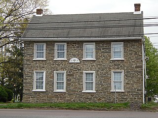
Belleville is a census-designated place (CDP) in the Kishacoquillas Valley of Mifflin County, Pennsylvania, United States. The population was 1,827 at the 2010 census. Much of the population is Amish or Mennonite.

<span class="mw-page-title-main">Audubon, Pennsylvania</span> Census-designated place in Pennsylvania, United States

Audubon is a census-designated place (CDP) in Montgomery County, Pennsylvania, United States. It was named for naturalist John James Audubon, who lived there as a young man. The population was 8,433 at the 2010 census.

<span class="mw-page-title-main">Eagleville, Montgomery County, Pennsylvania</span> Census-designated place in Pennsylvania, United States

Eagleville is a census-designated place (CDP) in Montgomery County, Pennsylvania, United States. The population was 4,800 at the 2010 census. It is within Lower Providence Township.

<span class="mw-page-title-main">Franconia Township, Montgomery County, Pennsylvania</span> Township in Pennsylvania, United States

Franconia Township is a township in Montgomery County, Pennsylvania, United States. The population was 13,064 at the 2010 census.

<span class="mw-page-title-main">Kulpsville, Pennsylvania</span> Census-designated place in Pennsylvania, United States

Kulpsville is a census-designated place (CDP) in Montgomery County, Pennsylvania. The population was 8,194 at the 2010 census. It is located in Towamencin Township, which is part of the North Penn Valley region that is centered around the borough of Lansdale. The name is derived from the Kulp family.

<span class="mw-page-title-main">Lower Frederick Township, Montgomery County, Pennsylvania</span> Township in Pennsylvania, United States

Lower Frederick Township is a township in Montgomery County, Pennsylvania, United States. The population was 4,840 at the 2010 census.

<span class="mw-page-title-main">Lower Providence Township, Montgomery County, Pennsylvania</span> Township in Pennsylvania, United States

Lower Providence Township is a township in Montgomery County, Pennsylvania, United States. The township is located approximately 17 miles northwest of Philadelphia. The population was 25,625 at the 2020 census.

<span class="mw-page-title-main">Lower Salford Township, Montgomery County, Pennsylvania</span> Township in Pennsylvania, United States

Lower Salford is a township in Montgomery County, Pennsylvania. It is located one mile west of the Lansdale exit of the Pennsylvania Turnpike. It is centered on the intersection of Route 63, and Route 113.

<span class="mw-page-title-main">Marlborough Township, Montgomery County, Pennsylvania</span> Township in Pennsylvania, United States

Marlborough Township is a township in Montgomery County, Pennsylvania, United States. The population was 3,178 at the 2010 census.

<span class="mw-page-title-main">Salford Township, Montgomery County, Pennsylvania</span> Township in Pennsylvania, United States

Salford Township is a township in Montgomery County, Pennsylvania, United States. The population was 2,504 at the 2010 census.

<span class="mw-page-title-main">Schwenksville, Pennsylvania</span> Borough in Pennsylvania, United States

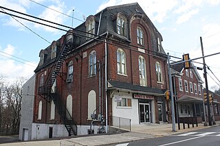
Schwenksville is a borough in Montgomery County, Pennsylvania, United States. The population was 1,385 at the 2010 census. It is notable for being located near the site of the Philadelphia Folk Festival. The borough was founded in 1684, when the Lenni-Lenape Indians ceded to William Penn the land along the Perkiomen Creek; it was incorporated in 1903. The borough was named for George Schwenk, whose son, Jacob Schwenk, served in George Washington's army.

<span class="mw-page-title-main">Skippack, Pennsylvania</span> Census-designated place in Pennsylvania, United States

Skippack is a census-designated place (CDP) in Montgomery County, Pennsylvania, United States. The population was 3,758 at the 2010 census.

<span class="mw-page-title-main">Skippack Township, Montgomery County, Pennsylvania</span> Township in Pennsylvania, United States

Skippack Township is a township in Montgomery County, Pennsylvania, United States. The population was 13,715 at the 2010 census. This represents a 110.5% increase from the 2000 count of 6,516 residents.

<span class="mw-page-title-main">Souderton, Pennsylvania</span> Borough in Pennsylvania, United States

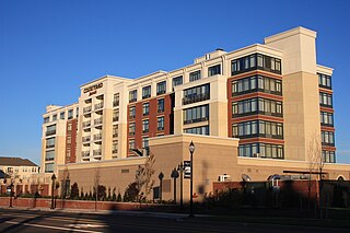
Souderton is a borough in Montgomery County, Pennsylvania, United States. The population was 7,191 at the 2020 census.

<span class="mw-page-title-main">Trappe, Pennsylvania</span> Borough in Pennsylvania, United States

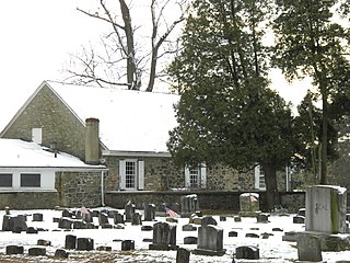
Trappe is a borough in Montgomery County, Pennsylvania, United States. The population was 3,509 at the 2010 census. Augustus Lutheran Church, built in 1743, is the oldest unchanged Lutheran church building in the United States in continuous use by the same congregation. It has been designated a National Historic Landmark.

<span class="mw-page-title-main">Trooper, Pennsylvania</span> Census-designated place in Pennsylvania, United States

Trooper is a census-designated place (CDP) in Montgomery County, Pennsylvania, United States. The population was 5,744 at the 2010 census.

<span class="mw-page-title-main">Upper Salford Township, Montgomery County, Pennsylvania</span> Township in Pennsylvania, United States

Upper Salford Township is a township in Montgomery County, Pennsylvania, United States. The population was 3,299 at the 2010 census.

References

  1. "ArcGIS REST Services Directory". United States Census Bureau. Retrieved October 12, 2022.
  2. U.S. Geological Survey Geographic Names Information System: Harleysville
  3. 1 2 "Census Population API". United States Census Bureau. Retrieved Oct 12, 2022.
  4. "National Register Information System". National Register of Historic Places . National Park Service. July 9, 2010.
  5. Pennsylvania Historical and Museum Commission, 1972, NRHP Nomination Form for Klein Meetinghouse Enter "public" for ID and "public" for password to access the site.
  6. "PRISM Climate Group at Oregon State University".
  7. "Census 2020".
  8. "Census 2010: Pennsylvania". USA Today. Archived from the original on May 11, 2020. Retrieved July 21, 2013.
  9. "U.S. Census website". United States Census Bureau . United States Census Bureau . Retrieved 2008-01-31.
  10. "Harleysville, PA on Instagram". Archived from the original on 2021-12-24. Retrieved December 24, 2020.
  11. "Mennonite Heritage Center" . Retrieved December 24, 2020.
  12. "History of the Harleysville Fire Company". Harleysville Fire Company Station 89. Harleysville Fire Company. 2013. Archived from the original on May 11, 2020. Retrieved March 8, 2017.