Skippack Creek is a 15.7-mile-long (25.3 km) [1] tributary of Perkiomen Creek in Montgomery County, Pennsylvania in the United States. [2]

A tributary or affluent is a stream or river that flows into a larger stream or main stem river or a lake. A tributary does not flow directly into a sea or ocean. Tributaries and the main stem river drain the surrounding drainage basin of its surface water and groundwater, leading the water out into an ocean.

Perkiomen Creek is a 37.7-mile-long (60.7 km) tributary of the Schuylkill River in Berks, Lehigh and Montgomery counties, Pennsylvania in the United States. The water course was also named Perquaminck Creek, on Thomas Holme's 1687 map.

Montgomery County, locally also referred to as Montco, is the third-most populous county in the U.S. state of the Commonwealth of Pennsylvania, and the 71st most populous in the United States. As of 2017, the census-estimated population of the county was 826,075, representing a 3.3% increase from the 799,884 residents enumerated in the 2010 census. Montgomery County is located adjacent to and northwest of Philadelphia. The county seat is Norristown. Montgomery County is geographically diverse, ranging from farms and open land in the extreme north of the county to densely populated suburban neighborhoods in the southern and central portions of the county.
A portion of the creek flows through Evansburg State Park and passes by the census-designated place of Skippack. [2]
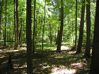
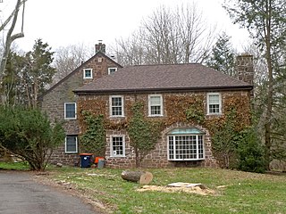
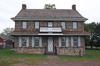
Evansburg State Park is a 3,349-acre (1,355 ha) Pennsylvania state park in Lower Providence, Lower Salford, Skippack, Towamencin, and Worcester Townships in Montgomery County, Pennsylvania in the United States. The park has a variety of habitats including forests, meadows, old fields, and farmland. The park offers a variety of recreational opportunities including picnicking, golf, ball fields, biking, hiking, hunting, horseback riding, and fishing. Evansburg State Park is near Collegeville and Norristown just off Pennsylvania Route 363.
A census-designated place (CDP) is a concentration of population defined by the United States Census Bureau for statistical purposes only. CDPs have been used in each decennial census since 1980 as the counterparts of incorporated places, such as self-governing cities, towns, and villages, for the purposes of gathering and correlating statistical data. CDPs are populated areas that generally include one officially designated but currently unincorporated small community, for which the CDP is named, plus surrounding inhabited countryside of varying dimensions and, occasionally, other, smaller unincorporated communities as well. CDPs include small rural communities, colonias located along the U.S. border with Mexico, and unincorporated resort and retirement communities and their environs.

Skippack is a census-designated place (CDP) in Montgomery County, Pennsylvania, United States. The population was 3,758 at the 2010 census.
Skippack Creek joins Perkiomen Creek approximately 3 miles (5 km) upstream of that creek's confluence with the Schuylkill River. [2]

The Schuylkill River is an important river running northwest to southeast in eastern Pennsylvania, which was improved by navigations into the Schuylkill Canal. Several of its tributaries drain major parts of the center-southern and easternmost Coal Regions in the state.
It is stocked with brown and rainbow trout; other fish in the creek include smallmouth bass, catfish, sucker, carp, panfish, and freshwater eel.

The brown trout is a European species of salmonid fish that has been widely introduced into suitable environments globally. It includes both purely freshwater populations, referred to as the riverine ecotype, Salmo trutta morpha fario, and a lacustrine ecotype, S. trutta morpha lacustris, also called the lake trout, as well as anadromous forms known as the sea trout, S. trutta morpha trutta. The latter migrates to the oceans for much of its life and returns to fresh water only to spawn. Sea trout in the Ireland and Britain have many regional names: sewin in Wales, finnock in Scotland, peal in the West Country, mort in North West England, and white trout in Ireland.

The rainbow trout is a trout and species of salmonid native to cold-water tributaries of the Pacific Ocean in Asia and North America. The steelhead is an anadromous (sea-run) form of the coastal rainbow trout(O. m. irideus) or Columbia River redband trout (O. m. gairdneri) that usually returns to fresh water to spawn after living two to three years in the ocean. Freshwater forms that have been introduced into the Great Lakes and migrate into tributaries to spawn are also called steelhead.

The smallmouth bass is a species of freshwater fish in the sunfish family (Centrarchidae) of the order Perciformes. It is the type species of its genus. One of the black basses, it is a popular game fish sought by anglers throughout the temperate zones of North America, and has been spread by stocking—as well as illegal introductions—to many cool-water tributaries and lakes in Canada and more so introduced in the United States. The maximum recorded size is approximately 27 inches and 12 pounds. The smallmouth bass is native to the upper and middle Mississippi River basin, the Saint Lawrence River–Great Lakes system, and up into the Hudson Bay basin. Its common names include smallmouth, bronzeback, brown bass, brownie, smallie, bronze bass, and bareback bass.