Chester County, Pennsylvania

Last updated

Chester County
Chester County Courthouse PA 2015.jpg
Flag of Chester County, Pennsylvania.svg
Chester County Seal.png
Map of Pennsylvania highlighting Chester County.svg
Location within the U.S. state of Pennsylvania
Pennsylvania in United States.svg
Pennsylvania's location within the U.S.
Coordinates: 39°58′N75°45′W / 39.97°N 75.75°W / 39.97; -75.75
CountryFlag of the United States.svg United States
StateFlag of Pennsylvania.svg  Pennsylvania
FoundedAugust 24, 1682
Named for Chester, England
Seat West Chester
Largest boroughWest Chester
Government
   County commission
Area
  Total759 sq mi (1,970 km2)
  Land751 sq mi (1,950 km2)
  Water8.7 sq mi (23 km2)  1.1%
Population
 (2020)
  Total534,413
  Density712.0/sq mi (274.9/km2)
Time zone UTC−5 (Eastern)
  Summer (DST) UTC−4 (EDT)
Congressional districts 5th, 6th
Website www.chesco.org
DesignatedOctober 26, 1982 [1]

Chester County (Pennsylvania Dutch: Tscheschter Kaundi), colloquially referred to as Chesco, is a county in the Commonwealth of Pennsylvania. It is located in the Delaware Valley region, located in the southeastern part of the state. As of the 2020 census, the population was 534,413, [2] increasing by 7.1% from 498,886 in 2010. [3] The county seat is the Borough of West Chester. [4] The most populous of its 73 municipalities (cities, boroughs, and townships as defined at the state level) is Tredyffrin Township. The most populous boroughs are West Chester and Phoenixville. Coatesville is the only municipality in the County organized under the City form of government, a technical rather than demographic distinction. Chester County was one of the three original Pennsylvania counties created by William Penn in 1682. It was named for Chester, England.

Contents

Chester County is part of the Philadelphia-Camden-Wilmington, PA-NJ-DE-MD Metropolitan Statistical Area. Along with southwest Delaware County, eastern Chester County is home to many communities that comprise part of the Philadelphia Main Line western suburbs of Philadelphia.

As of 2020, the county had the highest median household income level in Pennsylvania, and the 35th-highest in the nation.

History

Chester County, Pennsylvania
Interactive map of Chester County, Pennsylvania
A Chester County sign Chester County sign.JPG
A Chester County sign

Philadelphia, Bucks, and Chester were the three counties initially created by William Penn on August 24, 1682 in the colonial-era Province of Pennsylvania. [5] [6]

At the time, Chester County's borders were Philadelphia County to the north, the ill-defined western edge of the colony, located approximately at the Susquehanna River to the west, the Delaware River to the east, and Delaware and Maryland to the south. Chester County replaced the Pennsylvania portion of New Netherland's upland in New York, which was officially eliminated when Pennsylvania was chartered on March 4, 1681, and ceased existing in June of that year. [7] [8] Much of the Welsh Tract was in eastern Chester County, and Welsh place names, given by early settlers, continue to predominate there.

The fourth county in the state, Lancaster County, was formed from Chester County on May 10, 1729. On March 11, 1752, Berks County was formed from the northern section of Chester County and parts of Lancaster and Philadelphia counties.

The original Chester County seat was the City of Chester, a center of naval shipbuilding, at the eastern edge of the county. In an effort to accommodate the increased population of the western part of the county, the county seat was moved to a more central location in 1788; in order to mollify the eastern portion of the county, the village, known as Turk's Head, was renamed West Chester. In response to the new location of the county seat, the eastern portion of the county separated and formed the new Delaware County in 1789 with the City of Chester as its county seat. [9]

Much of the history of Chester County arises from its location between Philadelphia and the Susquehanna River. The first "road to the West," a reference to Lancaster County, passed through the central part of Chester County, following the Great Valley westward; with some realignments, it became the Lincoln Highway and later U.S. Route 30. This road is still named Lancaster Avenue in most of the Chester County towns it runs through. The first railroad (which became the Pennsylvania Railroad) followed much the same route, and the Reading Railroad progressed up the Schuylkill River to Reading. Industry tended to concentrate along the rail lines. Easy transportation allowed workers to commute to urban jobs, and the rise of the suburbs followed. To this day, the developed areas form "fingers" extending along major lines of transportation.

During the American Revolutionary War, the Battle of Brandywine was fought in the southeastern part of the county. The Battle of the Clouds and the Battle of Paoli both took place in the northeastern part of the county, along with George Washington's encampment at Valley Forge.

Geography

According to the U.S. Census Bureau, the county has a total area of 759 square miles (1,970 km2), of which 751 square miles (1,950 km2) is land and 8.7 square miles (23 km2) (1.1%) is water. [10] The topography consists of rolling hills and valleys and it is part of the region known as the Piedmont.

Watersheds that serve Chester County include the Octoraro, Brandywine, and Chester creeks, and the Schuylkill River. Many of the soils are fertile, rich loam as much as twenty-four inches thick; together with the temperate climate, this was long a major agricultural area. [11] Because of its proximity to Philadelphia, Chester County has seen large waves of development over the past half-century due to suburbanization. Although development in Chester County has increased, agriculture is still a major part of the county's economy, and the number of horse farms is increasing in the county.[ citation needed ] Mushroom growing is a specialty in the southern portion of the county.

Chester County is the only county to border both Delaware and Maryland.

Elevations (in feet): High point—1020 Welsh Mt., Honeybrook Twp. Other high points—960 Thomas Hill, Warwick Twp; 960 Barren Hill, West Caln Twp. Low point—66 Schuylkill River, Chester-Montgomery county line. Cities and boroughs: Coatesville 314; Downingtown 255; Kennett Square 300; Oxford 535; Parkesburg 542; Phoenixville 127; Spring City 114; West Chester 459. [12]

Adjacent counties

National protected area

State protected areas

Major roads and highways

I-76/Pennsylvania Turnpike westbound in Chester County 2022-08-31 12 38 19 View west along Interstate 76 (Pennsylvania Turnpike Philadelphia Extension) from the overpass for Pennsylvania State Route 82 (North Manor Road) in West Nantmeal Township, Chester County, Pennsylvania.jpg
I-76/Pennsylvania Turnpike westbound in Chester County

Economy and environment

Lanchester Landfill, located on the border of Chester and Lancaster Counties, captures methane which is sold for renewable natural gas credits, and piped to seven local businesses. This reduces the county's methane emissions, and provides an alternative to fracking for shale gas. [13] In addition, several companies have their headquarters or a major presence in the county including Bentley Systems, EBS Healthcare, Main Line Health, Lavazza North America (formerly Mars Drinks), Depuy Synthes (part of Johnson & Johnson), Metabo, QVC, Hankin Group, Axalta Coating Systems, CTDI, Pactiv, Ricoh Americas, Blinding Edge Pictures, J.G. Wentworth, The Vanguard Group, and Victory Brewing Company among others.

Demographics

Historical population
CensusPop.Note
1790 27,829
1800 32,09315.3%
1810 39,59623.4%
1820 44,45112.3%
1830 50,91014.5%
1840 57,51513.0%
1850 66,43815.5%
1860 74,57812.3%
1870 77,8054.3%
1880 83,4817.3%
1890 89,3777.1%
1900 95,6957.1%
1910 109,21314.1%
1920 115,1205.4%
1930 126,62910.0%
1940 135,6267.1%
1950 159,14117.3%
1960 210,60832.3%
1970 278,31132.1%
1980 316,66013.8%
1990 376,39618.9%
2000 433,50115.2%
2010 498,88615.1%
2020 534,4137.1%
U.S. Decennial Census [14]
1790–1960 [15] 1900–1990 [16]
1990–2000 [17] 2010–2019 [3]

As of the 2010 census, the county was 82.1% White Non-Hispanic, 6.1% Black or African American, 0.2% Native American or Alaskan Native, 3.9% Asian, 0.0% Native Hawaiian, 1.8% were two or more races, and 2.4% were some other race. 6.5% of the population were Hispanic or Latino.

As of the census [18] of 2000, there were 433,501 people, 157,905 households, and 113,375 families residing in the county. The population density was 573 inhabitants per square mile (221/km2). There were 163,773 housing units at an average density of 217 units per square mile (84/km2). The racial makeup of the county was 89.21% White, 6.24% Black or African American, 0.15% Native American, 1.95% Asian, 0.03% Pacific Islander, 1.35% from other races, and 1.06% from two or more races. 3.72% of the population were Hispanic or Latino of any race. 18.0% were of Irish, 17.3% German, 13.1% Italian, 10.1% English and 5.6% American ancestry. 91.4% spoke English and 3.7% Spanish as their first language.

There were 157,905 households, out of which 35.10% had children under the age of 18 living with them, 60.50% were married couples living together, 8.10% had a female householder with no husband present, and 28.20% were non-families. 22.60% of all households were made up of individuals, and 7.60% had someone living alone who was 65 years of age or older. The average household size was 2.65 and the average family size was 3.15.

In the county, the population was spread out, with 26.20% under the age of 18, 7.90% from 18 to 24, 30.40% from 25 to 44, 23.80% from 45 to 64, and 11.70% who were 65 years of age or older. The median age was 37 years. For every 100 females there were 96.40 males. For every 100 females age 18 and over, there were 93.10 males.

The median income for a household in the county was $65,295, and the median income for a family was $76,916 (these figures had risen to $80,818 and $97,894 respectively as of a 2007 estimate). Males had a median income of $51,223 versus $34,854 for females. The per capita income for the county was $31,627. About 3.10% of families and 5.20% of the population were below the poverty line, including 5.10% of those under age 18 and 5.50% of those age 65 or over.

The region was originally occupied by the Lenni Lenape people, who greeted European settlers in the seventeenth century with amity and kindness. British settlers were mostly English, Scotch-Irish and Welsh in ethnicity. From the late 19th to early 20th century, the industrial areas of the region, such as Coatesville, attracted immigrants and job seekers from Germany and Ireland, Eastern Europe, Italy, and the American rural South, with both black and white migrants coming north. Later Hispanic immigrants have included Puerto Ricans and, most recently, Mexicans.

Long a primarily rural area, Chester County is now [ when? ] the fastest-growing county in the Delaware Valley; it is one of the fastest growing in the entire Northeastern section of the United States.

Religion

Uwchlan Meetinghouse in Uwchlan Township Uwchlan Meeting.JPG
Uwchlan Meetinghouse in Uwchlan Township

In keeping with its colonial history, Chester County is home to a number of historic Quaker buildings, including Birmingham, Birmingham Orthodox, Bradford, Caln, Old Kennett, Parkersville, Westtown, and Uwchlan meeting houses.

Other historic religious buildings include St. Malachi Church, southeastern Pennsylvania's oldest active Catholic mission church, and the Episcopal St. Mary's, St. Paul's, and St. Peter's churches, and Washington Memorial Chapel. The First Presbyterian Church of West Chester, Coventryville United Methodist Church, which is part of the Coventryville Historic District, and Beth Israel Congregation of Chester County, a Conservative synagogue in Coatesville, a site of Eastern European immigration in the 20th century, are located in the county.

2020 census

Chester County Racial Composition [19]
RaceNum.Perc.
White (NH)405,47675.87%
Black or African American (NH)28,3915.31%
Native American (NH)5320.1%
Asian (NH)35,1436.62%
Pacific Islander (NH)1190.02%
Other/Mixed (NH)21,2104%
Hispanic or Latino 43,5428.15%

Politics

Voter registration

Chart of Voter Registration

   Democratic (41.74%)
   Republican (39.90%)
   Independent (12.92%)
   Other Parties (5.44%)

As of March 4, 2024, there were 379,780 registered voters in Chester County. [20]

Voter Registration and Party Enrollment
PartyNumber of VotersPercentage
Democratic 158,51841.74%
Republican 151,52039.90%
Independent 49,06212.92%
Third Parties 20,6805.44%
Total379,780100%

Election results

2020 US presidential election in Chester County
Biden--80-90%
Biden--70-80%
Biden--60-70%
Biden--50-60%
Biden--<50%
Trump--<50%
Trump--50-60%
Trump--60-70% 2020 United States presidential election in Chester County, Pennsylvania.svg
2020 US presidential election in Chester County
  Biden—80-90%
  Biden—70-80%
  Biden—60-70%
  Biden—50-60%
  Biden—<50%
  Trump—<50%
  Trump—50-60%
  Trump—60-70%

Chester County has historically been reliably Republican at the county level. From 1856 through 2012, it voted Democratic in 1856 for Pennsylvania native James Buchanan, and in three subsequent elections, 1912, 1964, and 2008. In recent elections, however, the county has been trending Democratic, although not as overwhelmingly as its fellow Main Line counties of Montgomery and Delaware. It remains the most conservative of these three.

In 2000, George W. Bush defeated Al Gore in the county by almost 10%, but in 2004, John Kerry cut Bush's margin of victory by over half, to just 4.5%. In 2008, Chester County voted for Barack Obama by 9%. In 2009, with a smaller turnout, Republican candidates swept all county-row offices, winning with an average margin of 20%. In 2012, the county voted for the Republican presidential candidate Mitt Romney, by a very small margin of 0.2%, or about 500 votes. [21]

In 2016, despite Pennsylvania voting for a Republican presidential candidate for the first time since 1988, Chester County voted more Democratic than in 2012, with Hillary Clinton leading Donald Trump by over 25,000 votes or 9.4 percentage points; a 9.2 percentage point swing from 2012. The only two statewide winners in 2016 to carry Chester County were U.S. Senator Pat Toomey (R) and Pennsylvania State Treasurer Joe Torsella (D). Republican candidates John Brown and John Rafferty carried Chester County, though both lost their races for Auditor General and Attorney General, respectively (Rafferty, a State Senator whose district includes northern Chester County, carried the county by a slim margin of 50 votes [22] ) Emphasizing its Democratic shift even further, Joe Biden defeated Donald Trump by 17.1 points in Chester County in the 2020 election; Trump's percentage of votes was the lowest for any Republican since 1912. Such a major shift in the county was a major factor in Biden's success in flipping Pennsylvania back into the Democratic column.

On November 8, 2017, Democrats made historic inroads in Chester County by winning their first county row office seats in history, picking up four row office seats. [23] On November 5, 2019, Democrats swept the county row office seat elections and took a majority on the Board of Commissioners, both firsts in the county's history. [24] In both the 2021 and 2023 elections, Democrats followed up with another sweep of the county row offices, along with retaining their majority on the Board of Commissioners. [25]

United States presidential election results for Chester County, Pennsylvania [26] [27]
Year Republican Democratic Third party
No.%No.%No.%
2020 128,56540.72%182,37257.76%4,8161.53%
2016 116,11442.53%141,68251.90%15,2025.57%
2012 124,84049.43%124,31149.22%3,4251.36%
2008 114,42144.83%137,83354.00%2,9981.17%
2004 120,03652.00%109,70847.53%1,0790.47%
2000 100,08053.33%82,04743.72%5,5492.96%
1996 77,02948.64%64,78340.91%16,55410.45%
1992 74,00243.73%59,64335.25%35,56321.02%
1988 93,52267.00%44,85332.13%1,2100.87%
1984 92,22170.11%38,87029.55%4400.33%
1980 73,04660.92%34,30728.61%12,54310.46%
1976 67,68660.42%42,71238.13%1,6281.45%
1972 72,72668.44%31,11829.29%2,4152.27%
1968 56,07357.19%32,60633.25%9,3729.56%
1964 40,28045.46%47,94054.10%3900.44%
1960 53,05963.64%30,16736.18%1470.18%
1956 47,22570.24%19,95729.68%500.07%
1952 39,96164.86%21,49034.88%1640.27%
1948 29,25865.78%14,67032.98%5501.24%
1944 26,65558.70%18,54840.84%2080.46%
1940 28,22255.47%22,47344.17%1830.36%
1936 29,34051.81%26,67647.11%6131.08%
1932 29,42569.21%12,04028.32%1,0522.47%
1928 36,65982.27%7,68917.26%2100.47%
1924 22,33375.76%5,94620.17%1,2014.07%
1920 18,12969.57%7,00426.88%9273.56%
1916 11,84556.77%8,51440.81%5052.42%
1912 5,70828.85%6,90134.88%7,17736.27%
1908 13,11864.07%6,55532.01%8033.92%
1904 14,20073.90%4,34222.60%6733.50%
1900 13,80966.20%6,21429.79%8354.00%
1896 14,23267.80%6,05828.86%7003.33%
1892 10,98255.57%7,85039.72%9324.72%
1888 11,57858.51%7,54138.11%6693.38%
1884 10,88558.59%7,10238.23%5923.19%
1880 11,29859.25%7,52439.46%2461.29%

Government

Commissioners

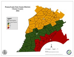
Chester County is administered by a three-person Board of Commissioners who serve four-year terms. Elections take place in the odd-numbered years that precede U.S. presidential elections, with the next election falling in 2027. The commissioners have selective policy-making authority to provide certain local services and facilities on a county-wide basis. Accordingly, the commissioners are responsible for the management of the fiscal and administrative functions of the county. Currently, the Democrats hold a majority on the board, with Commissioners Josh Maxwell and Marian Moskowitz holding two of the three seats. However, county law requires for the minority party to be represented with one seat, which is held by Eric Roe of the Republican Party. [28]

As of December 30,2023: [29]

OfficialPartyPosition
Josh Maxwell Democratic Chair
Marian Moskowitz Democratic Vice Chair
Eric Roe Republican

County row officers

As of December 30,2023: [29]

OfficeOfficialPartyTerm ends
Clerk of CourtsYolanda Van de Krol Democratic 2025
ControllerMargaret Reif Democratic 2025
CoronerSophia Garcia-Jackson Democratic 2025
District AttorneyChristopher de Barrena-Sarobe Democratic 2027
ProthonotaryDebbie Bookman Democratic 2027
Recorder of DeedsDiane O'Dwyer Democratic 2027
Register of WillsMichele Vaughn Democratic 2027
SheriffKevin Dykes Democratic 2027
TreasurerPatricia Maisano Democratic 2025

United States House of Representatives

As of January 3, 2023:

DistrictRepresentativeParty
5 Mary Gay Scanlon Democratic
6 Chrissy Houlahan Democratic

United States Senate

As of January 3, 2023:

SenatorParty
Bob Casey Jr. Democratic
John Fetterman Democratic

State House of Representatives

State House districts in Chester County PA House Districts in Chester County.pdf
State House districts in Chester County

As of January 3, 2023:

DistrictRepresentativeParty
13 John Lawrence Republican
26 Paul Friel Democratic
74 Dan Williams Democratic
155 Danielle Otten Democratic
156 Chris Pielli Democratic
157 Melissa Shusterman Democratic
158 Christina Sappey Democratic
160 Craig Williams Republican
167 Kristine Howard Democratic

State Senate

State Senate districts in Chester County PA State Senate districts within Chester County.pdf
State Senate districts in Chester County

As of January 3, 2023:

DistrictSenatorParty
9 John Kane Democratic
19 Carolyn Comitta Democratic
44 Katie Muth Democratic

Education

Colleges and universities

Philips Memorial Building at West Chester University PhilipsBlgWCU.JPG
Philips Memorial Building at West Chester University

Public school districts

Map of Chester County's public school districts Map of Chester County Pennsylvania School Districts.png
Map of Chester County's public school districts

School districts include: [30]

Charter schools

Independent schools

Libraries

The Chester County Library System in southeastern Pennsylvania was organized in 1965. It is a federated system composed of a District Center Library in Exton and sixteen member libraries. The system provides materials and information for life, work and pleasure.
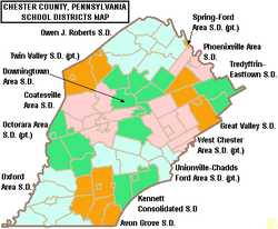
Communities

Map of Chester County with labels showing cities (in yellow), boroughs (in red), townships (in white), and census-designated places (in blue) Map of Chester County Pennsylvania With Municipal and Township Labels.svg
Map of Chester County with labels showing cities (in yellow), boroughs (in red), townships (in white), and census-designated places (in blue)

Under Pennsylvania law, there are four types of incorporated municipalities: cities, boroughs, townships, and, in at most two cases, towns. The post office uses community names and boundaries that usually do not correspond to the townships, and usually only have the same names as the municipalities for the cities and boroughs. The names used by the post office are generally used by residents to describe where they live. The following cities, boroughs and townships are located in Chester County:

City

Boroughs

Townships

Census-designated places

Census-designated places are unincorporated communities designated by the U.S. Census Bureau for the purposes of compiling demographic data. They are not actual jurisdictions under Pennsylvania law.

Other unincorporated communities

Historic community

Population ranking

The population ranking of the following table is based on the 2020 census of Chester County. [43]

county seat

RankCity/Town/etc.Municipal typePopulation (2020 Census)
1 Tredyffrin Township31,927
2 West Goshen Township23,040
3 West Whiteland Township19,632
4 Uwchlan Township19,161
5 West ChesterBorough18,671
6 Phoenixville Borough18,602
7 East Goshen Township18,410
8 Caln Township14,432
9 West Bradford Township14,316
10 East Whiteland Township13,917
11 Coatesville City13,350
12 Upper Uwchlan Township12,275
13 New Garden Township11,363
14 Willistown Township11,273
15 Westtown Township11,154
16 Easttown Township10,984
17 East Bradford Township10,339
18 East Brandywine Township9,738
19 East Nottingham Township8,982
20 West Caln Township8,910
21 London Grove Township8,797
22 Schuylkill Township8,780
23 North Coventry Township8,441
24 Kennett Township8,289
25 Honey Brook Township8,274
26 East Pikeland Township8,260
27 Valley Township7,985
28 Downingtown Borough7,892
29 East Fallowfield Township7,626
30 East Vincent Township7,433
31 West Brandywine Township7,331
32 East Marlborough Township7,306
33 East Coventry Township7,068
34 West Vincent Township6,668
35 Lionville CDP6,582
36 Paoli CDP6,002
37 Charlestown Township6,001
38 Kennett Square Borough5,936
39 New London Township5,810
40 Oxford Borough5,736
41 Penn Township5,644
42 Exton CDP5,622
43 Chesterbrook CDP5,610
44 Lower Oxford Township5,420
45 East Caln Township5,384
46 Pocopson Township4,455
47 Franklin Township4,433
48 Sadsbury Township4,125
49 Birmingham Township4,085
50 West Pikeland Township4,024
51 Pennsbury Township3,876
52 Parkesburg Borough3,862
53 Berwyn CDP3,775
54 Wallace Township3,711
55 Thorndale CDP3,669
56 Frazer CDP3,635
57 Spring City Borough3,494
58 Malvern Borough3,419
59 London Britain Township3,179
60 Thornbury Township3,177
61 Hayti CDP2,890
62 South Coventry Township2,796
63 West Grove Borough2,770
64 West Nottingham Township2,764
65 Warwick Township2,590
66 Upper Oxford Township2,560
67 Londonderry Township2,476
68 West Fallowfield Township2,459
69 West Sadsbury Township2,436
70 West Nantmeal Township2,251
71 Eagleview CDP2,193
72 South Pottstown CDP2,150
73 Kenilworth CDP2,148
74 Honey Brook Borough1,892
75 East Nantmeal Township1,832
76 Lincoln University CDP1,739
77 Elk Township1,698
78 South Coatesville Borough1,601
79 Devon CDP1,580
80 Caln CDP1,494
81 Chadds Ford (partially in Delaware County)CDP1,476
82 Newlin Township1,358
83 Elverson Borough1,330
84 Atglen Borough1,313
85 Toughkenamon CDP1,297
86 Avondale Borough1,274
87 Nottingham CDP1,260
88 Highland Township1,259
89 Dilworthtown (partially in Delaware County)CDP1,150
90 Pomeroy CDP1,085
91 Westwood CDP1,003
92 Sadsburyville CDP1,001
93 Glenmoore CDP872
94 Pughtown CDP849
95 West Marlborough Township819
96 Cochranville CDP631
97 Unionville CDP577
98 Kimberton CDP568
99 Cheyney University (partially in Delaware County)CDP565
100 Modena Borough541
101 Marshallton CDP500
102 Eagle CDP498
103 Hamorton CDP179

Climate

Chester County has four distinct seasons and has a hot-summer humid continental climate (Dfa) except for some far southern lowlands and areas along the Schuylkill River which have a humid subtropical climate (Cfa). The hardiness zone 7a except for 7b near the Brandywine Creek in Birmingham Township.

Climate data for Honey Brook Twp (Elevation: 728 ft (222 m)) 1981–2010 Averages
MonthJanFebMarAprMayJunJulAugSepOctNovDecYear
Mean daily maximum °F (°C)37.6
(3.1)
40.4
(4.7)
49.5
(9.7)
60.1
(15.6)
70.8
(21.6)
78.9
(26.1)
82.9
(28.3)
82.3
(27.9)
75.3
(24.1)
64.1
(17.8)
52.3
(11.3)
41.4
(5.2)
61.4
(16.3)
Daily mean °F (°C)29.1
(−1.6)
31.3
(−0.4)
39.2
(4.0)
49.3
(9.6)
59.6
(15.3)
68.1
(20.1)
72.6
(22.6)
71.8
(22.1)
64.7
(18.2)
53.6
(12.0)
43.8
(6.6)
33.9
(1.1)
51.5
(10.8)
Mean daily minimum °F (°C)20.7
(−6.3)
22.3
(−5.4)
28.9
(−1.7)
38.4
(3.6)
48.4
(9.1)
57.3
(14.1)
62.3
(16.8)
61.3
(16.3)
54.2
(12.3)
43.1
(6.2)
35.2
(1.8)
26.4
(−3.1)
41.6
(5.3)
Average precipitation inches (mm)3.13
(80)
2.73
(69)
3.78
(96)
3.79
(96)
4.08
(104)
4.11
(104)
4.92
(125)
3.64
(92)
4.37
(111)
4.19
(106)
3.73
(95)
3.66
(93)
46.13
(1,172)
Average relative humidity (%)69.967.862.162.264.572.772.673.674.772.672.472.869.8
Average dew point °F (°C)20.5
(−6.4)
21.9
(−5.6)
27.3
(−2.6)
36.9
(2.7)
47.6
(8.7)
59.0
(15.0)
63.3
(17.4)
62.9
(17.2)
56.5
(13.6)
45.0
(7.2)
35.5
(1.9)
26.1
(−3.3)
42.0
(5.6)
Source: PRISM [44]
Climate data for Coatesville, Pennsylvania
MonthJanFebMarAprMayJunJulAugSepOctNovDecYear
Mean daily maximum °C (°F)3.7
(38.7)
4
(40)
10.2
(50.4)
16.8
(62.2)
22.7
(72.9)
27.4
(81.3)
29.9
(85.8)
28.7
(83.7)
25.4
(77.7)
19.1
(66.3)
11.9
(53.4)
5.3
(41.6)
17.1
(62.8)
Mean daily minimum °C (°F)−6.2
(20.8)
−6.2
(20.9)
−1.4
(29.4)
3.8
(38.8)
9.5
(49.1)
14.6
(58.3)
17.3
(63.2)
16.3
(61.3)
12.4
(54.3)
5.7
(42.3)
0.4
(32.8)
−4.6
(23.8)
5.1
(41.2)
Average precipitation mm (inches)91
(3.6)
84
(3.3)
97
(3.8)
94
(3.7)
99
(3.9)
110
(4.5)
110
(4.4)
110
(4.5)
94
(3.7)
84
(3.3)
84
(3.3)
97
(3.8)
1,160
(45.8)
Source: Weatherbase [45]
Climate data for London Britain (Elevation: 167 ft (51 m)) 1981–2010 Averages
MonthJanFebMarAprMayJunJulAugSepOctNovDecYear
Mean daily maximum °F (°C)40.4
(4.7)
43.4
(6.3)
52.2
(11.2)
64.1
(17.8)
73.6
(23.1)
82.5
(28.1)
86.7
(30.4)
85.0
(29.4)
77.9
(25.5)
66.6
(19.2)
55.5
(13.1)
44.3
(6.8)
64.4
(18.0)
Daily mean °F (°C)31.9
(−0.1)
34.5
(1.4)
42.2
(5.7)
52.8
(11.6)
62.4
(16.9)
71.7
(22.1)
76.1
(24.5)
74.6
(23.7)
67.3
(19.6)
55.8
(13.2)
46.0
(7.8)
36.1
(2.3)
54.4
(12.4)
Mean daily minimum °F (°C)23.5
(−4.7)
25.6
(−3.6)
32.2
(0.1)
41.5
(5.3)
51.3
(10.7)
61.0
(16.1)
65.6
(18.7)
64.2
(17.9)
56.8
(13.8)
44.9
(7.2)
36.4
(2.4)
27.9
(−2.3)
44.3
(6.8)
Average precipitation inches (mm)3.30
(84)
2.79
(71)
4.21
(107)
3.72
(94)
4.18
(106)
4.05
(103)
4.66
(118)
3.66
(93)
4.48
(114)
3.49
(89)
3.50
(89)
3.73
(95)
45.77
(1,163)
Average relative humidity (%)66.863.359.058.662.766.668.169.671.169.367.968.165.9
Average dew point °F (°C)22.1
(−5.5)
23.3
(−4.8)
28.9
(−1.7)
38.7
(3.7)
49.5
(9.7)
60.0
(15.6)
64.8
(18.2)
64.0
(17.8)
57.6
(14.2)
45.9
(7.7)
36.0
(2.2)
26.6
(−3.0)
43.2
(6.2)
Source: PRISM [44]

Public health

Opioid crisis

In both 2018 and 2019, deaths from drug overdoses in Chester County declined. Of the 104 drug overdoses recorded by the coroner, an estimated 77 percent involved the presence of fentanyl. One of the reasons for the decline in overdose deaths was "the saturation across the county of Narcan, the anti-opioid nasal spray that can revive someone suffering an overdose." In 2019, any resident of Chester County could obtain a free Narcan dose at community training events across the county. [46]

Notable people

See also

Related Research Articles

<span class="mw-page-title-main">Caln Township, Pennsylvania</span> Township in Pennsylvania, United States

Caln Township is a township in Chester County, Pennsylvania, United States. The population was 14,428 at the 2020 census. The township was founded by settlers from Calne, Wiltshire in England in 1714; the relationship between Calne and Wiltshire continues in the present since the two are sister cities. Caln is a township of the First Class, and the governing body is a Board of Commissioners. The township also owns Ingleside Golf Club and over 200 acres (0.81 km2) of green space and parks.

<span class="mw-page-title-main">Coatesville, Pennsylvania</span> City in Pennsylvania, United States

Coatesville is a city in Chester County, Pennsylvania, United States. The population was 13,350 at the 2020 census. Coatesville is approximately 39 miles west of Philadelphia. It developed along the Philadelphia and Lancaster Turnpike beginning in the late 18th century. It spans U.S. Route 30, the "Main Line" highway that runs west of Philadelphia.

<span class="mw-page-title-main">Downingtown, Pennsylvania</span> Borough in Pennsylvania, United States

Downingtown is a borough in Chester County, Pennsylvania, United States, 33 miles (53 km) west of Philadelphia. As of the 2020 census, it had a population of 7,898. Downingtown was settled by European colonists in the early 18th century and has a number of historic buildings and structures.

<span class="mw-page-title-main">East Bradford Township, Pennsylvania</span> Township in Pennsylvania, United States

East Bradford Township is a township in Chester County, Pennsylvania, United States. The population was 10,308 at the 2020 census.

<span class="mw-page-title-main">East Caln Township, Pennsylvania</span> Township in Pennsylvania, United States

East Caln Township is a township in Chester County, Pennsylvania, United States. The population was 5,380 at the 2020 census. The township wraps around the eastern half of Downingtown and is mostly indistinguishable from it. East Caln Township is very developed, containing several shopping centers, including the regionally important Brandywine Square Center, several recently constructed housing developments varying from condominiums to large single family homes, and some industry in the southern fringe of the township.

<span class="mw-page-title-main">Upper Uwchlan Township, Pennsylvania</span> Township in Pennsylvania, United States

Upper Uwchlan Township is a township in Chester County, Pennsylvania, United States. The population was 11,227 at the 2010 census. The township included the community of Milford Mills before it was inundated by the creation of the Marsh Creek Dam in 1972.

<span class="mw-page-title-main">Uwchlan Township, Pennsylvania</span> Township in Pennsylvania, United States

Uwchlan Township is a township in Chester County, Pennsylvania, United States. The population was 19,161 at the 2020 census.

<span class="mw-page-title-main">West Bradford Township, Pennsylvania</span> Township in Pennsylvania, United States

West Bradford Township is a township that is located in Chester County, Pennsylvania, United States. The population was 12,376 at the time of the 2010 census.

<span class="mw-page-title-main">West Chester, Pennsylvania</span> Borough in Pennsylvania, United States

West Chester is a borough and the county seat of Chester County, Pennsylvania, United States. Located within the Philadelphia metropolitan area, the borough had a population of 18,461 at the 2010 census. West Chester is the mailing address for most of its neighboring townships. When calculated by mailing address, the population as of the 2010 U.S. Census was 108,696, which would make it the 10th largest city by mailing address in the state of Pennsylvania.

<span class="mw-page-title-main">West Goshen Township, Pennsylvania</span> Township in Pennsylvania, United States

West Goshen Township is a township in Chester County, Pennsylvania, United States. The population was 23,040 at the 2020 census. In 2013, Money Magazine voted West Goshen as the 10th best place to live in America. West Goshen has also been ranked in the top 15 places to live in America from 2014 to 2017 and is also at the top of best neighborhoods to raise a family in Pennsylvania every year.

<span class="mw-page-title-main">West Pikeland Township, Pennsylvania</span> Township in Pennsylvania, United States

West Pikeland Township is a township in Chester County, Pennsylvania, United States. The population was 4,024 at the 2010 census.

<span class="mw-page-title-main">Brandywine Creek (Christina River tributary)</span> Creek in Pennsylvania and Delaware, US

Brandywine Creek is a tributary of the Christina River in southeastern Pennsylvania and northern Delaware in the United States. The Lower Brandywine is 20.4 miles (32.8 km) long and is a designated Pennsylvania Scenic River with several tributary streams. The East Branch and West Branch of the creek originate within 2 miles (3 km) of each other on the slopes of Welsh Mountain in Honey Brook Township, Pennsylvania, about 20 miles (32 km) northwest of their confluence.

<span class="mw-page-title-main">Downingtown Area School District</span> School district in Pennsylvania

The Downingtown Area School District is a school district based in Downingtown, in Chester County, Pennsylvania, in the United States. The district operates ten elementary schools, three middle schools and three high schools. As of 2018, the district educates approximately 12,000 students, making it the largest school district in Chester County.

<span class="mw-page-title-main">Pennsylvania Route 82</span> State highway in Chester County, Pennsylvania, United States

Pennsylvania Route 82 is a 32-mile-long (51 km) north–south state highway located in Chester County in southeast Pennsylvania, USA. The southern terminus is at the Delaware state line southeast of Kennett Square, where the road continues south into that state as Delaware Route 82. The northern terminus is at PA 23 in Elverson. PA 82 heads through rural areas of Chester County along with the communities of Kennett Square, Unionville, and Coatesville. The route intersects many important roads including U.S. Route 1 near Kennett Square, PA 162 and PA 842 in Unionville, US 30 in Coatesville, and US 322 in Brandywine Manor. PA 82 is a two-lane undivided road most of its length.

<span class="mw-page-title-main">Pennsylvania Route 113</span> State highway in Pennsylvania, US

Pennsylvania Route 113 is a 46.9-mile-long (75.5 km) state route in eastern Pennsylvania. The southern terminus of the route is at U.S. Route 30 Business in Downingtown. Its northern terminus is at PA 611 in Tinicum Township. The route is signed as north–south although its exact alignment follows a northeast-southwest routing. The route serves Chester, Montgomery, and Bucks counties, passing through Lionville, Phoenixville, Trappe, Skippack, Harleysville, Souderton, and Silverdale along the way.

Bishop Shanahan High School is located in Downingtown, Pennsylvania. It's part of the Archdiocese of Philadelphia's Catholic school system. Named after Right Rev. John W. Shanahan, the third bishop of Harrisburg, the school is the only archdiocesan high school in Chester County. Construction of the current building began in 1996. It opened in 1998, and the first class graduated from it in 1999. The school had previously been located in West Chester, Pennsylvania.

<span class="mw-page-title-main">U.S. Route 30 Business (Chester County, Pennsylvania)</span> Highway in Pennsylvania

U.S. Route 30 Business is a 19-mile (31 km) business route of US 30 in Chester County, Pennsylvania. The route follows the former alignment of US 30 between Sadsbury Township and East Whiteland Township, passing through Coatesville, Downingtown, and Exton. US 30 follows a freeway bypass between these two points. The present alignment of US 30 Bus. was originally part of a turnpike called the Philadelphia and Lancaster Turnpike that was completed in 1794. The state took over the turnpike at the beginning of the 20th century. In 1913, present-day US 30 Bus. was incorporated into the Lincoln Highway, an auto trail that ran from San Francisco east to New York City. The Lincoln Highway through Pennsylvania became Pennsylvania Route 1 (PA 1) in 1924. US 30 was designated concurrent with PA 1 west of Philadelphia in 1926, with the PA 1 designation removed two years later. US 30 was widened into a multilane road through Chester County in the 1930s. In the 1960s, US 30 was moved to a freeway bypass around Coatesville and Downingtown, with US 30 Bus. designated onto the former alignment of US 30. In 1995, US 30 Bus. was extended east when US 30 was extended to bypass Exton.

<span class="mw-page-title-main">Coatesville Area School District</span> School district in Chester County, Pennsylvania, U. S.

The Coatesville Area School District (CASD) covers the City of Coatesville, the Boroughs of Modena and South Coatesville, and Caln Township, East Fallowfield Township, Sadsbury Township, Valley Township, West Brandywine Township and West Caln Township in Chester County, Pennsylvania. According to census data recorded between 2010 and 2019, Coatesville Area School District served a resident population of approximately 64,700. The district operates Coatesville Area Senior High School (10th-12th), Coatesville Area Intermediate High School (8th-9th), North Brandywine Middle School (7th), Scott 6th Grade Center, Caln Elementary School (K-5th), East Fallowfield Elementary School (K-5th), King's Highway Elementary School (K-5th), Rainbow Elementary School (K-5th), and Reeceville Elementary School (K-5th).

<span class="mw-page-title-main">Bruce Mowday</span>

Bruce E. Mowday is an author who lives in Chester County, Pennsylvania. He specializes in books about local history, business, sports, and true crime. He is active with the Chester County History Center.

The Ches-Mont League is a high school sports league primarily located in Chester County, Pennsylvania in the suburbs of Philadelphia. Currently, the league consists of thirteen high schools, divided into two divisions. Twelve of the schools are from Chester County, with one from Delaware County.

References

  1. "PHMC Historical Markers Search". Pennsylvania Historical and Museum Commission. Commonwealth of Pennsylvania. Archived from the original (Searchable database) on March 21, 2016. Retrieved January 25, 2014.
  2. "2020 Census Demographic Data". US Census Bureau. Archived from the original on August 12, 2021. Retrieved August 20, 2021.
  3. 1 2 "QuickFacts Chester County, Pennsylvania". United States Census Bureau . Retrieved June 18, 2018.
  4. "Find a County". National Association of Counties. Archived from the original on May 3, 2015. Retrieved June 7, 2011.
  5. Commonwealth of Pennsylvania (1852–1935). Pennsylvania Archives. 9 Series, 109 Volumes. Philadelphia, Pennsylvania and Harrisburg, Pennsylvania. pp. Series 2, Volume 5: 739–744.{{cite book}}: CS1 maint: location missing publisher (link)
  6. Futhey, John; Cope, Gilbert (1881). History of Chester County, Pennsylvania, with genealogical and biographical sketches. Philadelphia: L. H. Everts.
  7. Armstrong, Edward, ed. (1860). Record of the Court at Upland, in Pennsylvania, 1676 to 1681. Memoirs of the Historical Society of Pennsylvania Volume 7. p. 196.
  8. Swindler, William F., ed. (1973–1979). Sources and Documents of United States Constitutions. 10 Volumes. Dobbs Ferry, New York: Oceana Publications. pp. Vol. 8: 243.
  9. Ashmead, Henry Gordon (1884). A History of Delaware County, Pennsylvania. Philadelphia: L.H. Everts & Co. pp.  77–83. Retrieved May 24, 2017.
  10. "2010 Census Gazetteer Files". United States Census Bureau. August 22, 2012. Retrieved March 6, 2015.
  11. Commission, Chester County Planning. "Chester County Ag Council". www.chescofarming.org. Retrieved January 17, 2023.
  12. Elevations in Pennsylvania, Commonwealth of Pennsylvania Dept. of Environmental Resources, Bureau of Topographic and Geologic Survey, Information Circular 4, Fourth Series
  13. Hurdle, Jon (March 8, 2016). "Chester County landfill gas used as alternative to fracking". StateImpact Pennsylvania. Retrieved February 26, 2020.
  14. "U.S. Decennial Census". United States Census Bureau. Retrieved March 6, 2015.
  15. "Historical Census Browser". University of Virginia Library. Archived from the original on August 11, 2012. Retrieved March 6, 2015.
  16. Forstall, Richard L., ed. (March 24, 1995). "Population of Counties by Decennial Census: 1900 to 1990". United States Census Bureau. Retrieved March 6, 2015.
  17. "Census 2000 PHC-T-4. Ranking Tables for Counties: 1990 and 2000" (PDF). United States Census Bureau. April 2, 2001. Archived (PDF) from the original on October 9, 2022. Retrieved March 6, 2015.
  18. "U.S. Census website". United States Census Bureau . Retrieved January 31, 2008.
  19. "P2 HISPANIC OR LATINO, AND NOT HISPANIC OR LATINO BY RACE – 2020: DEC Redistricting Data (PL 94-171) – Chester County, Pennsylvania".
  20. Pennsylvania Department of State (February 5, 2024). "Voter registration statistics by county". dos.pa.gov. Retrieved February 7, 2024.
  21. Leip, David. "Dave Leip's Atlas of U.S. Presidential Elections". uselectionatlas.org.
  22. "Pennsylvania Attorney General Results: Josh Shapiro Wins". The New York Times. Retrieved January 14, 2017.
  23. Chambless, J. (November 8, 2017). "Election results 2017: Democrats take the lead - Chester County Press". Chester County Press. Archived from the original on November 9, 2017.
  24. Rellahan, Michael (November 6, 2019). "Commissioners race won by Chesco Democrats". Daily Local News. Retrieved November 6, 2019.
  25. "Another sweep for Chester County Democrats as courthouse remains 'blue'". Daily Local. November 8, 2023. Retrieved January 3, 2024.
  26. Leip, David. "Dave Leip's Atlas of U.S. Presidential Elections". uselectionatlas.org.
  27. The leading "other" candidate, Progressive Theodore Roosevelt, received 6,596 votes, while Socialist candidate Eugene Debs received 314 votes, Prohibition candidate Eugene Chafin received 263 votes, and Socialist Labor candidate Arthur Reimer received 4 votes.
  28. "Democrats maintain majority control of Chester County Board of Commissioners". WHYY. Retrieved January 3, 2024.
  29. 1 2 "Chester County Newly-Elected Officials, Judges Take Oath of Office". Chester County, PA. Retrieved January 3, 2024.
  30. "2020 CENSUS - SCHOOL DISTRICT REFERENCE MAP: Chester County, PA" (PDF). U.S. Census Bureau. Archived (PDF) from the original on October 9, 2022. Retrieved July 20, 2022. - Text list
  31. "Chester County Intermediate Unit / Overview". cciu.org.
  32. "Private School for Children with LD & Dyslexia in Philadelphia - DVFS". dvfs.org.
  33. "Fairville Friends School - Home". fairvillefriends.org/.
  34. "Goshen Friends School - Home". goshenfriends.org.
  35. "Kimberton Waldorf School - The Art of Education". kimberton.org.
  36. "Welcome to TCS! - The Concept School". theconceptschool.org.
  37. "Upland Country Day School Best Private Schools in Chester County". uplandcds.org.
  38. "West-Mont Christian Academy". west-mont.org.
  39. "westchesterfriends". westchesterfriends.
  40. "Windsor Christian Academy – Classical Christian Education in Upper Uwchlan, PA". windsorca.org.
  41. "Windsor Christian Preschool - Offering Morning or Afternoon Preschool Classes for 2-1/2, 3, 4, or 5 Year Olds". windsorcp.org.
  42. "Regina Luminis Academy - Catholic Classical Education". Regina Luminis Academy - Catholic Classical Education.
  43. "2020 U.S. Census website". United States Census Bureau . Retrieved August 10, 2022.
  44. 1 2 "PRISM Climate Group, Oregon State University" . Retrieved August 9, 2019.
  45. "Weatherbase.com". Weatherbase. 2013. Retrieved on 2 September 2019.
  46. Rellahan, Michael P. (February 20, 2020). "Overdoses in Chester County decrease for second year in a row". Daily Local News. Retrieved February 20, 2020.