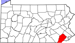
Doe Run, Pennsylvania | |
---|---|
Unincorporated community | |
Coordinates: 39°54′58″N75°49′4″W / 39.91611°N 75.81778°W | |
Country | United States |
State | Pennsylvania |
County | Chester |
Township | West Marlborough |
Elevation | 299 ft (91 m) |
Time zone | UTC-5 (Eastern (EST)) |
• Summer (DST) | UTC-4 (EDT) |
Area code(s) | 610 and 484 |
GNIS feature ID | 1203426 [1] |
Doe Run is an unincorporated community in West Marlborough Township in Chester County, Pennsylvania, United States. Doe Run is located at the intersection of state routes 82 and 841. [2]
Chester County is a county in the Commonwealth of Pennsylvania. It is located in the Delaware Valley region, located in the southeastern part of the state. As of the 2020 census, the population was 534,413, increasing by 7.1% from 498,886 in 2010. The county seat and most populated municipality is West Chester. Chester County was one of the three original Pennsylvania counties created by William Penn in 1682. It was named for Chester, England.
East Fallowfield Township is a township in Chester County, Pennsylvania, United States. The population was 7,626 at the 2020 census.
East Marlborough Township is a township in Chester County, Pennsylvania, United States. The population was 7,026 at the 2010 census. East Marlborough and West Marlborough townships were carved out of the larger Marlborough Township in 1729. The township is home to many Penn Oak trees, trees that were in existence when William Penn explored the area.
West Chester is a borough and the county seat of Chester County, Pennsylvania, United States. Located within the Philadelphia metropolitan area, the borough had a population of 18,461 at the 2010 census. West Chester is the mailing address for most of its neighboring townships. When calculated by mailing address, the population as of the 2010 U.S. Census was 108,696, which would make it the 10th largest city by mailing address in the state of Pennsylvania.
West Marlborough Township is a township in Chester County, Pennsylvania, United States. The population was 814 at the 2010 census. East Marlborough and West Marlborough townships were carved out of the larger Marlborough Township in 1729.
Middletown Township is a township in Delaware County, Pennsylvania, United States. The population was 15,807 at the 2010 census. The Pennsylvania State University has an undergraduate satellite campus called Penn State Brandywine located in the north-central portion of the township. Located outside of Philadelphia, it constitutes part of the Delaware Valley.
Pennsylvania's 6th congressional district is a district in the state of Pennsylvania. It includes all of Chester County and the southeastern portion of Berks County including the city of Reading and its southeastern suburbs. The district is represented by Democrat Chrissy Houlahan, who has served in Congress since 2019. As currently drawn, the district is among the wealthiest in Pennsylvania. The Supreme Court of Pennsylvania redrew the district in February 2018 after ruling the previous map unconstitutional.
Pennsylvania's 7th congressional district includes all of Carbon, Lehigh, and Northampton Counties; and parts of Monroe County. The district is represented by Democrat Susan Wild.
White Clay Creek Preserve is a 3,050-acre (1,230 ha) Pennsylvania state park along the valley of White Clay Creek in London Britain Township in Chester County, Pennsylvania in the United States. The park was donated by the DuPont Company in 1984 for the purpose of "preserving the diverse and unique plant and animal species, and the rich cultural heritage of the area". Dupont also donated an additional 528 acres (214 ha) for the adjoining White Clay Creek State Park to the state of Delaware. White Clay Creek Preserve is 3 miles (4.8 km) north of Newark, Delaware on Pennsylvania Route 896.
Pennsylvania's 16th congressional district is located in Northwestern Pennsylvania. It contains all of Erie County, Crawford County, Mercer County, Lawrence County, Butler County, and parts of Venango County. The district is represented by Republican Mike Kelly.
Pennsylvania Route 82 is a 32-mile-long (51 km) north–south state highway located in Chester County in southeast Pennsylvania, USA. The southern terminus is at the Delaware state line southeast of Kennett Square, where the road continues south into that state as Delaware Route 82. The northern terminus is at PA 23 in Elverson. PA 82 heads through rural areas of Chester County along with the communities of Kennett Square, Unionville, and Coatesville. The route intersects many important roads including U.S. Route 1 near Kennett Square, PA 162 and PA 842 in Unionville, US 30 in Coatesville, and US 322 in Brandywine Manor. PA 82 is a two-lane undivided road most of its length.
Pennsylvania Route 842 is a state highway in Chester County, Pennsylvania. The route runs from PA 841 in West Marlborough Township to U.S. Route 322 Business in downtown West Chester. PA 842 runs through rural areas with some development between PA 841 and West Chester as a two-lane undivided road. Along this stretch, the route forms a concurrency with PA 82 in Unionville, where it intersects the western terminus of PA 162. In West Chester, PA 842 is routed along one-way streets. PA 842 was first designated by 1928 between PA 82 in Unionville and US 122/PA 5/PA 62 in West Chester. The route was extended west to PA 841 in 1937.
Pennsylvania Route 841 is a state highway in Chester County, Pennsylvania. The route runs from the Maryland border in the community of Lewisville in Elk Township, where the road continues as Maryland Route 213, north to PA 82 in the community of Doe Run in West Marlborough Township. The route heads through rural areas of southwestern Chester County on a two-lane undivided road. PA 841 passes through West Grove, where it has an interchange with U.S. Route 1. PA 841 was first assigned to an unpaved road running from Springdell to PA 82 in 1928. The route was extended south to its current terminus in 1937 and was completely paved by 1940.
Doe Run Village Historic District is a national historic district located in West Marlborough Township and East Fallowfield Township, Chester County, Pennsylvania. It encompasses twenty-six contributing buildings and one contributing site in the rural community of Doe Run Village. Buildings cluster in three primary locations. The first cluster includes the Doe Run Garage, old general store, and some residences. The second cluster is associated with a cotton mill that was subsequently replaced with the town hall in 1898. The town hall subsequently contained a dairy. Located nearby are the ruins of a paper mill. The third cluster is associated with a gristmill (1744). Also in the district is the Doe Run School and former Presbyterian Church.
Lenape is an unincorporated community in Pocopson Township in Chester County, Pennsylvania, United States. Lenape is centered on the intersection of Pennsylvania Route 52 and Pocopson Road, west of the Brandywine Creek.
Mendenhall is an unincorporated community in Kennett Township in Chester County, Pennsylvania, United States. Mendenhall is located at the intersection of Pennsylvania Route 52 and Hillendale Road.
Lewisville is an unincorporated community in Elk Township in Chester County, Pennsylvania, United States. Lewisville is located at the intersection of state routes 472 and 841, just north of the Maryland border.
Ryan Anthony Costello is an American politician, lobbyist and attorney who served as the U.S. representative for Pennsylvania's 6th congressional district from 2015 to 2019. A member of the Republican Party, he was first elected to the Congress in the 2014 midterms. Costello previously served on the Chester County Board of Commissioners (2011–2015), which he chaired from 2013 to 2015.
Buck Run is a tributary of West Branch Brandywine Creek in Chester County, Pennsylvania, in the United States. It is approximately 17.2 miles (27.7 km) long and flows through West Sadsbury Township, Sadsbury Township, Pomeroy, Highland Township, East Fallowfield Township, West Marlborough Township, and Newlin Township. The watershed of the stream has an area of 48.6 square miles (126 km2). Its named tributaries include Doe Run and Birch Run. The stream's waters are slightly alkaline and contain various dissolved metals and nonmetals. Rock formations of shale, sandstone, and limestone occur in the watershed. Three covered bridges and several other bridges have been built over the stream. Additionally, a number of mills historically operated along the stream. Mayflies, stoneflies, and caddisflies inhabit the vicinity of the stream. Additionally, trout inhabit the stream.
Darlington Corners is an unincorporated community in Thornbury and Westtown townships in Chester County, Pennsylvania, United States. Darlington Corners is located at the intersection of U.S. Route 202/U.S. Route 322 and Pennsylvania Route 926, south of West Chester.