Darlington Corners, Pennsylvania

Last updated

Darlington Corners, Pennsylvania
Unincorporated community
USA Pennsylvania location map.svg
Red pog.svg
Darlington Corners
Usa edcp location map.svg
Red pog.svg
Darlington Corners
Coordinates: 39°55′11″N75°34′36″W / 39.91972°N 75.57667°W / 39.91972; -75.57667
Country United States
State Pennsylvania
County Chester
Township Thornbury and Westtown
Elevation
374 ft (114 m)
Time zone UTC-5 (Eastern (EST))
  Summer (DST) UTC-4 (EDT)
ZIP code
19382
Area code(s) 610 and 484
GNIS feature ID1172957 [1]

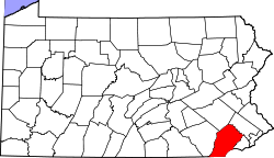
Darlington Corners is an unincorporated community in Thornbury and Westtown townships in Chester County, Pennsylvania, United States. Darlington Corners is located at the intersection of U.S. Route 202/U.S. Route 322 and Pennsylvania Route 926, south of West Chester. [2]

Related Research Articles

<span class="mw-page-title-main">Chester County, Pennsylvania</span> County in Pennsylvania, United States

Chester County is a county in the Commonwealth of Pennsylvania. It is located in the Delaware Valley region, located in the southeastern part of the state. As of the 2020 census, the population was 534,413, increasing by 7.1% from 498,886 in 2010. The county seat and most populated municipality is West Chester. Chester County was one of the three original Pennsylvania counties created by William Penn in 1682. It was named for Chester, England.

<span class="mw-page-title-main">Birmingham Township, Chester County, Pennsylvania</span> Township in Pennsylvania, United States

Birmingham Township is a township in Chester County, Pennsylvania, United States. The population was 4,085 at the 2020 census.

<span class="mw-page-title-main">Caln Township, Chester County, Pennsylvania</span> Township in Pennsylvania, United States

Caln Township is a township in Chester County, Pennsylvania, United States. The population was 14,428 at the 2020 census. The township was founded by settlers from Calne, Wiltshire in England in 1714; the relationship between Calne and Wiltshire continues in the present since the two are sister cities. Caln is a township of the First Class, and the governing body is a Board of Commissioners. The township also owns Ingleside Golf Club and over 200 acres (0.81 km2) of green space and parks. There are 53 employees, including 20 police officers, that work for Caln Township.

<span class="mw-page-title-main">Pocopson Township, Pennsylvania</span> Township in Pennsylvania, United States

Pocopson Township is a township in Chester County, Pennsylvania, United States. The population was 4,582 at the 2010 census.

<span class="mw-page-title-main">West Chester, Pennsylvania</span> Borough in Pennsylvania, United States

West Chester is a borough and the county seat of Chester County, Pennsylvania, United States. Located within the Philadelphia metropolitan area, the borough had a population of 18,461 at the 2010 census. West Chester is the mailing address for most of its neighboring townships. When calculated by mailing address, the population as of the 2010 U.S. Census was 108,696, which would make it the 10th largest city by mailing address in the state of Pennsylvania.

<span class="mw-page-title-main">West Nantmeal Township, Pennsylvania</span> Township in Pennsylvania, United States

West Nantmeal Township is a township in Chester County, Pennsylvania, United States. The population was 2,170 at the 2010 census. It and East Nantmeal Township were originally part of a single Nantmeal Township, which was divided in 1739.

<span class="mw-page-title-main">West Vincent Township, Pennsylvania</span> Township in Pennsylvania, United States

West Vincent Township is a township in Chester County, Pennsylvania, United States. The population was 4,567 at the 2010 census.

<span class="mw-page-title-main">Westtown Township, Pennsylvania</span> Township in Pennsylvania, United States

Westtown Township is a township in Chester County, Pennsylvania, United States. The population was 10,827 at the 2010 census.

<span class="mw-page-title-main">Middletown Township, Delaware County, Pennsylvania</span> Home rule municipality in Pennsylvania, United States

Middletown Township is a township in Delaware County, Pennsylvania, United States. The population was 15,807 at the 2010 census. The Pennsylvania State University has an undergraduate satellite campus called Penn State Brandywine located in the north-central portion of the township. Located outside of Philadelphia, it constitutes part of the Delaware Valley.

<span class="mw-page-title-main">U.S. Route 322</span> Highway in the United States

U.S. Route 322 is a 494 mi (795.0 km) long, east–west United States Highway, traversing Ohio, Pennsylvania, and New Jersey. The road is a spur of US 22 and one of the original highways from 1926. A portion of it at one time was concurrent with the Lakes-to-Sea Highway.

<span class="mw-page-title-main">Pennsylvania Route 100</span> State highway in Pennsylvania, US

Pennsylvania Route 100 is a 59.4-mile (95.6 km) long state highway in the U.S. state of Pennsylvania that runs from U.S. Route 202 near West Chester north to PA 309 in Pleasant Corners. The route runs between the western suburbs of Philadelphia and the Lehigh Valley region of the state, serving Chester, Montgomery, Berks, and Lehigh counties. PA 100 intersects several important highways, including US 30 in Exton, the Pennsylvania Turnpike (Interstate 76, near Lionville, US 422 near Pottstown, US 222 in Trexlertown, and I-78/US 22 in Fogelsville. Several sections of PA 100 are multi-lane divided highway with some interchanges, including between US 202 and the Pennsylvania Turnpike in Chester County between south of Pottstown and New Berlinville, and between Trexlertown and Fogelsville.

<span class="mw-page-title-main">Chadds Ford, Pennsylvania</span> Census-designated place in Pennsylvania, United States

Chadds Ford is a census-designated place (CDP) in Delaware and Chester counties, Pennsylvania, United States, comprising the unincorporated communities of Chadds Ford and Chadds Ford Knoll. It was first listed as a CDP prior to the 2020 census.

<span class="mw-page-title-main">Chester Creek</span>

Chester Creek is a 9.4-mile-long (15.1 km) tributary of the Delaware River in Delaware County, Pennsylvania in the United States.

<span class="mw-page-title-main">Pennsylvania Route 926</span> State highway in Pennsylvania, US

Pennsylvania Route 926 is a 26.2-mile-long (42.2 km) state route located west of Philadelphia in Chester County, Pennsylvania. The western terminus of the route is at PA 10 in Upper Oxford Township. The eastern terminus is at PA 3 in the Philadelphia suburb of Willistown Township. The route is known as Street Road for its entire length. For 0.9 miles (1.4 km), PA 926 runs along the county line between Delaware and Chester counties. The route passes through a mix of suburban and rural areas along its extent. PA 926 is two lanes and undivided its entire length.

<span class="mw-page-title-main">Smedley Darlington</span> American politician

Smedley Darlington was an American politician who served as a Republican member of the U.S. House of Representatives for Pennsylvania's 6th congressional district from 1887 to 1891.

Edward Darlington was a three term member of the U.S. House of Representatives from Pennsylvania from the Anti-Masonic Party. His cousins Isaac Darlington and William Darlington were also both members of the U.S. House of Representatives from Pennsylvania.

<span class="mw-page-title-main">Isaac Darlington</span> American politician

Isaac Darlington was a member of the U.S. House of Representatives from Pennsylvania.

<span class="mw-page-title-main">U.S. Route 322 Business (West Chester, Pennsylvania)</span> Highway in Chester County, Pennsylvania

U.S. Route 322 Business is a business route of US 322 in the borough and surrounding townships of West Chester in Chester County, Pennsylvania. US 322 bypasses West Chester to the north and east on the West Chester Bypass while US 322 Bus. heads through the downtown area. The business route begins at US 322 northwest of the borough and heads southeast, entering West Chester on Hannum Avenue. US 322 Bus. heads east into downtown West Chester along the one-way pair of West Market and West Chestnut streets. In the center of the borough, the route heads south along South High Street, passing through the West Chester University of Pennsylvania campus as it leaves the borough. US 322 Bus. comes to its eastern terminus at an interchange with US 202/US 322 at the southern terminus of the bypass.

<span class="mw-page-title-main">Pomeroy, Pennsylvania</span> Census-designated place in Pennsylvania, United States

Pomeroy is a census-designated place (CDP) in Sadsbury Township, Chester County, Pennsylvania, United States. The population was 401 at the 2010 census.

Lenape is an unincorporated community in Pocopson Township in Chester County, Pennsylvania, United States. Lenape is centered on the intersection of Pennsylvania Route 52 and Pocopson Road, west of the Brandywine Creek.

References

  1. "Darlington Corners". Geographic Names Information System . United States Geological Survey, United States Department of the Interior.
  2. Chester County, Pennsylvania Highway Map (PDF) (Map). PennDOT. 2019. Retrieved July 31, 2020.