London Grove, Pennsylvania

Last updated

London Grove, Pennsylvania
Unincorporated community
Blacksmith shop London Grove.jpg
London Grove blacksmith shop
Coordinates: 39°52′05″N75°46′22″W / 39.86806°N 75.77278°W / 39.86806; -75.77278
Country United States
State Pennsylvania
County Chester
Township West Marlborough
Elevation
443 ft (135 m)
Time zone UTC-5 (Eastern (EST))
  Summer (DST) UTC-4 (EDT)
Area code(s) 610 and 484
GNIS feature ID1179835 [1]

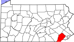
London Grove is an unincorporated community in West Marlborough Township in Chester County, Pennsylvania, United States. London Grove is located at the intersection of Pennsylvania Route 926 and Newark Road, north of Avondale. There was a blacksmith shop (at the middle of the intersection) and a general store, now the parking lot for an apartment building.[ citation needed ]
Related Research Articles

<span class="mw-page-title-main">Garrett County, Maryland</span> County in Maryland, United States

Garrett County is the westernmost county of the U.S. state of Maryland completely within the Appalachian Mountains. As of the 2020 census, the population was 28,806, making it the third-least populous county in Maryland. Its county seat is Oakland. The county was named for John Work Garrett (1820–1884), president of the Baltimore and Ohio Railroad. Created from Allegany County in 1872, it was the last Maryland county to be formed.

<span class="mw-page-title-main">Pine Grove Mills, Pennsylvania</span> Census-designated place in Pennsylvania, United States

Pine Grove Mills is an unincorporated community, village, and census-designated place (CDP) in Ferguson Township, Centre County, Pennsylvania, United States. It is part of the State College, Pennsylvania Metropolitan Statistical Area. The population was 1,481 at the 2020 census.

<span class="mw-page-title-main">London Grove Township, Chester County, Pennsylvania</span> Township in Pennsylvania, United States

London Grove Township is a township in Chester County, Pennsylvania, United States. The population was 8,797 at the 2020 census.

<span class="mw-page-title-main">West Grove, Pennsylvania</span> Borough in Pennsylvania, United States

West Grove is a borough in Chester County, Pennsylvania, United States. The population was 2,775 at the 2020 census.

<span class="mw-page-title-main">Horsham Township, Montgomery County, Pennsylvania</span> Home rule municipality in Pennsylvania, United States

Horsham Township is a home rule municipality in Montgomery County, Pennsylvania. It is located ten miles north of Center City Philadelphia. The township, incorporated in 1717, is one of the oldest original municipalities in Montgomery County. Although it retains the word "Township" in its official name, it has been governed by a Home Rule Charter since 1975 and is therefore not subject to the Pennsylvania Township Code. The population was 26,564 at the time of the 2020 census.

<span class="mw-page-title-main">Willow Grove, Pennsylvania</span> Census-designated place in Pennsylvania, United States

Willow Grove is a census-designated place (CDP) in Montgomery County, Pennsylvania, United States. A community in Philadelphia's northern suburbs, the population was 13,730 at the 2020 census. It is located in Upper Dublin Township, Abington Township and Upper Moreland Township. Willow Grove was once known for Willow Grove Park, an amusement park that was open from 1896 to 1976, now the site of Willow Grove Park Mall. Willow Grove is considered an edge city of Philadelphia, with large amounts of retail and office space.

<span class="mw-page-title-main">Pennsylvania Route 611</span> State highway in Pennsylvania, United States

Pennsylvania Route 611 is a state highway in eastern Pennsylvania running 109.7 mi (176.5 km) from Interstate 95 (I-95) in the southern part of the city of Philadelphia north to I-380 in Coolbaugh Township in the Pocono Mountains. Through most of Philadelphia, PA 611 follows Broad Street, the main north-south street in the city. The route continues north through the northern suburbs of Philadelphia and serves Jenkintown, Willow Grove, and Doylestown, the latter of which it bypasses on a freeway. North of Doylestown, PA 611 heads through rural areas and runs along the west bank of the Delaware River to the city of Easton in the Lehigh Valley. The route continues back into rural land and passes through the Delaware Water Gap, at which point it enters the Pocono Mountains region. Here, PA 611 heads northwest through Stroudsburg and Mount Pocono toward its northern terminus.

<span class="mw-page-title-main">Prompton State Park</span> State park in Wayne County, Pennsylvania

Prompton State Park is a Pennsylvania state park on 2,000 acres (809 ha) in Clinton and Dyberry Townships, Wayne County, Pennsylvania in the United States. This park, which was established in 1962, is officially listed by the Pennsylvania Department of Conservation and Natural Resources as being undeveloped. This means that it is officially a state park but the PA-DCNR is not currently managing the park. However, the lands of the park are open to visitors. Friends of Prompton State Park, a grassroots organization is working to take over management of the park in much the same way that Salt Springs State Park in Susquehanna County is managed by The Friends of Salt Springs Park. Northeast Sports Ltd. of Honesdale sponsors several outdoor sports events that are held at the park. Prompton State Park is 4.2 miles (6.8 km) west of Honesdale on Pennsylvania Route 170.

Strickersville is an unincorporated community in extreme southeastern Chester County, Pennsylvania, United States. It is located at the intersection of Pennsylvania Route 896 and Strickersville Road in London Britain Township. While it once supported a number of small businesses in the late 19th century, today its location is marked only by the aforementioned crossroads and several historic homes. Lunn's Tavern, a large stone and brick building just north of the Strickersville Road intersection, is a listing in the National Register of Historic Places.

Fivepointville is an unincorporated community and census-designated place (CDP) in Brecknock Township, Lancaster County, Pennsylvania, United States. As of the 2010 census, the population was 1,156. The town is named for its position at an intersection of five separate roads.

<span class="mw-page-title-main">Pennsylvania Route 711</span> State highway in Pennsylvania, US

Pennsylvania Route 711 is a 55-mile-long (89 km), north–south state highway that is located in Fayette, Westmoreland, and Indiana counties in Pennsylvania in the United States.

The 13th Pennsylvania House of Representatives District is located in southeast Pennsylvania and has been represented by John Lawrence since 2010.

<span class="mw-page-title-main">Russell, Pennsylvania</span> Unincorporated community and census-designated place in Pennsylvania, United States

Russell is an unincorporated community and census-designated place in Pine Grove Township, Warren County, Pennsylvania, United States. The community is east of Lander and lies at the intersection of U.S. Route 62 and Pennsylvania Route 957. It is drained by Conewango Creek. As of the 2010 census, the population was 1,408.

There are 21 routes assigned to the "E" zone of the California Route Marker Program, which designates county routes in California. The "E" zone includes county highways in Alpine, Amador, Butte, Calaveras, El Dorado, Placer, Plumas, Sacramento, Solano, Tuolumne, Yolo, and Yuba counties.

<span class="mw-page-title-main">Crestmont, Pennsylvania</span> Unincorporated community in Pennsylvania, United States

Crestmont is an unincorporated community in Abington Township in Montgomery County, Pennsylvania, United States. Crestmont is located at the intersection of Easton Road and Old Welsh Road, southwest of Willow Grove. The community is served by the Crestmont station along SEPTA Regional Rail's Warminster Line. Crestmont uses the Willow Grove ZIP code of 19090.

Furlong is an unincorporated community in Bucks County, Pennsylvania, United States. Furlong is located at the intersection of Pennsylvania Route 263 and Edison-Furlong Road/Forest Grove Road on the border of Buckingham and Doylestown townships.

Maple Grove is an unincorporated community in Longswamp Township in Berks County, Pennsylvania, United States. Maple Grove is located near the intersection of State Street and Mountain Road.

<span class="mw-page-title-main">Chatham, Pennsylvania</span> Unincorporated community in Pennsylvania, United States

Chatham is an unincorporated community in London Grove Township in Chester County, Pennsylvania, United States. Chatham is located at the intersection of state routes 41 and 841.

Forest Grove is an unincorporated community in Buckingham Township in Bucks County, Pennsylvania, United States. Forest Grove is located at the intersection of Forest Grove Road and Lower Mountain Road.

Honey Grove is an unincorporated community in Tuscarora Township, Juniata County, Pennsylvania, United States. The community is located at the intersection of Pennsylvania routes 75 and 850, 3.5 miles (5.6 km) northeast of East Waterford. Honey Grove has a post office with ZIP code 17035, which opened on August 16, 1842.

References

  1. "London Grove". Geographic Names Information System . United States Geological Survey, United States Department of the Interior.