This article needs additional citations for verification .(November 2013) |
Valley Forge, Pennsylvania | |
|---|---|
 Valley Forge Location within the U.S. state of Pennsylvania  Valley Forge Valley Forge (the United States) | |
| Coordinates: 40°5′49″N75°28′12″W / 40.09694°N 75.47000°W | |
| Country | United States |
| State | Pennsylvania |
| County | Chester |
| Township | Schuylkill |
| Time zone | UTC-5 (Eastern (EST)) |
| • Summer (DST) | UTC-4 (EDT) |
| ZIP Codes | 19481, 19482, 19484, 19493–19496 |
| Area codes | 610 and 484 |

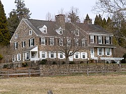


The village of Valley Forge is an unincorporated settlement. It is located on the west side of Valley Forge National Historical Park at the confluence of Valley Creek and the Schuylkill River in Pennsylvania. The remaining village is in Schuylkill Township of Chester County. It once spanned Valley Creek into Montgomery County.
Contents
The name Valley Forge is often used to refer to anywhere in the general vicinity of the park. Many places will use the name even though they are actually in King of Prussia, Trooper, Oaks, and other nearby communities. This leads to some ambiguity on the actual location of the modern village. There is a partial re-creation of the historic village from the time of the American Revolution that is located just within the outskirts of the park.
