Wayne, Pennsylvania

Last updated

Wayne, Pennsylvania
Wayne post office.jpg
Wayne post office
USA Pennsylvania location map.svg
Red pog.svg
Wayne, Pennsylvania
Location of Wayne in Pennsylvania
Usa edcp location map.svg
Red pog.svg
Wayne, Pennsylvania
Wayne, Pennsylvania (the United States)
Coordinates: 40°02′38″N75°23′16″W / 40.04389°N 75.38778°W / 40.04389; -75.38778
CountryFlag of the United States (23px).png  United States
State Flag of Pennsylvania.svg Pennsylvania
Counties Delaware, Montgomery, Chester
Townships Radnor
Elevation
117 m (384 ft)
Time zone UTC-5 (EST)
  Summer (DST) UTC-4 (EDT)
ZIP codes
19080, 19087-19089
Area code(s) 610 and 484
Keystone Marker for Wayne Wayne, PA Keystone Marker.jpg
Keystone Marker for Wayne

Wayne is an unincorporated community centered in Delaware County, Pennsylvania, United States, on the Main Line, a series of highly affluent Philadelphia suburbs located along the railroad tracks of the Pennsylvania Railroad and one of the wealthiest areas in the nation. While the center of Wayne is in Radnor Township, Wayne extends into both Tredyffrin Township in Chester County and Upper Merion Township in Montgomery County. The center of Wayne was designated the Downtown Wayne Historic District in 2012. [1] Considering the large area served by the Wayne post office, the community may extend slightly into Easttown Township, Chester County, as well.

Contents

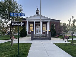
The center of the Wayne business district is the intersection of Lancaster Avenue and Wayne Avenue, its main street. The historic Wayne station is located one block north of this intersection. The Wayne business district also includes a post office, a cinema, a hotel, a library, the new Radnor Middle School, and several banks, stores, restaurants, cafes, bars and other commercial establishments. Other institutions and attractions in Wayne include the Wayne Hotel, Chanticleer Garden, and the Valley Forge Military Academy and College.

As of the 2020 U.S. Census, there is a Wayne census-designated place, entirely in Radnor Township. [2]

History

"Louella" home of J. Henry Askin, founder of Wayne Louella House 1875.JPG
"Louella" home of J. Henry Askin, founder of Wayne

Wayne's development began when a railroad stop called Cleaver's Landing was established. It was renamed Wayne Station after General Anthony Wayne. Parcels in the area totaling 293 acres (1.19 km2) were bought by banker J.H. Askin, where he built a mansion named "Louella" after his daughters Louisa and Ella. "Louella" was described as an 80-room stone building with a large porch overlooking manicured lawn. [3] His and surrounding land were bought in 1880 by banker A.J. Drexel and newspaper editor G.W. Childs, to form a larger development they called Wayne Estate. [4] More homes and a hotel were then built. In a brochure from 1887 about their development they noted they had provided Wayne with "water, light and drainage the three great conveniences of a large city by the most approved modern methods." They described Wayne Estate as follows:

The suburban village known as Wayne, on the Pennsylvania Railroad, fourteen miles from Philadelphia, differs so much from the ordinary town allowed to grow up hap-hazard and to develop conveniences as population increases, that it is necessary, in describing it as it appears, to keep in mind some facts about its history. Wayne is not an accidental aggregation of cottages; it is a town built by design, and provided at the start with all the conveniences to which residents of cities are accustomed and which they are so apt to miss and long for when they go into the country or even into the suburbs of a great city. The scheme of the town was well thought out and planned before any of the new cottages were built, and, as it was undertaken by liberal gentlemen of abundant means, no expense was spared in the preliminary municipal work.

The Chanticleer Garden, Downtown Wayne Historic District, North Wayne Historic District, Pennsylvania Railroad Station at Wayne, South Wayne Historic District and Wayne Hotel are all located on the National Register of Historic Places.

Geography

Wayne is located on the Main Line (the Paoli/Thorndale Line on SEPTA Regional Rail). The central business district of Wayne is located at the intersection of Lancaster and Wayne Avenues in Radnor Township, Delaware County, Pennsylvania. The area served by the Wayne ZIP code (19087) is large and encompasses areas both in Radnor Township, Delaware County and in the neighboring adjacent municipalities of Upper Merion in Montgomery County and Tredyffrin in Chester County, including the communities of Radnor, Strafford, St. Davids, and Chesterbrook.

Transportation

St. Davids station, Wayne station, and Strafford station on the Paoli/Thorndale SEPTA Line are in Wayne.

Demographics

House in the North Wayne Historic District North Wayne PA HD 210 Walnut Cozy.JPG
House in the North Wayne Historic District

Since, prior to 2020 Wayne is neither an incorporated area nor a census-designated place, all the data was for the ZIP code 19087. As of the census of 2010, there were 32,225 people and 12,754 households residing in the community. The median age was 40.8. The racial makeup of the community was 85.5% White, 7.9% Asian and 5.3% African American, while 3.7% of the population was Hispanic or Latino of any race. The median income for a household in the community was $118,801, and 5.1% of the population was below the poverty line. [5]

Economy

Teleflex, Kenexa, and DLL Group (U.S.) are based in Wayne.

Education

Elementary and high school

Public schools

Conestoga High School Conestoga High School.jpg
Conestoga High School

Pupils in the Radnor Township portion of Wayne attend schools in Radnor Township School District, while pupils in the Tredyffrin portion attend schools in Tredyffrin/Easttown School District. Those in the northeastern portion of the community in Upper Merion Township attend the Upper Merion Area School District.

Students in Radnor Township attend Radnor High School. Students in Tredyffrin Township attend Conestoga High School. Students in Upper Merion Township attend Upper Merion Area High School.

Catholic schools

The St. Katharine of Siena School is a Catholic K-8 grade school located in downtown Wayne operated by the Archdiocese of Philadelphia. Catholic students who live in Radnor Township as well as other towns in the Delaware Valley may choose to attend Archbishop John Carroll High School, located in the nearby community of Radnor.

Private schools

Many private schools are also located nearby including the Quaker-affiliated Shipley School in Bryn Mawr, all-boys Haverford School in Haverford and all-girls Agnes Irwin School in Rosemont, all located east of Wayne. [ citation needed ] Another private school, Episcopal Academy, opened in 2008 to the south in Newtown Square.

The Valley Forge Military Academy and College is also located in Wayne.

Post-secondary

Nearby post-secondary institutions include Villanova University, Cabrini University and Eastern University. Valley Forge Military Academy is also a junior college.

YSC Academy

The Philadelphia Union of Major League Soccer opened its own private school called YSC Academy on September 3, 2013. The originally Wayne-based academy is designed for student-athletes the club aims to groom for professional soccer. The initial 32 pupils already had experience playing for one of the Union's academy and junior teams. The school moved in 2023 to their new campus at the Union Power Plant on the Subaru Park campus. [6]

Notable people

House in the South Wayne Historic District 314 Louella S Wayne HD PA.JPG
House in the South Wayne Historic District

Points of interest

Anthony Wayne Theatre Wayne Theater Wayne PA.JPG
Anthony Wayne Theatre
Wayne Art Center Wayne Art Center 2021.jpg
Wayne Art Center
Old Eagle School Old Eagle School, Strafford PA 2022 01.jpg
Old Eagle School

Related Research Articles

<span class="mw-page-title-main">Montgomery County, Pennsylvania</span> County in Pennsylvania, United States

Montgomery County, colloquially referred to as Montco, is a county in the Commonwealth of Pennsylvania. As of the 2020 census, the population of the county was 856,553, making it the third-most populous county in Pennsylvania after Philadelphia and Allegheny counties.

<span class="mw-page-title-main">Bryn Mawr, Pennsylvania</span> Census-designated place in Pennsylvania, United States

Bryn Mawr, is a census-designated place (CDP) located across three townships: Radnor Township and Haverford Township in Delaware County and Lower Merion Township in Montgomery County, Pennsylvania, United States. It is located just west of Philadelphia along Lancaster Avenue, also known as U.S. Route 30.

<span class="mw-page-title-main">Chesterbrook, Pennsylvania</span> Census-designated place in Pennsylvania, United States

Chesterbrook is a census-designated place (CDP) in Chester County, Pennsylvania, United States. It is located within the Philadelphia metropolitan area and just south of Valley Forge National Historical Park. The population was 4,589 at the 2010 census.

<span class="mw-page-title-main">Easttown Township, Pennsylvania</span> Township in Pennsylvania, United States

Easttown Township is a township in Chester County, Pennsylvania, United States. The population was 10,984 at the 2020 census. The township, which lies in the western half of Philadelphia's Main Line suburbs, is comprised predominantly of parts of two unincorporated areas: Devon and Berwyn. A small portion of the township has a Paoli address.

<span class="mw-page-title-main">Paoli, Pennsylvania</span> Census-designated place in Pennsylvania, United States

Paoli is a census-designated place (CDP) in Chester County near Philadelphia, Pennsylvania, United States. It is situated in portions of two townships: Tredyffrin and Willistown. At the 2020 census, it had a total population of 6,002.

<span class="mw-page-title-main">Tredyffrin Township, Pennsylvania</span> Township in Pennsylvania, United States

Tredyffrin Township is a township located in eastern Chester County, Pennsylvania, United States. The population was 29,332 at the 2010 census.

<span class="mw-page-title-main">Lower Merion Township, Pennsylvania</span> Township in Pennsylvania, United States

Lower Merion Township is a township in Montgomery County, Pennsylvania, United States. It is part of the Philadelphia Main Line. The township's name originates with the county of Merioneth in north Wales. Merioneth is an English-language transcription of the Welsh Meirionnydd.

<span class="mw-page-title-main">Narberth, Pennsylvania</span> Borough in Montgomery County, Pennsylvania

Narberth is a borough in Montgomery County, Pennsylvania. It is one of many neighborhoods on the historic Philadelphia Main Line. The population was 4,282 at the 2010 census.

<span class="mw-page-title-main">Upper Merion Township, Pennsylvania</span> Township in Pennsylvania, United States of America

Upper Merion Township is a township in Montgomery County, Pennsylvania. The population was 33,613 at the 2020 U.S. Census. Located 16 miles (26 km) from Philadelphia, it consists of the villages of Gulph Mills, King of Prussia, Swedeland, Swedesburg, and portions of Radnor, and Wayne.

<span class="mw-page-title-main">Radnor Township, Pennsylvania</span> Township with home rule in Pennsylvania, United States

Radnor Township, often called simply Radnor, is a first class township with home rule status in Delaware County, Pennsylvania, United States.

<span class="mw-page-title-main">Merion Station, Pennsylvania</span> Census-designated place in Pennsylvania, United States

Merion Station, also known as Merion, is an unincorporated community in Montgomery County, Pennsylvania. It borders Philadelphia to its west and is one of the communities that make up the Philadelphia Main Line. Merion Station is part of Lower Merion Township, Montgomery County. The community is known for its grand mansions and for the wealth of its residents.

<span class="mw-page-title-main">Philadelphia Main Line</span> Collection of suburban communities in Pennsylvania, United States

The Philadelphia Main Line, known simply as the Main Line, is an informally delineated historical and social region of suburban Philadelphia, Pennsylvania. Lying along the former Pennsylvania Railroad's once prestigious Main Line, it runs northwest from Center City Philadelphia parallel to Lancaster Avenue, also known as U.S. Route 30.

<span class="mw-page-title-main">Berwyn, Pennsylvania</span> Census-designated place in Pennsylvania, United States

Berwyn is a census-designated place (CDP) in Chester County, Pennsylvania, United States. Berwyn is located in Tredyffrin and Easttown townships. The area is part of the Philadelphia Main Line suburbs.

<span class="mw-page-title-main">Radnor, Pennsylvania</span> Locality on the Philadelphia Main Line

Radnor is a community which straddles Montgomery and Delaware Counties, Pennsylvania, United States. It is located approximately 13 miles west of Philadelphia, in the Main Line suburbs. The community was named after Radnor, in Wales.

<span class="mw-page-title-main">Rosemont, Pennsylvania</span> Place in Pennsylvania, United States

Rosemont is a neighborhood and census-designated place that is located in Pennsylvania, United States on the Philadelphia Main Line. Partly in Lower Merion Township in Montgomery County and partly in Radnor Township in Delaware County, it is best known as the home of Rosemont College. It is the location of the 1894 gothic-revival Anglo-Catholic Church of the Good Shepherd.

<span class="mw-page-title-main">Villanova, Pennsylvania</span> Village in Pennsylvania

Villanova is a suburb of Philadelphia, Pennsylvania, United States. It straddles Lower Merion Township in Montgomery County and Radnor Township in Delaware County. It is located at the center of the Philadelphia Main Line, a series of Philadelphia suburbs located along the original east–west railroad tracks of the Pennsylvania Railroad. It is served by the SEPTA Paoli/Thorndale Line regional rail train and the Norristown High Speed Line.

<span class="mw-page-title-main">Wayne station</span>

Wayne station is a SEPTA Regional Rail station located in the western suburbs of Philadelphia in Wayne, Delaware County, Pennsylvania. It is served by most Paoli/Thorndale Line trains. It is in Radnor Township.

<span class="mw-page-title-main">Tredyffrin/Easttown School District</span> Public school district in Chester County, Pennsylvania

Tredyffrin/Easttown School District is a school district based in Tredyffrin Township, Chester County, Pennsylvania.

<span class="mw-page-title-main">Strafford, Pennsylvania</span> Unincorporated community in Pennsylvania, United States

Strafford is an unincorporated community in the southeastern part of the U.S. state of Pennsylvania, located partly in Tredyffrin Township, Chester County, and partly in Radnor Township, Delaware County. It is served by its own stop on the SEPTA Paoli/Thorndale Line regional rail train. The SEPTA station at Strafford is one of the few buildings that survives from the 1876 Centennial Exposition at Philadelphia. It is also the site of the Strafford School, and the Old Eagle School. It is in the Eastern Standard time zone. Elevation is 440 feet.

<span class="mw-page-title-main">Pennsylvania Route 252</span> State highway in Pennsylvania, US

Pennsylvania Route 252 is a north–south state highway in the U.S. state of Pennsylvania that connects PA 320 in Nether Providence Township at its southern terminus to PA 23 in Valley Forge at its northern terminus. The route runs through the western suburbs of Philadelphia in Delaware, Chester, and Montgomery counties, including Nether Providence Township, the borough of Media, Upper Providence Township, Marple Township, Newtown Township, Easttown Township, Tredyffrin Township, and Upper Merion Township. The route intersects many roads including U.S. Route 1 north of Media, PA 3 in Newtown Square, US 30 in Paoli, and US 202 near Berwyn.

References

  1. "National Register of Historic Places Listings". Weekly List of Actions Taken on Properties: 9/29/12 through 10/05/12. National Park Service. October 12, 2012.
  2. "2020 CENSUS - CENSUS BLOCK MAP: Wayne CDP, PA" (PDF). U.S. Census Bureau . Retrieved July 8, 2023.
    See also: "2020 CENSUS - CENSUS BLOCK MAP (INDEX): Radnor township, PA" (PDF). U.S. Census Bureau . Retrieved July 8, 2023.
  3. Library Company of Philadelphia: 2002 Annual Report. Philadelphia. 2003. p. 63. ISBN   9781422373149.{{cite book}}: CS1 maint: location missing publisher (link)
  4. Ashmeade, Henry Graham (1884). History of Delaware County, Pennsylvania. Philadelphia: L.H. Everts & Co. p. 682. Retrieved June 16, 2017.
  5. "American Fact Finder - Community Facts". United States Census Bureau. Archived from the original on February 13, 2020. Retrieved January 30, 2017.
  6. "Philadelphia Union's YSC Academy opens its doors: "It's a landmark day" for the club's future". September 23, 2009. Retrieved September 6, 2013.
  7. Cleaver, William Jessup (1983). Some of the Descendants of Peter Cleaver. pp. 86–88. Retrieved November 18, 2023 via Archive.org. Open Access logo PLoS transparent.svg