Yeadon, Pennsylvania | |
---|---|
Coordinates: 39°55′58″N75°15′06″W / 39.93278°N 75.25167°W | |
Country | United States |
State | Pennsylvania |
County | Delaware |
Incorporated | 1893 |
Area | |
• Total | 1.59 sq mi (4.13 km2) |
• Land | 1.59 sq mi (4.13 km2) |
• Water | 0.00 sq mi (0.00 km2) |
Elevation | 69 ft (21 m) |
Population (2010) | |
• Total | 11,443 |
• Estimate (2019) [2] | 11,496 |
• Density | 7,207.52/sq mi (2,783.10/km2) |
Time zone | UTC-5 (EST) |
• Summer (DST) | UTC-4 (EDT) |
ZIP Code | 19050 |
Area code(s) | 610 and 484 |
FIPS code | 42-045-86968 |
FIPS code | 42-86968 |
GNIS feature ID | 1191867 |
Website | yeadonborough |
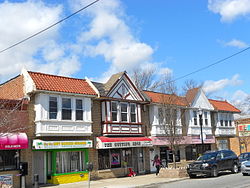
Yeadon is a borough in Delaware County, Pennsylvania, United States. It borders the city of Philadelphia. The population was 11,443 at the 2010 census. [3]
Yeadon is located in eastern Delaware County at 39°55′58″N75°15′6″W / 39.93278°N 75.25167°W (39.932862, -75.251540). [4] It is bordered on the south by the borough of Darby, on the northwest by the borough Lansdowne, on the west and north by Upper Darby Township, and on the east, across Cobbs Creek, by the city of Philadelphia, whose Center City lies 6 miles (10 km) to the east.
According to the U.S. Census Bureau, Yeadon has a total area of 1.6 square miles (4.1 km2), all land. [3]
Yeadon and its surrounding land were once part of New Sweden. Yeadon was then known as the Swedish settlement of Mölndal (founded in 1645). The borough of Yeadon took its name from Yeadon Manor, which takes its name from Yeadon, West Yorkshire, in England.
In the years following World War II, Yeadon became home to a large middle-class African American community. In 1959, the borough's Nile Swim Club became the first swim club owned and operated by African Americans in the United States. [5]
William Penn School District serves Yeadon. [7] The district was created in 1972; prior to that year, Yeadon was in the Yeadon School District. [8]
The Roman Catholic Archdiocese of Philadelphia operates Catholic churches. In October 1928, St. Louis Church in Yeadon opened. [9] Circa 2008 1,267 families were registered with the church. [10] In 2013 St. Louis merged into Blessed Virgin Mary Church in Darby, with the St. Louis parish closed. [11]
As of Census 2010, the racial makeup of the borough was 7.5% White, 88.6% African American, 0.2% Native American, 0.8% Asian, 0.1% Native Hawaiian and Pacific Islander, 0.6% from other races, and 2.1% from two or more races. Hispanic or Latino of any race were 1.9% of the population. [17]
As of the census [14] of 2000, there were 11,762 people, 4,696 households, and 2,967 families residing in the borough. The population density was 7,297.1 inhabitants per square mile (2,817.4/km2). There were 4,958 housing units at an average density of 3,075.9 per square mile (1,187.6/km2). The racial makeup of the borough was 79.77% African American, 15.56% White, 0.21% Native American, 0.89% Asian, 0.01% Pacific Islander, 0.41% from other races, and 2.15% from two or more races. Hispanic or Latino of any race were 1.02% of the population.
There were 4,696 households, of which 31.2% had children under the age of 18 living with them, 37.6% were married couples living together, 20.0% had a female householder with no husband present, and 36.8% were non-families. 32.2% of all households were made up of individuals, and 10.9% had someone living alone who was 65 years of age or older. The average household size was 2.43 and the average family size was 3.09.
In the borough, the population was spread out in age, with 24.5% under 18, 7.7% from 18 to 24, 29.8% from 25 to 44, 22.7% from 45 to 64, and 15.4% who were 65 or older. The median age was 38 years. For every 100 females there were 79.7 males. For every 100 females age 18 and over, there were 74.1 males.
The median income for a household in the borough was $45,550, and the median income for a family was $55,169. Males had a median income of $39,830 versus $35,118 for females. The per capita income for the borough was $22,546. About 12.5% of families and 14.6% of the population were below the poverty line, including 5.1% of those under age 18 and 6.7% of those age 65 or over.
As of 2010, there were 21.78 miles (35.05 km) of public roads in Yeadon, of which 2.39 miles (3.85 km) were maintained by the Pennsylvania Department of Transportation (PennDOT) and 19.39 miles (31.21 km) were maintained by the borough. [18]
U.S. Route 13 is the only numbered highway serving Yeadon. It follows a generally southwest-to-northeast alignment through the borough, using MacDade Boulevard, Church Lane and Baltimore Avenue.
West Grove is a borough in Chester County, Pennsylvania, United States. The population was 2,775 at the 2020 census.
Aldan is a borough in Delaware County, Pennsylvania, United States. The population was 4,244 at the 2020 census.
Clifton Heights is a borough in Delaware County, Pennsylvania, United States, located on Darby Creek 5 miles (8 km) west of downtown Philadelphia. As of the 2020 census, the population was 6,863.
Collingdale is a borough in Delaware County, Pennsylvania, United States. The population was 8,908 at the 2020 census.
Colwyn is a borough in Delaware County, Pennsylvania, United States. The population was 2,546 at the 2010 census.
Darby is a borough in Delaware County, Pennsylvania, United States. The borough is located along Darby Creek 5 miles (8.0 km) southwest of Center City Philadelphia. The borough of Darby is distinct from the nearby municipality of Darby Township.
Drexel Hill is a neighborhood and census-designated place (CDP) located in Upper Darby Township, Pennsylvania, United States. The population was 29,181 at the 2020 census, an increase over 28,043 in 2010, and accounting for over one-third of Upper Darby Township's population.
East Lansdowne is a borough in Delaware County Pennsylvania, United States. The population was 2,714 at the 2020 census.
Folcroft is a borough in Delaware County, Pennsylvania, United States. The population was 6,606 at the 2010 census, down from 6,978 at the 2000 census.
Glenolden is a borough in Delaware County, Pennsylvania, United States. The population was 7,223 at the 2020 census, up from 7,153 at the 2010 census.
Lansdowne is a borough in Delaware County, Pennsylvania, United States, located 6 miles (10 km) southwest of Center City Philadelphia. It was named for the Marquess of Lansdowne. As of the 2010 census, the borough had a population of 10,620.
Norwood is a borough that is located in Delaware County, Pennsylvania, United States. The population was 5,890 at the time of the 2010 census.
Prospect Park is a borough in Delaware County, Pennsylvania, United States. The population was 6,454 at the 2010 census, down from 6,594 at the 2000 census. It originated as a bedroom community of Philadelphia. It is located within 10 miles (16 km) of Center City, Philadelphia, with convenient rail access.
Ridley Park is a borough in Delaware County, Pennsylvania, United States. The population was 7,002 at the 2010 census. Ridley Park is the home of Boeing's CH-47 Chinook helicopter division.
Sharon Hill is a borough in Delaware County, Pennsylvania, United States. The population was 5,697 at the 2010 census. Currently the population stands at 6,356 residents.
Swarthmore is a borough in Delaware County, Pennsylvania, United States. Swarthmore was originally named "Westdale" in honor of noted painter Benjamin West, who was one of the early residents of the town. The name was changed to "Swarthmore" after the establishment of Swarthmore College. The borough population was 6,194 as of the 2010 census.
Trainer is a borough in Delaware County, Pennsylvania, United States. The population was 1,828 at the 2010 census, down from 1,901 at the 2000 census. The borough was named after David Trainer, a wealthy textile manufacturer.
Upper Darby Township, often shortened to Upper Darby, is a home rule township in Delaware County, Pennsylvania, United States. As of the 2020 census, the township had a total population of 85,681, making it the state's sixth-most populated municipality after Philadelphia, Pittsburgh, Allentown, Reading, and Erie. Upper Darby borders Philadelphia, the nation's sixth-most populous city, and constitutes part of the Delaware Valley, also known as the Philadelphia metropolitan area, the nation's seventh-largest metropolitan area.
Darby Township is a township in Delaware County, Pennsylvania, United States. The population was 9,264 as of the 2010 census. It is home to both residential areas and expansive industrial districts. Darby Township is home to a diverse population and its industrial districts are popular among shipping companies for their proximity to Philadelphia International Airport. It also is known for being made up of two non-contiguous geographical areas, requiring one to pass through at least two neighboring municipalities to make it from one end of Darby Township to the other. Darby Township is a distinct municipality from the nearby and similarly named Darby Borough and Upper Darby Township.
The William Penn School District is a large suburban, public school district located in Delaware County, Pennsylvania. It comprises eight elementary schools, one middle school, one alternative school, and one high school, based on two campuses. The district serves the boroughs of Aldan, Colwyn, Darby, East Lansdowne, Lansdowne, and Yeadon. The district is adjacent to the City of Philadelphia. The total enrollment is about 5,610. The district encompasses approximately 5 square miles. According to 2000 local census data, it serves a resident population of 42,457.The district administration offices are located at 100 Green Avenue – Annex Lansdowne, PA 19050.