Brandamore, Pennsylvania

Last updated

Brandamore, Pennsylvania
Unincorporated community
USA Pennsylvania location map.svg
Red pog.svg
Brandamore
Usa edcp location map.svg
Red pog.svg
Brandamore
Coordinates: 40°03′13″N75°49′12″W / 40.05361°N 75.82000°W / 40.05361; -75.82000
Country United States
State Pennsylvania
County Chester
Township West Brandywine
Elevation
617 ft (188 m)
Time zone UTC-5 (Eastern (EST))
  Summer (DST) UTC-4 (EDT)
ZIP code
19316
Area code(s) 610 and 484
GNIS feature ID1203138 [1]

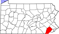
Brandamore is an unincorporated community in West Brandywine Township in Chester County, Pennsylvania, United States. Brandamore is located at the intersection of Hibernia Road and Brandamore Road, north of Coatesville. [2]

Related Research Articles

<span class="mw-page-title-main">East Bradford Township, Chester County, Pennsylvania</span> Township in Pennsylvania, United States

East Bradford Township is a township in Chester County, Pennsylvania, United States. The population was 10,308 at the 2020 census.

<span class="mw-page-title-main">West Chester, Pennsylvania</span> Borough in Pennsylvania, United States

West Chester is a borough and the county seat of Chester County, Pennsylvania, United States. Located within the Philadelphia metropolitan area, the borough had a population of 18,461 at the 2010 census. West Chester is the mailing address for most of its neighboring townships. When calculated by mailing address, the population as of the 2010 U.S. Census was 108,696, which would make it the 10th largest city by mailing address in the state of Pennsylvania.

<span class="mw-page-title-main">West Pikeland Township, Chester County, Pennsylvania</span> Township in Pennsylvania, United States

West Pikeland Township is a township in Chester County, Pennsylvania, United States. The population was 4,024 at the 2010 census.

<span class="mw-page-title-main">U.S. Route 322</span> Highway in the United States

U.S. Route 322 is a 494 mi (795.0 km) long, east–west United States Highway, traversing Ohio, Pennsylvania, and New Jersey. The road is a spur of US 22 and one of the original highways from 1926. A portion of it at one time was concurrent with the Lakes-to-Sea Highway.

<span class="mw-page-title-main">National Register of Historic Places listings in Delaware County, Pennsylvania</span>

This is a list of the National Register of Historic Places listings in Delaware County, Pennsylvania.

<span class="mw-page-title-main">White Clay Creek Preserve</span> State park in Chester County, Pennsylvania

White Clay Creek Preserve is a 3,050-acre (1,230 ha) Pennsylvania state park along the valley of White Clay Creek in London Britain Township in Chester County, Pennsylvania in the United States. The park was donated by the DuPont Company in 1984 for the purpose of "preserving the diverse and unique plant and animal species, and the rich cultural heritage of the area". Dupont also donated an additional 528 acres (214 ha) for the adjoining White Clay Creek State Park to the state of Delaware. White Clay Creek Preserve is 3 miles (4.8 km) north of Newark, Delaware on Pennsylvania Route 896.

Parker Ford is an unincorporated community in East Coventry Township, Chester County, Pennsylvania, United States. Maps show it at the intersection of Pennsylvania Route 724 and Bethel Church Road/Linfield Road. Linfield Road crosses the Schuylkill River to Linfield, an unincorporated village in Limerick Township, Montgomery County.

Springdell is an unincorporated community in West Marlborough Township in Chester County, Pennsylvania, United States. Springdell is located at the intersection of Pennsylvania Route 841 and Spring Dell Road.

Pocopson is an unincorporated community in Pocopson Township in Chester County, Pennsylvania, United States. Pocopson is located at the intersection of Pennsylvania Route 926 and Pocopson Road.

Devault is an unincorporated community in Charlestown Township in Chester County, Pennsylvania, United States. Devault is located at the intersection of Pennsylvania Route 29, Phoenixville Pike, and Charlestown Road.

Lenape is an unincorporated community in Pocopson Township in Chester County, Pennsylvania, United States. Lenape is centered on the intersection of Pennsylvania Route 52 and Pocopson Road, west of the Brandywine Creek.

Mendenhall is an unincorporated community in Kennett Township in Chester County, Pennsylvania, United States. Mendenhall is located at the intersection of Pennsylvania Route 52 and Hillendale Road.

Glen Riddle is an unincorporated community in Middletown Township in Delaware County, Pennsylvania, United States. Glen Riddle is located at the intersection of Pennsylvania Route 452 and Parkmount Road/Glen Riddle Road north of the Chester Creek.

Chesterville is an unincorporated community in Franklin Township in Chester County, Pennsylvania, United States. Chesterville is located at the intersection of Pennsylvania Route 841, Chesterville Road, and North Creek Road.

Kelton is an unincorporated community in Penn Township in Chester County, Pennsylvania, United States. Kelton is located at the intersection of Pennsylvania Route 796 and Kelton Road.

Lenni is an unincorporated community in Middletown Township in Delaware County, Pennsylvania, United States. Lenni is located at the intersection of Lenni Road and Lungren Road, northeast of the Chester Creek.

<span class="mw-page-title-main">Sadsburyville, Pennsylvania</span> Unincorporated community in Pennsylvania, United States

Sadsburyville is an unincorporated area in Sadsbury Township in Chester County, Pennsylvania, United States

Suplee is an unincorporated community in Honey Brook Township in Chester County, Pennsylvania, United States. Suplee is located along Suplee Road, east of Honey Brook.

Steelville is an unincorporated community in Chester County, Pennsylvania, United States. According to the 2016 census, the town has not been included in past census counts because the town is so small. It lies next to the Octoraro Creek: the border line between Lancaster County and Chester County.

Feltonville is an unincorporated community in Delaware County in the U.S. state of Pennsylvania. Feltonville is located at the intersection of Felton Avenue and Bethel Road, adjacent to Interstate 95/U.S. Route 322 in Chester Township, northwest of the city of Chester.

References

  1. "Brandamore". Geographic Names Information System . United States Geological Survey, United States Department of the Interior.
  2. Chester County, Pennsylvania Highway Map (PDF) (Map). PennDOT. 2015. Retrieved January 29, 2016.