Hamorton, Pennsylvania | |
---|---|
Coordinates: 39°52′4″N75°39′15″W / 39.86778°N 75.65417°W | |
Country | United States |
State | Pennsylvania |
County | Chester |
Township | Kennett |
Area | |
• Total | 0.12 sq mi (0.30 km2) |
• Land | 0.11 sq mi (0.29 km2) |
• Water | 0.01 sq mi (0.02 km2) |
Elevation | 460 ft (140 m) |
Population | |
• Total | 179 |
• Density | 1,612.61/sq mi (620.02/km2) |
Time zone | UTC-5 (Eastern (EST)) |
• Summer (DST) | UTC-4 (EDT) |
ZIP Codes | |
Area code(s) | [Area codes 610, 484, and 835[[[Category:Pages using infobox settlement with possible area code list]] |
FIPS code | 42-32280 |
GNIS feature ID | 2812901 [3] |
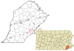
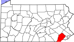
Hamorton is an unincorporated community and census-designated place (CDP) in Chester County, Pennsylvania, United States. It was first listed as a CDP prior to the 2020 census. [3]
Mamorton is located primarily in southern Chester County, in the northeastern part of Kennett Township. U.S. Route 1 passes through the community, leading east (northbound) 3 miles (5 km) to Chadds Ford and west (southbound) the same distance to Kennett Square. Pennsylvania Route 52 intersects Route 1 in Hamorton, leading southeast 10 miles (16 km) to Wilmington, Delaware, and northeast 9 miles (14 km) to West Chester.
The Hamorton Historic District, listed on the National Register of Historic Places, comprises 75 historic buildings in the northern part of the CDP along US 1.
Census | Pop. | Note | %± |
---|---|---|---|
2020 | 179 | — | |
U.S. Decennial Census [4] |
Gap is a census-designated place (CDP) and unincorporated community in Salisbury Township, Lancaster County, Pennsylvania, United States, with a ZIP code of 17527. The population was 1,931 at the 2010 census. U.S. Route 30 passes through the town, which is also the terminus for four Pennsylvania highways: 772, 741, 897, and the heavily used 41, which leads toward Wilmington, Delaware.
Maytown is an unincorporated community and census-designated place (CDP) in Lancaster County, Pennsylvania, United States. The population was 4,098 at the 2020 census.
Kennett Township is a township in Chester County, Pennsylvania, United States. The population was 8,289 at the 2020 census.
Leola is a census-designated place (CDP) in Lancaster County, Pennsylvania, United States. It includes the unincorporated communities of Leola, Leacock, and Bareville, and prior to 2010 was known as the Leacock-Leola-Bareville census-designated place. Originally named "Mechanicsburg", its present name is a portmanteau of "Leacock" and the "Glenola" train station that once served the town. As of the 2010 census, the population of the CDP was 7,214.
Brownstown is an unincorporated community and census-designated place (CDP) in West Earl Township, Lancaster County, Pennsylvania, United States. As of the 2010 census, the population was 2,816.
East Earl is an unincorporated community and census-designated place (CDP) in East Earl Township, Lancaster County, Pennsylvania, United States. As of the 2010 census, it had a population of 1,144.
Chadds Ford is a census-designated place (CDP) in Delaware and Chester counties, Pennsylvania, United States, comprising the unincorporated communities of Chadds Ford and Chadds Ford Knoll. It was first listed as a CDP prior to the 2020 census.
Hopeland is a small unincorporated hamlet and census-designated place (CDP) that is located in Lancaster County in the south of the U.S. state of Pennsylvania in the United States. The hamlet's ZIP code is 17533.
Kirkwood is an unincorporated farming town and census-designated place (CDP) in Colerain Township, Lancaster County, Pennsylvania, United States. It is part of the Lancaster Metro area, in Pennsylvania Dutch Country. The ZIP code is 17536. As of the 2010 census, the population was 396.
Reinholds is an unincorporated community and census-designated place (CDP) in West Cocalico Township, Lancaster County, Pennsylvania, United States. As of the 2010 census the population was 1,803.
Bowmansville is an unincorporated community and census-designated place (CDP) in Brecknock Township, Lancaster County, Pennsylvania, United States. Bowmansville is home to the Pennsylvania Turnpike's Bowmansville Service Plaza. The population was 2,077 as of the 2010 census.
Fivepointville is an unincorporated community and census-designated place (CDP) in Brecknock Township, Lancaster County, Pennsylvania, United States. As of the 2010 census, the population was 1,156. The town is named for its position at an intersection of five separate roads.
Churchtown is an unincorporated community and census-designated place (CDP) in Caernarvon Township, Lancaster County, Pennsylvania, United States, along Pennsylvania Route 23. The population was 470 as of the 2010 census.
Frizzleburg is an unincorporated community and census-designated place (CDP) in Lawrence County, Pennsylvania, United States. The population was 602 at the 2010 census.
New Bedford is an unincorporated community and census-designated place (CDP) in Lawrence County, Pennsylvania, United States. The population was 925 at the 2010 census.
Fort Loudon (CDP) is an unincorporated community and census-designated place (CDP) in Peters Township, Franklin County, Pennsylvania, United States. As of the 2020 census, the population was 895.
Little Britain is an unincorporated community and census-designated place (CDP) in Little Britain Township, Lancaster County, Pennsylvania, United States. At the 2010 census, the population was 372.
Swartzville is an unincorporated community and census-designated place (CDP) in East Cocalico Township, Lancaster County, Pennsylvania, United States. As of the 2010 census, the population was 2,283.
Continental Courts is a mobile home park and census-designated place (CDP) in Centre County, Pennsylvania, United States. It was first listed as a CDP prior to the 2020 census.
Dilworthtown is an unincorporated community and census-designated place (CDP) in Chester and Delaware counties, Pennsylvania, United States. It was first listed as a CDP prior to the 2020 census.