Frazer, Pennsylvania

Last updated
Frazer, Pennsylvania
Unincorporated community
FrazerDiner11.jpg
Chester County Pennsylvania incorporated and unincorporated areas Frazer highlighted.svg
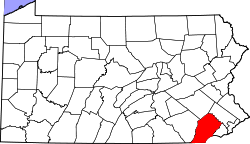
Location in Chester County and the U.S. state of Pennsylvania
USA Pennsylvania location map.svg
Red pog.svg
Frazer
Usa edcp location map.svg
Red pog.svg
Frazer
Coordinates: 40°01′56″N75°33′22″W / 40.03222°N 75.55611°W / 40.03222; -75.55611
Country United States
State Pennsylvania
County Chester
Township East Whiteland
Area
[1]
  Total2.12 sq mi (5.48 km2)
  Land2.12 sq mi (5.48 km2)
  Water0.00 sq mi (0.01 km2)
Elevation
558 ft (170 m)
Population
 (2020) [2]
  Total3,635
  Density1,718.68/sq mi (663.67/km2)
Time zone UTC-5 (Eastern (EST))
  Summer (DST) UTC-4 (EDT)
ZIP code
19355
Area code(s) 610 and 484
GNIS feature ID1175184 [3]

Frazer is a census-designated place (CDP) in East Whiteland Township in Chester County, Pennsylvania, United States. It is located along US 30 between Exton and Malvern, and is the northern terminus for Pennsylvania Route 352. The former main line of the Pennsylvania Railroad, currently owned and operated by Amtrak and also used by SEPTA, passes through Frazer. While no station is located there, SEPTA Frazer Yard is a maintenance facility for the Paoli/Thorndale Line regional rail service. In 2019, the Delaware Valley Regional Planning Commission conducted a feasibility study for a new SEPTA station in Frazer and recommended a location near Immaculata University. [4]

Contents

Demographics

Historical population
CensusPop.Note
2020 3,635
[5] [2]

As of the 2020 census, there were 3,635 people living in Frazer. The racial makeup of the CDP was 62.2% White, 2.3% African-American, 0.7% Native American, 24.7% Asian, 4.3% from some other race, and 5.8% from two or more races.

Notable people

Related Research Articles

<span class="mw-page-title-main">Churchville, Pennsylvania</span> Census-designated place in Pennsylvania, United States

Churchville is a census-designated place (CDP) in Northampton Township, Bucks County, Pennsylvania. The population was 4,128 at the 2010 census.

<span class="mw-page-title-main">Chesterbrook, Pennsylvania</span> Census-designated place in Pennsylvania, United States

Chesterbrook is a census-designated place (CDP) in Chester County, Pennsylvania, United States. It is located within the Philadelphia metropolitan area and just south of Valley Forge National Historical Park. The population was 4,589 at the 2010 census.

<span class="mw-page-title-main">East Whiteland Township, Chester County, Pennsylvania</span> Township in Pennsylvania, United States

East Whiteland Township is a township in Chester County, Pennsylvania, United States. The population was 10,650 at the 2010 census. Mailing addresses associated with East Whiteland include Malvern, Frazer, and a small area of Exton.

<span class="mw-page-title-main">Exton, Pennsylvania</span> Census-designated place in Pennsylvania, United States

Exton is a census-designated place (CDP) in West Whiteland Township in Chester County, Pennsylvania, United States. Its population was 5,622 at the 2020 census. The Exton Square Mall and Main Street at Exton are both located within Exton along with several other shopping centers, making Exton the major shopping district in Chester County.

<span class="mw-page-title-main">Malvern, Pennsylvania</span> Borough in Pennsylvania, United States

Malvern is a borough in Chester County, Pennsylvania, United States. Malvern is the terminus of the Main Line, a series of highly affluent Philadelphia suburbs located along the railroad tracks of the Pennsylvania Railroad and one of the wealthiest parts of the United States. It is 19.4 miles (31.2 km) west of Philadelphia. The population was 3,419 at the 2020 census.

<span class="mw-page-title-main">Paoli, Pennsylvania</span> Census-designated place in Pennsylvania, United States

Paoli is a census-designated place (CDP) in Chester County near Philadelphia, Pennsylvania, United States. It is situated in portions of two townships: Tredyffrin and Willistown. At the 2020 census, it had a total population of 6,002.

<span class="mw-page-title-main">West Whiteland Township, Chester County, Pennsylvania</span> Township in Pennsylvania, United States

West Whiteland Township is a township in Chester County, Pennsylvania, United States. The population was 19,632 at the 2020 census.

<span class="mw-page-title-main">Ridley Township, Delaware County, Pennsylvania</span> Township in Pennsylvania, United States

Ridley Township is a township in Delaware County, Pennsylvania, United States. The population was 30,768 at the 2010 census. Ridley Township contains the (CDPs) of Folsom and Woodlyn, along with the unincorporated communities of Crum Lynne and Holmes and a portion of Secane.

<span class="mw-page-title-main">Glenside, Pennsylvania</span> Place in Pennsylvania, United States

Glenside is a census-designated place (CDP) located in Cheltenham Township and Abington Township in Montgomery County, Pennsylvania, United States. It borders Northwest Philadelphia. The population was 7,737 at the 2020 census on a land area of 1.3 square miles. Glenside is most notable for its entertainment, such as the Keswick Theatre, restaurants, recreational facilities and parks. The Glenside station is one of the busiest in the SEPTA system. Glenside is located approximately six miles from Center City Philadelphia.

<span class="mw-page-title-main">Horsham, Pennsylvania</span> Census-designated place in Pennsylvania, United States

Horsham is a census place in Horsham Township, Montgomery County, Pennsylvania, United States. The population was 15,193 at the 2020 census. It is home to the Horsham Air Guard Station at the former site of Naval Air Station Joint Reserve Base Willow Grove.

<span class="mw-page-title-main">Jenkintown, Pennsylvania</span> Borough in Pennsylvania, United States

Jenkintown is a borough in Montgomery County, Pennsylvania. It is approximately 10 miles (16 km) north of Center City Philadelphia.

<span class="mw-page-title-main">Upper Moreland Township, Montgomery County, Pennsylvania</span> Township in Pennsylvania, United States

Upper Moreland Township is a township in Montgomery County, Pennsylvania. The population was 24,015 at the 2010 census. Upper Moreland Township is primarily a residential community with distinctive neighborhoods that are complemented by several thriving business, industrial, and commercial districts.

<span class="mw-page-title-main">Willow Grove, Pennsylvania</span> Census-designated place in Pennsylvania, United States

Willow Grove is a census-designated place (CDP) in Montgomery County, Pennsylvania, United States. A community in Philadelphia's northern suburbs, the population was 13,730 at the 2020 census. It is located in Upper Dublin Township, Abington Township and Upper Moreland Township. Willow Grove was once known for Willow Grove Park, an amusement park that was open from 1896 to 1976, now the site of Willow Grove Park Mall. Willow Grove is considered an edge city of Philadelphia, with large amounts of retail and office space.

<span class="mw-page-title-main">Wyncote, Pennsylvania</span> Place in Pennsylvania, United States

Wyncote is a census-designated place (CDP) in Cheltenham Township, Montgomery County, Pennsylvania. It borders the northwestern and northeastern section of Philadelphia. Wyncote is located 11 miles from Center City Philadelphia at the southeasternmost tip of Montgomery County. The Jenkintown-Wyncote SEPTA station is the fifth busiest regional rail station in the SEPTA system.

<span class="mw-page-title-main">Ardmore, Pennsylvania</span> Census-designated place in Pennsylvania, United States

Ardmore is an unincorporated community and census-designated place (CDP) spanning the border between Delaware and Montgomery counties in the U.S. state of Pennsylvania. The population was 12,455 at the time of the 2010 census and had risen to 13,566 in the 2020 census.

<span class="mw-page-title-main">Cornwells Heights, Pennsylvania</span> Census-designated place in Pennsylvania, United States

Cornwells Heights is a census-designated place located in Bensalem Township in Bucks County, Pennsylvania, United States. The community was formerly part of Cornwells Heights-Eddington, but was split into two separate CDPs. As of the 2010 census, the population was 1,391. The Cornwells Heights train station, with a park-and-ride with access to Interstate 95, serves SEPTA Regional Rail's Trenton Line and Amtrak's Keystone Service and Northeast Regional service along the Northeast Corridor.

<span class="mw-page-title-main">Berwyn, Pennsylvania</span> Census-designated place in Pennsylvania, United States

Berwyn is a census-designated place (CDP) in Chester County, Pennsylvania, United States. Berwyn is located within Tredyffrin and Easttown Townships. The area is part of the Philadelphia Main Line suburbs.

<span class="mw-page-title-main">Devon, Pennsylvania</span> Census-designated place in Pennsylvania, United States

Devon is a census-designated place (CDP) located in Tredyffrin and Easttown townships in Chester County, Pennsylvania, United States. The population was 1,515 at the 2010 census. The area is part of the Philadelphia Main Line suburbs.

<span class="mw-page-title-main">Eddington, Pennsylvania</span> Census-designated place in Pennsylvania, United States

Eddington is a census-designated place located in Bucks County, Pennsylvania, United States. The community was part of Cornwells Heights-Eddington, which was split into two separate CDPs. As of the 2010 census, the population was 1,906. The community is served by the Eddington station along SEPTA Regional Rail's Trenton Line.

Plains is a census-designated place (CDP) in Plains Township, Luzerne County, Pennsylvania, United States. The population of the CDP was 4,335 at the 2010 census, out of 9,961 in the entire township.

References

  1. "ArcGIS REST Services Directory". United States Census Bureau. Retrieved October 12, 2022.
  2. 1 2 "Census Population API". United States Census Bureau. Retrieved Oct 12, 2022.
  3. "Frazer". Geographic Names Information System . United States Geological Survey, United States Department of the Interior.
  4. "Train Station Feasibility Study". East Whiteland Township, PA. Retrieved 14 June 2023.
  5. "Census 2020".
  6. Where are they buried? How did they die?