Whitehall Township, Pennsylvania

Last updated

Whitehall Township
Helfrich Springs Gristmill Lehigh Co PA.JPG
Helfrich's Springs Grist Mill, built in 1807 in Whitehall Township, in October 2012
Whitehall Township Seal.png
Lehigh county - Whitehall.png
Location of Whitehall Township in Lehigh County, Pennsylvania
USA Pennsylvania location map.svg
Red pog.svg
Whitehall Township
Location of Whitehall Township in Pennsylvania
Usa edcp location map.svg
Red pog.svg
Whitehall Township
Location in the United States
Coordinates: 40°40′00″N75°30′00″W / 40.66667°N 75.50000°W / 40.66667; -75.50000
Country Flag of the United States.svg  United States
State Flag of Pennsylvania.svg  Pennsylvania
County Lehigh
Government
  MayorJoseph J. Marx, Jr. [1] (Democratic)
Area
[2]
   Township 12.86 sq mi (33.31 km2)
  Land12.57 sq mi (32.55 km2)
  Water0.29 sq mi (0.76 km2)
Elevation
384 ft (117 m)
Population
 (2010) [3]
   Township 26,738
  Estimate 
(2016) [4]
27,423
  Density2,181.80/sq mi (842.43/km2)
   Metro
865,310 (US: 68th)
Time zone UTC-5 (EST)
  Summer (DST) UTC-4 (EDT)
ZIP code
18052
Area code(s) 610 and 484
FIPS code 42-077-84528
Primary airport Lehigh Valley International Airport
Major hospital Lehigh Valley Hospital–Cedar Crest
School district Whitehall-Coplay
Website www.whitehalltownship.org
Breadon Field, which was home to three Minor League Baseball teams during its existence, was based in Whitehall Township from 1948 until its 1964 demolition. 1960 - Opening Night - Max Hess Stadium - Allentown PA.jpg
Breadon Field, which was home to three Minor League Baseball teams during its existence, was based in Whitehall Township from 1948 until its 1964 demolition.
MacArthur Road's retail corridor in Whitehall Township in June 2015 PA 145 NB past Grape Street.jpg
MacArthur Road's retail corridor in Whitehall Township in June 2015
Lehigh Valley Mall in Whitehall Township in October 2011 Lehigh Valley Mall lifestyle center entrance.jpg
Lehigh Valley Mall in Whitehall Township in October 2011
Lehigh Valley Mall's second floor interior, in Whitehall Township in October 2020 2020 - Lehigh Valley Mall - 7 - Allentown PA.jpg
Lehigh Valley Mall's second floor interior, in Whitehall Township in October 2020

Whitehall Township is a township with home rule status in Lehigh County, Pennsylvania. The township's population was 26,738 as of the 2010 census.

Contents

Whitehall Township is a suburb of Allentown in the Lehigh Valley metropolitan region, which had a population of 861,899 and was the 68th-most populous metropolitan area in the U.S. as of the 2020 census.

The township is 4.4 miles (7.1 km) north of Allentown, 64.1 miles (103.2 km) northwest of Philadelphia, and 93.7 miles (150.8 km) west of New York City. [5]

History

The province of Pennsylvania was created in 1681 when King Charles II granted a tract of land in America to William Penn.

18th century

After the death of Penn, his sons, John, Thomas, and Richard, became the owners of Pennsylvania. The Lenape Indian tribe deeded that part of Lehigh County lying between the South Mountain and Blue Mountain to Penn's sons in 1736.

A wave of German immigrants from Germany's Palatinate settled in Whitehall Township. The first was Jacob Kohler, who settled in the vicinity of Egypt about 1728. The settlers staked their claim on the lands by applying to the Penns for a land warrant. They cleared the land for farming and established churches around which villages grew.

When the first European settlers came to the Whitehall area, the Lenape people were living on the banks of Hokendauqua Creek. The Europeans and the Lenape designed a deal to determine how much land the Europeans would acquire based on how far the Europeans were able to walk in two days. To gain more land, the Europeans paid a professional runner who got as far as what is now Coaldale, in Schuylkill County.

The Lenape lived peacefully among the German settlers for a time. But the tribe suffered injustices at the hands of the settlers and lashed back during a 1763 uprising in Lehigh County. Fort Deshler, which stood near Route 145 at Chestnut Street, played a key role in the defense of settler-held lands during this battle, in which 23 settlers were killed.

19th century

The original Whitehall Township, established in 1753, was split into the three townships of Whitehall, North Whitehall, and South Whitehall in 1867. The name Whitehall is said to have originated from Lynford Lardner's hunting lodge that was painted with whitewash.[ disputed ] Lardner named it "Grouse Hall", but the common people of the region called it "White Hall". Whitehall Township's villages include Cementon, Egypt, Fullerton, Hokendauqua, Mickleys, Stiles, and West Catasauqua. Coplay was also part of Whitehall until it incorporated as a borough in 1869. Agriculture was the major industry until the mid-1800s. Today, about 2,000 acres (809 ha) are under cultivation. There were six grist mills in Whitehall, built to process grains for the farmers into flour and animal feed. Only one grist mill remains, the Helfrich Springs Grist Mill, which is also home to the Whitehall Historical Preservation Society, which has preserved the building for use as a local history museum.

Completion of the Lehigh Canal in 1829 led to further development. Discovery of iron ore deposits brought Whitehall into the Industrial Revolution when the first blast iron furnace was built in Hokendauqua in 1854. This was immediately followed by the establishment of a railroad system to transport raw materials to the furnaces and to ship the final product. Population grew rapidly as these industries attracted Welsh and Irish immigrants.

While the railroads were being constructed, cuts in the bedrock led to the discovery of Whitehall's deposits of Jacksonburg limestone. David O. Saylor perfected and patented the process of manufacturing Portland cement. The first Portland cement plant was located between the villages of Cementon and Coplay. Others quickly followed, and by 1914 70% of the cement produced in the United States came from the "Cement Belt" or Lehigh District. The cement industry attracted a new wave of immigrants from Austria-Hungary, creating yet another population spurt.

20th century

Whitehall became classified as a first class township with a population of 7,935 in 1900. This gave the township specified municipal rights for supplying electric lights, highways, and sewers at public expense. The post-World War II era began the transition from the manufacturing industries to the retail industry as Whitehall became a bedroom community and suburb of Allentown. The individual villages united into a single entity known as Whitehall in 1968, when the U.S. Post Office combined its separate town branches. Breadon Field, which was the home field for a series of Minor League Baseball teams from the stadium's 1948 opening until its 1964 demolition, was based in Whitehall Township.

In 1974, voters approved the adoption of a Home Rule Charter form of government, creating a seven-member legislative body and an elected mayor. Today, with an annual budget in excess of $21 million, Whitehall provides a full range of municipal services to its residents. [6]

Geography

Whitehall Township is in eastern Lehigh County on the north side of the city of Allentown. According to the U.S. Census Bureau, the township has a total area of 12.9 square miles (33.3 km2), of which 12.6 square miles (32.6 km2) are land and 0.3 square miles (0.7 km2), or 2.22%, are water. [2] Whitehall is drained by the Lehigh River, which forms the eastern boundary of the township, separating it from the boroughs of Northampton and North Catasauqua in Northampton County and the borough of Catasauqua in Lehigh County.

The township was originally created on March 20, 1753, and included what is now North Whitehall and South Whitehall townships. In 1810, a petition was made to the Northampton County Court to split the township into two portions; at the time, the area now encompassed by Lehigh County was part of Northampton County. The name "Whitehall" refers to a white hall that was built along Jordan Creek in the early 1700s as a hunting lodge. The area had a large ruffed grouse population along with numerous white-tailed deer, eastern elk, eastern wolves, and black bear. Mountain lions or cougars may have also existed within Whitehall Township at some point in time. Because of the rich biodiversity of the area it became known as the wilderness of Whitehall. Old-growth forest consisting of oak, tulip poplar, hickory, black walnut, sugar maple, basswood, American chestnut, American beech, and sycamore covered the entire township.

In 1867, eastern portions of both North and South Whitehall were reapportioned into the current Whitehall Township. The new Whitehall Township is generally rectangular in shape, running from north-northwest to south-southeast, and is situated along the western bank of the Lehigh River. Two years after the new township's formation, the borough of Coplay was incorporated, removing from the township a square section of 0.6 square miles (1.6 km2).

The township's villages include Cementon, Eagle Point, Egypt, Fullerton, Hokendauqua, Mickleys, North Coplay, Scherersville (also in South Whitehall), Stiles, and West Catasauqua.

Adjacent municipalities

Climate

Whitehall Township has a hot-summer humid continental climate (Dfa) and the hardiness zone is 6b. Average monthly temperatures in Hokendauqua range from 28.8 °F (−1.8 °C) in January to 73.8 °F (23.2 °C) in July. [7]

Demographics

Historical population
CensusPop.Note
2000 24,896
2010 26,7387.4%
2020 29,1739.1%
[8]

As of the census [9] of 2010, there were 26,738 people, 10,376 households, and 6,817 families residing in the township. The population density was 1,981.1 inhabitants per square mile (764.9/km2). There were 10,744 housing units at an average density of 855.0 per square mile (330.1/km2). The racial makeup of the township was 90.56% White, 2.74% African American, 0.13% Native American, 3.62% Asian, 0.06% Pacific Islander, 1.71% from other races, and 1.18% from two or more races. Hispanic or Latino of any race were 4.37% of the population.

There were 10,376 households, out of which 27.0% had children under the age of 18 living with them, 53.3% were married couples living together, 8.8% had a female householder with no husband present, and 34.3% were non-families. 28.6% of all households were made up of individuals, and 52% had someone living alone who was 65 years of age or older. The average household size was 2.37 and the average family size was 2.93.

In the township, the population was spread out, with 21.2% under the age of 18, 7.3% from 18 to 24, 30.6% from 25 to 44, 22.7% from 45 to 64, and 18.1% who were 65 years of age or older. The median age was 40 years. For every 100 females, there were 92.0 males. For every 100 females age 18 and over, there were 89.3 males. The median income for a household in the township was $43,070, and the median income for a family was $51,597. Males had a median income of $39,175 versus $26,933 for females. The per capita income for the township was $21,383. About 4.4% of families and 6.5% of the population were below the poverty line, including 8.7% of those under age 18 and 7.0% of those age 65 or over.

Education

Whitehall-Coplay School District serves the township and also the borough of Coplay. Students in grades 9–12 from both municipalities attend Whitehall High School.

There also are several parochial and private schools within the Township:

Historic sites

The Dent Hardware Company Factory Complex in Fullerton and Helfrich's Springs Grist Mill in the township are listed on the National Register of Historic Places. [10]

Businesses

The Lehigh Valley Mall, the largest Lehigh Valley-based shopping mall, is located in Whitehall Township, as is the Whitehall Mall.

Several radio stations have broadcast facilities within the township (all owned by iHeartMedia), including:

Government

Whitehall Township operates as a First Class Township. On November 5, 1974, the township adopted a Home Rule Charter (here) form of government that became effective January 5, 1976.

As part of this governmental arrangement, the Township has separate executive and legislative branches. The legislative branch consists of a Township Board of Commissioners of seven (7) members, each serving 4-year terms. Four of the seats have terms that overlap the remaining three seat terms (e.g. four of the current terms end in 2007, while the remaining 3 terms end in 2009). The seated members then elect a President and Vice President who conduct Board meetings.

The executive branch consists of a Mayor, who also serves a 4-year term. The Mayor may appoint a Deputy Mayor at his/her discretion, with approval from the Board of Commissioners. The Deputy Mayor does not automatically become Mayor should the standing Mayor leave office for any reason—a replacement is to be appointed by the Board of Commissioners.

Whitehall Township also maintains an elected Treasurer who serves a four-year term.

Current officials

Township

Mayor
  • Joseph J. Marx, Jr. (D); term January 2024 to Dec 2027.
Township treasurer
  • Tina Koren, 2022-Present (R)
Township commissioners
  • Phillip J. Ginder, President Term 2019-2023 (D; $4,125 [11] );
  • Joseph J. Marx Jr., Vice President Term 2017-2021 (D;$4,125);
  • Thomas Slonaker, Secretary Term 2017-2021 (D;$4,125);
  • Randy Atiyeh Term 2019-2023 (D; $4,125);
  • Michael Dee, Term 2020-2021 (D:$4,125);
  • Charles G. Fisher, Term 2019-2023 (D;$4,125);
  • Jeffrey Warren Term 2019-2023 (D;$4,125);

Lehigh County

County executive

Phillips Armstrong (D; $75,000); 2018-2021

County commissioners
  • 1st County District, Marc Grammes
  • 2nd County District, Percy Dougherty
  • 3rd County District, Amy Zanelli
  • 4th County District, Geoff Brace
  • 5th County District, Nathan Brown
  • At Large
    • Bob Elbich
    • Dave Harrington
    • Dan Hartzell
    • Zakiya Smalls

Pennsylvania

Senate
State House
  • 133rd State Legislative District
Whitehall Districts: 2–6, 8–9 (plus others outside Whitehall)
  • 183rd State Legislative District
Whitehall Districts: 1, 7, 10–12 (plus others outside Whitehall)

Federal

Senate
House

Transportation

US 22 East in Whitehall Township in September 2022 2022-09-26 10 05 31 View east along U.S. Route 22 (Lehigh Valley Thruway) from the overpass for Pennsylvania State Route 145 (MacArthur Road) in Whitehall Township, Lehigh County, Pennsylvania.jpg
US 22 East in Whitehall Township in September 2022

As of 2018, there were 120.85 miles (194.49 km) of public roads in Whitehall Township, of which 23.25 miles (37.42 km) were maintained by the Pennsylvania Department of Transportation (PennDOT) and 97.60 miles (157.07 km) were maintained by the township. [12]

The township's main north–south road is MacArthur Road (PA 145), which has an interchange with US 22 in the south and crosses PA 329 in the north. PA 145 heads south into Allentown and north to Walnutport. US 22 passes east–west through the southern portion of Whitehall Township on a freeway called the Lehigh Valley Thruway, with interchanges at PA 145 and Fullerton Avenue. US 22 leads west to connections with PA 309, I-476 (Pennsylvania Turnpike Northeast Extension), and I-78 and east to Bethlehem and Easton. PA 329 passes east–west through the northern portion of Whitehall Township on Main Street, leading west to Schnecksville and east to Northampton and Bath. [13]

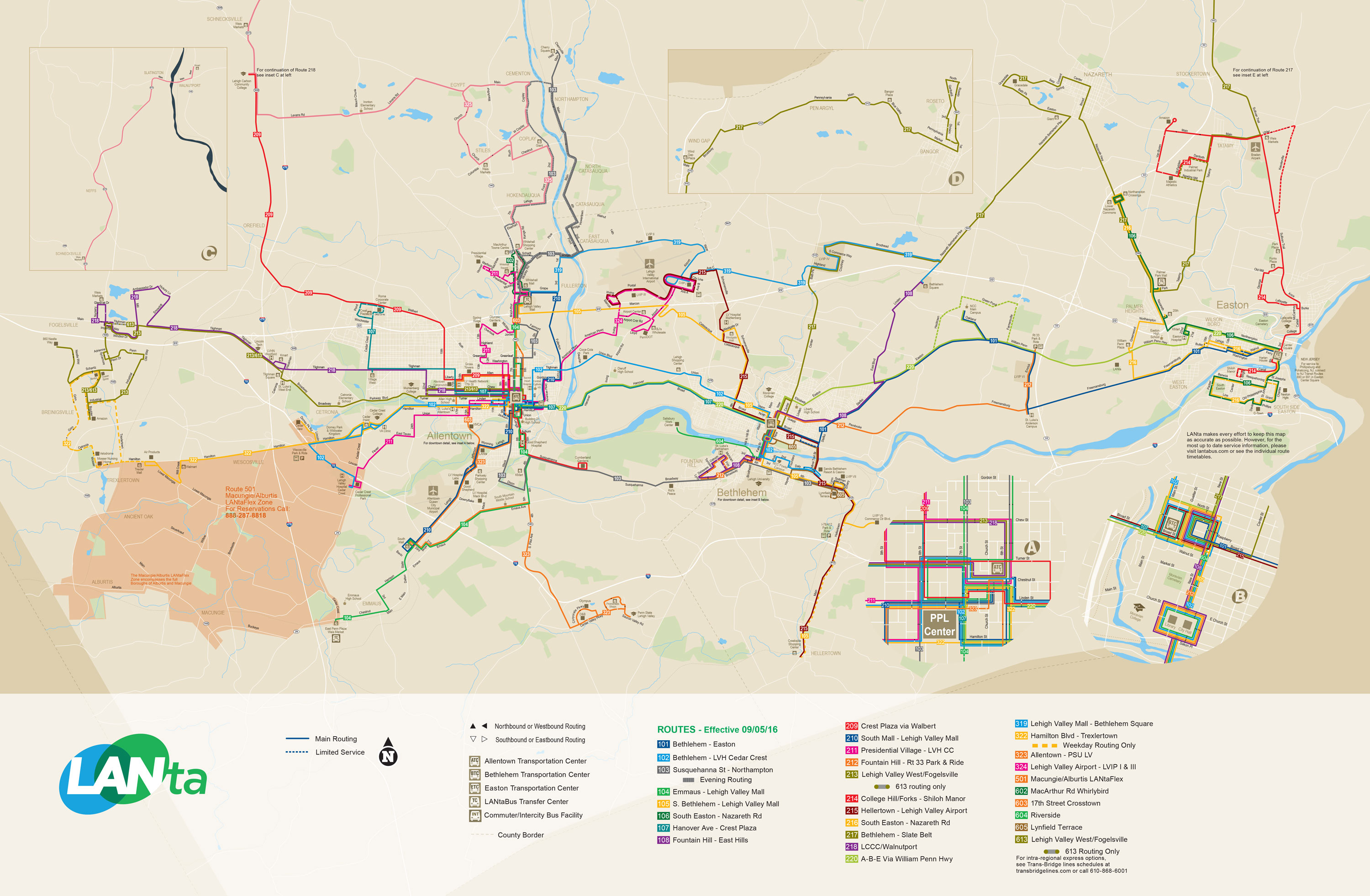
LANta provides bus service in Whitehall Township with several routes serving the MacArthur Road retail corridor and a transfer center located at the Lehigh Valley Mall. The bus routes connect the township with Allentown, Bethlehem, and other points in the Lehigh Valley. [14]

Notable people

Related Research Articles

<span class="mw-page-title-main">Northampton County, Pennsylvania</span> County in Pennsylvania, United States

Northampton County is a county in the Commonwealth of Pennsylvania, United States. As of the 2020 census, the population was 312,951. Its county seat is Easton. The county was formed in 1752 from parts of Bucks County. Its namesake was the county of Northamptonshire in England, and the county seat of Easton was named for Easton Neston, a country house in Northamptonshire.

<span class="mw-page-title-main">Lehigh County, Pennsylvania</span> County in Pennsylvania, United States

Lehigh County is a county in the Commonwealth of Pennsylvania. As of the 2020 census, the county's population was 374,557. Its county seat is Allentown, the state's third-largest city after Philadelphia and Pittsburgh.

<span class="mw-page-title-main">Catasauqua, Pennsylvania</span> Borough in Pennsylvania, United States

Catasauqua, referred to colloquially as Catty, is a borough in Lehigh County, Pennsylvania, United States. Catasauqua's population was 6,518 at the 2020 census. It is a suburb of Allentown in the Lehigh Valley, which had a population of 861,899 and was the 68th-most populous metropolitan area in the U.S. as of the 2020 census.

<span class="mw-page-title-main">Coplay, Pennsylvania</span> Borough in Pennsylvania, United States

Coplay is a borough in Lehigh County, Pennsylvania. Coplay's population was 3,348 at the 2020 census. It is located six miles (10 km) northwest of Allentown. The borough is part of the Lehigh Valley metropolitan area, which had a population of 861,899 and was the 68th-most populous metropolitan area in the U.S. as of the 2020 census.

<span class="mw-page-title-main">Fullerton, Pennsylvania</span> Census-designated place in Pennsylvania, United States

Fullerton is an unincorporated area and census-designated place (CDP) in Whitehall Township in Lehigh County, Pennsylvania. The population of Fullerton was 16,588 as of the 2020 census.

<span class="mw-page-title-main">Hanover Township, Lehigh County, Pennsylvania</span> Township in Pennsylvania, United States

Hanover Township is a township in Lehigh County, Pennsylvania. As of the 2010 census, the township had a population of 1,571. It is a suburb of Allentown and Bethlehem and part of the Lehigh Valley metropolitan area, which had a population of 861,899 and was the 68th-most populous metropolitan area in the U.S. as of the 2020 census.

<span class="mw-page-title-main">Hokendauqua, Pennsylvania</span> Census-designated place in Pennsylvania, United States

Hokendauqua is an unincorporated community and census-designated place (CDP) in Whitehall Township in Lehigh County, Pennsylvania, United States. The population of Hokendauqua was 3,340 as of the 2020 census. Hokendauqua is a suburb of Allentown, Pennsylvania in the Lehigh Valley metropolitan area, which had a population of 861,899 and was the 68th-most populous metropolitan area in the U.S. as of the 2020 census.

<span class="mw-page-title-main">North Whitehall Township, Pennsylvania</span> Township in Pennsylvania, United States

North Whitehall Township is a township in Lehigh County, Pennsylvania. The population of North Whitehall Township was 15,655 at the 2020 census. It is a suburb of Allentown in the Lehigh Valley, which had a population of 861,899 and was the 68th-most populous metropolitan area in the U.S. as of the 2020 census.

<span class="mw-page-title-main">South Whitehall Township, Pennsylvania</span> Township in Pennsylvania, United States

South Whitehall Township is a township in Lehigh County, Pennsylvania. The township's population was 19,180 at the 2010 census. It is a suburb of Allentown and is part of the Lehigh Valley, which had a population of 861,899 and was the 68th-most populous metropolitan area in the U.S. as of the 2020 census.

<span class="mw-page-title-main">Upper Saucon Township, Pennsylvania</span> Township in Pennsylvania, United States

Upper Saucon Township is a township in Lehigh County, Pennsylvania. It is part of the Lehigh Valley metropolitan area, which had a population of 861,899 and was the 68th-most populous metropolitan area in the U.S. as of the 2020 census. The township had a population of 16,973 as of the 2020 census.

<span class="mw-page-title-main">Hellertown, Pennsylvania</span> Place in Pennsylvania, United States

Hellertown is a borough in Northampton County, Pennsylvania. Its population was 6,131 at the 2020 census. Hellertown is part of the Lehigh Valley metropolitan area, which had a population of 861,899 and was the 68th-most populous metropolitan area in the U.S. as of 2020.

<span class="mw-page-title-main">Moore Township, Pennsylvania</span> Place in Pennsylvania, United States

Moore Township is a township in Northampton County, Pennsylvania. The population of Moore Township was 9,198 at the 2010 census. The township is located in the Lehigh Valley, which had a population of 861,899 and was the 68th-most populous metropolitan area in the U.S. as of the 2020 census.

<span class="mw-page-title-main">Lehigh Valley</span> Metropolitan Statistical Area in the United States

The Lehigh Valley, known colloquially as The Valley, is a geographic and metropolitan region formed by the Lehigh River in Lehigh and Northampton counties in eastern Pennsylvania. It is a component valley of the Great Appalachian Valley bounded to its north by Blue Mountain, to its south by South Mountain, to its west by Lebanon Valley, and to its east by the Delaware River and Warren County, New Jersey. The Valley is about 40 miles (64 km) long and 20 miles (32 km) wide. The Lehigh Valley's largest city is Allentown, the third-largest city in Pennsylvania and the county seat of Lehigh County, with a population of 125,845 residents as of the 2020 census.

<span class="mw-page-title-main">Pennsylvania Route 145</span> State highway in Pennsylvania, US

Pennsylvania Route 145 is a 20.89 mi (33.62 km) long north–south state highway in the Lehigh Valley area of eastern Pennsylvania. It connects Interstate 78 (I-78) and PA 309 in Lanark, Lehigh County, north to PA 248 in Lehigh Gap, Northampton County.

<span class="mw-page-title-main">Pennsylvania Route 329</span> State highway in Pennsylvania, US

Pennsylvania Route 329 is a Pennsylvania state highway that runs for 12.9 miles (20.8 km) through Lehigh and Northampton counties in the Lehigh Valley region of the state. It runs from PA 873 in the North Whitehall Township village of Neffs east to PA 248 and PA 987 in Bath. The route is a two-lane undivided road that runs through a mix of rural and developed areas to the north of the cities of Allentown and Bethlehem, serving the communities of Balliettsville, Egypt, Cementon, and Northampton. PA 329 intersects PA 145 near Egypt and runs concurrent with PA 987 between East Allen Township and the eastern terminus in Bath.

Pennsylvania State Senate District 14 includes parts of Lehigh County and Northampton County. It is currently represented by Democrat Nick Miller. Prior to the current reapportionment plan it was a Luzerne County seat that was moved to the Lehigh Valley to reflect long-term population shifts.

<span class="mw-page-title-main">Egypt, Pennsylvania</span> Census-designated place in Pennsylvania, United States

Egypt is an unincorporated community and census-designated place (CDP) in Whitehall Township in Lehigh County, Pennsylvania, United States. The population of Egypt was 2,588 as of the 2020 census.

<span class="mw-page-title-main">Cementon, Pennsylvania</span> Census-designated place in Pennsylvania, United States

Cementon is an unincorporated area and census-designated place (CDP) in Lehigh County, Pennsylvania. The town is in Whitehall Township, 7 miles (11 km) north of Allentown. As of the 2020 census, the population of Cementon was 1,657. Cementon is part of the Lehigh Valley metropolitan area, which had a population of 861,899 and was the 68th-most populous metropolitan area in the U.S. as of 2020. It uses the Whitehall Township ZIP Code of 18052.

West Catasauqua is an unincorporated village in Whitehall Township in Lehigh County, Pennsylvania. Once a port and station along the busy Lehigh Canal, it is colloquially known as West Catty. It is part of the Lehigh Valley, which has a population of 861,899 and is the 68th-most populous metropolitan area in the U.S. as of the 2020 census.

<span class="mw-page-title-main">Stiles, Pennsylvania</span> Census-designated place in Pennsylvania, United States

Stiles is an unincorporated community and census-designated place (CDP) that is located in Whitehall Township in Lehigh County, Pennsylvania. As of the 2010 census, the population was 1,113.

References

  1. "Administration". Whitehall Township. Archived from the original on February 20, 2020.
  2. 1 2 "2016 U.S. Gazetteer Files". United States Census Bureau. Retrieved August 14, 2017.
  3. "Total Population: 2010 Census DEC Summary File 1 (P1), Whitehall township, Lehigh County, Pennsylvania". data.census.gov. U.S. Census Bureau. Retrieved October 22, 2020.
  4. "Population and Housing Unit Estimates" . Retrieved June 9, 2017.
  5. "The Official Borough of Emmaus Pennsylvania". www.borough.emmaus.pa.us. Retrieved December 20, 2016.
  6. William, Ford. "In a numbers game, Hunsicker looks to be No. 1".
  7. Prism at Oregon State University
  8. "Census 2020".
  9. "U.S. Census website". United States Census Bureau . Retrieved January 31, 2008.
  10. "National Register Information System". National Register of Historic Places . National Park Service. July 9, 2010.
  11. "§ 1-7. Compensation of Commissioners". eCode360.com. Retrieved May 15, 2012.
  12. "Whitehall Township map" (PDF). PennDOT. Retrieved March 17, 2023.
  13. Lehigh County, Pennsylvania Highway Map (PDF) (Map). PennDOT. 2012. Retrieved April 17, 2013.
  14. System Map (Map). LANTA. Retrieved February 14, 2018.