North Whitehall Township, Pennsylvania

Last updated

North Whitehall Township
Rex Covered Bridge 1.jpg
Rex Covered Bridge in North Whitehall Township in October 2006
North Whitehall Seal.png
Lehigh county - North Whitehall.png
Location of North Whitehall Township in Lehigh County, Pennsylvania
USA Pennsylvania location map.svg
Red pog.svg
North Whitehall Twp
Location of North Whitehall Township in Pennsylvania
Usa edcp location map.svg
Red pog.svg
North Whitehall Twp
North Whitehall Twp (the United States)
Coordinates: 40°37′27″N75°37′25″W / 40.62417°N 75.62361°W / 40.62417; -75.62361
Country Flag of the United States.svg  United States
State Flag of Pennsylvania.svg  Pennsylvania
County Lehigh
Area
[1]
   Township 28.55 sq mi (73.95 km2)
  Land28.07 sq mi (72.71 km2)
  Water0.48 sq mi (1.24 km2)
Elevation
627 ft (191 m)
Population
 (2020) [2]
   Township 15,655
  Density548.34/sq mi (211.70/km2)
   Metro
865,310 (US: 68th)
Time zone UTC-5 (EST)
  Summer (DST) UTC-4 (EDT)
ZIP Codes
18037, 18059, 18065, 18069, 18078, 18104
Area codes 610 and 484
FIPS code 42-077-55576
Primary airport Lehigh Valley International Airport
Major hospital Lehigh Valley Hospital–Cedar Crest
School district Parkland
Website www.northwhitehall.org

North Whitehall Township is a township in Lehigh County, Pennsylvania. The population of North Whitehall Township was 15,655 at the 2020 census. [2] It is a suburb of Allentown in the Lehigh Valley, which had a population of 861,899 and was the 68th-most populous metropolitan area in the U.S. as of the 2020 census.

Contents

North Whitehall Township is located 9.4 miles (15.1 km) northwest of Allentown, 65.2 miles (104.9 km) northwest of Philadelphia, and 99.2 miles (159.6 km) west of New York City.

Geography

The township is located in northeastern Lehigh County. According to the U.S. Census Bureau, it has a total area of 28.5 square miles (73.9 km2), 28.1 square miles (72.7 km2) of which is land and 0.46 square miles (1.2 km2), or 1.56%, of which is water. [1] It is drained by the Lehigh River, which separates it from Northampton County.

The township has a hot-summer humid continental climate (Dfa) and the hardiness zone is 6b. Average monthly temperatures in Ironton range from 28.4 °F (−2.0 °C) in January to 73.3 °F (22.9 °C) in July. [3]

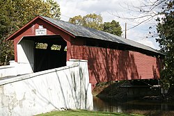
North Whitehall's villages include Ballietsville, Coffeetown, Ironton, Kernsville, Laurys Station, Mechanicsville (also in South Whitehall Township), Meyersville (also in South Whitehall), Neffs (also in Washington Township), Orefield (also in South Whitehall), Ormrod, Ruchsville, Scheidy, and Schnecksville.

Adjacent municipalities

Demographics

Historical population
CensusPop.Note
2000 14,731
2010 15,7036.6%
2020 15,655−0.3%

As of the census [4] of 2010, there were 15,703 people, 5,766 households, and 4,453 families residing in the township. The population density was 543.4 inhabitants per square mile (209.8/km2). There were 6,000 housing units at an average density of 207.6 per square mile (80.2/km2). The racial makeup of the township was 94.71% White, 1.53% African American, 0.12% Native American, 1.34% Asian, 0.01% Pacific Islander, 1.02% from other races, and 1.26% from two or more races. Hispanic or Latino of any race were 3.69% of the population.

There were 5,766 households, out of which 36.39% had children under the age of 18 living with them, 64.46% were married couples living together, 4.06% had a male household with no wife present, 8.71% had a female householder with no husband present, and 22.77% were non-families. 18.21% of all households were made up of individuals, and 7.25% had someone living alone who was 65 years of age or older. The average household size was 2.68 and the average family size was 3.05.

In the township, the population was spread out, with 27.74% under the age of 20, 4.36% from 20 to 24, 20.99% from 25 to 44, 33.87% from 45 to 64, and 13.04% who were 65 years of age or older. The median age was 43.3 years. For every 100 females there were 98.72 males. For every 100 females age 18 and over, there were 94.94 males age 18 and over. As of 2015, the median income for a household in the township was $75,714, and the median income for a family was $89,182. Males had a median income of $56,152 versus $43,855 for females. The per capita income for the township was $35,470. About 4.1% of families and 4.8% of the population were below the poverty line, including 5.0% of those under age 18 and 9.1% of those age 65 or over.

Education

Primary education

Lehigh Carbon Community College in Schnecksville in North Whitehall Township in 2014 Lehigh Carbon Community College Main Campus.jpg
Lehigh Carbon Community College in Schnecksville in North Whitehall Township in 2014

Along with South Whitehall and Upper Macungie townships, North Whitehall Township is served by the Parkland School District. Ironton, Kernsville, and Schnecksville Elementary Schools are located in North Whitehall Township. Secondary students attend Orefield Middle School in Orefield and Parkland High School in Allentown. [5]

Community college

North Whitehall Township is also home to Lehigh Carbon Community College in Schnecksville.

Transportation

I-476, the Northeast Extension of the Pennsylvania Turnpike North, in North Whitehall Township 2022-09-23 14 47 26 View north along Interstate 476 (Pennsylvania Turnpike Northeast Extension) from the overpass for Shankweiler Road in North Whitehall Township, Lehigh County, Pennsylvania.jpg
I-476, the Northeast Extension of the Pennsylvania Turnpike North, in North Whitehall Township

As of 2020, there were 159.25 miles (256.29 km) of public roads in North Whitehall Township, of which 4.70 miles (7.56 km) were maintained by the Pennsylvania Turnpike Commission (PTC), 37.84 miles (60.90 km) were maintained by the Pennsylvania Department of Transportation (PennDOT) and 116.71 miles (187.83 km) were maintained by the township. [6]

Interstate 476 follows the Pennsylvania Turnpike's Northeast Extension along a northwest–southeast alignment across southern and western portions of North Whitehall Township, but the closest interchange is in neighboring South Whitehall Township. Numbered highways providing local access include Pennsylvania Route 309, Pennsylvania Route 873, Pennsylvania Route 329, and Pennsylvania Route 145. Another thoroughfare is Mauch Chunk Road, which runs from PA 329 in Ballietsville into Allentown. LANta serves the township with bus route 325 along the Route 309/873 corridor.

Related Research Articles

<span class="mw-page-title-main">Lehigh County, Pennsylvania</span> County in Pennsylvania, United States

Lehigh County is a county in the Commonwealth of Pennsylvania. As of the 2020 census, the county's population was 374,557. Its county seat is Allentown, the state's third-largest city after Philadelphia and Pittsburgh.

<span class="mw-page-title-main">Coplay, Pennsylvania</span> Borough in Pennsylvania, United States

Coplay is a borough in Lehigh County, Pennsylvania. Coplay's population was 3,348 at the 2020 census. It is located six miles (10 km) northwest of Allentown. The borough is part of the Lehigh Valley metropolitan area, which had a population of 861,899 and was the 68th-most populous metropolitan area in the U.S. as of the 2020 census.

<span class="mw-page-title-main">Hanover Township, Lehigh County, Pennsylvania</span> Township in Pennsylvania, United States

Hanover Township is a township in Lehigh County, Pennsylvania. As of the 2010 census, the township had a population of 1,571. It is a suburb of Allentown and Bethlehem and part of the Lehigh Valley metropolitan area, which had a population of 861,899 and was the 68th-most populous metropolitan area in the U.S. as of the 2020 census.

<span class="mw-page-title-main">Lower Macungie Township, Pennsylvania</span> Township in Pennsylvania, United States

Lower Macungie Township is a township in Lehigh County, Pennsylvania. The township's population was 31,964 as of the 2020 census, making it the second-largest population center in Lehigh County after Allentown and the third-largest population center in the Lehigh Valley metropolitan area after Allentown and Bethlehem.

<span class="mw-page-title-main">Lowhill Township, Pennsylvania</span> Township in Pennsylvania, United States

Lowhill Township is a township in Lehigh County, Pennsylvania. The population of Lowhill Township was 2,173 at the 2010 census. It is a suburb of Allentown, in the Lehigh Valley, which had a population of 861,899 and was the 68th-most populous metropolitan area in the U.S. as of the 2020 census.

<span class="mw-page-title-main">Salisbury Township, Lehigh County, Pennsylvania</span> Township in Pennsylvania, United States

Salisbury Township is a township in Lehigh County, Pennsylvania. The township's population was 13,505 at the 2010 census. The township borders Allentown, Pennsylvania's third-largest city, Bethlehem, and Emmaus, in the Lehigh Valley, which had a population of 861,899 and was the 68th-most populous metropolitan area in the U.S. as of the 2020 census.

<span class="mw-page-title-main">Schnecksville, Pennsylvania</span> Census-designated place in Pennsylvania, United States

Schnecksville is an unincorporated community and census-designated place (CDP) in North Whitehall Township in Lehigh County, Pennsylvania. The population of Schnecksville was 2,935 at the 2010 census.

<span class="mw-page-title-main">South Whitehall Township, Pennsylvania</span> Township in Pennsylvania, United States

South Whitehall Township is a township in Lehigh County, Pennsylvania. The township's population was 19,180 at the 2010 census. It is a suburb of Allentown and is part of the Lehigh Valley, which had a population of 861,899 and was the 68th-most populous metropolitan area in the U.S. as of the 2020 census.

<span class="mw-page-title-main">Upper Macungie Township, Pennsylvania</span> Township in Pennsylvania, United States

Upper Macungie Township is a township in Lehigh County, Pennsylvania. The population of Upper Macungie Township was 26,377 as of the 2020 U.S. census, making it the fourth-fastest growing municipality of any category in Pennsylvania in terms of total population growth between 2010 and 2020.

<span class="mw-page-title-main">Upper Milford Township, Pennsylvania</span> Township in Pennsylvania, United States

Upper Milford Township is a township in Lehigh County, Pennsylvania. The township's population was 7,292 at the 2010 census. Upper Milford Township is a suburb of Allentown in the Lehigh Valley, which had a population of 861,899 and was the 68th-most populous metropolitan area in the U.S. as of the 2020 census.

<span class="mw-page-title-main">Upper Saucon Township, Pennsylvania</span> Township in Pennsylvania, United States

Upper Saucon Township is a township in Lehigh County, Pennsylvania. It is part of the Lehigh Valley metropolitan area, which had a population of 861,899 and was the 68th-most populous metropolitan area in the U.S. as of the 2020 census. The township had a population of 16,973 as of the 2020 census.

<span class="mw-page-title-main">Washington Township, Lehigh County, Pennsylvania</span> Township in Pennsylvania, United States

Washington Township is a township in Lehigh County, Pennsylvania. The population of Washington Township was 6,624 at the 2010 census. It is a suburb of Allentown in the Lehigh Valley, which had a population of 861,899 and was the 68th-most populous metropolitan area in the U.S. as of the 2020 census.

<span class="mw-page-title-main">Whitehall Township, Pennsylvania</span> Township in Pennsylvania, United States

Whitehall Township is a township with home rule status in Lehigh County, Pennsylvania. The township's population was 26,738 as of the 2010 census.

<span class="mw-page-title-main">Allen Township, Northampton County, Pennsylvania</span> Township in Pennsylvania, United States

Allen Township is a township in Northampton County, Pennsylvania. The population of Allen Township was 4,269 at the 2010 census. Allen Township is part of the Lehigh Valley metropolitan area, which had a population of 861,899 and was the 68th-most populous metropolitan area in the U.S. as of the 2020 census.

<span class="mw-page-title-main">Lehigh Township, Northampton County, Pennsylvania</span> Place in Pennsylvania, United States

Lehigh Township is a township in Northampton County, Pennsylvania. The population of Lehigh Township was 10,526 as of the 2010 census. It is part of the Lehigh Valley metropolitan area, which had a population of 861,899 and was the 68th-most populous metropolitan area in the U.S. as of the 2020 census.

<span class="mw-page-title-main">Moore Township, Pennsylvania</span> Place in Pennsylvania, United States

Moore Township is a township in Northampton County, Pennsylvania. The population of Moore Township was 9,198 at the 2010 census. The township is located in the Lehigh Valley, which had a population of 861,899 and was the 68th-most populous metropolitan area in the U.S. as of the 2020 census.

<span class="mw-page-title-main">Breinigsville, Pennsylvania</span> Census-designated place in Pennsylvania, United States

Breinigsville is an unincorporated community and census-designated place (CDP) in Lehigh County, Pennsylvania. As of the 2020 census, it had a population of 7,495. The town is part of Upper Macungie Township and is located approximately 11 miles (18 km) southwest of downtown Allentown and 8 miles (13 km) east of Kutztown.

<span class="mw-page-title-main">Trexlertown, Pennsylvania</span> Census-designated place in Pennsylvania, United States

Trexlertown is an unincorporated community and census-designated place (CDP) in Upper Macungie Township in Lehigh County, Pennsylvania. As of the 2020 census, the population was 2,382. It is part of the Lehigh Valley, which had a population of 861,899 and was the 68th-most populous metropolitan area in the U.S. as of the 2020 census, and lies between Breinigsville and Wescosville.

<span class="mw-page-title-main">Orefield, Pennsylvania</span> Unincorporated community in Pennsylvania, United States

Orefield is a small unincorporated community in Lehigh County, Pennsylvania. The community is split between North Whitehall and South Whitehall townships. Orefield is part of the Lehigh Valley, which has a population of 861,899 and is the 68th-most populous metropolitan area in the U.S. as of the 2020 census.

<span class="mw-page-title-main">Parkland School District</span> School district in Pennsylvania

Parkland School District is a large public school district located in the Lehigh Valley region of eastern Pennsylvania. It serves North Whitehall Township, South Whitehall Township, Upper Macungie Township, and part of western Allentown. The district also includes the South Whitehall villages of Cetronia, Dorneyville, Orefield, Scherersville, Walbert, and others.

References

  1. 1 2 "2016 U.S. Gazetteer Files". United States Census Bureau. Retrieved August 14, 2017.
  2. 1 2 "QuickFacts North Whitehall township, Lehigh County, Pennsylvania". www.census.gov. U.S. Census Bureau. Retrieved August 12, 2021.
  3. Prism at Oregon State University
  4. "U.S. Census website". United States Census Bureau . Retrieved May 30, 2010.
  5. "District Map — Parkland School District : Grades K -12, Allentown PA". Archived from the original on November 20, 2011. Retrieved November 16, 2011.
  6. "North Whitehall Township map" (PDF). PennDOT. Retrieved March 17, 2023.