Trexlertown, Pennsylvania

Last updated

Trexlertown, Pennsylvania
Hamilton Boulevard wb, Trexlertown, PA (3), Nov. 2023.jpg
Trexlertown at the intersection of Hamilton Boulevard and Trexlertown Road
Lehigh county - Trexlertown.png
Location of Trexlertown in Lehigh County, Pennsylvania
USA Pennsylvania location map.svg
Red pog.svg
Trexlertown
Location of Trexlertown in Pennsylvania
Usa edcp location map.svg
Red pog.svg
Trexlertown
Location in the United States
Coordinates: 40°32′53″N75°36′21″W / 40.54806°N 75.60583°W / 40.54806; -75.60583
Country Flag of the United States.svg  United States
State Flag of Pennsylvania.svg  Pennsylvania
County Lehigh
Township Upper Macungie
Area
[1]
   Census-designated place 2.09 sq mi (5.42 km2)
  Land2.08 sq mi (5.38 km2)
  Water0.02 sq mi (0.04 km2)
Elevation
397 ft (121 m)
Population
 (2020) [2]
   Census-designated place 2,382
  Density1,147.40/sq mi (443.06/km2)
   Metro
865,310 (US: 68th)
Time zone UTC-5 (Eastern (EST))
  Summer (DST) UTC-4 (EDT)
ZIP Code
18087
Area code(s) 610 and 484
FIPS code 42-77488
GNIS feature ID1189757 [3]
Primary airport Lehigh Valley International Airport
Major hospital Lehigh Valley Hospital–Cedar Crest
School district Parkland

Trexlertown is an unincorporated community and census-designated place (CDP) in Upper Macungie Township in Lehigh County, Pennsylvania. As of the 2020 census, the population was 2,382. [4] It is part of the Lehigh Valley, which had a population of 861,899 and was the 68th-most populous metropolitan area in the U.S. as of the 2020 census, and lies between Breinigsville and Wescosville.

Contents

The global corporate headquarters of Air Products is located immediately across the Trexlertown's eastern border with Allentown. Lehigh Valley Velodrome, a velodrome for professional and amateur cycling, also is located next to Trexlertown, in Breinigsville.

History

Jeremiah Trexler obtained land adjoining that of his father in present-day Upper Macungie Township, where he operated a tavern as early as in 1732. Two years later, in 1734, a road was developed from his Upper Macungie Township tavern south through North Wales to Philadelphia.

As was the custom of the time, a village grew around the tavern, and the village came to be known as Trexlertown in honor of Trexler's role in its founding. [5]

Historical population
CensusPop.Note
2000 957
2010 1,988107.7%
2020 2,38219.8%
U.S. Decennial Census [6]

Geography

Trexlertown is located southwest of the center of Lehigh County along the southeastern edge of Upper Macungie Township at an altitude of 397 feet (121 m). It is bordered to the southwest by Breinigsville and to the southeast by Lower Macungie Township. U.S. Route 222 forms the northern edge of the community; US 222 leads northeast 3 miles (5 km) to its terminus at Interstate 78 outside of Allentown and southwest 30 miles (48 km) to Reading. Pennsylvania Route 100 forms the western edge of Trexlertown, leading north 11 miles (18 km) to its terminus at PA 309 near Pleasant Corners and south 27 miles (43 km) to Pottstown.

According to the U.S. Census Bureau, Trexlertown has a total area of 2.1 square miles (5.4 km2), of which 0.02 square miles (0.04 km2), or 0.80%, are water. [7] Schaefer Run and Iron Run join in the southwestern part of the community to form Spring Creek, a southwestward-flowing tributary of Little Lehigh Creek and part of the Lehigh River watershed.

Education

Trexlertown is part of the Parkland School District, and students in grades nine through 12 attend Parkland High School.

Related Research Articles

<span class="mw-page-title-main">Lehigh County, Pennsylvania</span> County in Pennsylvania, United States

Lehigh County is a county in the Commonwealth of Pennsylvania. As of the 2020 census, the county's population was 374,557. Its county seat is Allentown, the state's third-largest city after Philadelphia and Pittsburgh.

Ancient Oaks is a census-designated place (CDP) in Lower Macungie Township in Lehigh County, Pennsylvania, United States. It is named after the housing subdivision named Ancient Oaks, located off PA Route 100 just north of Macungie. The population of Ancient Oaks was 6,995 at the 2020 census.

<span class="mw-page-title-main">Lower Macungie Township, Pennsylvania</span> Township in Pennsylvania, United States

Lower Macungie Township is a township in Lehigh County, Pennsylvania. The township's population was 31,964 as of the 2020 census, making it the second-largest population center in Lehigh County after Allentown and the third-largest population center in the Lehigh Valley metropolitan area after Allentown and Bethlehem.

<span class="mw-page-title-main">Lowhill Township, Pennsylvania</span> Township in Pennsylvania, United States

Lowhill Township is a township in Lehigh County, Pennsylvania. The population of Lowhill Township was 2,173 at the 2010 census. It is a suburb of Allentown, in the Lehigh Valley, which had a population of 861,899 and was the 68th-most populous metropolitan area in the U.S. as of the 2020 census.

<span class="mw-page-title-main">Macungie, Pennsylvania</span> Borough in Pennsylvania, United States

Macungie is the second oldest borough in Lehigh County, Pennsylvania. As of the 2020 census, Macungie had a population of 3,257.

<span class="mw-page-title-main">North Whitehall Township, Pennsylvania</span> Township in Pennsylvania, United States

North Whitehall Township is a township in Lehigh County, Pennsylvania. The population of North Whitehall Township was 15,655 at the 2020 census. It is a suburb of Allentown in the Lehigh Valley, which had a population of 861,899 and was the 68th-most populous metropolitan area in the U.S. as of the 2020 census.

<span class="mw-page-title-main">Salisbury Township, Lehigh County, Pennsylvania</span> Township in Pennsylvania, United States

Salisbury Township is a township in Lehigh County, Pennsylvania. The township's population was 13,505 at the 2010 census. The township borders Allentown, Pennsylvania's third-largest city, Bethlehem, and Emmaus, in the Lehigh Valley, which had a population of 861,899 and was the 68th-most populous metropolitan area in the U.S. as of the 2020 census.

<span class="mw-page-title-main">Schnecksville, Pennsylvania</span> Census-designated place in Pennsylvania, United States

Schnecksville is an unincorporated community and census-designated place (CDP) in North Whitehall Township in Lehigh County, Pennsylvania. The population of Schnecksville was 2,935 at the 2010 census.

<span class="mw-page-title-main">South Whitehall Township, Pennsylvania</span> Township in Pennsylvania, United States

South Whitehall Township is a township in Lehigh County, Pennsylvania. The township's population was 19,180 at the 2010 census. It is a suburb of Allentown and is part of the Lehigh Valley, which had a population of 861,899 and was the 68th-most populous metropolitan area in the U.S. as of the 2020 census.

<span class="mw-page-title-main">Upper Macungie Township, Pennsylvania</span> Township in Pennsylvania, United States

Upper Macungie Township is a township in Lehigh County, Pennsylvania. The population of Upper Macungie Township was 26,377 as of the 2020 U.S. census, making it the fourth-fastest growing municipality of any category in Pennsylvania in terms of total population growth between 2010 and 2020.

<span class="mw-page-title-main">Upper Milford Township, Pennsylvania</span> Township in Pennsylvania, United States

Upper Milford Township is a township in Lehigh County, Pennsylvania. The township's population was 7,292 at the 2010 census. Upper Milford Township is a suburb of Allentown in the Lehigh Valley, which had a population of 861,899 and was the 68th-most populous metropolitan area in the U.S. as of the 2020 census.

<span class="mw-page-title-main">Lehigh Valley</span> Metropolitan Statistical Area in the United States

The Lehigh Valley, known colloquially as The Valley, is a geographic and metropolitan region formed by the Lehigh River in Lehigh and Northampton counties in eastern Pennsylvania. It is a component valley of the Great Appalachian Valley bounded to its north by Blue Mountain, to its south by South Mountain, to its west by Lebanon Valley, and to its east by the Delaware River and Warren County, New Jersey. The Valley is about 40 miles (64 km) long and 20 miles (32 km) wide. The Lehigh Valley's largest city is Allentown, the third-largest city in Pennsylvania and the county seat of Lehigh County, with a population of 125,845 residents as of the 2020 census.

<span class="mw-page-title-main">Breinigsville, Pennsylvania</span> Census-designated place in Pennsylvania, United States

Breinigsville is an unincorporated community and census-designated place (CDP) in Lehigh County, Pennsylvania. As of the 2020 census, it had a population of 7,495. The town is part of Upper Macungie Township and is located approximately 11 miles (18 km) southwest of downtown Allentown and 8 miles (13 km) east of Kutztown.

<span class="mw-page-title-main">Dorneyville, Pennsylvania</span> Census-designated place in Pennsylvania, United States

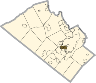
Dorneyville is a census-designated place in Lehigh County, Pennsylvania. As of the 2020 census the population was 4,850. Dorneyville is located just west of Allentown in South Whitehall Township and Salisbury Township.

<span class="mw-page-title-main">New Tripoli, Pennsylvania</span> Census-designated place in Pennsylvania, United States

New Tripoli is an unincorporated community and census-designated place (CDP) in Lynn Township in Lehigh County, Pennsylvania. As of the 2020 census, the population was 840. New Tripoli is part of the Lehigh Valley, which had a population of 861,899 and was the 68th-most populous metropolitan area in the U.S. as of the 2020 census.

Cedar Crest Boulevard, colloquially known as Cedar Crest and The Boulevard, is a major north-south highway in Lehigh County, Pennsylvania in the Lehigh Valley region of eastern Pennsylvania. South of Interstate 78 (I-78), the road is part of Pennsylvania Route 29. North of it, the road becomes State Route 1019.

Kuhnsville is a small, unincorporated village in Upper Macungie Township in Lehigh County, Pennsylvania. It is part of the Lehigh Valley, which has a population of 861,899 and is the 68th-most populous metropolitan area in the U.S. as of the 2020 census.

<span class="mw-page-title-main">Wescosville, Pennsylvania</span> Census-designated place in Pennsylvania, United States

Wescosville is a census-designated place located in Lehigh County, Pennsylvania. It is located between Allentown and Trexlertown in Lower Macungie Township. It is part of the Lehigh Valley, which had a population of 861,899 and was the 68th-most populous metropolitan area in the U.S. as of the 2020 census.

<span class="mw-page-title-main">Cetronia, Pennsylvania</span> Census-designated place in Pennsylvania, United States

Cetronia is a census-designated place (CDP) in South Whitehall Township in Lehigh County, Pennsylvania, located near Allentown. As of the 2020 census, its population was 2,421.

<span class="mw-page-title-main">Laurys Station, Pennsylvania</span> Census-designated place in Pennsylvania, United States

Laurys Station is an unincorporated community and census-designated place (CDP) in North Whitehall Township in Lehigh County, Pennsylvania. It is part of the Lehigh Valley, which had a population of 861,899 and was the 68th-most populous metropolitan area in the U.S. as of the 2020 census. It is located approximately 9 miles (14 km) north of Allentown and about 6 miles (10 km) southeast of Walnutport.

References

  1. "ArcGIS REST Services Directory". United States Census Bureau. Retrieved October 16, 2022.
  2. "Census Population API". United States Census Bureau. Retrieved October 12, 2022.
  3. "Trexlertown". Geographic Names Information System . United States Geological Survey, United States Department of the Interior.
  4. "Total Population: 2010 Census DEC Summary File 1 (P1), Trexlertown CDP, Pennsylvania". data.census.gov. U.S. Census Bureau. Retrieved October 28, 2020.
  5. Roberts, Stoudt, Krick and Dietrich, History of Lehigh County, Pennsylvania, 3:1321; "History of Upper Macungie Township, Lehigh County, Pennsylvania", online < "Lehigh County Website". Archived from the original on April 18, 2005. Retrieved May 26, 2005.>; Thomas Lynch Montgomery, Pennsylvania Archives, Sixth Series, 14: 269-271.
  6. "Census of Population and Housing". Census.gov. Retrieved June 4, 2016.
  7. "2019 U.S. Gazetteer Files: Places: Pennsylvania". United States Census Bureau. Retrieved October 28, 2020.