Upper Macungie Township, Pennsylvania

Last updated

Upper Macungie Township
Upper Macungie Township (2).JPG
Township sign in Breinigsville in March 2014
Upper Macungi Seal.png
Lehigh county - Upper Macungie.png
Location of Upper Macungie Township in Lehigh County, Pennsylvania
USA Pennsylvania location map.svg
Red pog.svg
Upper Macungie Township
Location of Upper Macungie Township in Pennsylvania
Usa edcp location map.svg
Red pog.svg
Upper Macungie Township
Location in the United States
Coordinates: 40°34′46″N75°37′00″W / 40.57944°N 75.61667°W / 40.57944; -75.61667
Country Flag of the United States.svg  United States
State Flag of Pennsylvania.svg  Pennsylvania
County Lehigh
Area
[1]
   Township 26.26 sq mi (68.02 km2)
  Land26.07 sq mi (67.53 km2)
  Water0.19 sq mi (0.49 km2)
Elevation
463 ft (141 m)
Population
 (2020) [2]
   Township 26,377
  Estimate 
(July 2022) [3]
27,875
  Density1,011.0/sq mi (353.70/km2)
   Metro
865,310 (US: 68th)
Time zone UTC-5 (EST)
  Summer (DST) UTC-4 (EDT)
ZIP Codes
18031, 18051, 18087, 18104, and 18106
Area code(s) 610 and 484
FIPS code 42-077-79104
Primary airport Lehigh Valley International Airport
Major hospital Lehigh Valley Hospital–Cedar Crest
School district Parkland
Website www.uppermac.org

Upper Macungie Township is a township in Lehigh County, Pennsylvania. The population of Upper Macungie Township was 26,377 as of the 2020 U.S. census, [2] making it the fourth-fastest growing municipality of any category in Pennsylvania in terms of total population growth between 2010 and 2020.

Contents

The township was created in 1832 when Macungie Township was divided into Upper and Lower Macungie townships. It is part of the Lehigh Valley metropolitan area, which had a population of 861,899 and was the 68th-most populous metropolitan area in the U.S. as of the 2020 census.

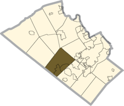
Upper Macungie Township is located 11.5 miles (18.5 km) southwest of Allentown, 60.8 miles (97.8 km) northwest of Philadelphia, and 99.2 miles (159.6 km) west of New York City. [4]

Geography

According to the U.S. Census Bureau, the township has a total area of 26.3 square miles (68.0 km2), of which 26.1 square miles (67.6 km2) are land and 0.2 square miles (0.4 km2), or 0.65%, are water. [1] It is drained by tributaries of Little Lehigh Creek and Jordan Creek into the Lehigh River, which in turn joins the Delaware River in Easton.

Villages

Upper Macungie Township villages include Breinigsville, Fogelsville, Krocksville, Kuhnsville, Newtown, Ruppsville, and Trexlertown.

Climate

The township has a hot-summer humid continental climate (Dfa) and the hardiness zone is 6b. The monthly average temperature in Fogelsville ranges from 28.5 °F (−1.9 °C) in January to 73.3 °F (22.9 °C) in July. [5]

Adjacent municipalities

Demographics

Historical population
CensusPop.Note
2000 13,895
2010 20,06344.4%
2020 26,37731.5%
[6]

As of the 2020 census, [7] the population of the township was 26,377. The population density was 1,011 inhabitants per square mile (390/km2). The racial makeup of the township was 71.3% White, 8.9% African American, 0.1% Native American, 12.7% Asian, and 5.9% from two or more races. Hispanic or Latino of any race were 9.5% of the population.

There were 9,313 households, out of which 35.8% had children under the age of 18 living with them, 66.0% were married couples living together, 6.5% had a female householder with no husband present, and 25.2% were non-families. 20.2% of all households were made up of individuals, and 8.8% had someone living alone who was 65 years of age or older. The average household size was 2.65 and the average family size was 3.08.

In the township, the population was spread out, with 26.0% under the age of 18, 3.71% from 19 to 24, 36.08% from 25 to 49 and 31.1% age 50 or older. The median age was 39 years. For every 100 females, there were 92.9 males. For every 100 females age 18 and over, there were 92.9 males. The median income for a household in the township was $85,600, and the median income for a family was $97,180. Upper Macungie has one of the highest median family incomes in the state of Pennsylvania with an amount nearly double the state average. Males had a median income of $57,971 versus $38,490 for females. The per capita income for the township was $35,506. About 0.8% of families and 2.6% of the population were below the poverty line, including 1.8% of those under age 18 and 9.0% of those age 65 or over.

Government and politics

A Pennsylvania Dutch-style barn in the Breiningsville section of Upper Macungie Township in March 2012 Barn Style (1).jpg
A Pennsylvania Dutch-style barn in the Breiningsville section of Upper Macungie Township in March 2012
Valley Preferred Cycling Center in Breinigsville in April 2014 Cyclists on the valley preferred cycling center track 2.jpg
Valley Preferred Cycling Center in Breinigsville in April 2014
Upper Macungie Township Police Department in Breinigsville in March 2014 Upper Macungie Township Police (5).JPG
Upper Macungie Township Police Department in Breinigsville in March 2014

Legislators

Police and fire

Upper Macungie Township is served by the Upper Macungie Township Police Department. Prior to 2012, it was served by the now defunct Berks-Lehigh Regional Police.

Fire and emergency services are provided by:

Education

The township is served by Parkland School District. Students in grades 9-12 attend Parkland High School in the district.

Most of its middle school students attend Springhouse Middle School except those in the far north of the township. The district maintains six elementary schools for students in kindergarten through fifth grades, including Fogelsville, Fred J. Jaindl, and Veterans Memorial Elementary Schools in Upper Macungie, and Cetronia, Kernsville, and Parkway Manor Elementary Schools located elsewhere in the district. [11]

Transportation

I-78 East in Upper Macungie Township 2022-09-23 10 45 25 View east along Interstate 78 from the overpass for eastbound U.S. Route 22 (Lehigh Valley Thruway) in Upper Macungie Township, Lehigh County, Pennsylvania.jpg
I-78 East in Upper Macungie Township

As of 2022, there were 182.81 miles (294.20 km) of public roads in Upper Macungie Township, of which 0.90 miles (1.45 km) were maintained by the Pennsylvania Turnpike Commission (PTC), 45.97 miles (73.98 km) were maintained by the Pennsylvania Department of Transportation (PennDOT) and 135.94 miles (218.77 km) were maintained by the township. [12]

Interstate 78 and U.S. Route 22 run through Fogelsville at exit 49, where they meet Pennsylvania Route 100; they are the primary east-to-west roads. U.S. Route 222 runs from the southwest to the northeast, while Pennsylvania Route 100, Interstate 476, and Pennsylvania Route 863 are the primary north-to-south roads. Another important east-to-west road is Schantz Road, which serves multiple industrial and commerce parks and nearly traverses the township. LANta bus routes 213, 218, and 322 serve the township.

Related Research Articles

<span class="mw-page-title-main">Lehigh County, Pennsylvania</span> County in Pennsylvania, United States

Lehigh County is a county in the Commonwealth of Pennsylvania. As of the 2020 census, the county's population was 374,557. Its county seat is Allentown, the state's third-largest city after Philadelphia and Pittsburgh.

<span class="mw-page-title-main">Hereford Township, Pennsylvania</span> Township in Pennsylvania, United States

Hereford Township is a township in Berks County, Pennsylvania, United States. It is the easternmost municipality within Berks County. Its population was 2,969 at the 2020 census. It is in Upper Perkiomen School District.

<span class="mw-page-title-main">Maxatawny Township, Pennsylvania</span> Township in Pennsylvania, United States

Maxatawny Township is a township in Berks County, Pennsylvania, United States. The population was 7,906 at the 2010 census.

<span class="mw-page-title-main">Washington Township, Berks County, Pennsylvania</span> Township in Pennsylvania, United States

Washington Township is a township in eastern Berks County, Pennsylvania, United States. The population was 3,810 at the 2010 census.

<span class="mw-page-title-main">Alburtis, Pennsylvania</span> Borough in Pennsylvania, United States

Alburtis is a borough in Lehigh County, Pennsylvania. The borough's population was 2,596 as of the 2020 census. It is a suburb of Allentown, the third largest city in Pennsylvania. It is part of the Lehigh Valley metropolitan area, which had a population of 861,899 and was the 68th-most populous metropolitan area in the U.S. as of the 2020 census.

Ancient Oaks is a census-designated place (CDP) in Lower Macungie Township in Lehigh County, Pennsylvania, United States. It is named after the housing subdivision named Ancient Oaks, located off PA Route 100 just north of Macungie. The population of Ancient Oaks was 6,995 at the 2020 census.

<span class="mw-page-title-main">Lower Macungie Township, Pennsylvania</span> Township in Pennsylvania, United States

Lower Macungie Township is a township in Lehigh County, Pennsylvania. The township's population was 31,964 as of the 2020 census, making it the second-largest population center in Lehigh County after Allentown and the third-largest population center in the Lehigh Valley metropolitan area after Allentown and Bethlehem.

<span class="mw-page-title-main">Lowhill Township, Pennsylvania</span> Township in Pennsylvania, United States

Lowhill Township is a township in Lehigh County, Pennsylvania. The population of Lowhill Township was 2,173 at the 2010 census. It is a suburb of Allentown, in the Lehigh Valley, which had a population of 861,899 and was the 68th-most populous metropolitan area in the U.S. as of the 2020 census.

<span class="mw-page-title-main">Macungie, Pennsylvania</span> Borough in Pennsylvania, United States

Macungie is the second oldest borough in Lehigh County, Pennsylvania. As of the 2020 census, Macungie had a population of 3,257.

<span class="mw-page-title-main">North Whitehall Township, Pennsylvania</span> Township in Pennsylvania, United States

North Whitehall Township is a township in Lehigh County, Pennsylvania. The population of North Whitehall Township was 15,655 at the 2020 census. It is a suburb of Allentown in the Lehigh Valley, which had a population of 861,899 and was the 68th-most populous metropolitan area in the U.S. as of the 2020 census.

<span class="mw-page-title-main">Salisbury Township, Lehigh County, Pennsylvania</span> Township in Pennsylvania, United States

Salisbury Township is a township in Lehigh County, Pennsylvania. The township's population was 13,505 at the 2010 census. The township borders Allentown, Pennsylvania's third-largest city, Bethlehem, and Emmaus, in the Lehigh Valley, which had a population of 861,899 and was the 68th-most populous metropolitan area in the U.S. as of the 2020 census.

<span class="mw-page-title-main">Schnecksville, Pennsylvania</span> Census-designated place in Pennsylvania, United States

Schnecksville is an unincorporated community and census-designated place (CDP) in North Whitehall Township in Lehigh County, Pennsylvania. The population of Schnecksville was 2,935 at the 2010 census.

<span class="mw-page-title-main">South Whitehall Township, Pennsylvania</span> Township in Pennsylvania, United States

South Whitehall Township is a township in Lehigh County, Pennsylvania. The township's population was 19,180 at the 2010 census. It is a suburb of Allentown and is part of the Lehigh Valley, which had a population of 861,899 and was the 68th-most populous metropolitan area in the U.S. as of the 2020 census.

<span class="mw-page-title-main">Upper Milford Township, Pennsylvania</span> Township in Pennsylvania, United States

Upper Milford Township is a township in Lehigh County, Pennsylvania. The township's population was 7,292 at the 2010 census. Upper Milford Township is a suburb of Allentown in the Lehigh Valley, which had a population of 861,899 and was the 68th-most populous metropolitan area in the U.S. as of the 2020 census.

<span class="mw-page-title-main">Upper Saucon Township, Pennsylvania</span> Township in Pennsylvania, United States

Upper Saucon Township is a township in Lehigh County, Pennsylvania. It is part of the Lehigh Valley metropolitan area, which had a population of 861,899 and was the 68th-most populous metropolitan area in the U.S. as of the 2020 census. The township had a population of 16,973 as of the 2020 census.

<span class="mw-page-title-main">Weisenberg Township, Pennsylvania</span> Township in Pennsylvania, United States

Weisenberg Township is a township in Lehigh County, Pennsylvania. The population of Weisenberg Township was 4,923 at the 2010 U.S. census. The township is a suburb of Allentown in the Lehigh Valley, which had a population of 861,899 and was the 68th-most populous metropolitan area in the U.S. as of the 2020 census.

<span class="mw-page-title-main">Upper Hanover Township, Pennsylvania</span> Township in Pennsylvania, United States

Upper Hanover Township is a township in Montgomery County, Pennsylvania, United States. The population was 6,464 at the 2010 census.

<span class="mw-page-title-main">Breinigsville, Pennsylvania</span> Census-designated place in Pennsylvania, United States

Breinigsville is an unincorporated community and census-designated place (CDP) in Lehigh County, Pennsylvania. As of the 2020 census, it had a population of 7,495. The town is part of Upper Macungie Township and is located approximately 11 miles (18 km) southwest of downtown Allentown and 8 miles (13 km) east of Kutztown.

<span class="mw-page-title-main">Trexlertown, Pennsylvania</span> Census-designated place in Pennsylvania, United States

Trexlertown is an unincorporated community and census-designated place (CDP) in Upper Macungie Township in Lehigh County, Pennsylvania. As of the 2020 census, the population was 2,382. It is part of the Lehigh Valley, which had a population of 861,899 and was the 68th-most populous metropolitan area in the U.S. as of the 2020 census, and lies between Breinigsville and Wescosville.

<span class="mw-page-title-main">Pennsylvania Route 100</span> State highway in Pennsylvania, US

Pennsylvania Route 100 is a 59.4-mile (95.6 km) long state highway in the U.S. state of Pennsylvania that runs from U.S. Route 202 near West Chester north to PA 309 in Pleasant Corners. The route runs between the western suburbs of Philadelphia and the Lehigh Valley region of the state, serving Chester, Montgomery, Berks, and Lehigh counties. PA 100 intersects several important highways, including US 30 in Exton, the Pennsylvania Turnpike (Interstate 76, near Lionville, US 422 near Pottstown, US 222 in Trexlertown, and I-78/US 22 in Fogelsville. Several sections of PA 100 are multi-lane divided highway with some interchanges, including between US 202 and the Pennsylvania Turnpike in Chester County between south of Pottstown and New Berlinville, and between Trexlertown and Fogelsville.

References

  1. 1 2 "2016 U.S. Gazetteer Files". United States Census Bureau. Retrieved August 14, 2017.
  2. 1 2 "Total Population: 2010 Census DEC Summary File 1 (P1), Upper Macungie township, Lehigh County, Pennsylvania". data.census.gov. U.S. Census Bureau. Retrieved October 21, 2020.
  3. https://www.census.gov/quickfacts/uppermacungietownshiplehighcountypennsylvania.{{cite web}}: Missing or empty |title= (help)
  4. "The Official Borough of Emmaus Pennsylvania". www.borough.emmaus.pa.us. Retrieved December 20, 2016.
  5. Prism at Oregon State University
  6. "Census 2020".
  7. "U.S. Census Bureau QuickFacts: Upper Macungie township, Lehigh County, Pennsylvania". www.census.gov. Retrieved October 24, 2023.
  8. www.fogelsvillefire.org
  9. www.goodwillfirecompany.com
  10. www.umtfire56.org
  11. "District Map — Parkland School District : Grades K -12, Allentown PA". www.parklandsd.org. Archived from the original on December 29, 2010.
  12. "Upper Macungie Township map" (PDF). PennDOT. Retrieved March 17, 2023.