Lehigh County, Pennsylvania

Last updated

Lehigh County
2011 - Old Lehigh County Courthouse.jpg
Old Lehigh County Courthouse in Allentown, built between 1814 and 1819
Map of Pennsylvania highlighting Lehigh County.svg
Location within the U.S. state of Pennsylvania
Pennsylvania in United States.svg
Pennsylvania's location within the U.S.
Coordinates: 40°37′N75°35′W / 40.61°N 75.59°W / 40.61; -75.59
CountryFlag of the United States.svg United States
StateFlag of Pennsylvania.svg  Pennsylvania
FoundedMarch 6, 1812
Named for Lehigh River
Seat Allentown
Largest cityAllentown
Area
  Total348 sq mi (900 km2)
  Land345 sq mi (890 km2)
  Water3.1 sq mi (8 km2)  0.9%
Population
 (2020)
  Total374,557
  Density1,046/sq mi (404/km2)
Time zone UTC−5 (Eastern)
  Summer (DST) UTC−4 (EDT)
Congressional district 7th
Website www.lehighcounty.org

Lehigh County (Pennsylvania Dutch: Lechaa Kaundi) is a county in the Commonwealth of Pennsylvania. As of the 2020 census, the county's population was 374,557. [1] Its county seat is Allentown, the state's third-largest city after Philadelphia and Pittsburgh. [2]

Contents

Along with Northampton County to its east, the two counties combine to form the Lehigh Valley region of eastern Pennsylvania, the third-largest metropolitan area of Pennsylvania with a population of 861,889 as of 2020. Lehigh County is one of the fastest-growing counties in Pennsylvania and the more highly populated of the two counties. [3] [4] Both counties are part of the Philadelphia television market, the fourth-largest television market in the nation.

The county is named for the Lehigh River, a 109-mile-long (175 km) tributary of the Delaware River, which flows through Lehigh County. During the Industrial Revolution, the Lehigh River served a vital role in the nation's development by offering one of the first transportation and trading routes for mining products, including anthracite, iron, manganese, limestone, and ultimately manufactured steel products.

Lehigh County falls geographically between two Pennsylvania Appalachian mountain ridges, Blue Mountain to the county's north and South Mountain to its south. Lehigh County borders Montgomery County to its south, Bucks County to its southeast, Northampton County to its east, Carbon County to its north, Schuylkill County to its northwest, and Berks County to its southwest.

The county is located 64 miles (103 km) northwest of Philadelphia and 93 miles (150 km) west of New York City.

History

Shelter House in Emmaus, constructed in 1734 by Pennsylvania German settlers, is believed to be the oldest continuously occupied building structure in both Lehigh County and the Lehigh Valley and among the oldest still-standing building structures in Pennsylvania. Shelter House Emmaus PA 2.JPG
Shelter House in Emmaus, constructed in 1734 by Pennsylvania German settlers, is believed to be the oldest continuously occupied building structure in both Lehigh County and the Lehigh Valley and among the oldest still-standing building structures in Pennsylvania.
The Soldiers and Sailors Monument, erected in 1899 at 7th and Hamilton streets in Center City Allentown, honors men from Allentown and its suburbs killed in their volunteer service in the 47th Pennsylvania Infantry Regiment and other Union Army units during the American Civil War. 2021 - Monument - Looking West - Allentown PA.jpg
The Soldiers and Sailors Monument, erected in 1899 at 7th and Hamilton streets in Center City Allentown, honors men from Allentown and its suburbs killed in their volunteer service in the 47th Pennsylvania Infantry Regiment and other Union Army units during the American Civil War.

Settlement and founding

Lehigh County was first settled around 1730 and was formed in 1812 when Northampton County was divided into two counties. The county is named after the Lehigh River, a 109-mile-long (175 km) river that runs through the county and whose name is derived from the Lenape Indian term Lechauweki or Lechauwekink, meaning "where there are forks." [7] Shelter House, constructed in Emmaus in 1734 by Pennsylvania German settlers, is the oldest continuously occupied structure in both Lehigh County and Lehigh Valley and among the oldest still-standing building structures in the U.S. state of Pennsylvania. [5] [6]

American Revolution

Some of the first resistance to British colonialism, which led ultimately to the American Revolutionary War, began in present-day Lehigh County. On December 21, 1774, patriots in the area formed one of the colonies' first Committee of Observations. Following the Declaration of Independence, patriot militas pressured Tories out of Allentown and the surrounding area, and the colonial government in the area began to break down.

After Washington and the Continental Army were defeated at the Battle of Brandywine on September 11, 1777, the revolutionary capital of Philadelphia was left defenseless and Pennsylvania's Supreme Executive Council ordered that eleven Philadelphia bells, including the Liberty Bell (then known as the State House Bell), be taken down and moved to present day Allentown (then called Northampton Towne) and hidden in the basement of Zion Reformed Church on present day West Hamilton Street to protect them from being melted down by the British Army for use as munitions.

Industrial Revolution

The opening of the Lehigh Canal beginning in 1827 transformed Allentown and Lehigh County from a rural agricultural area dominated by German-speaking people into an urbanized industrialized area and expanded the city's commercial and industrial capacity greatly. With this, Lehigh County underwent significant industrialization, ultimately becoming a major 20th century center for heavy industry and manufacturing and one of several hubs for the Industrial Revolution.

American Civil War

Following the Union Army's defeat at the Battle of Fort Sumter and Lincoln's April 15, 1861 proclamation calling for state militia to provide 75,000 volunteer troops to defend the nation's capital of Washington, D.C., Allentown deployed the Allen Infantry, also known as the Allen Guards and composed of volunteers from Allentown and its surrounding suburbs. The unit mustered in for duty on April 18, 1861. As the Civil War progressed, multiple Union Army units were drawn from Lehigh County, including roughly seventy percent of the 47th Pennsylvania Infantry Regiment.

On October 19, 1899, a monument in honor of the Lehigh County men killed in their volunteer service to preservation of the Union, the Soldiers and Sailors Monument, was erected at Seventh and Hamilton streets in Center City Allentown, where it still stands. [8]

Geography

The city skyline of Allentown, Lehigh County's largest city, at Christmas 2017 2017 - Hamilton Street Christmas Skyline - Allentown PA.jpg
The city skyline of Allentown, Lehigh County's largest city, at Christmas 2017
South Mountain, part of the Appalachian Mountain range in Lehigh County, with Allentown in the foreground in December 2010 Allentown viewed from Egypt.jpg
South Mountain, part of the Appalachian Mountain range in Lehigh County, with Allentown in the foreground in December 2010
Lehigh River, a 109-mile-long (175 km) tributary of the Delaware River, in Lehigh County near Slatington in June 2007 Watercourse.jpg
Lehigh River, a 109-mile-long (175 km) tributary of the Delaware River, in Lehigh County near Slatington in June 2007

Lehigh County has a total area of 348 square miles (900 km2), 345 square miles (890 km2) of which is land and 3.1 square miles (8.0 km2) (0.9%) of which is water. [9]

Topography

Lehigh County borders two Appalachian mountain ridges. To the north, the county borders Blue Mountain, which has an altitude of 1,300 to 1,604 feet (396 to 489 m). To the south, it is bordered by South Mountain, which has an altitude of 700 to 1,100 feet (210 to 340 m) and cuts through the southern portions of both Lehigh and Northampton counties. The Lehigh County's highest point is near Germansville at Bake Oven Knob, a mass of Tuscarora conglomeratic rocks that rise about 100 feet (30 m) above the main Blue Mountain ridge in northwestern Heidelberg Township. [10]

Lehigh County is part of the Delaware River watershed. Most of the county is drained by the Lehigh River and its tributaries, though the Schuylkill River also drains regions in the county's south through Perkiomen Creek and (in the county's northwest) through Maiden Creek.

Adjacent counties

Climate

Lehigh County's climate falls in the humid continental climate zone. The variety is hot-summer (Dfa) except in the county's higher elevation areas, where it is warm-summer (Dfb). Summers are typically hot and muggy, fall and spring are generally mild, and winter is cold. Precipitation is almost uniformly distributed throughout the year.

In Allentown, January lows average −6 °C (21 °F) and highs average 1.3 °C (34.3 °F). The lowest officially recorded temperature was −26.7 °C (−16.1 °F) in 1912. July lows average 17.6 °C (63.7 °F) and highs average 29.2 °C (84.6 °F) with an average relative humidity of 82%. The highest temperature on record was 40.6 °C (105.1 °F) in 1966. Early fall and mid-winter are generally driest with October being the driest month with only 74.7 mm of average precipitation. [11]

Snowfall is variable with some winters bringing light snow and others bringing numerous significant snowstorms. Average snowfall is 82.3 centimetres (32.4 in) per year, [12] with the months of January and February receiving the most now with just over 22.86 centimetres (9.00 in) in each of these months. Rainfall is generally spread throughout the year with eight to twelve wet days per month, [13] at an average annual rate of 110.54 centimetres (43.52 in). [14]

The hardiness zone in the majority of the county has increased from 6b to 7a. 6b still exists in some northern and higher areas.

Climate data for Allentown, Pennsylvania (Lehigh Valley International Airport) 1991-2020 normals (Records x-2021)
MonthJanFebMarAprMayJunJulAugSepOctNovDecYear
Record high °F (°C)72
(22)
81
(27)
87
(31)
93
(34)
97
(36)
100
(38)
105
(41)
100
(38)
99
(37)
93
(34)
81
(27)
72
(22)
105
(41)
Mean daily maximum °F (°C)38.4
(3.6)
41.6
(5.3)
50.8
(10.4)
63.4
(17.4)
73.5
(23.1)
81.9
(27.7)
86.4
(30.2)
84.3
(29.1)
77.4
(25.2)
65.5
(18.6)
53.8
(12.1)
43.1
(6.2)
63.3
(17.4)
Daily mean °F (°C)30.1
(−1.1)
32.4
(0.2)
40.7
(4.8)
51.8
(11.0)
62.0
(16.7)
70.9
(21.6)
75.6
(24.2)
73.6
(23.1)
66.3
(19.1)
54.6
(12.6)
43.9
(6.6)
35.0
(1.7)
53.1
(11.7)
Mean daily minimum °F (°C)21.8
(−5.7)
23.2
(−4.9)
30.5
(−0.8)
40.3
(4.6)
50.6
(10.3)
59.9
(15.5)
64.7
(18.2)
62.8
(17.1)
55.2
(12.9)
43.8
(6.6)
34.1
(1.2)
26.8
(−2.9)
42.8
(6.0)
Record low °F (°C)−15
(−26)
−12
(−24)
−5
(−21)
12
(−11)
28
(−2)
39
(4)
46
(8)
41
(5)
30
(−1)
21
(−6)
3
(−16)
−8
(−22)
−15
(−26)
Average precipitation inches (mm)3.30
(84)
2.77
(70)
3.63
(92)
3.67
(93)
3.65
(93)
4.40
(112)
5.30
(135)
4.56
(116)
4.84
(123)
4.14
(105)
3.24
(82)
3.86
(98)
47.36
(1,203)
Average snowfall inches (cm)9.8
(25)
10.8
(27)
6.3
(16)
0.5
(1.3)
0.0
(0.0)
0.0
(0.0)
0.0
(0.0)
0.0
(0.0)
0.0
(0.0)
0.2
(0.51)
0.9
(2.3)
4.6
(12)
33.1
(84)
Average precipitation days (≥ 0.01 in)11101112121111101010912129
Average snowy days (≥ 0.1 in)54300000001316
Source: NOAA [15]

Demographics

Historical population
CensusPop.Note
1820 18,895
1830 22,25617.8%
1840 25,78715.9%
1850 32,47926.0%
1860 43,75334.7%
1870 56,79629.8%
1880 65,96916.2%
1890 76,63116.2%
1900 93,89322.5%
1910 118,83226.6%
1920 148,10124.6%
1930 172,89316.7%
1940 177,5332.7%
1950 198,20711.6%
1960 227,53614.8%
1970 255,30412.2%
1980 272,3496.7%
1990 291,1306.9%
2000 312,0907.2%
2010 349,49712.0%
2020 374,5577.2%
U.S. Decennial Census [16]
1790-1960 [17] 1900-1990 [18]
1990-2000 [19] 2010-2019 [20]

As of the 2020 census, the county's population was 374,557. [1] The county's population growth of 7.2% since 2010 is among the fastest in the state. [21] The racial makeup of the county, as of the 2020 census, was 60.8% White, 26% Hispanic or Latino, 6.12% Black or African American, 3.66% Asian, 3.33% from other or mixed races, 0.02% Pacific Islander, and 0.1% Native American. [22]

Politics and government

As of March 4, 2024, there were 243,427 registered voters in Lehigh County: [23]

Lehigh County and neighboring Northampton County are part of Pennsylvania's 7th Congressional district. The 7th Congressional district is a contentious swing district with neither Republicans nor Democrats winning the district consistently. Voters elected Republican Charlie Dent in 2004, 2006, and 2008 and, previously, Republican Pat Toomey in 1998, 2000, and 2002. In 2004, the county narrowly voted for John Kerry over George W. Bush for President. In 2008, all statewide Democratic candidates won the county with significant leads and, in the presidential election, Barack Obama won the county, 57.1% to 41.5%, over John McCain. In the 2012 presidential election, Obama again carried the county but by a narrower margin, 53.17% to 45.52%. [24]

United States presidential election results for Lehigh County, Pennsylvania [25]
Year Republican Democratic Third party
No.%No.%No.%
2020 84,41845.47%98,49853.05%2,7391.48%
2016 73,69045.28%81,32449.97%7,7194.74%
2012 66,87445.42%78,28353.17%2,0671.40%
2008 63,38241.57%87,08957.12%2,0021.31%
2004 70,16048.36%73,94050.96%9910.68%
2000 55,49247.71%56,66748.72%4,1483.57%
1996 45,10342.51%48,56845.77%12,43911.72%
1992 42,63137.12%46,71140.68%25,49422.20%
1988 56,36356.30%42,80142.76%9430.94%
1984 61,79959.69%41,08939.69%6490.63%
1980 50,78252.91%34,82736.28%10,37610.81%
1976 46,89549.20%46,62048.92%1,7931.88%
1972 58,02362.39%33,32535.83%1,6541.78%
1968 47,25549.53%44,03346.15%4,1204.32%
1964 32,24534.64%60,37764.86%4710.51%
1960 54,27857.64%39,64042.10%2490.26%
1956 50,56463.30%29,06736.39%2510.31%
1952 45,14357.52%33,03342.09%3030.39%
1948 32,20253.65%26,82644.69%9941.66%
1944 31,58451.75%29,13447.73%3150.52%
1940 29,58447.00%33,00752.43%3590.57%
1936 25,84141.27%35,32556.41%1,4552.32%
1932 21,16946.95%21,93948.65%1,9854.40%
1928 40,29174.35%13,46324.84%4340.80%
1924 20,82659.02%10,41529.52%4,04311.46%
1920 18,03259.49%10,86335.84%1,4154.67%
1916 10,58844.67%11,92050.29%1,1945.04%
1912 2,72212.20%10,83448.56%8,75539.24%
1908 11,59348.80%11,28547.50%8793.70%
1904 11,82652.89%10,13845.34%3941.76%
1900 9,77547.64%10,43850.87%3041.48%
1896 9,50748.90%9,36948.19%5672.92%
1892 7,08941.65%9,69956.99%2311.36%
1888 6,97743.35%8,92755.47%1901.18%
1884 6,35743.72%8,09555.67%880.61%
1880 6,14442.49%8,29257.35%230.16%

State House of Representatives [26]

DistrictRepresentativeParty
22 Joshua Siegel Democratic
131 Milou Mackenzie Republican
132 Michael H. Schlossberg Democratic
133 Jeanne McNeill Democratic
134 Peter Schweyer Democratic
183 Zach Mako Republican
187 Ryan Mackenzie Republican

State Senate [26]

DistrictRepresentativeParty
14 Nick Miller Democratic
16 Jarrett Coleman Republican
18 Lisa Boscola Democratic

U.S. House of Representatives

Education

Baum School of Art in Allentown in January 2009 Baum School of Art, Allentown PA.jpg
Baum School of Art in Allentown in January 2009
Cedar Crest College in Allentown in March 2014 Cedar Crest College (6).JPG
Cedar Crest College in Allentown in March 2014
Muhlenberg College in Allentown in March 2014 Muhlenberg College 04.JPG
Muhlenberg College in Allentown in March 2014
Allen High School, one of Allentown's two large public high schools, in July 2008 William Allen High School, Allentown PA.jpg
Allen High School, one of Allentown's two large public high schools, in July 2008
Salisbury High School in Salisbury Township in June 2015 Salisbury High School, LehighCo PA.JPG
Salisbury High School in Salisbury Township in June 2015

Four-year colleges and universities

Two-year colleges and technical institutes

Public school districts

Public charter schools

Private high schools

Vocational high school

Transportation and infrastructure

Air

Lehigh Valley International Airport, Pennsylvania's fourth-busiest airport, in Hanover Township in Lehigh County ABE terminal (2).JPG
Lehigh Valley International Airport, Pennsylvania's fourth-busiest airport, in Hanover Township in Lehigh County

Lehigh County's primary commercial airport is Lehigh Valley International Airport ( IATA : ABE, ICAO : KABE), located in Hanover Township in the county. The county is also served by Allentown Queen City Municipal Airport, a two-runway general aviation facility located off Lehigh Street in Allentown used predominantly by private aviation. [27]

Bus

Public bus service in Lehigh County is available through LANta. Several private bus lines, including Trans-Bridge Lines, provide bus service from Allentown to New York City's Port Authority Bus Terminal, Philadelphia's Greyhound Terminal and 30th Street Station, Atlantic City's Bus Terminal, and other regional locations.

Major highways

The merger of I-78 East and PA Route 309 South in Lehigh County in September 2022 2022-09-23 11 09 58 View east along Interstate 78 and south along Pennsylvania State Route 309 from the overpass for Rock Road in Upper Saucon Township, Lehigh County, Pennsylvania.jpg
The merger of I-78 East and PA Route 309 South in Lehigh County in September 2022

Media

Newspapers

The Morning Call (in Allentown), The Express-Times (in Easton), and The Times News (in Lehighton) each cover Lehigh County.

Radio

Lehigh County-area radio stations include WAEB-AM in Allentown (talk and news), B104 in Allentown (contemporary hits), WZZO in Bethlehem (classic rock), WHOL in Allentown (rhythmic contemporary), and others. Some major New York City stations and every major Philadelphia station are received in the county.

Television

Lehigh County is part of the Philadelphia broadcast media market, the nation's fourth-largest media market. Numerous New York City radio and television stations are also carried in the county. Three television stations are based in the county, WBPH-TV Channel 60, WLVT Channel 39 (the Lehigh Valley's PBS affiliate), and WFMZ Channel 69 (an independent television station).

The four major Philadelphia-based network stations serving Lehigh County are KYW-TV (the CBS affiliate), WCAU (the NBC affiliate), WPVI (the ABC affiliate), and WTXF (the Fox affiliate). The four major New York City-based network stations serving Lehigh County are WABC (the ABC affiliate), WCBS-TV (the CBS affiliate), WNBC (the NBC affiliate), and WNYW (the Fox affiliate). The four major Scranton-Wilkes-Barre-based network stations serving Lehigh County are WNEP-TV (the ABC affiliate), WBRE-TV (the NBC affiliate), WYOU (the CBS affiliate), and WOLF-TV (the Fox affiliate).

Telecommunications

From 1947 until 1994, Lehigh County was served exclusively by the 215 area code. With the county's growing population, area code 610 was also allocated to the county in 1994. Today, Lehigh County is covered largely by the 610 area code. An overlay area code, 484, was added to the 610 service area in 1999. [28] A plan to introduce area code 835 as an additional overlay was rescinded in 2001. It has since been reintroduced and will begin use once 610 and 484 extensions are exhausted, possibly as early as September 2022. [29]

Recreation

Dorney Park & Wildwater Kingdom's Steel Force and Thunderhawk roller coasters in Allentown; Steel Force is the eighth-tallest steel roller coaster in the world with a first drop of 205 feet (62 m) and a top speed of 75 miles per hour (121 km/h). Dorney Park Steel Force Thunderhawk.jpg
Dorney Park & Wildwater Kingdom's Steel Force and Thunderhawk roller coasters in Allentown; Steel Force is the eighth-tallest steel roller coaster in the world with a first drop of 205 feet (62 m) and a top speed of 75 miles per hour (121 km/h).
Coca-Cola Park in Allentown, home of the Lehigh Valley IronPigs, the Triple-A affiliate of the Philadelphia Phillies Cokepark allentown.jpg
Coca-Cola Park in Allentown, home of the Lehigh Valley IronPigs, the Triple-A affiliate of the Philadelphia Phillies
Little Lehigh Creek in Allentown's Lehigh Parkway in September 2012 Lehigh Parkway.JPG
Little Lehigh Creek in Allentown's Lehigh Parkway in September 2012
Christmas lights at Lehigh Valley Zoo in Schnecksville in December 2020 XMAS AT LEHIGH COUNTY ZOO.jpg
Christmas lights at Lehigh Valley Zoo in Schnecksville in December 2020

Amusement parks

Dorney Park & Wildwater Kingdom, one of the largest amusement and water parks on the U.S. East Coast, is located in South Whitehall Township in the county. It is open May through the end of October.

Fairs and festivals

The Great Allentown Fair, one of the nation's largest and longest ongoing city fairs, is held annually at Allentown Fairgrounds on North 17th Street in Allentown the end of August and beginning of September. Mayfair Festival of the Arts, an arts and festival fair, is held annually in May on the campus of Cedar Crest College in Allentown.

Golf

Lehigh County is home to multiple golf courses, including Brookside Country Club in Macungie, Lehigh Country Club on Cedar Crest Boulevard in Allentown, Olde Homestead Golf Club in New Tripoli, Saucon Valley Country Club in Upper Saucon Township, Shepherd Hills Golf Club in Wescosville, and Wedgewood Golf Course in Coopersburg.

Museums and history

The county has several museums, including Allentown Art Museum, America on Wheels, Da Vinci Science Center, George Taylor House, Lehigh County Historical Society at Trout Hall, Museum of Indian Culture, The 1803 House, and others.

Parks and zoo

Lehigh County also has 25 acres (100,000 m2) of public parks, including:

Communities

Young people gather on 19th Street in Allentown's West End in July 2007 2007 - Nineteenth Street Theatre District.jpg
Young people gather on 19th Street in Allentown's West End in July 2007
The historic Emmaus Theatre on South Fourth Street in Emmaus in October 2012 Emmaus Theater 4th Street Lehigh Co PA.JPG
The historic Emmaus Theatre on South Fourth Street in Emmaus in October 2012
Bear Creek Mountain Resort in Longswamp Township in January 2012 Bear-creek-lodge.JPG
Bear Creek Mountain Resort in Longswamp Township in January 2012
The George Taylor House in Catasauqua, the former home of George Taylor, a Founding Father of the United States who signed the Declaration of Independence George Taylor House.jpg
The George Taylor House in Catasauqua, the former home of George Taylor, a Founding Father of the United States who signed the Declaration of Independence
A farm in Lynn Township in the northwest corner of Lehigh County in February 2008 Lynn Township farm.jpg
A farm in Lynn Township in the northwest corner of Lehigh County in February 2008

Under Pennsylvania law, there are four types of incorporated municipalities: cities, boroughs, townships, and, in only one case, towns. The following cities, boroughs, and townships are located in Lehigh County:

Cities

Boroughs

Townships

Census-designated places

Census-designated places are geographical areas designated by the U.S. Census Bureau for the purposes of compiling demographic data. They are not actual jurisdictions under Pennsylvania law. Other unincorporated communities, such as villages, may be listed here as well.

Unincorporated communities

Population ranking

Lehigh County's largest cities, townships, boroughs, and other communities, based on the 2020 census, include: [31]

county seat

RankCity/Town/etc.Municipal typePopulation (2020 Census)
1 Allentown City125,845
2 Bethlehem (mostly in Northampton County)City74,982
4 Emmaus Borough11,652
5 Ancient Oaks CDP6,995
6 Catasauqua Borough6,518
7 Wescosville CDP6,039
8 Fountain Hill Borough4,878
9 Dorneyville CDP4,406
10 Slatington Borough4,232
11 Breinigsville CDP4,138
13 Coplay Borough3,192
14 Macungie Borough3,074
15 Schnecksville CDP2,935
17 Coopersburg Borough2,386
18 Alburtis Borough2,361
19 Cetronia CDP2,115
20 Trexlertown CDP1,988
22 Laurys Station CDP1,243
24 DeSales University CDP953
25 New Tripoli CDP898
26 Slatedale CDP455

Notable people

Since its founding in 1812, Lehigh County has been the birthplace or home to several notable Americans, including:

Related Research Articles

<span class="mw-page-title-main">Emmaus, Pennsylvania</span> Borough in Pennsylvania, United States

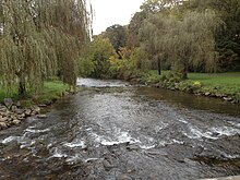
Emmaus is a borough in Lehigh County, Pennsylvania, United States. As of the 2020 U.S. census, it had a population of 11,652. Emmaus is located in the Lehigh Valley, the third-largest metropolitan area in Pennsylvania and 68th-largest metropolitan area in the nation.

<span class="mw-page-title-main">Hanover Township, Lehigh County, Pennsylvania</span> Township in Pennsylvania, United States

Hanover Township is a township in Lehigh County, Pennsylvania, United States. As of the 2010 census, the township had a population of 1,571. It is a suburb of Allentown and Bethlehem and part of the Lehigh Valley metropolitan area, which had a population of 861,899 and was the 68th-most populous metropolitan area in the U.S. as of the 2020 census.

<span class="mw-page-title-main">Lower Macungie Township, Pennsylvania</span> Township in Pennsylvania, United States

Lower Macungie Township is a township in Lehigh County, Pennsylvania, United States. The township's population was 31,964 as of the 2020 census, making it the second-largest population center in Lehigh County after Allentown and the third-largest population center in the Lehigh Valley metropolitan area after Allentown and Bethlehem.

<span class="mw-page-title-main">North Whitehall Township, Pennsylvania</span> Township in Pennsylvania, United States

North Whitehall Township is a township in Lehigh County, Pennsylvania, United States. The population of North Whitehall Township was 15,655 at the 2020 census. It is a suburb of Allentown in the Lehigh Valley, which had a population of 861,899 and was the 68th-most populous metropolitan area in the U.S. as of the 2020 census.

<span class="mw-page-title-main">Salisbury Township, Lehigh County, Pennsylvania</span> Township in Pennsylvania, United States

Salisbury Township is a township in Lehigh County, Pennsylvania, United States. The township's population was 13,621 at the 2020 census. The township borders Allentown, Pennsylvania's third-largest city, Bethlehem, and Emmaus, in the Lehigh Valley, which had a population of 861,899 and was the 68th-most populous metropolitan area in the U.S. as of the 2020 census.

<span class="mw-page-title-main">South Whitehall Township, Pennsylvania</span> Township in Pennsylvania, United States

South Whitehall Township is a township in Lehigh County, Pennsylvania, United States. The township's population was 19,180 at the 2010 census. It is a suburb of Allentown and is part of the Lehigh Valley, which had a population of 861,899 and was the 68th-most populous metropolitan area in the U.S. as of the 2020 census.

<span class="mw-page-title-main">Upper Macungie Township, Pennsylvania</span> Township in Pennsylvania, United States

Upper Macungie Township is a township in Lehigh County, Pennsylvania, United States. The population of Upper Macungie Township was 26,377 as of the 2020 U.S. census, making it the fourth-fastest growing municipality of any category in Pennsylvania in terms of total population growth between 2010 and 2020.

<span class="mw-page-title-main">Upper Milford Township, Pennsylvania</span> Township in Pennsylvania, United States

Upper Milford Township is a township in Lehigh County, Pennsylvania, United States. The township's population was 7,292 at the 2010 census. Upper Milford Township is a rural area southwest of Allentown in the Lehigh Valley, which had a population of 861,899 and was the 68th-most populous metropolitan area in the U.S. as of the 2020 census.

<span class="mw-page-title-main">Whitehall Township, Pennsylvania</span> Township in Pennsylvania, United States

Whitehall Township is a township with home rule status in Lehigh County, Pennsylvania, United States. The township's population was 26,738 as of the 2010 census.

<span class="mw-page-title-main">Lehigh Township, Northampton County, Pennsylvania</span> Place in Pennsylvania, United States

Lehigh Township is a township in Northampton County, Pennsylvania, United States. The population of Lehigh Township was 10,526 as of the 2010 census. It is part of the Lehigh Valley metropolitan area, which had a population of 861,899 and was the 68th-most populous metropolitan area in the U.S. as of the 2020 census.

<span class="mw-page-title-main">Index of Pennsylvania-related articles</span>

The following is an alphabetical list of articles on people, places, and things related to Pennsylvania in the United States.

<span class="mw-page-title-main">Lehigh Valley</span> Metropolitan Statistical Area in the United States

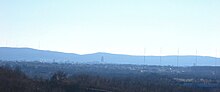
The Lehigh Valley is a geographic and metropolitan region formed by the Lehigh River in Lehigh and Northampton counties in eastern Pennsylvania. It is a component valley of the Great Appalachian Valley bounded to its north by Blue Mountain, to its south by South Mountain, to its west by Lebanon Valley, and to its east by the Delaware River and Warren County, New Jersey. The Lehigh Valley is about 40 miles (64 km) long and 20 miles (32 km) wide. The Lehigh Valley's largest city is Allentown, the third-largest city in Pennsylvania and the county seat of Lehigh County, with a population of 125,845 residents as of the 2020 census.

<span class="mw-page-title-main">Breinigsville, Pennsylvania</span> Census-designated place in Pennsylvania, United States

Breinigsville is an unincorporated community and census-designated place (CDP) in Lehigh County, Pennsylvania. As of the 2020 census, it had a population of 7,495. The town is part of Upper Macungie Township and is located approximately 11 miles (18 km) southwest of downtown Allentown and 8 miles (13 km) east of Kutztown.

Cedar Crest Boulevard, colloquially known as Cedar Crest and The Boulevard, is a major north-south highway in Lehigh County, Pennsylvania in the Lehigh Valley region of eastern Pennsylvania. South of Interstate 78 (I-78), the road is part of Pennsylvania Route 29. North of it, the road becomes State Route 1019.

The Lehigh Valley Interscholastic Athletic Conference, known informally as the Lehigh Valley Conference or LVC, was an athletic conference consisting of 12 of the largest high schools from Lehigh and Northampton counties in the Lehigh Valley region of Pennsylvania. It was part of District XI of the Pennsylvania Interscholastic Athletic Association (PIAA). In 2014, its teams were mostly assimilated into the Eastern Pennsylvania Conference, an even larger 18-team league of the largest high schools in the Lehigh Valley and Pocono Mountains regions of eastern and northeastern Pennsylvania.

<span class="mw-page-title-main">Wescosville, Pennsylvania</span> Census-designated place in Pennsylvania, United States

Wescosville is a census-designated place located in Lehigh County, Pennsylvania. It is located between Allentown and Trexlertown in Lower Macungie Township. It is part of the Lehigh Valley, which had a population of 861,899 and was the 68th-most populous metropolitan area in the U.S. as of the 2020 census.

Pennsylvania State Senate District 14 includes parts of Lehigh County and Northampton County. It is currently represented by Democrat Nick Miller. Prior to the current reapportionment plan it was a Luzerne County seat that was moved to the Lehigh Valley to reflect long-term population shifts.

<span class="mw-page-title-main">Egypt, Pennsylvania</span> Census-designated place in Pennsylvania, United States

Egypt is an unincorporated community and census-designated place (CDP) in Whitehall Township in Lehigh County, Pennsylvania, United States. The population of Egypt was 2,588 as of the 2020 census.

<span class="mw-page-title-main">Cementon, Pennsylvania</span> Census-designated place in Pennsylvania, United States

Cementon is an unincorporated area and census-designated place (CDP) in Lehigh County, Pennsylvania. The town is in Whitehall Township, 7 miles (11 km) north of Allentown. As of the 2020 census, the population of Cementon was 1,657. Cementon is part of the Lehigh Valley metropolitan area, which had a population of 861,899 and was the 68th-most populous metropolitan area in the U.S. as of 2020. It uses the Whitehall Township ZIP Code of 18052.

Zach Mako is an American politician who has served in the Pennsylvania House of Representatives from the 183rd district since 2017.

References

  1. 1 2 Lehigh County at U.S. Census Quick Facts
  2. "Find a County". National Association of Counties. Retrieved June 7, 2011.
  3. "The Lehigh Valley is growing, census numbers show," Lehigh Valley Live, August 23, 2021
  4. Kraus, Scott (April 2, 2016). "Migration driving Lehigh Valley's recent population growth". The Morning Call. Retrieved May 17, 2017.
  5. 1 2 Shelter House official website, Shelterhouseemmaus.org, retrieved May 4, 2022
  6. 1 2 "Emmaus" at Lehigh Valley Marketplace
  7. Roberts, Charles R. (1936). "Place Names of Lehigh County and Their Origin". Proceedings: Lehigh County Historical Society. Lehigh County Historical Society.
  8. Farris, Jaccii. "Eagles to be returned to the top of Soldiers and Sailors Monument in Allentown". Wfmz.com. Retrieved September 11, 2022.
  9. "2010 Census Gazetteer Files". United States Census Bureau. August 22, 2012. Retrieved March 9, 2015.
  10. Miller, Benjamin LeRoy (1941). Lehigh County Pennsylvania: Geology and Geography. Harrisburg, Pennsylvania: Department of Internal Affairs, Commonwealth of Pennsylvania.
  11. "Normal Monthly Precipitation, Inches". Archived from the original on September 19, 2006. Retrieved November 4, 2006.
  12. "Snowfall – Average Total In Inches". Archived from the original on June 19, 2011. Retrieved November 4, 2006.
  13. "Average Days of Precipitation, .01 cm or more". Archived from the original on November 3, 2006. Retrieved November 4, 2006.
  14. "Average Monthly Precipitation". Archived from the original on September 19, 2006. Retrieved November 4, 2006.
  15. "NowData - NOAA Online Weather Data". National Oceanic and Atmospheric Administration . Retrieved May 11, 2021.
  16. "U.S. Decennial Census". United States Census Bureau. Retrieved March 9, 2015.
  17. "Historical Census Browser". University of Virginia Library. Retrieved March 9, 2015.
  18. Forstall, Richard L., ed. (March 24, 1995). "Population of Counties by Decennial Census: 1900 to 1990". United States Census Bureau. Retrieved March 9, 2015.
  19. "Census 2000 PHC-T-4. Ranking Tables for Counties: 1990 and 2000" (PDF). United States Census Bureau. April 2, 2001. Archived (PDF) from the original on October 9, 2022. Retrieved March 9, 2015.
  20. "State & County QuickFacts". United States Census Bureau. Archived from the original on June 6, 2011. Retrieved November 17, 2013.
  21. "The Lehigh Valley is growing, census numbers show" Lehigh Valley Live, August 23, 2021
  22. "P2 HISPANIC OR LATINO, AND NOT HISPANIC OR LATINO BY RACE – 2020: DEC Redistricting Data (PL 94-171) – Lehigh County, Pennsylvania". Data.census.gov.
  23. "Commonwealth of Pennsylvania 2021 Voter Registration Statistics - Official Primary Voting Analysis" (PDF). Dos.pa.gov. May 18, 2021. Archived (PDF) from the original on October 9, 2022. Retrieved November 7, 2022.
  24. "Election Results 2008: President Map". New York Times . November 21, 2008. Retrieved November 23, 2008.
  25. Leip, David. "Dave Leip's Atlas of U.S. Presidential Elections". uselectionatlas.org.
  26. 1 2 "Find Your Legislator". The official website for the Pennsylvania General Assembly. Legislativate Data Processing Center. Retrieved April 21, 2017.
  27. "Queen City Airport Designated General Aviation Airport of the Year by the Federal Administration Eastern Region". Lehigh Valley International Airport. Archived from the original on June 12, 2007. Retrieved June 22, 2007.
  28. "NANP-Overlay of 610 (Pennsylvania) Numbering Plan Area (NPA) with 484 NPA". Nanpa.com. (359 KB)
  29. "PUC reminds eastern and southern pa residents of uocoming activation of '835' area code". Puc.pa.gov. (20.8 KB)
  30. "Rollercoaster Database: Steel Force (Dorney Park & Wildwater Kingdom)". Rcdb.com. Retrieved July 10, 2008.
  31. "2010 U.S. Census website". United States Census Bureau . Retrieved July 10, 2016.

    40°37′N75°35′W / 40.61°N 75.59°W / 40.61; -75.59