List of Allentown neighborhoods

Last updated

Allentown, the largest city in the Lehigh Valley, the third-largest city in Pennsylvania, and county seat of Lehigh County in May 2010 Allentown.jpg
Allentown, the largest city in the Lehigh Valley, the third-largest city in Pennsylvania, and county seat of Lehigh County in May 2010

Allentown, Pennsylvania is the largest city in the Lehigh Valley, the third-largest city in Pennsylvania, and the county seat of Lehigh County. The city includes several neighborhoods, districts, and other places, though these neighborhoods and districts are only informally defined.

Contents

Center City

Center City Allentown in October 2020 2020 - Allentown CBD at Night - 11 - Allentown PA.jpg
Center City Allentown in October 2020
The 700 Block of Hamilton Street in Center City Allentown in January 2007 2007 - 700 Block Hamilton Street North Side.jpg
The 700 Block of Hamilton Street in Center City Allentown in January 2007
Jordan Creek in Allentown in January 2007 Jordan Creek Allentown.jpg
Jordan Creek in Allentown in January 2007

7th Street is a retail and residential corridor just north of Center City Allentown. It is Allentown's fastest growing commercial corridor and serves as the primary gateway to Allentown with new streetlights, planters, and waste receptacles. Neighborhood service establishments and family-owned ethnic restaurants dominate business on 7th Street. [1]

Downtown Allentown is the city’s central business district. It is home to PPL Corporation and various city, county, and federal government centers. While downtown is no longer considered the premier regional shopping destination of the Lehigh Valley, dozens of small businesses and several prominent restaurants and nightclubs. [2]

Downtown Allentown has been the beneficiary of the Neighborhood Improvement Zone (NIZ), a tax increment financing district that financed the construction of PPL Center at 7th and Hamilton streets and other Center City buildings. [3]

One of the anchors of downtown Allentown is its arts district between North 5th and North 6th Streets. The district is home to cultural arts and entertainment venues, including Allentown Art Museum, Allentown Symphony Hall, Baum School of Art, and others. [2]

This area, including Jordan Creek, is predominantly residential. It has historically had higher poverty rates than the surrounding neighborhoods. Prices of properties here are especially affordable, and in recent years it has been a magnet for working artists.

The Old Allentown Historic District was established on September 6, 1978, by City Ordinance #12314 and was certified by the Pennsylvania State Historical and Museum Commission on September 26, 1978. The neighborhood was laid out in the original plan for Allentown by order of William Allen in 1762, and developed as Allentown grew northward and westward. It includes a mix of Federal, Italianate, Eastlake, and Victorian housing styles.

Old Allentown now is also the home of the United Way's Allentown Promise Neighborhood initiative, modeled on the work of Geoffrey Canada and the Harlem Children's Zone. The Allentown Promise Neighborhood takes a systems approach to improving the academic performance and the college and career readiness of the children in its nine block area.

The Old Fairgrounds Historic District was established on July 8, 1981, by City Ordinance #12314 and was certified by the Pennsylvania State Historical and Museum Commission on September 9, 1981. The district takes its name from the use of the area as the Lehigh County Agricultural Society's fairgrounds from 1852-1888. After the society moved the Allentown Fairgrounds to its current location at 17th and Chew Streets, the land was auctioned off to developers. The area was developed with a mixture of architectural styles, but Victorian architecture is most common.

East-side

Coca-Cola Park in East Allentown, home of the Lehigh Valley IronPigs, the Triple A affiliate of the Philadelphia Phillies of Major League Baseball Cokepark allentown.jpg
Coca-Cola Park in East Allentown, home of the Lehigh Valley IronPigs, the Triple A affiliate of the Philadelphia Phillies of Major League Baseball

Mainly residential area located between East Hamilton Street and the Lehigh River.

A mix of both residential and industrial across the lower east-side of Allentown.

Residential area with mostly detached and relatively larger houses than those in Center City or surrounding areas.

A HOPE VI mixed income residential area containing privately managed low-income based rental housing as well as owner-occupied single and multi-family dwellings.

Not originally incorporated with the city, Rittersville is mainly residential, but has a small and recently remodelled shopping center. The neighborhood is the former home to the Allentown State Hospital, a recently demolished psychiatric hospital.

South-side

Little Lehigh Creek in Lehigh Parkway in Allentown in September 2012 Lehigh Parkway.JPG
Little Lehigh Creek in Lehigh Parkway in Allentown in September 2012

Alton Park is a largely residential areas with some forest and park land.

Public housing area in the southeast area of Allentown, off of East Susquehanna Street. Cumberland Gardens includes the area along the Jefferson Street corridor and Allentown Queen City Municipal Airport, an airport used predominantly for small privately-owned aircraft.

Named for the mountain that PA Route 145 travels over, this neighborhood is at the foot of the South Mountain. It contains a mix of businesses, industry, and residential areas. Mack Trucks' former global headquarters is located nearby.

The Wards

The 1st Ward was created under the name "Lehigh Ward" on August 30, 1852. It was the first section annexed to Allentown beyond the original boundaries of the city as established by city founder William Allen in 1762. The industrial sites near the Lehigh River were mostly abandoned by the turn of the 21st century and are now slowly undergoing redevelopment.

A residential area with a mix of cultures. Houses are spaced farther apart as one nears Allentown/Whitehall Township border.

The redevelopment will transform approximately 26 acres of abandoned industrial land along the west side of the Lehigh River into a unique and vibrant waterfront featuring offices, retail, restaurants, residential and other commercial uses. With its half mile of direct river frontage, it will be the only location of its kind in the Lehigh Valley to offer unparalleled views of and direct access to the Lehigh River.

West-end

Young people gather on 19th Street in Allentown's West End in July 2007 2007 - Nineteenth Street Theatre District.jpg
Young people gather on 19th Street in Allentown's West End in July 2007

Residential areas on the West End south of Cedar Creek Park.

Trexler Park is the area of Allentown west of Cedar Crest Boulevard, including the park itself.

Also known as the 19th Street Theatre District, this area is Allentown’s most promising mixed use neighborhood. Centered on the Civic Theatre of Allentown’s two venues on 19th Street, the West End Theatre District is home to nearly 140 businesses. Within close proximity are Muhlenberg College, Lehigh Valley Health Network’s 17th Street campus, and the Allentown Farmers Market. The opening of several boutique small businesses over the past several years has enhanced the neighborhood’s appeal as a specialty shopping destination.

Attractions such as historic Victorian and American Craftsman-style homes and a public park founded by Harry Clay Trexler in 1908 can be found here. West Park features a newly restored bandshell, where the Allentown Band and others can be heard throughout the summer.

The West End Pharmacy, Seward's Steak Shop, and the former Hersh's Market are located in this southwest Allentown neighborhood of West Walnut, known to its residents as Union Terrace and often colloquially referred to as UT. It is a small community of row homes, small apartment complexes, bungalow houses, and Victorian-style homes. Two public Allentown School District schools, Union Terrace Elementary School and Francis D. Raub Middle School, are located in the neighborhood.

Related Research Articles

<span class="mw-page-title-main">Lehigh County, Pennsylvania</span> County in Pennsylvania, United States

Lehigh County is a county in the Commonwealth of Pennsylvania. As of the 2020 census, the county's population was 374,557. Its county seat is Allentown, the state's third-largest city after Philadelphia and Pittsburgh.
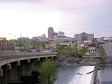
<span class="mw-page-title-main">Allentown, Pennsylvania</span> Home rule municipality in Pennsylvania, United States

Allentown is a city in the Commonwealth of Pennsylvania and the county seat of Lehigh County, in the United States. It is the third-most-populous city in Pennsylvania with a population of 125,845 as of the 2020 census and the largest city in the Lehigh Valley metropolitan area, which had a population of 861,899 and was the 68th-most populous metropolitan area in the nation as of 2020.

<span class="mw-page-title-main">South Whitehall Township, Pennsylvania</span> Township in Pennsylvania, United States

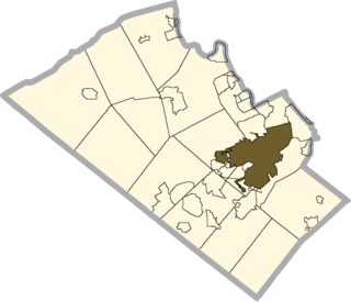
South Whitehall Township is a township in Lehigh County, Pennsylvania. The township's population was 19,180 at the 2010 census. It is a suburb of Allentown and is part of the Lehigh Valley, which had a population of 861,899 and was the 68th-most populous metropolitan area in the U.S. as of the 2020 census.

<span class="mw-page-title-main">U.S. Route 222</span> Highway in Maryland and Pennsylvania

U.S. Route 222 is a U.S. Highway that is a spur of US 22 in the states of Maryland and Pennsylvania. It runs for 95 miles (153 km) from US 1 in Conowingo, Maryland, north to the junction of Interstate 78 (I-78) and Pennsylvania Route 309 in Dorneyville, Pennsylvania. US 222 is almost entirely in Pennsylvania, and serves as the state's principal artery between the Lancaster and Reading areas in the west and the Lehigh Valley in the east.

<span class="mw-page-title-main">Pennsylvania Route 309</span> State highway in Pennsylvania, United States

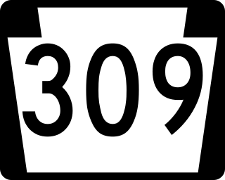
Pennsylvania Route 309 is a state highway that runs for 134 miles (216 km) through eastern Pennsylvania. The route runs from an interchange between PA 611 and Cheltenham Avenue on the border of Philadelphia and Cheltenham Township north to an intersection with PA 29 in Bowman Creek, a village in Monroe Township in Wyoming County. The highway connects Philadelphia and its northern suburbs to Allentown and the Lehigh Valley, and Hazleton and Wilkes-Barre in Wyoming Valley.

<span class="mw-page-title-main">Pennsylvania Route 145</span> State highway in Pennsylvania, US

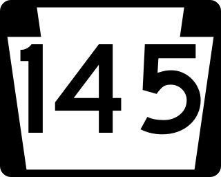
Pennsylvania Route 145 is a 20.89 mi (33.62 km) long north–south state highway in the Lehigh Valley area of eastern Pennsylvania. It connects Interstate 78 (I-78) and PA 309 in Lanark, Lehigh County, north to PA 248 in Lehigh Gap, Northampton County.

<span class="mw-page-title-main">Pennsylvania Route 329</span> State highway in Pennsylvania, US

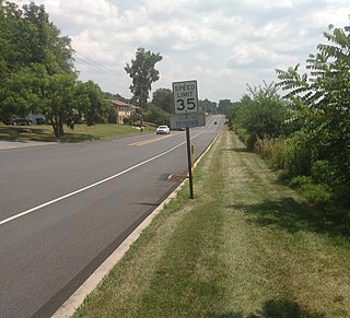
Pennsylvania Route 329 is a Pennsylvania state highway that runs for 12.9 miles (20.8 km) through Lehigh and Northampton counties in the Lehigh Valley region of the state. It runs from PA 873 in the North Whitehall Township village of Neffs east to PA 248 and PA 987 in Bath. The route is a two-lane undivided road that runs through a mix of rural and developed areas to the north of the cities of Allentown and Bethlehem, serving the communities of Balliettsville, Egypt, Cementon, and Northampton. PA 329 intersects PA 145 near Egypt and runs concurrent with PA 987 between East Allen Township and the eastern terminus in Bath.

<span class="mw-page-title-main">Pennsylvania Route 222</span> Highway in Pennsylvania

Pennsylvania Route 222 is a 4.482 mi (7.213 km)-long state highway located in Allentown and its surrounding suburbs in the Lehigh Valley region in eastern Pennsylvania.

Cedar Crest Boulevard, colloquially known as Cedar Crest and The Boulevard, is a major north-south highway in Lehigh County, Pennsylvania in the Lehigh Valley region of eastern Pennsylvania. South of Interstate 78 (I-78), the road is part of Pennsylvania Route 29. North of it, the road becomes State Route 1019.

<span class="mw-page-title-main">U.S. Route 22 in Pennsylvania</span> Highway in Pennsylvania

U.S. Route 22 (US 22) is an east–west United States Numbered Highway that stretches from Cincinnati, Ohio, in the west, to Newark, New Jersey, in the east. In Pennsylvania, the route runs for 338.20 miles (544.28 km) between the West Virginia state line in Washington County, where it is a freeway through the western suburbs of Pittsburgh, and then runs east to Easton and the Pennsylvania–New Jersey state line in the Lehigh Valley region of eastern Pennsylvania.

<span class="mw-page-title-main">State Route 1002 (Lehigh County, Pennsylvania)</span> Highway in Pennsylvania

State Route 1002(SR 1002), locally known as Tilghman Street and Union Boulevard, is a major 13.8 mi (22.2 km) long east–west road in the Lehigh Valley region of eastern Pennsylvania. The majority of the roadway is the former alignment of U.S. Route 22, maintained by the Pennsylvania Department of Transportation as a Quadrant Route, and is not signed except on small white segment markers.

The following is a list of neighborhoods and commercial districts in Sioux City, Iowa.

<span class="mw-page-title-main">Cetronia, Pennsylvania</span> Census-designated place in Pennsylvania, United States

Cetronia is a census-designated place (CDP) in South Whitehall Township in Lehigh County, Pennsylvania, located near Allentown. As of the 2020 census, its population was 2,421.

<span class="mw-page-title-main">Allentown School District</span> School district in Pennsylvania

The Allentown School District is a large, urban public school district located in Allentown, Pennsylvania in the Lehigh Valley region of eastern Pennsylvania. The district is the fourth-largest school district in Pennsylvania as of the 2016-17 academic year.

<span class="mw-page-title-main">Buildings and architecture of Allentown, Pennsylvania</span>

The buildings and architecture of Allentown, Pennsylvania reflect the city's history from its founding in 1762 through the present.

<span class="mw-page-title-main">Center City Allentown</span>

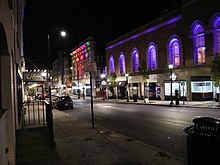
Center City Allentown is the downtown and central business district of Allentown, Pennsylvania, the third largest city in the U.S. state of Pennsylvania. It has a dense population and is currently undergoing an urban revitalization process.

The American Parkway is an arterial street in Allentown, Pennsylvania. The street connects Center City Allentown with Pennsylvania Route 987, U.S. Route 22, and Lehigh Valley International Airport.

<span class="mw-page-title-main">Allentown station (Central Railroad of New Jersey)</span> Defunct train station in Allentown, Pennsylvania

Allentown is a defunct train station in Allentown, Pennsylvania. It was constructed by the Central Railroad of New Jersey (CNJ) and Reading Railroad from 1888–1889. The station closed in 1967 with the cessation of CNJ passenger service. The station is located one block east of the Lehigh Valley Railroad's Allentown station.

<span class="mw-page-title-main">Trexler Nature Preserve</span> Park in Lehigh County, Pennsylvania (est. 2006)

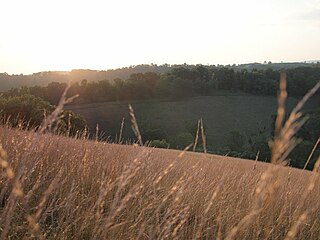
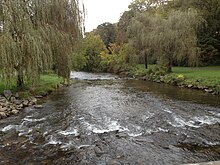
The Trexler Nature Preserve is an 1,108-acre county park (448 ha) owned and maintained by Lehigh County in the Lehigh Valley region of Pennsylvania. The preserve is situated in Lowhill Township and North Whitehall Township and the land that comprises the preserve was originally purchased between 1901 and 1911 by local industrialist General Harry Clay Trexler.

References

  1. 7th Street Allentown
  2. 1 2 "Community Planning". Allentownpa.gov. Retrieved 2013-04-02.
  3. "Neighborhood Improvement Zone".