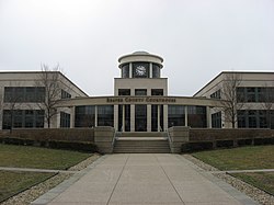
Beaver County | |
---|---|
Motto(s): Divided by its Rivers, United by its People [1] | |
Coordinates: 40°41′N80°21′W / 40.69°N 80.35°W | |
Country | United States |
State | Pennsylvania |
Founded | March 12, 1800 |
Named for | Beaver River |
Seat | Beaver |
Largest city | Aliquippa |
Area | |
• Total | 444 sq mi (1,150 km2) |
• Land | 435 sq mi (1,130 km2) |
• Water | 9.3 sq mi (24 km2) 2.1% |
Population (2020) | |
• Total | 168,215 |
• Estimate (2023) | 165,677 |
• Density | 380/sq mi (150/km2) |
Time zone | UTC−5 (Eastern) |
• Summer (DST) | UTC−4 (EDT) |
Congressional district | 17th |
Website | www |
Designated | July 5, 1982 [2] |
Beaver County is a county in the Commonwealth of Pennsylvania. As of the 2020 census, the population was 168,215. [3] Its county seat is Beaver, and its largest city is Aliquippa. [4] The county is part of the Greater Pittsburgh region of the state. [a]
Beaver County was created on March 12, 1800, from parts of Allegheny and Washington counties. [5] It took its name from the Beaver River. [6]
The original townships at the date of the erection of Beaver County (1800) were North Beaver, east and west of the Big Beaver Creek; South Beaver, west of the Big Beaver; and Sewickley, east of the Big Beaver—all north of the Ohio River; and Hanover, First Moon, and Second Moon, south of the Ohio. [7]
According to the U.S. Census Bureau, the county has a total area of 444 square miles (1,150 km2), of which 435 square miles (1,130 km2) is land and 9.3 square miles (24 km2) (2.1%) is water. [8] It has a humid continental climate (Dfa/Dfb) and average monthly temperatures in the Beaver/Rochester vicinity range from 29.4 °F in January to 73.2 °F in July. [9] Beaver County is one of the 423 counties served by the Appalachian Regional Commission, [10] and it is identified as part of the "Midlands" by Colin Woodard in his book American Nations: A History of the Eleven Rival Regional Cultures of North America . [11]
Census | Pop. | Note | %± |
---|---|---|---|
1800 | 5,776 | — | |
1810 | 12,168 | 110.7% | |
1820 | 15,340 | 26.1% | |
1830 | 24,183 | 57.6% | |
1840 | 29,368 | 21.4% | |
1850 | 26,689 | −9.1% | |
1860 | 29,140 | 9.2% | |
1870 | 36,148 | 24.0% | |
1880 | 39,605 | 9.6% | |
1890 | 50,077 | 26.4% | |
1900 | 56,432 | 12.7% | |
1910 | 78,253 | 38.7% | |
1920 | 111,621 | 42.6% | |
1930 | 149,062 | 33.5% | |
1940 | 156,754 | 5.2% | |
1950 | 175,192 | 11.8% | |
1960 | 206,948 | 18.1% | |
1970 | 208,418 | 0.7% | |
1980 | 204,441 | −1.9% | |
1990 | 186,093 | −9.0% | |
2000 | 181,412 | −2.5% | |
2010 | 170,539 | −6.0% | |
2020 | 168,215 | −1.4% | |
2022 (est.) | 165,677 | −1.5% | |
[12] |
As of the census [13] of 2000, there were 181,412 people, 72,576 households, and 50,512 families residing in the county. The population density was 418 inhabitants per square mile (161/km2). There were 77,765 housing units at an average density of 179 units per square mile (69/km2). The racial makeup of the county was 92.55% White, 5.96% Black or African American, 0.10% Native American, 0.25% Asian, 0.01% Pacific Islander, 0.20% from other races, and 0.92% from two or more races. 0.72% of the population were Hispanic or Latino of any race. 23.0% were of German, 17.4% Italian, 9.9% Irish, 6.5% English, 6.4% Polish and 5.8% American ancestry.
There were 72,576 households, out of which 28.60% had children under the age of 18 living with them, 54.50% were married couples living together, 11.40% had a female householder with no husband present, and 30.40% were non-families. Of all households 26.90% were made up of individuals, and 13.10% had someone living alone who was 65 years of age or older. The average household size was 2.44 and the average family size was 2.96.
In the county, the age distribution of the population shows 22.60% under the age of 18, 7.40% from 18 to 24, 27.30% from 25 to 44, 24.20% from 45 to 64, and 18.40% who were 65 years of age or older. The median age was 41 years. For every 100 females, there were 91.90 males. For every 100 females age 18 and over, there were 88.20 males.
Race | Num. | Perc. |
---|---|---|
White (NH) | 143,881 | 85.53% |
Black or African American (NH) | 11,069 | 6.6% |
Native American (NH) | 195 | 0.12% |
Asian (NH) | 1,022 | 0.61% |
Pacific Islander (NH) | 53 | 0.03% |
Other/Mixed (NH) | 8,384 | 5% |
Hispanic or Latino | 3,611 | 2.15% |
Year | Republican | Democratic | Third party(ies) | |||
---|---|---|---|---|---|---|
No. | % | No. | % | No. | % | |
2024 | 56,837 | 59.71% | 37,196 | 39.07% | 1,161 | 1.22% |
2020 | 54,759 | 58.01% | 38,122 | 40.38% | 1,516 | 1.61% |
2016 | 48,167 | 57.03% | 32,531 | 38.52% | 3,764 | 4.46% |
2012 | 42,344 | 52.41% | 37,055 | 45.86% | 1,394 | 1.73% |
2008 | 42,895 | 50.45% | 40,499 | 47.63% | 1,638 | 1.93% |
2004 | 39,916 | 48.36% | 42,146 | 51.06% | 481 | 0.58% |
2000 | 32,491 | 44.12% | 38,925 | 52.85% | 2,233 | 3.03% |
1996 | 26,048 | 35.07% | 39,578 | 53.28% | 8,653 | 11.65% |
1992 | 21,361 | 25.94% | 44,877 | 54.50% | 16,102 | 19.56% |
1988 | 25,764 | 33.69% | 50,327 | 65.81% | 378 | 0.49% |
1984 | 32,052 | 36.79% | 54,765 | 62.86% | 300 | 0.34% |
1980 | 30,496 | 38.23% | 43,955 | 55.11% | 5,314 | 6.66% |
1976 | 33,593 | 41.40% | 46,117 | 56.83% | 1,440 | 1.77% |
1972 | 43,637 | 56.42% | 31,570 | 40.82% | 2,130 | 2.75% |
1968 | 28,264 | 34.46% | 45,396 | 55.34% | 8,368 | 10.20% |
1964 | 23,174 | 27.59% | 60,492 | 72.02% | 327 | 0.39% |
1960 | 36,796 | 43.71% | 47,182 | 56.04% | 212 | 0.25% |
1956 | 38,263 | 51.21% | 36,373 | 48.68% | 79 | 0.11% |
1952 | 31,700 | 45.18% | 38,136 | 54.35% | 334 | 0.48% |
1948 | 22,324 | 43.83% | 26,629 | 52.28% | 1,983 | 3.89% |
1944 | 23,555 | 41.57% | 32,743 | 57.79% | 360 | 0.64% |
1940 | 24,324 | 41.78% | 33,609 | 57.73% | 282 | 0.48% |
1936 | 20,223 | 34.68% | 37,205 | 63.80% | 884 | 1.52% |
1932 | 19,751 | 47.87% | 19,805 | 48.00% | 1,704 | 4.13% |
1928 | 27,949 | 69.50% | 11,868 | 29.51% | 400 | 0.99% |
1924 | 16,768 | 64.14% | 3,220 | 12.32% | 6,153 | 23.54% |
1920 | 11,691 | 62.90% | 4,771 | 25.67% | 2,124 | 11.43% |
1916 | 6,864 | 48.67% | 5,805 | 41.16% | 1,434 | 10.17% |
1912 | 2,759 | 21.89% | 3,037 | 24.10% | 6,806 | 54.01% |
1908 | 7,008 | 55.95% | 4,200 | 33.53% | 1,318 | 10.52% |
1904 | 7,122 | 68.88% | 2,342 | 22.65% | 876 | 8.47% |
1900 | 6,759 | 60.11% | 4,076 | 36.25% | 409 | 3.64% |
1896 | 6,842 | 59.95% | 4,322 | 37.87% | 248 | 2.17% |
1892 | 4,890 | 52.04% | 3,822 | 40.68% | 684 | 7.28% |
1888 | 5,552 | 58.23% | 3,706 | 38.87% | 276 | 2.89% |
1884 | 5,075 | 56.51% | 3,546 | 39.48% | 360 | 4.01% |
1880 | 4,700 | 56.40% | 3,498 | 41.97% | 136 | 1.63% |
In November 2008, there were 118,269 registered voters in Beaver County. [16]
By April 2016, there were 109,091 registered voters, a decrease of 7.7% since 2008.
The county is divided into 129 precincts. [17]
As of January 8, 2024, there were 111,767 registered voters in Beaver county. Republicans hold a plurality of voters by a margin of just 190 voters (less than 1% of the total registered), after overtaking Dems at the end of December 2023. There were 48,229 registered Republicans, 48,039 registered Democrats, 10,390 registered non-affiliated voters and 5,109 voters registered to other parties. [18]
Voter registration and party enrollment | |||||
---|---|---|---|---|---|
Party | Number of voters | Percentage | |||
Republican | 51,030 | 43.15% | |||
Democratic | 48,008 | 42.98% | |||
Independent | 10,390 | 9.30% | |||
Third Party | 5,109 | 4.57% | |||
Total | 111,767 | 100% |
Beaver County used to be a Democratic stronghold, and had a slight Democratic edge in registration until 2023. [19] In 2015, the GOP took majority status in the Commissioners' Office for the first time since 1955. In 2004, Democrat John Kerry won Beaver County over Republican George W. Bush 51% to 48%. In 2008, Republican John McCain defeated Democrat Barack Obama 50% to 47%, becoming the first Republican to win there since 1972 and only the third since 1928. Mitt Romney and Donald Trump (twice) carried the county in the next three elections. In 2010, Republican Governor Tom Corbett and Republican Senator Pat Toomey both carried Beaver in their successful statewide bids, and Toomey won the county again in 2016. However, Democrats have still seen recent success in Beaver County in non-presidential races, with Democrats often being competitive in the county in Senate and gubernatorial elections. Beaver County voted for Bob Casey Jr. in his reelection bid in 2012 50% to 47%, and again voted to re-elect Casey in 2018, as well as Democrat Tom Wolf.
In 2022, Democratic gubernatorial candidate Josh Shapiro defeated Republican Doug Mastriano in the county, but was the only Democrat that cycle to do so.
Commissioner [20] | Party | Title |
---|---|---|
Daniel C. Camp III [21] | Republican | Chairman |
Tony Amadio [22] | Democratic | |
Jack Manning [23] | Republican | |
Office | Official | Party |
---|---|---|
Clerk of Courts | Judy R. Enslen [24] | Democratic |
Controller | Maria Longo [25] | Republican |
Coroner | Trent Liptak | Republican |
District Attorney | Nathan Bible | Democratic |
Prothonotary | Jodi Janicki-Jones [26] | Republican |
Recorder of Deeds | Ronald Alberti [27] | Republican |
Register of Wills | Tracey Antoline Patton [28] | Democratic |
Sheriff | Tony Guy | Republican |
Treasurer | Sandie Egley [29] | Republican |
District | Representative | Party |
---|---|---|
14 | Jim Marshall | Republican |
15 | Josh Kail | Republican |
16 | Robert Matzie | Democratic |
District | Senator | Party |
---|---|---|
46 | Camera Bartolotta | Republican |
47 | Elder Vogel | Republican |
District | Representative | Party |
---|---|---|
17 | Chris Deluzio | Democratic |
Senator | Party |
---|---|
Bob Casey Jr. | Democratic |
John Fetterman | Democratic |
Near Koppel there is Buttermilk Falls, a naturally occurring waterfall. [30] In Brighton Township there is Brady's Run Park. [31] Racoon Creek State Park is one of Pennsylvania's largest and most visited state parks.[ citation needed ] The park encompasses 7,572 acres (3,064 ha) and features the 101 acres (41 ha) Raccoon Lake. Additionally, there are many riverfront parks throughout the county. The North Country National Scenic Trail (NCT) passes through the county's northern end. The NCT has an 11-mile point-to-point off-road section near Darlington to the Ohio state line and a 2.5 mile off-road section near New Galilee and Enon Valley, Pennsylvania. [32]
As reported by the Pennsylvania Department of Education – EdNA, as of April 2010.
In 2009, Center Area School District and Monaca School District merged to form Central Valley School District.
Under Pennsylvania law, there are four types of incorporated municipalities: cities, boroughs, townships, and, in at most two cases, towns. The following cities, boroughs and townships are in Beaver County:
The population ranking of the following table is based on the 2010 census of Beaver County. [35]
†county seat
Rank | City/town/etc. | Population (2010 Census) | Municipal type | Incorporated |
---|---|---|---|---|
1 | Aliquippa | 9,438 | City | 1928 (borough) 1987 (city) |
2 | Beaver Falls | 8,987 | City | 1868 (borough) 1928 (city) |
3 | Economy | 8,970 | Borough | 1957 |
4 | Ellwood City (mostly in Lawrence County) | 7,921 | Borough | |
5 | Ambridge | 7,050 | Borough | 1905 |
6 | New Brighton | 6,025 | Borough | 1838 |
7 | Monaca | 5,737 | Borough | 1840 |
8 | † Beaver | 4,531 | Borough | 1802 |
9 | Baden | 4,135 | Borough | 1868 |
10 | Rochester | 3,657 | Borough | 1849 |
11 | Ohioville | 3,533 | Borough | 1860 |
12 | Harmony Township | 3,197 | CDP and township | 1851 |
13 | Patterson Township | 3,029 | CDP and township | 1845 |
14 | Midland | 2,635 | Borough | 1906 |
15 | Conway | 2,176 | Borough | 1902 |
16 | Big Beaver | 1,970 | Borough | 1858 |
17 | Industry | 1,835 | Borough | 1960 |
18 | Freedom | 1,569 | Borough | 1838 |
19 | West Mayfield | 1,239 | Borough | 1923 |
20 | Koppel | 762 | Borough | 1910 |
21 | Bridgewater | 704 | Borough | 1835 |
22 | Patterson Heights | 636 | Borough | 1899 |
23 | East Rochester | 567 | Borough | 1908 |
24 | South Heights | 475 | Borough | 1910 |
25 | New Galilee | 379 | Borough | 1854 |
26 | Fallston | 266 | Borough | 1829 |
27 | Darlington | 254 | Borough | 1820 |
28 | Eastvale | 225 | Borough | 1892 |
29 | Shippingport | 214 | Borough | 1910 |
30 | Georgetown | 174 | Borough | 1850 |
31 | Hookstown | 147 | Borough | 1843 |
32 | Frankfort Springs | 130 | Borough | 1844 |
33 | Homewood | 109 | Borough | 1910 |
34 | Glasgow | 60 | Borough | 1854 |
Allegheny County is a county in Pennsylvania, United States. As of the 2020 census, the population was 1,250,578, making it the state's second-most populous county, after Philadelphia County. Its county seat and most populous city is Pittsburgh, Pennsylvania's second most populous city. The county is part of the Greater Pittsburgh region of the commonwealth, and is the center of the Pittsburgh media market.
Armstrong County is a county in the Commonwealth of Pennsylvania. As of the 2020 census, the population was 65,558. The county seat is Kittanning. The county was organized on March 12, 1800, from parts of Allegheny, Westmoreland and Lycoming Counties. It was named in honor of John Armstrong, who represented Pennsylvania in the Continental Congress and served as a major general during the Revolutionary War.
Westmoreland County is a county in the Commonwealth of Pennsylvania, United States, located in the Pittsburgh Metropolitan Statistical Area. As of the 2020 census, the population was 354,663. The county seat is Greensburg and the most populous community is Hempfield Township. It is named after Westmorland, a historic county of England. The county is part of the Southwest Pennsylvania region of the state.
Washington County is a county in the Commonwealth of Pennsylvania, United States. As of the 2020 census, the population was 209,349. Its county seat is Washington. The county is part of the Greater Pittsburgh region of the state. The county is home to Washington County Airport, three miles (4.8 km) southwest of Washington.
Mercer County is a county in the Commonwealth of Pennsylvania. As of the 2020 census, the population was 110,652. Its county seat is Mercer, and its largest city is Hermitage. The county is part of the Northwest Pennsylvania region of the state.
Indiana County is a county in the Commonwealth of Pennsylvania. It is located in the west central part of Pennsylvania. As of the 2020 census, the population was 83,246. Its county seat is Indiana. Indiana County comprises the Indiana, PA Micropolitan Statistical Area, which is also included in the Pittsburgh-New Castle-Weirton, PA-WV-OH Combined Statistical Area. The county is part of the Southwest Pennsylvania region of the state.
Leet Township is a township in Allegheny County, Pennsylvania, United States. The population was 1,620 at the 2020 census. Leet Township includes the neighborhood of Fair Oaks and Leet Township's fire department includes the name "Fair Oaks Volunteer Fire Department".
Moon Township is a township in Allegheny County, Pennsylvania, United States, along the Ohio River. The population was 27,261 at the 2020 census. Located 12 miles (19 km) northwest of Pittsburgh, the township is part of the Pittsburgh metropolitan area and is home to Pittsburgh International Airport.
Sewickley is a borough in Allegheny County, Pennsylvania, United States, 12 miles (19 km) west northwest of Pittsburgh along the Ohio River. It is a residential suburb of the Pittsburgh metropolitan area. The population was 3,907 at the 2020 census. The Sewickley Bridge crosses the Ohio River from Sewickley to Moon Township.
Aliquippa is a city in Beaver County, Pennsylvania, United States, along the Ohio River. The population was 9,238 at the 2020 census. It is located 18 miles (29 km) northwest of Pittsburgh and is part of the Pittsburgh metropolitan area.
Ambridge is a borough in Beaver County, Pennsylvania, United States. Incorporated in 1905 as a company town by the American Bridge Company, Ambridge is located 16 miles (25 km) northwest of Pittsburgh, along the Ohio River. The population was 6,972 at the 2020 census.
Hopewell Township is a township in Beaver County, Pennsylvania, United States. The population was 13,506 at the 2020 census. A suburb of Pittsburgh, it is part of the Pittsburgh metropolitan area. The township shares the ZIP Code of nearby Aliquippa.
North Sewickley Township is a township in Beaver County, Pennsylvania, United States. The population was 5,496 at the 2020 census. It is part of the Pittsburgh metropolitan area.
The Allegheny County Belt System color codes various county roads to form a unique system of routes in Allegheny County, Pennsylvania, and around the city of Pittsburgh.
The Western Pennsylvania Interscholastic Athletic League is an interscholastic athletic association in Western Pennsylvania. It is District 7 of the Pennsylvania Interscholastic Athletic Association.
Pennsylvania Route 65 is a major 51-mile-long (82 km) state highway located in western Pennsylvania, United States. The route, traveling north–south from the Interstate 279/U.S. Route 19 Truck concurrency in Pittsburgh north to the PA 108/PA 168 concurrency in New Castle, connects downtown Pittsburgh to the northwestern portion of the Pittsburgh Metropolitan Area. PA 65 is similar in its purpose to PA 18 and PA 51, both of which run parallel to PA 65 at one point or another; however, the three routes pass through different cities for most of their respective alignments.
Pennsylvania State Senate District 47 includes parts of Beaver County, Butler County, and Lawrence County. It is currently represented by Republican Elder Vogel.
The 16th Pennsylvania House of Representatives District is in southwest Pennsylvania and has been represented by Democrat Robert Matzie since 2009.
The Beaver County Transportation Authority (BCTA) is the operator of mass transportation in Beaver County, Pennsylvania. Seven routes are provided, all of which serve the southern and central portions of the county, which are incorporated into suburban Pittsburgh. In 2023, the system had a ridership of 478,200, or about 7,900 per weekday as of the third quarter of 2024.
Lawrence County is a county in the Commonwealth of Pennsylvania. As of the 2020 census, the population was 86,070. The county seat and largest city is New Castle.