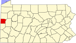
Wurtemburg, Pennsylvania | |
|---|---|
| Coordinates: 40°51′21.6″N80°15′3.6″W / 40.856000°N 80.251000°W | |
| Country | United States |
| State | Pennsylvania |
| County | Beaver and Lawrence |
| Township | Franklin and Perry |
| Area | |
• Total | 1.527 km2 (0.5895 sq mi) |
| • Land | 1.500 km2 (0.5790 sq mi) |
| • Water | 0.041 km2 (0.0160 sq mi) |
| Elevation | 270 m (886 ft) |
| Time zone | UTC-5 (Eastern (EST)) |
| • Summer (DST) | UTC-4 (EDT) |
| FIPS code | 4286648 [1] |
| GNIS feature ID | 2830944 [2] |
Wurtemburg is an unincorporated community and census designated place (CDP) in Franklin Township, Beaver County, Pennsylvania and Perry Township, Lawrence County, Pennsylvania. [2]


