Chewton, Pennsylvania | |
|---|---|
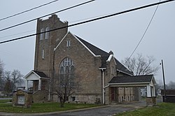 Chewton Christian Church | |
 Chewton  Chewton | |
| Coordinates: 40°53′21″N80°19′33″W / 40.88917°N 80.32583°W | |
| Country | United States |
| State | Pennsylvania |
| County | Lawrence |
| Township | Wayne |
| Area | |
• Total | 1.51 sq mi (3.91 km2) |
| • Land | 1.49 sq mi (3.87 km2) |
| • Water | 0.02 sq mi (0.04 km2) |
| Elevation | 910 ft (280 m) |
| Population | |
• Total | 395 |
| • Density | 264.39/sq mi (102.07/km2) |
| Time zone | UTC-4 (EST) |
| • Summer (DST) | UTC-5 (EDT) |
| Area code | 724 |
| FIPS code | 42-13408 |
| GNIS feature ID | 1171765 |
Chewton is an unincorporated community and census-designated place (CDP) in Lawrence County, Pennsylvania, United States. The population was 395 at the 2020 census. [3]

