Allegheny County is a county in Pennsylvania, United States. As of the 2020 census, the population was 1,250,578, making it the state's second-most populous county, after Philadelphia County. Its county seat and most populous city is Pittsburgh, Pennsylvania's second most populous city. The county is part of the Greater Pittsburgh region of the commonwealth, and is the center of the Pittsburgh media market.

Buffalo Township is a township in Butler County, Pennsylvania, United States. The population was 7,896 at the 2020 census.

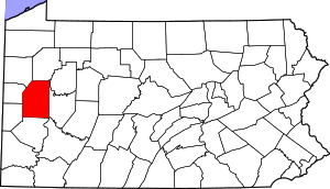
Butler is a city and the county seat of Butler County, Pennsylvania, United States. It is 35 miles (56 km) north of Pittsburgh and part of the Greater Pittsburgh region. As of the 2020 census, the population was 13,502.

Butler Township is a township in Butler County, Pennsylvania, United States. The population was 17,230 at the 2020 census. The township was first settled by Europeans in 1795. It was established as a township in 1804 and as a first class township in 1922.

Clinton Township is a township in Butler County, Pennsylvania, United States. The population was 2,913 at the 2020 census. For generations, it was home to a U.S. Steel plant.

Franklin Township is a township in Butler County, Pennsylvania, United States. The population was 2,596 at the 2020 census.

Portersville is a borough in Butler County, Pennsylvania, United States. The population was 235 at the 2010 census.
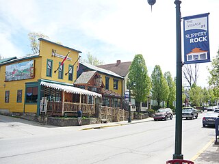
Slippery Rock is a borough in Butler County, Pennsylvania. The population was 3,081 at the 2020 census. Slippery Rock is included in the Greater Pittsburgh Region. The area is home to Slippery Rock University of Pennsylvania, partially in the borough limits, and attended by nearly 9,000 students as a member of the Pennsylvania State System of Higher Education.

Slippery Rock Creek is a stream in western Pennsylvania, a tributary of Connoquenessing Creek.

Moraine State Park is a Pennsylvania state park on 16,725 acres (6,768 ha) in Brady, Clay, Franklin, Muddy Creek, and Worth townships in Butler County, Pennsylvania.

McConnells Mill State Park is a 2,546 acres (1,030 ha) Pennsylvania state park in Perry and Slippery Rock Townships, Lawrence County, Pennsylvania in the United States. The park features a deep scenic gorge with the restored watermill and a covered bridge at the bottom, accessible by a roadway that winds between large, room-sized boulders on the hillside. McConnells Mill State Park is along the Slippery Rock Creek. just southwest of the intersection of US 422 and US 19.

Greater Pittsburgh is the metropolitan area surrounding the city of Pittsburgh in Western Pennsylvania, United States. The region includes Allegheny County, Pittsburgh's urban core county and economic hub, and seven adjacent Pennsylvania counties: Armstrong, Beaver, Butler, Fayette, Lawrence, Washington, and Westmoreland in Western Pennsylvania, which constitutes the Pittsburgh, PA Metropolitan Statistical Area MSA as defined by the U.S. Office of Management and Budget.
Muddy Creek is a tributary of Slippery Rock Creek in Butler and Lawrence Counties in Pennsylvania in the United States. The run is 23.2 miles (37.3 km) long, flows generally west, and its watershed is 58.2 square miles (150.7 km2) in area. Muddy Creek is the main water source for Lake Arthur in Moraine State Park.
Pennsylvania House of Representatives District 8 is located in Western Pennsylvania and has been represented by Republican Aaron Bernstine since 2023.

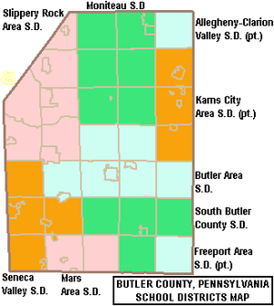
Slippery Rock Area School District is a school district in Slippery Rock, Pennsylvania, U.S.A.

Pennsylvania Route 488 is a 17-mile-long (27 km) state highway located in Lawrence and Butler counties in Pennsylvania. The western terminus is at PA 65/PA 288 in Ellwood City. The eastern terminus is at U.S. Route 422 in Moraine State Park.
Pennsylvania State Senate District 21 includes parts of Butler County and Erie County and all of Clarion County, Forest County, Venango County, and Warren County. It is currently represented by Republican Scott Hutchinson.
The 17th Pennsylvania House of Representatives District is located in western Pennsylvania and has been represented by Republican Timothy R. Bonner since 2023.

Lawrence County is a county in the Commonwealth of Pennsylvania. As of the 2020 census, the population was 86,070. The county seat and largest city is New Castle.
Lake Arthur Estates is a census-designated place and mobile home court located in Muddy Creek Township, Butler County, in the U.S. state of Pennsylvania. Located near the intersections of I-79 and US 422, the village is situated west of Lake Arthur, a reservoir on Muddy Creek. The community is also just west of Moraine State Park, which surrounds the lake. As of the 2010 census the population was 594.