This article relies largely or entirely on a single source .(March 2023) |

Pennsylvania is the fifth-most populous state in the United States. Regions of Pennsylvania include:
Contents
- Lehigh Valley
- Southeastern Pennsylvania
- Delaware Valley
- Pennsylvania Piedmont
- Pennsylvania Dutch Country
- Northeastern Pennsylvania
- Northeastern Pennsylvania 2
- Poconos
- Coal Region
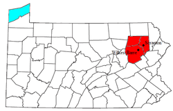
- Wyoming Valley
- Endless Mountains
- Northern Tier
- Central Pennsylvania
- Susquehanna River Valley
- South Central Pennsylvania
- Southern Alleghenies (West Central)
- Happy Valley
- Cumberland Valley
- Western Pennsylvania
- Laurel Highlands
- Greater Pittsburgh
- Allegheny National Forest
- Northwestern Pennsylvania
- References