McVille Airport

Last updated
McVille Airport
Hangar at McVille Airport, Armstrong County, Pennsylvania.jpg
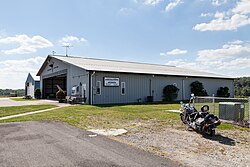
Hangars in September 2015
Summary
Airport typePublic
OwnerTheodore & Thomas Kijowski
Serves Freeport, Pennsylvania
Elevation  AMSL 1,090 ft / 332 m
Coordinates 40°44′00″N079°35′59″W / 40.73333°N 79.59972°W / 40.73333; -79.59972
Map
USA Pennsylvania location map.svg
Airplane silhouette.svg
6P7
Location of airport in Pennsylvania
Usa edcp location map.svg
Airplane silhouette.svg
6P7
6P7 (the United States)
Runways
Direction LengthSurface
ftm
14/322,800854Asphalt
Statistics (2007)
Aircraft operations11,010
Based aircraft56

McVille Airport( FAA LID : 6P7) is a privately owned, public use airport located six nautical miles (11 km) northeast of the central business district of Freeport, a borough in Armstrong County, Pennsylvania, United States. [1]

Contents

Facilities and aircraft

Aerial photograph of the airport at 1000ft above the ground McVille Airport aerial shot 01.jpg
Aerial photograph of the airport at 1000ft above the ground

McVille Airport covers an area of 100 acres (40 ha) at an elevation of 1,090 feet (332 m) above mean sea level. It has one runway with asphalt surface: 14/32 is 2,800 by 60 feet (854 x 18 m). [1]

For the 12-month period ending April 30, 2007, the airport had 11,010 aircraft operations, an average of 30 per day: 99.9% general aviation and 0.1% military. At that time there were 56 aircraft based at this airport: 95% single-engine, 4% multi-engine and 2% ultralight. [1]

See also

Related Research Articles

<span class="mw-page-title-main">Arnold Palmer Regional Airport</span> Airport in Pennsylvania

Arnold Palmer Regional Airport is in Westmoreland County, Pennsylvania, United States, two miles (3 km) southwest of Latrobe and about 33 miles (53 km) southeast of Pittsburgh. It was formerly Westmoreland County Airport; it was renamed in September 1999 for Arnold Palmer as part of his 70th birthday celebration. Palmer learned to fly at the airport, and the dedication ceremony included Governor Tom Ridge and a flyover of three A-10s of the Pennsylvania Air National Guard.

Rostraver Airport is a public use airport in Westmoreland County, Pennsylvania, United States.

Williston Municipal Airport is a city-owned, public-use airport located two nautical miles (4 km) southwest of the central business district of Williston, a city in Levy County, Florida, United States. Commonly referred to as Williston Airport, it is located 23 miles (37 km) southwest of Gainesville Regional Airport (GNV). Opened in 1974 for public use, it does not have a control tower.

Schuylkill County Airport, also known as Schuylkill County Joe Zerbey Airport, is a public use airport located eight nautical miles west of the central business district of Pottsville, a city in Schuylkill County, Pennsylvania, United States. It is owned by the Schuylkill County Airport Authority. This airport is included in the National Plan of Integrated Airport Systems for 2011–2015, which categorized it as a general aviation facility.

<span class="mw-page-title-main">Gustavus Airport</span> Airport

Gustavus Airport is a state-owned public-use airport located in Gustavus, a city in the Hoonah-Angoon Census Area of the U.S. state of Alaska. Scheduled airline service is subsidized by the Essential Air Service program.

<span class="mw-page-title-main">Gulkana Airport</span> Airport

Gulkana Airport is a state owned, public use airport located four nautical miles northeast of the central business district of Gulkana, in the Valdez-Cordova Census Area of the U.S. state of Alaska. It is also and five miles (8 km) northeast of Glenallen. Scheduled passenger service is subsidized by the Essential Air Service program.

Hazleton Regional Airport is a public airport two miles northwest of Hazleton, in Luzerne County, Pennsylvania.

<span class="mw-page-title-main">William T. Piper Memorial Airport</span> Airport

William T. Piper Memorial Airport is a city-owned public airport two miles east of Lock Haven, in Clinton County, Pennsylvania. The National Plan of Integrated Airport Systems for 2011–2015 categorized it as a general aviation facility.

Quakertown Airport is a public airport in Bucks County, Pennsylvania, owned by the Bucks County Airport Authority. It is two miles west of Quakertown, Pennsylvania and was dedicated on 22 January 1965. It is home to the Civil Air Patrol Squadron 904.

<span class="mw-page-title-main">Pittsburgh Northeast Airport</span> Airport in the US

Pittsburgh Northeast Airport is a privately owned, public use airport in Allegheny County, Pennsylvania, United States. The airport is located 12 nautical miles north-northeast of the central business district of Pittsburgh, in West Deer Township. The airport is located a few miles north of Pittsburgh Mills shopping mall.

<span class="mw-page-title-main">Zelienople Municipal Airport</span> Airport in Fombell, Pennsylvania, US

Zelienople Municipal Airport is a public airport in Beaver County, Pennsylvania, a mile west of Zelienople, a borough in Butler County, Pennsylvania, in the Pittsburgh metropolitan area. The airport is owned by the Borough of Zelienople and operated by the Zelienople Municipal Authority. The National Plan of Integrated Airport Systems for 2011–2015 categorized it as a general aviation facility.

New Castle Municipal Airport is a small municipal airport located in Union Township, Lawrence County, Pennsylvania serving Lawrence County, Pennsylvania, part of the Pittsburgh metropolitan area. Union Township is an outskirt of New Castle, Pennsylvania hence the name. The airport is located four nautical miles northwest of the central business district of New Castle. The airport is a public-owned airport and is controlled by the Lawrence County Airport Authority.

Skyhaven Airport is a public use airport located in Eaton Township, Wyoming County, Pennsylvania, United States. The airport is one nautical mile south of the central business district of the borough of Tunkhannock.

Red Lodge Airport is a public use airport located one nautical mile northwest of the central business district of Red Lodge, a city in Carbon County, Montana, United States. It is owned by the City of Red Lodge and Carbon County. According to the FAA's National Plan of Integrated Airport Systems for 2009–2013, it is categorized as a general aviation airport.

Grimes Airport is a privately owned public-use airport located two nautical miles east of the central business district of Bethel, in Berks County, Pennsylvania, United States.

Port Meadville Airport is a public use airport located three nautical miles west of the central business district of Meadville, in Crawford County, Pennsylvania, United States. It is included in the FAA's National Plan of Integrated Airport Systems for 2011–2015, which categorized it as a general aviation facility.

<span class="mw-page-title-main">Pocono Mountains Regional Airport</span> Airport in Monroe County, Pennsylvania

Pocono Mountains Regional Airport is a public airport two miles northwest of Mount Pocono, in Coolbaugh Township, Monroe County, Pennsylvania. It is owned by the Pocono Mountains Regional Airport Authority. The National Plan of Integrated Airport Systems for 2011–2015 categorized it as a general aviation facility.

<span class="mw-page-title-main">Penn Valley Airport</span> Airport

Penn Valley Airport is a public airport in Monroe Township, Snyder County, and is a mile north of Selinsgrove, a borough in Snyder County, Pennsylvania. It is owned by the Penn Valley Airport Authority. The National Plan of Integrated Airport Systems for 2011–2015 categorized it as a general aviation facility.

McVille Municipal Airport is a city-owned, public-use airport located one nautical mile (2 km) northwest of the central business district of McVille, a city in Nelson County, North Dakota, United States.

The Greensburg Jeannette Regional Airport is a privately owned, public use airport which is located three nautical miles (6 km) north of the central business district of Jeannette, a city in Westmoreland County, Pennsylvania, United States.

References

  1. 1 2 3 4 FAA Airport Form 5010 for 6P7 PDF . Federal Aviation Administration. Effective 11 February 2010.