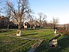
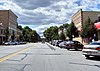
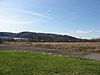
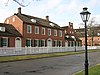
Marker title Image Date dedicated Location Marker type Topics Beaver County July 5, 1982 County Courthouse, at park on 3rd Street (PA 68), Beaver(MISSING) City Business & Industry, Government & Politics, Government & Politics 19th Century, Transportation Fort McIntosh October 31, 1946 3rd Street (PA 68) at Insurance Street, Beaver 40°41′41″N 80°18′22″W / 40.69479°N 80.30601°W / 40.69479; -80.30601 (Fort McIntosh ) Roadside American Revolution, Forts, Military Harmony Society Cemetery December 2, 1963 Church Street & 11th Street, center of cemetery, Ambridge 40°35′35″N 80°13′56″W / 40.59304°N 80.23217°W / 40.59304; -80.23217 (Harmony Society Cemetery ) City Religion Harmony Society Church September 11, 1967 Church Street near Creese Street, Ambridge 40°35′46″N 80°13′56″W / 40.59605°N 80.23218°W / 40.59605; -80.23218 (Harmony Society Church ) City Buildings, Religion Ingram-Richardson Manufacturing Co. May 4, 2001 24th Street Extension and 31st Street Extension, Beaver Falls 40°46′13″N 80°19′41″W / 40.7704°N 80.328°W / 40.7704; -80.328 (Ingram-Richardson Manufacturing Co. ) Roadside Business & Industry King Beaver's Town September 25, 1946 3rd Street (PA 68) at Wilson Avenue, Beaver 40°41′51″N 80°17′59″W / 40.69742°N 80.29964°W / 40.69742; -80.29964 (King Beaver's Town ) Roadside Cities & Towns, Government & Politics, Government & Politics 18th Century, Native American Legionville September 25, 1946 Duss Avenue at Anthony Wayne Drive north of Ambridge 40°37′30″N 80°13′45″W / 40.62488°N 80.22926°W / 40.62488; -80.22926 (Legionville ) Roadside American Revolution, Cities & Towns, Military, Native American Legionville September 25, 1946 Duss Avenue at Anthony Wayne Drive, north of Ambridge (MISSING) Roadside American Revolution, Military Logstown October 31, 1946 Duss Avenue at Anthony Wayne Drive, north of Ambridge 40°37′22″N 80°13′35″W / 40.62283°N 80.2265°W / 40.62283; -80.2265 (Logstown ) Roadside Cities & Towns, Early Settlement, French & Indian War, Government & Politics, Government & Politics 18th Century, Native American Logstown - PLAQUE June 1, 1918 Duss Avenue at Anthony Wayne Drive, north of Ambridge (MISSING) 40°37′22″N 79°46′24″W / 40.6228°N 79.7734°W / 40.6228; -79.7734 (Logstown - PLAQUE ) Plaque Early Settlement, French & Indian War, Native American Matthew S. Quay July 22, 1949 3rd Street (PA 68) at Insurance Street, Beaver 40°41′41″N 80°18′22″W / 40.69464°N 80.30617°W / 40.69464; -80.30617 (Matthew S. Quay ) Roadside Government & Politics, Government & Politics 19th Century NLRB v. Jones & Laughlin Supreme Court Ruling April 8, 2000 112 Station Street, Aliquippa 40°37′11″N 80°14′34″W / 40.61964°N 80.2428°W / 40.61964; -80.2428 (NLRB v. Jones & Laughlin Supreme Court Ruling ) Roadside Government & Politics 20th Century, Labor Old Economy n/a PA 65 in Ambridge, across from site 40°35′44″N 80°13′56″W / 40.59565°N 80.23218°W / 40.59565; -80.23218 (Old Economy ) Roadside Religion Old Economy Memorial n/a Old Economy, 13th & Church Streets, Ambridge 40°35′45″N 80°14′01″W / 40.59585°N 80.23373°W / 40.59585; -80.23373 (Old Economy Memorial ) Roadside Religion Pennsylvania March 25, 1949 US 30, .4 miles from state line (MISSING) Roadside Government & Politics, Government & Politics 17th Century, William Penn Pennsylvania March 25, 1949 PA 68 at state line (MISSING) Roadside Government & Politics, Government & Politics 17th Century, William Penn White Cottage May 27, 1969 1221 3rd Avenue (PA 65/18), New Brighton 40°43′51″N 80°18′36″W / 40.73084°N 80.31003°W / 40.73084; -80.31003 (White Cottage ) City Houses & Homesteads, Women, Writers