Mertztown, Pennsylvania

Last updated

Mertztown, Pennsylvania
Mertztown, PA, May 2024.jpg
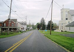
Chestnut Street in Mertztown
USA Pennsylvania location map.svg
Red pog.svg
Mertztown
Usa edcp location map.svg
Red pog.svg
Mertztown
Coordinates: 40°30′21″N75°39′56″W / 40.50583°N 75.66556°W / 40.50583; -75.66556
Country United States
State Pennsylvania
County Berks
Township Longswamp Township
Area
[1]
  Total1.06 sq mi (2.74 km2)
  Land1.05 sq mi (2.72 km2)
  Water0.00 sq mi (0.01 km2)
Elevation
466 ft (142 m)
Population
 (2020) [2]
  Total600
  Density570.34/sq mi (220.24/km2)
Time zone UTC-5 (Eastern (EST))
  Summer (DST) UTC-4 (EDT)
ZIP Code
19539
Area code(s) 610 and 484
FIPS code 42-48824

Mertztown is a census-designated place [3] in Longswamp Township in Berks County, Pennsylvania. It is located near the borough of Topton. As of the 2010 census, the population was 664 residents. [4]

Mertztown is located in Berks County at latitude 40.506 and longitude -75.665. Its elevation is 466 feet. It appears on the United States Geological Survey map for Topton and is in the Eastern Time Zone (UTC-5).

The Reading Railroad which ran through Mertztown, was later acquired by Norfolk Southern as the Reading Line, and remains a heavily used railroad branch. A branch of the Catasauqua and Fogelsville Railroad once passed through the Farmington and Klines Corner section in Mertztown, but the tracks were later removed.

Mertztown was founded in 1823 by Robert Mertz. The population density is .01% Black, .01% Hispanic or other, and 99.8% white. Atlas Minerals, a major mineral company, is located in Mertztown. The company, which moved to Mertztown in 1917, has been based there ever since.

Mertztown is served by Brandywine Heights Area School District, which is based in Mertztown. Gateway Christian School is also located in Mertztown. The area code is 610. The Toad Creek runs east through the village from Topton into the Little Lehigh Creek.

Historical population
CensusPop.Note
2020 600
U.S. Decennial Census [5]

Notable places

Related Research Articles

<span class="mw-page-title-main">Berks County, Pennsylvania</span> County in Pennsylvania, United States

Berks County is a county in the Commonwealth of Pennsylvania. As of the 2020 census, the county's population was 428,849. The county seat is Reading, the fourth-most populous city in the state. The county is part of the South Central Pennsylvania region of the state.

<span class="mw-page-title-main">Birdsboro, Pennsylvania</span> Borough in Pennsylvania, United States

Birdsboro is a borough in Berks County, Pennsylvania, United States. It is located along the Schuylkill River 8 miles (13 km) southeast of Reading. As of the 2020 census, it had a population of 5,106. Birdsboro's economy had historically been rooted in large foundries and machine shops, none of which remain in operation today.

<span class="mw-page-title-main">Fleetwood, Pennsylvania</span> Borough in Pennsylvania, United States

Fleetwood, also called Schlegelschteddel in Pennsylvania Dutch, is a borough in Berks County, Pennsylvania, United States. The population was 4,049 at the 2020 census. It was home to the Fleetwood Metal Body company, an automobile coachbuilder purchased by Fisher Body and integrated into General Motors in 1931. The name lived on in the Cadillac Fleetwood automobile.

<span class="mw-page-title-main">Hamburg, Pennsylvania</span> Borough in Pennsylvania, United States

Hamburg is a borough in Berks County, Pennsylvania, United States. The population was 4,270 at the 2020 census. The town is thought to have been named after Hamburg, Germany, but this is likely to have been a corruption of Bad Homburg.

<span class="mw-page-title-main">Kutztown, Pennsylvania</span> Borough in Pennsylvania, United States

Kutztown is a borough in Berks County, Pennsylvania, United States. It is located 18 miles (29 km) southwest of Allentown and 17 miles (27 km) northeast of Reading. As of the 2020 census, the borough had a population of 4,162. Kutztown University of Pennsylvania is located just outside the borough limits to the southwest.

<span class="mw-page-title-main">Leesport, Pennsylvania</span> Borough in Pennsylvania, United States

Leesport is a borough in Berks County, Pennsylvania, United States. The population was 1,954 at the 2020 census.

<span class="mw-page-title-main">Longswamp Township, Pennsylvania</span> Township in Pennsylvania, United States

Longswamp Township is a township in Berks County, Pennsylvania, United States. The population was 5,551 at the 2020 census.

<span class="mw-page-title-main">Lyons, Pennsylvania</span> Borough in Pennsylvania, United States

Lyons is a borough that is located in Berks County, Pennsylvania, United States. The population was 439 at the time of the 2020 census.

<span class="mw-page-title-main">Maxatawny Township, Pennsylvania</span> Township in Pennsylvania, United States

Maxatawny Township is a township in Berks County, Pennsylvania, United States. The population was 7,906 at the 2010 census.

<span class="mw-page-title-main">Shoemakersville, Pennsylvania</span> Borough in Pennsylvania, United States

Shoemakersville is a borough in Berks County, Pennsylvania, United States. The population was 1,360 at the 2020 census, a decline from the figure of 1,378 tabulated in 2010.

<span class="mw-page-title-main">Topton, Pennsylvania</span> Borough in Pennsylvania, United States

Topton is a borough in Berks County, Pennsylvania, United States. The population was 2,041 at the 2020 census.

<span class="mw-page-title-main">Wyomissing, Pennsylvania</span> Borough in Pennsylvania, United States

Wyomissing is a borough in Berks County, Pennsylvania, United States, adjacent to Reading. The borough was incorporated on July 2, 1906. As of the 2020 census, the population was 11,114, compared to 10,461 at the 2010 census. The growth was significantly larger between 2000 and 2010 largely because of its merger in January 2002 with neighboring Wyomissing Hills. Wyomissing is the most populous borough in Berks County.

<span class="mw-page-title-main">Elverson, Pennsylvania</span> Borough in Pennsylvania, United States

Elverson is a borough in Chester County, Pennsylvania, United States. The population was 1,332 at the 2020 census.

<span class="mw-page-title-main">Palmyra, Pennsylvania</span> Borough in Pennsylvania, United States

Palmyra is a borough in Lebanon County, Pennsylvania, United States. It is part of the Lebanon, Pennsylvania Metropolitan Statistical Area. The population was 7,807 at the 2020 census.

<span class="mw-page-title-main">Mount Carmel, Pennsylvania</span> Borough in Pennsylvania, United States

Mount Carmel is a borough in Northumberland County, located in the Coal Heritage Region of Central Pennsylvania's Susquehanna River Valley, United States. The population was 5,725 at the 2020 census. It is located 88 miles (141 km) northwest of Philadelphia and 71 miles (114 km) northeast of Harrisburg, in the Coal Region. It is completely encircled by Mount Carmel Township.

<span class="mw-page-title-main">Rockwood, Pennsylvania</span> Borough in Pennsylvania, United States

Rockwood is a borough in Somerset County, Pennsylvania, United States. The population was 850 at the 2020 census. It is part of the Johnstown, Pennsylvania, Metropolitan Statistical Area, and located due north of Pennsylvania's highest peak, Mount Davis, which significantly constricts land travel routing south of the municipality.

Bowers is a census-designated place in Maxatawny Township, Berks County, Pennsylvania.

<span class="mw-page-title-main">Shartlesville, Pennsylvania</span> Census-designated place in Pennsylvania, United States

Shartlesville is a census-designated place that is located in Upper Bern Township, Berks County, Pennsylvania, United States. As of the 2010 census, the population was 455 residents.

Dryville is a census-designated place in Rockland Township, Berks County, Pennsylvania, United States. It is located one mile south of Lyons, and is located in the South Mountains and is drained by Bieber Creek into Manatawny Creek, a tributary of the Schuylkill River. It is split between the Fleetwood zip code of 19522 and the Mertztown Zip Code of 19539. As of the 2010 census, the population was 398 residents.

<span class="mw-page-title-main">Oley, Pennsylvania</span> Census-designated place in Pennsylvania, United States

Oley, also called Friedensburg, is a census-designated place (CDP) that is located on Routes 73 and 662 in northern Oley Township, Berks County, United States.

References

  1. "ArcGIS REST Services Directory". United States Census Bureau. Retrieved October 12, 2022.
  2. "Census Population API". United States Census Bureau. Retrieved October 12, 2022.
  3. "Decennial Census of Population and Housing by Decades".
  4. https://www.census.gov/# [ not specific enough to verify ]
  5. "Census of Population and Housing". Census.gov. Retrieved June 4, 2016.