Washington Township | |
---|---|
Barto Bridge in Washington Township | |
Motto: "Continuing the Vision/Preserving the Values" | |
![]() Location of Washington Township in Berks County, Pennsylvania | |
Coordinates: 40°23′00″N75°37′59″W / 40.38333°N 75.63306°W | |
Country | United States |
State | Pennsylvania |
County | Berks |
Area | |
• Total | 14.0 sq mi (36 km2) |
• Land | 14.0 sq mi (36 km2) |
• Water | 0.0 sq mi (0 km2) |
Elevation | 554 ft (169 m) |
Population (2010) | |
• Total | 3,810 |
• Estimate (2016) [1] | 4,023 |
• Density | 239.2/sq mi (92.4/km2) |
Time zone | UTC-5 (EST) |
• Summer (DST) | UTC-4 (EDT) |
ZIP Codes | 18041, mainly 19504, 19505 |
Area Code | 610 and 484 |
FIPS code | 42-011-81184 |
Website | www |
Washington Township is a township in eastern Berks County, Pennsylvania, United States. The population was 3,810 at the 2010 census.
The Barto Bridge, Borneman Mill, Philip Christman House, and Dale Furnace and Forge Historic District are listed on the National Register of Historic Places. [2]
Washington Township is named in honor of George Washington, first US President.
According to the United States Census Bureau, the township has a total area of 14.0 square miles (36.3 km2), all land. It is drained by the Perkiomen Creek into the Schuylkill River. The northwestern portion is located in the South Mountains. Washington Township's villages include Barto, Clayton (also in Hereford Township), Dale, Shultzville, and Eshbach.
The township has a hot-summer humid continental climate (Dfa) and is in hardiness zone 6b. The average monthly temperature in Barto ranges from 29.4 °F in January to 74.2 °F in July. [3]
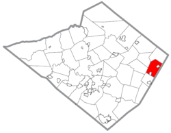
Washington Township surrounds the boroughs of Bally and Bechtelsville.
Census | Pop. | Note | %± |
---|---|---|---|
1980 | 2,569 | — | |
1990 | 2,799 | 9.0% | |
2000 | 3,354 | 19.8% | |
2010 | 3,810 | 13.6% | |
2016 (est.) | 4,023 | [1] | 5.6% |
Source: US Census Bureau |
As of the census [4] of 2000, there were 3,354 people, 1,212 households, and 970 families living in the township. The population density was 239.2 inhabitants per square mile (92.4/km2). There were 1,250 housing units at an average density of 89.2 per square mile (34.4/km2). The racial makeup of the township was 97.88% White, 0.75% African American, 0.09% Native American, 0.33% Asian, 0.24% from other races, and 0.72% from two or more races. Hispanic or Latino of any race were 0.66% of the population.
There were 1,212 households, out of which 35.6% had children under the age of 18 living with them, 70.5% were married couples living together, 6.0% had a female householder with no husband present, and 19.9% were non-families. 15.1% of all households were made up of individuals, and 6.0% had someone living alone who was 65 years of age or older. The average household size was 2.77 and the average family size was 3.08.
In the township the population was spread out, with 25.8% under the age of 18, 6.1% from 18 to 24, 30.8% from 25 to 44, 25.8% from 45 to 64, and 11.5% who were 65 years of age or older. The median age was 38 years. For every 100 females there were 104.8 males. For every 100 females age 18 and over, there were 103.7 males.
The median income for a household in the township was $53,241, and the median income for a family was $60,054. Males had a median income of $37,951 versus $26,298 for females. The per capita income for the township was $20,454. About 2.1% of families and 3.0% of the population were below the poverty line, including 2.3% of those under age 18 and 2.1% of those age 65 or over.
One parcel of the Pennsylvania State Game Lands Number 315 is located on Forge Dale Road north of Barto, a second parcel is located along the northern border with Hereford Township. [5] [6]
As of 2019, there were 46.55 miles (74.91 km) of public roads in Washington Township, of which 13.51 miles (21.74 km) were maintained by the Pennsylvania Department of Transportation (PennDOT) and 33.04 miles (53.17 km) were maintained by the township. [7]
Pennsylvania Route 100 crosses Washington Township north-to-south on its path from Lehigh County to Pottstown via Bally. Other local roads of note include Barto Road, County Line Road, Forgedale Road, Hoffmansville Road, Old Route 100, and Niantic Road.
Bally is a borough in Berks County, Pennsylvania, United States. The population was 1,228 at the 2020 census.
Brecknock Township is a township in Berks County, Pennsylvania, United States. The population was 4,618 at the 2020 census.
Colebrookdale Township is a township in Berks County, Pennsylvania, United States. The population was 5,127 at the 2020 census.
District Township is a township in eastern Berks County, Pennsylvania, United States. The population was 1,381 at the 2020 census.
Hereford Township is a township in Berks County, Pennsylvania, United States. It is the easternmost municipality within Berks County. Its population was 2,969 at the 2020 census. It is in Upper Perkiomen School District.
Longswamp Township is a township in Berks County, Pennsylvania, United States. The population was 5,551 at the 2020 census.
Marion Township is a township in Berks County, Pennsylvania, United States. The population was 1,688 at the 2010 census.
Maxatawny Township is a township in Berks County, Pennsylvania, United States. The population was 7,906 at the 2010 census.
Muhlenberg Township is a township in Berks County, Pennsylvania, United States. The population was 21,915 at the 2020 census, making it the third-most populous township in Berks County after Spring Township and Exeter Township.
North Heidelberg Township is a township in Berks County, Pennsylvania, United States. The population was 1,214 at the 2010 census.
Oley Township is a township in Berks County, Pennsylvania, United States. As of the 2010 census, the township had a population of 3,620. Oley Township was originally formed in 1740 as a part of Philadelphia County, before Berks County was formed in 1752. The entire township was listed as a historic district by the National Register of Historic Places in 1983. Oley is a Native American name purported to mean "a hollow". Daniel Boone was born in Oley Township November 2, 1734.
Ontelaunee Township is a township in Berks County, Pennsylvania, United States. The population was 1,646 at the 2010 census.
Pike Township is a township in Berks County, Pennsylvania, United States. The population was 1,723 at the 2010 census.
Richmond Township is a township in Berks County, Pennsylvania, United States. The population was 3,397 at the 2010 census.
Robeson Township is a township in Berks County, Pennsylvania, United States. The population was 7,216 at the 2010 census.
Tulpehocken Township is a township in Berks County, Pennsylvania, United States. The population was 3,274 at the 2010 census.
Lower Macungie Township is a township in Lehigh County, Pennsylvania, United States. The township's population was 31,964 as of the 2020 census, making it the second-largest population center in Lehigh County after Allentown and the third-largest population center in the Lehigh Valley metropolitan area after Allentown and Bethlehem.
Upper Milford Township is a township in Lehigh County, Pennsylvania, United States. The township's population was 7,292 at the 2010 census. Upper Milford Township is a rural area southwest of Allentown in the Lehigh Valley, which had a population of 861,899 and was the 68th-most populous metropolitan area in the U.S. as of the 2020 census.
Douglass Township is a township in Montgomery County, Pennsylvania, United States. The population was 10,195 at the 2010 census.
Upper Hanover Township is a township in Montgomery County, Pennsylvania, United States. The population was 6,464 at the 2010 census.