Lower Heidelberg Township, Pennsylvania

Last updated

Lower Heidelberg Township
OLD DRY ROAD (FARM) WERNERSVILLE, BERKS COUNTY.jpg
Berks County Pennsylvania Incorporated areas Lower Heidelberg Township Highlighted.svg
USA Pennsylvania location map.svg
Red pog.svg
Lower Heidelberg Township
Location of Lower Heidelberg Township in Pennsylvania
Usa edcp location map.svg
Red pog.svg
Lower Heidelberg Township
Lower Heidelberg Township (the United States)
Coordinates: 40°22′36″N76°03′59″W / 40.37667°N 76.06639°W / 40.37667; -76.06639
CountryUnited States
StatePennsylvania
County Berks
Founded1842
Area
[1]
  Total15.42 sq mi (39.95 km2)
  Land14.84 sq mi (38.44 km2)
  Water0.58 sq mi (1.50 km2)
Elevation
394 ft (120 m)
Population
 (2010)
  Total5,513
  Estimate 
(2016) [2]
6,044
  Density407.20/sq mi (157.22/km2)
Time zone UTC-5 (EST)
  Summer (DST) UTC-4 (EDT)
Area code(s) 610
FIPS code 42-011-44928
Website www.lowerheidelbergtownship.org

Lower Heidelberg Township is a township in Berks County, Pennsylvania, United States. The population was 5,513 at the 2010 census.

Contents

History

The Hain Mill, Knorr-Bare Farm, Old Dry Road, and Tulpehocken Creek Historic District are listed on the National Register of Historic Places. [3]

Geography

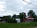
According to the U.S. Census Bureau, the township has a total area of 15.5 square miles (40.1 km2), of which 14.9 square miles (38.7 km2) is land and 0.5 square mile (1.4 km2) (3.49%) is water.

Adjacent townships

Adjacent boroughs

The unincorporated communities of Brownsville, State Hill, Cacoosing, Wooltown, (former) Blue Marsh are located in Lower Heidelberg Township.

Demographics

Historical population
CensusPop.Note
1980 1,819
1990 2,20921.4%
2000 4,15087.9%
2010 5,51332.8%
2016 (est.)6,044 [2] 9.6%
Source: US Census Bureau

As of the 2000 census, [4] there were 4,150 people, 1,544 households, and 1,156 families living in the township. The population density was 277.7 inhabitants per square mile (107.2/km2). There were 1,578 housing units at an average density of 105.6 per square mile (40.8/km2). The racial makeup of the township was 97.30% White, 0.87% African American, 0.02% Native American, 1.18% Asian, 0.27% from other races, and 0.36% from two or more races. Hispanic or Latino of any race were 1.04% of the population.

There were 1,544 households, out of which 35.0% had children under the age of 18 living with them, 67.3% were married couples living together, 5.1% had a female householder with no husband present, and 25.1% were non-families. 22.1% of all households were made up of individuals, and 14.2% had someone living alone who was 65 years of age or older. The average household size was 2.64 and the average family size was 3.11.

In the township, the population was spread out, with 26.6% under the age of 18, 5.1% from 18 to 24, 27.3% from 25 to 44, 23.0% from 45 to 64, and 18.0% who were 65 years of age or older. The median age was 40 years. For every 100 females, there were 91.9 males. For every 100 females age 18 and over, there were 88.7 males.

The median income for a household in the township was $61,375, and the median income for a family was $69,706. Males had a median income of $50,391 versus $27,500 for females. The per capita income for the township was $27,700. About 1.4% of families and 2.9% of the population were below the poverty line, including 1.5% of those under age 18 and 9.6% of those age 65 or over.

Recreation

Part of the Blue Marsh Lake and part of the Pennsylvania State Game Lands Number 280 is located in the northern part of the township. [5] [6]

Transportation

US 422 eastbound along the south edge of Lower Heidelberg Township 2022-08-24 13 44 09 View east along U.S. Route 422 (Penn Avenue) just east of Green Valley Road along the border of Lower Heidelberg Township and South Heidelberg Township in Berks County, Pennsylvania.jpg
US 422 eastbound along the south edge of Lower Heidelberg Township

As of 2019, there were 50.62 miles (81.46 km) of public roads in Lower Heidelberg Township, of which 17.40 miles (28.00 km) were maintained by the Pennsylvania Department of Transportation (PennDOT) and 33.22 miles (53.46 km) were maintained by the township. [7]

U.S. Route 422 is the only numbered highway serving Lower Heidelberg Township. It follows an east-west alignment along the southern edge of the township.

Related Research Articles

<span class="mw-page-title-main">Alsace Township, Pennsylvania</span> Township in Pennsylvania, United States

Alsace Township is a township in Berks County, Pennsylvania, United States. The population was 3,848 at the 2020 census.

<span class="mw-page-title-main">Bern Township, Berks County, Pennsylvania</span> Township in Pennsylvania, United States

Bern Township is a township in Berks County, Pennsylvania, United States. As of the 2020 census, the population is 6,609. The township is in Schuylkill Valley School District.

<span class="mw-page-title-main">Colebrookdale Township, Berks County, Pennsylvania</span> Township in Pennsylvania, United States

Colebrookdale Township is a township in Berks County, Pennsylvania, United States. The population was 5,127 at the 2020 census.

<span class="mw-page-title-main">Heidelberg Township, Berks County, Pennsylvania</span> Township in Pennsylvania, United States

Heidelberg Township is a township in Berks County, Pennsylvania, United States. The population was 1,726 at the 2020 census.

<span class="mw-page-title-main">Hereford Township, Berks County, Pennsylvania</span> Township in Pennsylvania, United States

Hereford Township is a township in Berks County, Pennsylvania, United States. It is the easternmost municipality within Berks County. Its population was 2,969 at the 2020 census. It is in Upper Perkiomen School District.

<span class="mw-page-title-main">Jefferson Township, Berks County, Pennsylvania</span> Township in Pennsylvania, United States

Jefferson Township is a township in Berks County, Pennsylvania, United States. The population was 2,376 at the 2020 census.

<span class="mw-page-title-main">Lower Alsace Township, Pennsylvania</span> Township in Pennsylvania, United States

Lower Alsace Township is a township in Berks County, Pennsylvania, United States. The population was 4,475 at the 2010 census. By area, it is the smallest township in Berks County.

<span class="mw-page-title-main">Marion Township, Berks County, Pennsylvania</span> Township in Pennsylvania, United States

Marion Township is a township in Berks County, Pennsylvania, United States. The population was 1,688 at the 2010 census.

<span class="mw-page-title-main">Mount Penn, Pennsylvania</span> Borough in Pennsylvania, United States

Mount Penn is a borough in Berks County, Pennsylvania, United States. The population was 3,106 at the 2010 census. The borough shares a name with a 1,120-foot-high (340 m) mountain that rises to the north and overlooks the city of Reading. The peak is sometimes recognized as the southern end of the Reading Prong group of mountains.

<span class="mw-page-title-main">New Morgan, Pennsylvania</span> Borough in Berks County, Pennsylvania, United States

New Morgan is a borough in Berks County, Pennsylvania, United States. The population was 71 at the 2010 census.

<span class="mw-page-title-main">North Heidelberg Township, Pennsylvania</span> Township in Pennsylvania, United States

North Heidelberg Township is a township in Berks County, Pennsylvania, United States. The population was 1,214 at the 2010 census.

<span class="mw-page-title-main">Penn Township, Berks County, Pennsylvania</span> Township in Pennsylvania, United States

Penn Township is a township in Berks County, Pennsylvania, United States. The population was 1,949 at the 2010 census.

<span class="mw-page-title-main">Pike Township, Berks County, Pennsylvania</span> Township in Pennsylvania, United States

Pike Township is a township in Berks County, Pennsylvania, United States. The population was 1,723 at the 2010 census.

<span class="mw-page-title-main">Richmond Township, Berks County, Pennsylvania</span> Township in Pennsylvania, United States

Richmond Township is a township in Berks County, Pennsylvania, United States. The population was 3,397 at the 2010 census.

<span class="mw-page-title-main">Ruscombmanor Township, Pennsylvania</span> Township in Pennsylvania, United States

Ruscombmanor Township is a township in Berks County, Pennsylvania, United States. The population was 4,112 at the 2010 census.

<span class="mw-page-title-main">South Heidelberg Township, Pennsylvania</span> Township in Pennsylvania, United States

South Heidelberg Township is a township in Berks County, Pennsylvania, United States. The population was 7,271 at the 2010 census.

<span class="mw-page-title-main">Spring Township, Berks County, Pennsylvania</span> Township in Pennsylvania, United States

Spring Township is a township in Berks County, Pennsylvania, United States. The population was 27,119 at the 2010 census, making it the second most populous municipality in Berks County after Reading.

<span class="mw-page-title-main">Union Township, Berks County, Pennsylvania</span> Township in Pennsylvania, United States

Union Township is a township in Berks County, Pennsylvania, United States. The population was 3,503 at the 2010 census.

<span class="mw-page-title-main">Upper Tulpehocken Township, Pennsylvania</span> Township in Pennsylvania, United States

Upper Tulpehocken Township is a township in Berks County, Pennsylvania, United States. The population was 1,575 at the 2010 census.

<span class="mw-page-title-main">Honey Brook Township, Chester County, Pennsylvania</span> Township in Pennsylvania, United States

Honey Brook Township is a township in Chester County, Pennsylvania, United States. The population was 8,274 at the time of the 2020 census.

References

  1. "2016 U.S. Gazetteer Files". United States Census Bureau. Retrieved August 13, 2017.
  2. 1 2 "Population and Housing Unit Estimates" . Retrieved June 9, 2017.
  3. "National Register Information System". National Register of Historic Places . National Park Service. July 9, 2010.
  4. "U.S. Census website". United States Census Bureau . Retrieved January 31, 2008.
  5. https://viewer.nationalmap.gov/advanced-viewer/ The National Map, retrieved 31 October 2018
  6. Pennsylvania State Game Lands Number 280, retrieved 31 October 2018
  7. "Lower Heidelberg Township map" (PDF). PennDOT. Retrieved March 14, 2023.