Adamstown, Pennsylvania

Last updated
Adamstown, Pennsylvania
Adamschteddel
Bollmans Hat Factory.jpg
Bollman Hat Factory
Lancaster County Pennsylvania Incorporated and Unincorporated areas Adamstown Highlighted.svg
Location on the border of Lancaster and Berks Counties, Pennsylvania
USA Pennsylvania location map.svg
Red pog.svg
Adamstown
Location in Pennsylvania and the United States
Usa edcp location map.svg
Red pog.svg
Adamstown
Adamstown (the United States)
Coordinates: 40°14′30″N76°03′28″W / 40.24167°N 76.05778°W / 40.24167; -76.05778
CountryUnited States
StatePennsylvania
Counties Lancaster, Berks
Area
[1]
  Total1.39 sq mi (3.59 km2)
  Land1.38 sq mi (3.57 km2)
  Water0.01 sq mi (0.02 km2)
Elevation
568 ft (173 m)
Population
 (2020) [2]
  Total1,938
  Density1,404.35/sq mi (542.33/km2)
Time zone UTC-5 (EST)
  Summer (DST) UTC-4 (EDT)
ZIP Code
19501
Area code 717
FIPS code 42-00364
Website adamstownborough.org

Adamstown (Pennsylvania Dutch: Adamschteddel) is a borough that is located in Lancaster County (primarily) and Berks County in the U.S. state of Pennsylvania. [3]

Contents

The population was 1,938 at the time of the 2020 census. Of this, 1,772 were residents of Lancaster County and only seventeen were living in Berks County.

History

Adamstown was initially founded on July 4, 1761, by William Addams on the site of a former village of Native Americans, and Addams named the community Addamsburry. The community was incorporated as a borough on April 2, 1850, [4] following the passage of a bill by the Pennsylvania General Assembly that was introduced by Representative Joseph Konigmacher the previous month. [5] That year, the borough's population was 307. [6] [7]

In 1855, a new stage coach route was established from Lancaster to Reading, which included stops in the communities of Adamstown, Reamstown, Ephrata, New Berlin, and Oregon. The fare from Reading to Adamstown was fifty cents. [8]

The Kagerise Store and House was listed on the National Register of Historic Places in 1988. [9]

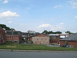
The town promotes itself as the antiques capital of the United States because it attracts many antiques dealers and collectors. Adamstown is home to the Stoudt's Brewery, Pennsylvania's first microbrewery, which was established here in 1987. The town is also home to the US's oldest hat manufacturer, the Bollman Hat Company, which was established in 1868.

Geography

According to the U.S. Census Bureau, the borough has a total area of 1.4 square miles (3.6 km2), all land.

Demographics

Historical population
CensusPop.Note
1860 432
1870 431−0.2%
1880 70162.6%
1890 603−14.0%
1900 597−1.0%
1910 67513.1%
1920 80018.5%
1930 90913.6%
1940 9555.1%
1950 1,0206.8%
1960 1,19016.7%
1970 1,2021.0%
1980 1,119−6.9%
1990 1,108−1.0%
2000 1,2038.6%
2010 1,78948.7%
2020 1,9388.3%
Sources: [10] [11] [2]

At the time of the 2010 census, Adamstown had a population of 1,789. The median age was 37.5. The racial and ethnic composition of the population was 91.3% non-Hispanic white, 1.1% black or African American, 0.3% Native American, 4.4% Asian, 0.1% Pacific Islander, 1.6% of two or more race and 1.7% Hispanic or Latino. [12]

At the time of the 2000 census, [13] there were 1,203 people, 501 households and 351 families living in the borough.

The population density was 880.7 inhabitants per square mile (340.0/km2). There were 533 housing units at an average density of 390.2 per square mile (150.7/km2).

The racial makeup of the borough was 99.09% White, 0.08% African American, 0.25% Asian, 0.42% from other races, and 0.17% from two or more races. Hispanic or Latino of any race were 1.00% of the population.

There were 501 households, of which 29.5% had children who were under the age of eighteen living with them; 59.1% were married couples living together, 7.2% had a female householder with no husband present, and 29.9% were non-families. 24.8% of all households were made up of individuals, and 10.8% had someone living alone who was sixty-five years of age or older.

The average household size was 2.40 and the average family size was 2.85.
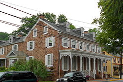
Kagarise Store and House 86-84 West Main Adamstown Lanco PA.JPG
Kagarise Store and House
House on West Main Street Spectacular W Main Adamstown PA.JPG
House on West Main Street
A Walk up Main Street, video (2 minutes),
Gallery format

Slightly less than 23% of residents were under the age of eighteen, 5.6% were aged eighteen to twenty-four, 33.3% were aged twenty-five to forty-four, 23.3% were aged forty-five to sixty-four, and 14.9% were sixty-five years of age or older. The median age was thirty-seven years.

For every one hundred females, there were 94.7 males. For every one hundred females who were aged eighteen or older, there were 91.9 males.

The median household income was $43,578 and the median family income was $47,337. Males had a median income of $35,000 compared with that of $25,400 for females.

The per capita income for the borough was $20,840.

Approximately 1.4% of families and 2.4% of the population were living below the poverty line, including 3.0% of those who were under the age of eighteen and 2.8% of those who were aged sixty-five or older.

Notable person

Schools

Public services

The Adamstown Area Library is located at 3000 North Reading Road. [15] The library shares a building with the Adamstown Borough office.

In recent years, the role and responsibility of the library has increased. It became a full-fledged member of the Library System of Lancaster County and is now responsible for providing library services to the 31,000+ residents of Adamstown, Brecknock, Denver, East Cocalico and West Cocalico. The library is run by its own board of trustees.

The spirit of volunteerism is still strong in the library and volunteers continue to play a key role in ensuring the library is funded and assisting in library functions. The library also now benefits from a staff of full-time and part-time trained employees, including a Library Director who holds a master's degree in library and information science.

Transportation

View southwest along Main Street entering Adamstown 2022-08-22 16 28 48 View southwest along East Main Street between Furlow Road and Bowmansville Road in Adamstown, Berks County, Pennsylvania.jpg
View southwest along Main Street entering Adamstown

As of 2013, there were 9.36 miles (15.06 km) of public roads in Adamstown, of which 2.67 miles (4.30 km) were maintained by the Pennsylvania Department of Transportation (PennDOT) and 6.69 miles (10.77 km) were maintained by the borough. [16]

Pennsylvania Route 272 is the only numbered road serving Adamstown. It follows North Reading Road along a southwest–northeast alignment through the center of the borough, just southeast of Main Street.

Related Research Articles

<span class="mw-page-title-main">Akron, Pennsylvania</span> Borough in Pennsylvania, United States

Akron is a borough in Lancaster County, Pennsylvania, United States. As of the 2020 census, it had a population of 4,169,

<span class="mw-page-title-main">Ephrata, Pennsylvania</span> Borough in Pennsylvania, United States

Ephrata is a borough in Lancaster County, Pennsylvania, United States. It is located 42 miles (68 km) east of Harrisburg and about 60 miles (97 km) west-northwest of Philadelphia and is named after Ephrath, the former name for current-day Bethlehem. In its early history, Ephrata was a pleasure resort and an agricultural community.

<span class="mw-page-title-main">Denver, Pennsylvania</span> Borough in Pennsylvania, United States

Denver is a borough in Lancaster County, Pennsylvania, United States. The population was 3,794 at the 2020 census, a decline from the figure of 3,861 tabulated in 2010.

<span class="mw-page-title-main">Christiana, Pennsylvania</span> Borough in Pennsylvania, United States

Christiana is a borough in Lancaster County, Pennsylvania, United States. The population was 1,100 at the time of the 2020 census.

<span class="mw-page-title-main">East Cocalico Township, Pennsylvania</span> Township in Pennsylvania, United States

East Cocalico Township is a township in northeastern Lancaster County, Pennsylvania, United States. At the 2020 census, the population was 10,808.

<span class="mw-page-title-main">Glenfield, Pennsylvania</span> Borough in Pennsylvania, United States

Glenfield is a borough in Allegheny County, Pennsylvania, United States, situated along the Ohio River. The population was two hundred and twelve at the time of the 2020 census.

<span class="mw-page-title-main">South Heidelberg Township, Pennsylvania</span> Township in Pennsylvania, United States

South Heidelberg Township is a township in Berks County, Pennsylvania, United States. The population was 7,271 at the 2010 census.

<span class="mw-page-title-main">Spring Township, Berks County, Pennsylvania</span> Township in Pennsylvania, United States

Spring Township is a township in Berks County, Pennsylvania, United States. The population was 27,119 at the 2010 census, making it the second most populous municipality in Berks County after Reading.

<span class="mw-page-title-main">Royalton, Pennsylvania</span> Borough in Pennsylvania, United States

Royalton is a borough in Dauphin County, Pennsylvania, United States. As of the 2020 census the borough population was 1,134.

<span class="mw-page-title-main">Leacock Township, Pennsylvania</span> Township in Pennsylvania, United States

Leacock Township is an American township that is located in east central Lancaster County, Pennsylvania. As of the 2020 census, the population of the township was 5,652, an increase over the figure of 5,220 tabulated in 2010.

<span class="mw-page-title-main">Penn Township, Lancaster County, Pennsylvania</span> Township in Pennsylvania, United States

Penn Township is a township that is located in north central Lancaster County, Pennsylvania, United States. The population was 10,224 at the time of the 2020 census.

<span class="mw-page-title-main">Reamstown, Pennsylvania</span> Census-designated place in Pennsylvania, United States

Reamstown is an unincorporated community and census-designated place (CDP) in Lancaster County, Pennsylvania, United States. The population was 3,361 at the 2010 census.

<span class="mw-page-title-main">Rothsville, Pennsylvania</span> Census-designated place in Pennsylvania, United States

Rothsville is an unincorporated community and census-designated place (CDP) in Warwick Township, Lancaster County, Pennsylvania, United States. The population was 3,044 at the 2010 census. Lititz is the town for residents' mailing addresses.

<span class="mw-page-title-main">West Cocalico Township, Pennsylvania</span> Township in Pennsylvania, United States

West Cocalico Township is a township that is located in northeastern Lancaster County, Pennsylvania, United States. The population was 7,491 at the time of the 2020 census.

<span class="mw-page-title-main">New Ringgold, Pennsylvania</span> Borough in Pennsylvania, United States

New Ringgold is a borough in Schuylkill County, Pennsylvania, United States. The population was 253 at the time of the 2020 census.

<span class="mw-page-title-main">Tremont, Pennsylvania</span> Borough in Pennsylvania, United States

Tremont is a borough in Schuylkill County, Pennsylvania, United States. Situated in the eastern section of Tremont Township, it was incorporated as a borough in 1866, around the same time that a water system was erected in the community.

<span class="mw-page-title-main">Seward, Pennsylvania</span> Borough in Pennsylvania, United States

Seward is a borough in Westmoreland County, Pennsylvania, United States. The population was four hundred and ninety-five at the time of the 2010 census.

<span class="mw-page-title-main">Shrewsbury, Pennsylvania</span> Borough in Pennsylvania, United States

Shrewsbury is a borough in York County, Pennsylvania, United States. The population was 3,848 at the time of the 2020 census.

<span class="mw-page-title-main">Cocalico School District</span> School district in Pennsylvania

The Cocalico School District is a small, suburban public school district located in Lancaster County, Pennsylvania in the United States. The school district covers the boroughs of Denver and Adamstown and East Cocalico Township and West Cocalico Township. Cocalico School District encompasses approximately 51 square miles (130 km2) square miles. According to 2008 local census data, it served a resident population of 21,095 people. Per 2011, US Census Bureau data, it serves a resident population of 21,115 people. The educational attainment levels for the Cocalico School District population were 80.9% high school graduates and 16% college graduates. In 2009, the district residents’ per capita income was $20,736, while the median family income was $54,850. In the Commonwealth, the median family income was $49,501 and the United States median family income was $49,445, in 2010. In Lancaster County, the median household income was $54,765. By 2013, the median household income in the United States rose to $52,100.

Swartzville is an unincorporated community and census-designated place (CDP) in East Cocalico Township, Lancaster County, Pennsylvania, United States. As of the 2010 census, the population was 2,283.

References

  1. "ArcGIS REST Services Directory". United States Census Bureau. Retrieved October 12, 2022.
  2. 1 2 "Census Population API". United States Census Bureau. Retrieved Oct 12, 2022.
  3. "Subcounty population estimates: Pennsylvania 2000-2006" (CSV). United States Census Bureau, Population Division. 2007-06-28. Retrieved 2008-05-28.
  4. "Adamstown Borough: History". archive.is. 25 December 2012. Archived from the original on 25 December 2012.
  5. "Pennsylvania Legislature." Lancaster, Pennsylvania: Lancaster Examiner and Herald, March 6, 1850, p. 2 (subscription required).
  6. "Population of Lancaster County, 1850." Lancaster, Pennsylvania: Intelligencer & Journal, December 10, 1850, p. 2 (subscription required).
  7. "City and County Items." Lancaster, Pennsylvania: Lancaster Examiner and Herald, October 2, 1850, p. 2 (subscription required).
  8. "New Stage Route from Lancaster to Reading." Lancaster, Pennsylvania: Intelligencer & Journal, December 25, 1855, p. 3 (subscription required).
  9. "National Register Information System". National Register of Historic Places . National Park Service. July 9, 2010.
  10. "Census of Population and Housing: Decennial Censuses". United States Census Bureau . Retrieved 2012-03-04.
  11. "Incorporated Places and Minor Civil Divisions Datasets: Subcounty Resident Population Estimates: April 1, 2010 to July 1, 2012". Population Estimates. U.S. Census Bureau. Archived from the original on 11 June 2013. Retrieved 11 December 2013.
  12. 2010 general profile of population and housing characteristics from the US Census
  13. "U.S. Census website". United States Census Bureau . Retrieved 2008-01-31.
  14. Hudson, Wally (1974-04-14). "Reading's Mayor Shirk Marks 73rd Birthday". Reading Eagle . Retrieved 2014-02-23.
  15. "Adamstown Area Library". Archived from the original on 2009-04-19. Retrieved 2009-10-18.
  16. "Adamstown Borough map" (PDF). PennDOT. Retrieved March 13, 2023.