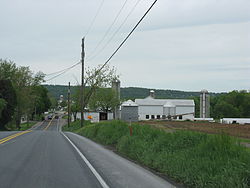
Earl Township, Lancaster County, Pennsylvania | |
---|---|
Country | United States |
State | Pennsylvania |
County | Lancaster |
Settled | 1717 |
Incorporated | 1729 |
Government | |
• Type | Board of Supervisors |
Area | |
• Total | 22.10 sq mi (57.24 km2) |
• Land | 21.96 sq mi (56.87 km2) |
• Water | 0.14 sq mi (0.36 km2) |
Population | |
• Total | 7,149 |
• Estimate (2021) [2] | 7,108 |
• Density | 325.79/sq mi (125.79/km2) |
Time zone | UTC-5 (Eastern (EST)) |
• Summer (DST) | UTC-4 (EDT) |
Area code | 717 |
FIPS code | 42-071-20688 |
Website | earltownship |
Earl Township is a township in northeastern Lancaster County, Pennsylvania, United States. The population was 7,149 at the 2020 census. [2]
The David Davis Farm was listed on the National Register of Historic Places in 1994. [3]
According to the United States Census Bureau, the township has a total area of 22.0 square miles (57 km2), of which 22.0 square miles (57 km2) is land and 0.04 square miles (0.10 km2) (0.14%) is water. It contains the communities of Martindale, Hinkletown, Vogansville, and Laurel Hill, and it surrounds the borough of New Holland, a separate municipality.
Census | Pop. | Note | %± |
---|---|---|---|
2000 | 6,183 | — | |
2010 | 7,024 | 13.6% | |
2020 | 7,149 | 1.8% | |
2021 (est.) | 7,108 | [2] | −0.6% |
U.S. Decennial Census [4] |
As of the census [5] of 2000, there were 6,183 people, 2,019 households, and 1,617 families living in the township. The population density was 281.7 people per square mile (108.8/km2). There were 2,126 housing units at an average density of 96.9/sq mi (37.4/km2). The racial makeup of the township was 97.27% White, 0.60% African American, 1.15% Asian, 0.19% from other races, and 0.79% from two or more races. Hispanic or Latino of any race were 1.07% of the population.
There were 2,019 households, out of which 34.5% had children under the age of 18 living with them, 72.4% were married couples living together, 5.4% had a female householder with no husband present, and 19.9% were non-families. 17.9% of all households were made up of individuals, and 11.1% had someone living alone who was 65 years of age or older. The average household size was 3.06 and the average family size was 3.50.
In the township the population was spread out, with 31.6% under the age of 18, 9.3% from 18 to 24, 21.0% from 25 to 44, 20.3% from 45 to 64, and 17.9% who were 65 years of age or older. The median age was 34 years. For every 100 females, there were 92.3 males. For every 100 females age 18 and over, there were 89.1 males.
The median income for a household in the township was $39,266, and the median income for a family was $42,667. Males had a median income of $32,635 versus $21,211 for females. The per capita income for the township was $17,503. About 9.5% of families and 15.0% of the population were below the poverty line, including 25.9% of those under age 18 and 8.4% of those age 65 or over.
Conestoga Township is a township in west central Lancaster County, Pennsylvania, United States. At the 2020 census the population was 3,922.
Conoy Township is a township in northwestern Lancaster County, Pennsylvania, United States. At the 2020 census, the population was 3,373.
East Earl Township is a township in northeastern Lancaster County, Pennsylvania, United States. At the 2020 census, the population was 6,721.
Sandy Township is a township in Clearfield County, Pennsylvania, United States. The population was 11,852 at the 2020 census.
Bald Eagle Township is a township in Clinton County, Pennsylvania, United States. The population was 2,039 at the 2020 census.
Penn Township is a township in Cumberland County, Pennsylvania, United States, established on October 23, 1860 from Upper Dickinson Township. The population was 2,924 at the 2010 census.
Conewago Township is a township in Dauphin County, Pennsylvania, United States. The population was 2,997 at the 2010 census.
Colerain Township is a township in southeastern Lancaster County, Pennsylvania, United States. The population was 3,883 at the 2020 census, an increase over the figure of 3,635 tabulated in 2010. It is part of the Solanco School District.
Leacock Township is a township in east central Lancaster County, Pennsylvania. As of the 2020 census, the population of the township was 5,652, an increase over the figure of 5,220 tabulated in 2010. The township has a large Amish and Mennonite population.
Paradise Township is a township in east-central Lancaster County, Pennsylvania, United States. The population was 5,696 at the 2020 census.
Penn Township is a township in north central Lancaster County, Pennsylvania, United States. The population was 10,224 at the 2020 census.
Upper Leacock Township is a township in east central Lancaster County, Pennsylvania, United States. The population was 8,949 at the 2020 census.
West Earl Township is a township in northeastern Lancaster County, Pennsylvania, United States. The population was 8,565 at the 2020 census. The township was founded by its first settler, Hans Conrad Groff (1661-1746) in 1717.
Plain Grove Township is a township in Lawrence County, Pennsylvania, United States. The population was 777 at the time of the 2020 census, a decline from the figure of 813 tabulated in 2010.
Sugarloaf Township is a township in Luzerne County, Pennsylvania, United States. The population was 3,879 at the 2020 census.
West Bethlehem Township is a township in Washington County, Pennsylvania, United States established in 1781. In 1790, it was split into East and West Bethlehem Townships. The Martin's Mill Covered Bridge, Horn Davis Overholtzer Bridge, and Ulery Mill are listed on the National Register of Historic Places. According to the United States Census Bureau, the township has a total area of 22.2 square miles (57.5 km2), all of it land.
Cook Township is a township in Westmoreland County, Pennsylvania, United States. The population was 1,888 at the 2020 census, a decrease from 2,250 at the 2010 census, and 2,403 at the 2000 census.
Mount Pleasant Township is a township in Westmoreland County, Pennsylvania, United States. As of the 2020 census, the township population was 10,101. Mount Pleasant Township should not be confused with the Borough of Mount Pleasant, which is a separate municipality and comprises the town of that name.
South Huntingdon Township is a township in Westmoreland County, Pennsylvania, United States. The population was 5,412 at the 2020 census.
Carroll Township is a township in York County, Pennsylvania, United States. The population was 6,853 at the 2020 census.