Gap, Pennsylvania

Last updated

Gap, Pennsylvania
Gap, Lancaster Co, PA 1.JPG
Store in Gap
Gap, Lancaster County Highlighted.png
Location in Lancaster County
USA Pennsylvania location map.svg
Red pog.svg
Gap
Location in Pennsylvania
Usa edcp location map.svg
Red pog.svg
Gap
Location in the United States
Coordinates: 39°59′14″N76°01′14″W / 39.98722°N 76.02056°W / 39.98722; -76.02056
Country United States
State Pennsylvania
County Lancaster
Townships Salisbury, Sadsbury
Area
[1]
  Total2.91 sq mi (7.52 km2)
  Land2.90 sq mi (7.52 km2)
  Water0.00 sq mi (0.01 km2)
Elevation
545 ft (166 m)
Population
 (2020) [2]
  Total2,186
  Density753.27/sq mi (290.88/km2)
Time zone UTC-5 (Eastern (EST))
  Summer (DST) UTC-4 (EDT)
ZIP code
17527
Area code 717
GNIS feature ID1175420 [3]
FIPS code 42-28376

Gap is a census-designated place (CDP) and unincorporated community in Salisbury Township, Lancaster County, Pennsylvania, United States, with a ZIP code of 17527. The population was 1,931 at the 2010 census. [4] U.S. Route 30 passes through the town, which is also the terminus for four Pennsylvania highways: 772, 741, 897, and the heavily used 41, which leads toward Wilmington, Delaware.

Contents

Gap lies approximately 16 miles (26 km) east of Lancaster and 49 miles (79 km) west of Philadelphia.

History

Gap was named for its location at a low pass through Mine Ridge. [5] Gap has a history which can be dated as far back as William Penn's first visits to the area. Isaac Taylor erected the first house in what would become Gap in 1747. [6] The area around Gap had a copper mine and what at the time were the only nickel mines in the United States. [7]

From 1792, the Rising Sun Tavern stood on the Philadelphia–Lancaster Pike (which is now U.S. Route 30) and had a small village with blacksmith shop. [8] Most of the buildings stood until circa 2020–2021, when they were removed for redevelopment; the site now contains a large convenience store and gas station. Although there was interest among locals to preserve the buildings, the real estate was valuable commercial frontage and funding for preservation was not available.

A stretch of railroad line was laid through the pass in the 19th century.[ when? ] Today the same railroad right-of-way carries Amtrak trains on the Keystone service.

In the mid-19th century there was a group of men known as "The Gap Gang". They would engage in raids and robberies of citizens traveling the Lancaster Philadelphia Turnpike. They were notorious for kidnapping free blacks and escaped slaves and selling them to slave traders in Maryland, Delaware, and Virginia. The Gap Gang were most noted for their involvement in the Christiana Riot. [9]

Nearby to the west, and traditionally closely associated with Gap, is White Chimneys, a country estate that began as a Church Dutch family farm much like any other in the area but eventually became known for wealth because it was the home of the Slaymaker family, who owned the Slaymaker Lock Company of Lancaster City.

Geography

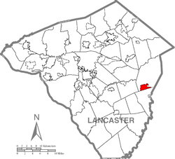
Gap is in eastern Lancaster County, in the southern part of Salisbury Township. A small portion of the community extends south into Sadsbury Township. The gap for which the community is named is at an elevation of 580 feet (180 m) above sea level, between Mine Ridge to the west and Gap Hill to the east, both ridges rising to about 750 feet (230 m) above sea level. The community occupies the center of the gap and extends northward downslope into Salisbury Township.

According to the United States Census Bureau, the CDP has a total area of 2.8 square miles (7.3 km2), of which 2.0 acres (7,943 m2), or 0.11%, are water. The gap separates the watersheds of two tributaries of the Susquehanna River. To the north, streams flow to Pequea Creek, which flows west to the Susquehanna at Pequea. To the south, water flows to the East Branch of Octoraro Creek, reaching the Susquehanna just south of Conowingo Dam in Maryland.

Roads

U.S. Route 30 (the Lincoln Highway) passes through Gap, leading west 16 miles (26 km) to Lancaster and east 10 miles (16 km) to Coatesville and eventually Philadelphia.

Pennsylvania Route 41 begins in Gap at US 30 and leads southeast 30 miles (48 km) to the Wilmington, Delaware, area. It is a major route for commercial trucks.[ citation needed ]

Pennsylvania Route 772 starts four blocks west of the intersection of PA 41 and US 30. It leads northwest 21 miles (34 km) to Lititz, passing through Intercourse, Leola, Brownstown, and Rothsville along the way.

In August 2016, a major realignment project was completed, separating eastbound and westbound traffic on US Route 30 between PA Route 41 and just west of PA Route 772. This has mostly eliminated the previous congestion problems that often plagued that area. [10]

Pennsylvania Route 897 starts in Gap one block east of Route 41 at US 30. It leads north 11 miles (18 km) to Blue Ball, passing over Welsh Mountain along the way.

Pennsylvania Route 741 starts at the intersection of PA 41 and Bridge Street in the center of the gap. The route leads west 19 miles (31 km) to Millersville.

The Gap Fire Co. is located along Pequea Avenue, one block west of PA 41. The fire company was originally located atop Pequea Avenue by their water refilling area. The original fire house was renovated into a home that is leased out. A new facility was built to house all of the rescue trucks. [11] Up the street another block is a historic building which was used for the Pequea Feeds Company.[ citation needed ]

Demographics

Historical population
CensusPop.Note
2020 2,186
U.S. Decennial Census [12]
The Gap Town Clock Gap Town Clock.jpg
The Gap Town Clock

As of the census [13] of 2000, there were 1,611 people, 572 households, and 459 families residing in the CDP. The population density was 576.5 inhabitants per square mile (222.6/km2). There were 597 housing units at an average density of 213.6 units per square mile (82.5 units/km2). The racial makeup of the CDP was 97.89% White, 0.43% Black or African American, 0.06% Native American, 1.06% Asian, 0.12% Pacific Islander, 0.12% from other races, and 0.31% from two or more races. 0.81% of the population were Hispanic or Latino of any race.

There were 572 households, out of which 38.8% had children under the age of 18 living with them, 68.7% were married couples living together, 7.2% had a female householder with no husband present, and 19.6% were non-families. 16.4% of all households were made up of individuals, and 5.8% had someone living alone who was 65 years of age or older. The average household size was 2.82 and the average family size was 3.14.

In the CDP, the population was spread out, with 29.4% under the age of 18, 7.1% from 18 to 24, 29.7% from 25 to 44, 23.7% from 45 to 64, and 10.1% who were 65 years of age or older. The median age was 36 years. For every 100 females, there were 98.2 males. For every 100 females age 18 and over, there were 95.9 males.

The median income for a household in the CDP was $46,036, and the median income for a family was $51,181. Males had a median income of $38,958 versus $24,803 for females. The per capita income for the CDP was $18,052. About 4.4% of families and 4.3% of the population were below the poverty line, including none of those under age 18 and 19.5% of those age 65 or over.

Attractions

The Gap Town Clock, built in 1892, is a Lancaster County Historic Preservation Trust Site. According to the Gap Clock Tower Association, "The clock's face, long telling the time to passing multitudes, overlooks, at the gap, William Penns' entrance into Conestoga, now Lancaster County, in 1701." [14]

Notable people

Related Research Articles

<span class="mw-page-title-main">Paradise, Pennsylvania</span> Census-designated place in Pennsylvania, United States

Paradise is an unincorporated community and census-designated place (CDP) in Lancaster County, Pennsylvania, United States, with a ZIP code of 17562. The population was 1,129 at the 2010 census.

<span class="mw-page-title-main">Willow Street, Pennsylvania</span> Census-designated place in Pennsylvania, United States

Willow Street is an unincorporated community and census-designated place (CDP) in Lancaster County, Pennsylvania, United States. The population was 7,578 at the 2010 census. In the early part of the 20th century, the main thoroughfare in town was lined with willow trees on both sides for the length of the town, hence the community's name. As time passed and the town grew, the road was widened and sidewalks were installed, which required the trees be removed. Only a few of the original trees remain to this day.

<span class="mw-page-title-main">Strasburg, Pennsylvania</span> Borough in Pennsylvania, United States

Strasburg is a borough in Lancaster County, Pennsylvania, United States. It developed as a linear village stretching approximately 2 miles (3 km) along the Great Conestoga Road, later known as the Strasburg Road. The population was 3,117 at the 2020 census.

<span class="mw-page-title-main">Brickerville, Pennsylvania</span> Census-designated place in Pennsylvania, United States

Brickerville is an unincorporated community and census-designated place (CDP) in Elizabeth Township, Lancaster County, Pennsylvania, United States, with a ZIP code of 17543. The population was 1,309 at the 2010 census.

<span class="mw-page-title-main">Dunnstown, Pennsylvania</span> Census-designated place in Pennsylvania, United States

Dunnstown is a census-designated place (CDP) in Clinton County, Pennsylvania, United States. The population was 1,360 at the 2010 census.

<span class="mw-page-title-main">Espy, Pennsylvania</span> Census-designated place in Pennsylvania, United States

Espy is a census-designated place (CDP) in Columbia County, Pennsylvania, United States. It is part of Northeastern Pennsylvania. The population was 1,620 at the 2020 census. It is part of the Bloomsburg-Berwick micropolitan area. Espy was first settled in the late 18th century. It was home to a boatyard in the 19th century.

<span class="mw-page-title-main">Mifflinville, Pennsylvania</span> Census-designated place in Pennsylvania, United States

Mifflinville is an unincorporated community and census-designated place (CDP) in Columbia County, Pennsylvania, United States. It is part of Northeastern Pennsylvania. The population was 1,253 at the 2010 census. It is part of the Bloomsburg-Berwick micropolitan area.

<span class="mw-page-title-main">Rupert, Pennsylvania</span> Census-designated place in Pennsylvania, United States

Rupert is a census-designated place (CDP) in Columbia County, Pennsylvania, United States. It is part of Northeastern Pennsylvania. The population was 183 at the 2010 census. It is part of the Bloomsburg-Berwick micropolitan area.

Mount Cobb is an unincorporated community and census-designated place (CDP) in Lackawanna County, Pennsylvania, United States. The population was 1,799 at the 2010 census.

<span class="mw-page-title-main">Quarryville, Pennsylvania</span> Borough in Pennsylvania, United States

Quarryville is a borough in Lancaster County, Pennsylvania, United States. The population was 2,852 at the 2020 census, an increase over the figure of 2,576 tabulated in 2010.

<span class="mw-page-title-main">Reamstown, Pennsylvania</span> Census-designated place in Pennsylvania, United States

Reamstown is an unincorporated community and census-designated place (CDP) in Lancaster County, Pennsylvania, United States. The population was 3,361 at the 2010 census.

<span class="mw-page-title-main">Rothsville, Pennsylvania</span> Census-designated place in Pennsylvania, United States

Rothsville is an unincorporated community and census-designated place (CDP) in Warwick Township, Lancaster County, Pennsylvania, United States. The population was 3,044 at the 2010 census. Lititz is the town for residents' mailing addresses.

<span class="mw-page-title-main">Mountain Top, Pennsylvania</span> Census-designated place in Pennsylvania, United States

Mountain Top is an unincorporated area and census-designated place (CDP) in Luzerne County, Pennsylvania, United States. As of the 2010 census, its population was 10,982.

Brownstown is an unincorporated community and census-designated place (CDP) in West Earl Township, Lancaster County, Pennsylvania, United States. As of the 2010 census, the population was 2,816.

<span class="mw-page-title-main">Georgetown, Lancaster County, Pennsylvania</span> Census-designated place in Pennsylvania, United States

Georgetown is an unincorporated community and census-designated place (CDP) in Bart Township, Lancaster County, Pennsylvania, United States. As of the 2010 census, the population was 1,022. Georgetown has a post office for P.O. boxes that is called Bart and has the ZIP code of 17503. Otherwise, the CDP is divided into three ZIP code areas for more distant communities.

<span class="mw-page-title-main">Smoketown, Pennsylvania</span> Census-designated place in Pennsylvania, United States

Smoketown is an unincorporated village and census-designated place (CDP) in East Lampeter Township, Lancaster County, Pennsylvania, United States. Also known as Smoke Town, it is served by the Smoketown Airport. As of the 2010 census, it had a population of 357.

Wakefield is an unincorporated community and census-designated place (CDP) within Fulton Township, Lancaster County, Pennsylvania, United States. As of the 2010 census, the population was 609. It is the largest community within the "Peach Bottom" ZIP code, with the area post office on Pennsylvania Route 272, just north of town.

<span class="mw-page-title-main">Refton, Pennsylvania</span> Census-designated place in Pennsylvania, United States

Refton is an unincorporated community and census-designated place (CDP) in Strasburg Township, Lancaster County, Pennsylvania, United States, with a ZIP code of 17560. The community is located along U.S. Route 222. As of the 2010 census, the population was 298.

<span class="mw-page-title-main">Lampeter, Pennsylvania</span> Census-designated place in Pennsylvania, United States

Lampeter is an unincorporated community and census-designated place (CDP) in West Lampeter Township, Lancaster County, Pennsylvania, United States. As of the 2010 census, it had a population of 1,669. It is a suburb of Lancaster and has a ZIP code of 17537. The community was named after Lampeter, in Wales.

<span class="mw-page-title-main">Soudersburg, Pennsylvania</span> Census-designated place in Pennsylvania, United States

Soudersburg is an unincorporated community and census-designated place (CDP) in East Lampeter and Leacock townships in Lancaster County, Pennsylvania, United States. As of the 2010 census, the population was 540.

References

  1. "ArcGIS REST Services Directory". United States Census Bureau. Retrieved October 12, 2022.
  2. "Census Population API". United States Census Bureau. Retrieved October 12, 2022.
  3. "Gap". Geographic Names Information System . United States Geological Survey, United States Department of the Interior.
  4. "Total Population: 2010 Census DEC Summary File 1 (P1), Gap CDP, Pennsylvania". data.census.gov. U.S. Census Bureau. Retrieved September 22, 2020.
  5. Espenshade, Abraham Howry (1925). Pennsylvania Place Names. Evangelical Press. p. 310. ISBN   978-0-8063-0416-8.
  6. Harris, Alex (1872). A Biographical History of Lancaster County. Lancaster, PA: Elias Barr & Co.
  7. Roddy, Henry Justin (1917). Physical and Industrial Geography of Lancaster County, Pennsylvania. Lancaster, PA: The New Era Printing Company. p. 62.
  8. Logan, Rebecca (October 10, 2019). "Buildings in Gap historic district may soon become part of the past [with photos]". LNP Lancaster Online. Archived from the original on January 25, 2021. Retrieved March 20, 2022.
  9. "Tried For High Treason - A celebrated incident of the Fugitive Slave Law. Citizens of Lancaster County, Penn., will celebrate an event which has become historical" (PDF). The New York Times . New York. August 15, 1888. ISSN   0362-4331. Archived (PDF) from the original on December 4, 2022. Retrieved December 8, 2013.
  10. "New bypass for routes 30 and 41 Gap bottleneck project now open to traffic | Local News | lancasteronline.com".
  11. Gap Fire Company
  12. "Census of Population and Housing". Census.gov. Retrieved June 4, 2016.
  13. "U.S. Census website". United States Census Bureau . Retrieved January 31, 2008.
  14. Gap Clock Tower Association, Gap Town Clock onsite descriptions.