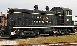
Strasburg Township, Pennsylvania | |
---|---|
Country | United States |
State | Pennsylvania |
County | Lancaster |
Settled | 1712 |
Incorporated | 1730 |
Government | |
• Type | Board of Supervisors |
Area | |
• Total | 20.14 sq mi (52.16 km2) |
• Land | 19.98 sq mi (51.75 km2) |
• Water | 0.16 sq mi (0.41 km2) |
Population | |
• Total | 4,467 |
• Estimate (2021) [2] | 4,466 |
• Density | 214.02/sq mi (82.63/km2) |
Time zone | UTC-5 (Eastern (EST)) |
• Summer (DST) | UTC-4 (EDT) |
Area code | 717 |
FIPS code | 42-071-74720 |
Website | www |
Strasburg Township is a township in south central Lancaster County, Pennsylvania, United States. The population was 4,467 at the 2020 census. [2]
According to the United States Census Bureau, the township has a total area of 20.0 square miles (51.9 km2), of which 20.0 square miles (51.8 km2) are land and 0.04 square miles (0.1 km2), or 0.20%, are water. The township surrounds the borough of Strasburg, a separate municipality. Unincorporated communities in the township include Refton and Hessdale.
Census | Pop. | Note | %± |
---|---|---|---|
2000 | 4,021 | — | |
2010 | 4,182 | 4.0% | |
2020 | 4,467 | 6.8% | |
2021 (est.) | 4,466 | [2] | 0.0% |
U.S. Decennial Census [3] |
At the 2000 census there were 4,021 people, 1,275 households, and 1,071 families living in the township. The population density was 201.1 inhabitants per square mile (77.6/km2). There were 1,295 housing units at an average density of 64.8 per square mile (25.0/km2). The racial makeup of the township was 98.96% White, 0.20% African American, 0.02% Native American, 0.10% Asian, 0.05% Pacific Islander, 0.07% from other races, and 0.60% from two or more races. Hispanic or Latino of any race were 0.25%. [4]
There were 1,275 households, 41.8% had children under the age of 18 living with them, 77.4% were married couples living together, 4.4% had a female householder with no husband present, and 16.0% were non-families. 13.8% of households were made up of individuals, and 6.6% were one person aged 65 or older. The average household size was 3.15 and the average family size was 3.50.
The age distribution was 32.8% under the age of 18, 8.7% from 18 to 24, 25.7% from 25 to 44, 23.4% from 45 to 64, and 9.4% 65 or older. The median age was 33 years. For every 100 females, there were 102.7 males. For every 100 females age 18 and over, there were 97.2 males.
The median household income was $55,750 and the median family income was $58,849. Males had a median income of $35,704 versus $25,030 for females. The per capita income for the township was $18,556. About 4.7% of families and 4.7% of the population were below the poverty line, including 4.6% of those under age 18 and 5.8% of those age 65 or over.
Strasburg is a borough in Lancaster County, Pennsylvania, United States. It developed as a linear village stretching approximately 2 miles (3 km) along the Great Conestoga Road, later known as the Strasburg Road. The population was 3,117 at the 2020 census.
Conestoga Township is a township in west central Lancaster County, Pennsylvania. At the 2020 census, the population was 3,922.
Conoy Township is a township in northwestern Lancaster County, Pennsylvania, United States. At the 2020 census, the population was 3,373.
East Earl Township is a township in northeastern Lancaster County, Pennsylvania, United States. At the 2020 census, the population was 6,721.
East Lampeter Township is a township in central Lancaster County, Pennsylvania, United States. At the 2020 census, the population was 17,834.
Fulton Township is a township in southern Lancaster County, Pennsylvania, United States, and it is the only municipality in the county to touch the Maryland border. At the 2020 census the population was 3,227. It is part of the Solanco School District.
Warren Township is a township in Bradford County, Pennsylvania. It is part of Northeastern Pennsylvania. The population was 959 at the 2010 census.
Penn Township is a township in Clearfield County, Pennsylvania, United States. The population was 1,203 at the 2020 census.
Gaskill Township is a township in Jefferson County, Pennsylvania, United States. The population was 677 at the 2020 census. It was named for Charles C. Gaskill, agent of the Holland Land Company.
Clay Township is a township in north central Lancaster County, Pennsylvania, United States. The population was 6,887 at the 2020 census.
Earl Township is a township in northeastern Lancaster County, Pennsylvania, United States. The population was 7,149 at the 2020 census.
Ceres Township is a township in McKean County, Pennsylvania, United States. The population was 842 at the 2020 census.
Bingham Township is a township in Potter County, Pennsylvania, United States. The population was 621 at the 2020 census.
Genesee Township is a township in Potter County, Pennsylvania, United States and lies near the source of the Genesee River. The population was 729 at the 2020 census. The name Genesee derives from Indian term for "beautiful valley".
Oswayo Township is a township in Potter County, Pennsylvania, United States. The population was 224 at the 2020 census.
Deerfield Township is a township in Tioga County, Pennsylvania, United States. The population was 541 at the 2020 census.
Buffalo Township is a township in Union County, Pennsylvania, United States. The population was 3,536 at the 2020 census.
Farmington Township is a township in Warren County, Pennsylvania, United States. The population was 1,281 at the 2020 census, up from 1,259 in 2010.
Pine Grove Township is a township in Warren County, Pennsylvania, United States. As of the 2020 census, the township population was 2,603, down from 2,965 at the 2010 census.
Lower Windsor Township is a township in York County, Pennsylvania, United States. The population was 7,511 at the 2020 census. Samuel S. Lewis State Park overlooks the Susquehanna River in the eastern part of the township.