Reamstown, Pennsylvania

Last updated

Reamstown, Pennsylvania
7703 - Reamstown - StateSt at ChurchSt.JPG
North Reamstown Road at Church Street
Map of Pennsylvania highlighting Lancaster County.svg
Reamstown, Lancaster County Highlighted.png
Reamstown's location in Lancaster County
Coordinates: 40°12′43″N76°7′3″W / 40.21194°N 76.11750°W / 40.21194; -76.11750
Country Flag of the United States.svg  United States
State Pennsylvania
County Lancaster
Township East Cocalico
Area
[1]
  Total2.27 sq mi (5.88 km2)
  Land2.26 sq mi (5.85 km2)
  Water0.01 sq mi (0.04 km2)
  [2]
Elevation
392 ft (119 m)
Population
 (2020) [3]
  Total3,367
  Density1,491.80/sq mi (575.96/km2)
  [4]
Time zone UTC-5 (EST)
  Summer (DST) UTC-4 (EDT)
ZIP Code
17567
Area code 717
FIPS code 42-63664
GNIS feature ID1184739

Reamstown (Pennsylvania Dutch: Riemeschteddel) is an unincorporated community and census-designated place (CDP) in Lancaster County, Pennsylvania, United States. The population was 3,361 at the 2010 census. [4]

Contents

Geography

Reamstown is located in northeastern Lancaster County at 40°12′43″N76°7′3″W / 40.21194°N 76.11750°W / 40.21194; -76.11750 (40.212046, -76.117587), [5] in the southern part of East Cocalico Township. It is bordered to the northwest by the borough of Denver.

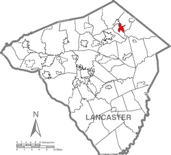
Pennsylvania Route 272 passes through the community north of the downtown section. PA 272 leads northeast 4 miles (6 km) to Adamstown and southwest the same distance to Ephrata. U.S. Route 222, a four-lane expressway, passes through the south side of the Reamstown CDP, but the closest access is 2 miles (3 km) to the northeast, from Colonel Howard Boulevard, which also provides access to the Pennsylvania Turnpike. Reading is 15 miles (24 km) northeast of Reamstown, Lancaster is 17 miles (27 km) to the southwest, and Philadelphia is 62 miles (100 km) to the southeast.

According to the United States Census Bureau, the CDP has a total area of 2.3 square miles (5.9 km2), of 0.02 square miles (0.04 km2), or 0.63%, are water. [2] Cocalico Creek runs along the northwestern edge of the CDP, flowing southwest to the Conestoga River, which continues southwest to the Susquehanna.

History

The town was named after Eberhard Ream (Johann Eberhardt Riehm 1687–1779), whose son, Tobias Ream, founded it in the 1740s. It was originally known as "Zohar." [6]

During the American Revolution, Reamstown served as one of a number of field hospitals for the wounded following the Battle of Brandywine on September 11, 1777. A dozen or more of these troops died here and are buried in unmarked graves in the Salem Evangelical Cemetery. The cemetery is also home to a large boulder that once served as a mortar and pestle by the native people who lived on nearby Ephrata Mountain to the south. It was transported to Reamstown by Pierce Lesher, and today a plaque on the stone details both the Native American and military history.[ citation needed ]

Demographics

Historical population
CensusPop.Note
2020 3,367
U.S. Decennial Census [7]

As of the census [8] of 2000, there were 3,498 people, 1,161 households, and 897 families living in the CDP. The population density was 1,542.0 inhabitants per square mile (595.4/km2). There were 1,194 housing units at an average density of 526.3 per square mile (203.2/km2). The racial makeup of the CDP was 95.23% White, 0.31% African American, 0.26% Native American, 2.23% Asian, 0.03% Pacific Islander, 0.80% from other races, and 1.14% from two or more races. Hispanic or Latino of any race were 1.92% of the population.

There were 1,161 households, out of which 41.6% had children under the age of 18 living with them, 67.9% were married couples living together, 6.1% had a female householder with no husband present, and 22.7% were non-families. 18.1% of all households were made up of individuals, and 6.5% had someone living alone who was 65 years of age or older. The average household size was 2.85 and the average family size was 3.25.

In the CDP, the population was spread out, with 28.6% under the age of 18, 6.0% from 18 to 24, 33.3% from 25 to 44, 19.8% from 45 to 64, and 12.3% who were 65 years of age or older. The median age was 36 years. For every 100 females, there were 99.7 males. For every 100 females age 18 and over, there were 97.6 males.

The median income for a household in the CDP was $53,423, and the median income for a family was $58,625. Males had a median income of $40,516 versus $25,625 for females. The per capita income for the CDP was $21,143. About 3.3% of families and 5.5% of the population were below the poverty line, including 9.1% of those under age 18 and 4.8% of those age 65 or over.

Notable person

Related Research Articles

<span class="mw-page-title-main">Akron, Pennsylvania</span> Borough in Pennsylvania, United States

Akron is a borough in Lancaster County, Pennsylvania, United States. As of the 2020 census, it had a population of 4,169,

<span class="mw-page-title-main">Ephrata, Pennsylvania</span> Borough in Pennsylvania, United States

Ephrata is a borough in Lancaster County, Pennsylvania, United States. It is located 42 miles (68 km) east of Harrisburg and about 60 miles (97 km) west-northwest of Philadelphia and is named after Ephrath, the former name for current-day Bethlehem, which is now a Syriac Aramaic-, Hebrew- and Arabic-speaking community in Palestine. In its early history, Ephrata was a pleasure resort and an agricultural community.

<span class="mw-page-title-main">Denver, Pennsylvania</span> Borough in Pennsylvania, United States

Denver is a borough in Lancaster County, Pennsylvania, United States. The population was 3,794 at the 2020 census, a decline from the figure of 3,861 tabulated in 2010.

Rheems is an unincorporated community and census-designated place (CDP) in Lancaster County, Pennsylvania, United States, between the boroughs of Elizabethtown and Mount Joy. The population was 1,598 during the 2010 census.

<span class="mw-page-title-main">Willow Street, Pennsylvania</span> Census-designated place in Pennsylvania, United States

Willow Street is an unincorporated community and census-designated place (CDP) in Lancaster County, Pennsylvania, United States. The population was 7,578 at the 2010 census. In the early part of the 20th century, the main thoroughfare in town was lined with willow trees on both sides for the length of the town, hence the community's name. As time passed and the town grew, the road was widened and sidewalks were installed, which required the trees be removed. Only a few of the original trees remain to this day.

<span class="mw-page-title-main">Brickerville, Pennsylvania</span> Census-designated place in Pennsylvania, United States

Brickerville is an unincorporated community and census-designated place (CDP) in Elizabeth Township, Lancaster County, Pennsylvania, United States, with a ZIP code of 17543. The population was 1,309 at the 2010 census.

<span class="mw-page-title-main">East Cocalico Township, Lancaster County, Pennsylvania</span> Township in Pennsylvania, United States

East Cocalico Township is a township in northeastern Lancaster County, Pennsylvania, United States. At the 2020 census, the population was 10,808.

<span class="mw-page-title-main">South Heidelberg Township, Berks County, Pennsylvania</span> Township in Pennsylvania, United States

South Heidelberg Township is a township in Berks County, Pennsylvania, United States. The population was 7,271 at the 2010 census.

<span class="mw-page-title-main">Ephrata Township, Lancaster County, Pennsylvania</span> Township in Pennsylvania, United States

Ephrata Township is a township in northeastern Lancaster County, Pennsylvania, United States. The population was 10,391 at the 2020 census.

<span class="mw-page-title-main">Rothsville, Pennsylvania</span> Census-designated place in Pennsylvania, United States

Rothsville is an unincorporated community and census-designated place (CDP) in Warwick Township, Lancaster County, Pennsylvania, United States. The population was 3,044 at the 2010 census. Lititz is the town for residents' mailing addresses.

<span class="mw-page-title-main">West Cocalico Township, Lancaster County, Pennsylvania</span> Township in Pennsylvania, United States

West Cocalico Township is a township that is located in northeastern Lancaster County, Pennsylvania, United States. The population was 7,491 at the time of the 2020 census.

Campbelltown is an unincorporated community and census-designated place (CDP) in Lebanon County, Pennsylvania, United States. The population was 3,616 at the 2010 census. It is located east of Hershey at the intersection of U.S. Route 322 and Pennsylvania Route 117 and is located in the Harrisburg metropolitan area.

<span class="mw-page-title-main">Quentin, Pennsylvania</span> Census-designated place in Pennsylvania, United States

Quentin is an unincorporated community and census-designated place (CDP) in Lebanon County, Pennsylvania, United States. It was named after Quentin Roosevelt, youngest son of President Theodore Roosevelt. The population was 594 at the 2010 census, up from 529 at the 2000 census.

Brownstown is an unincorporated community and census-designated place (CDP) in West Earl Township, Lancaster County, Pennsylvania, United States. As of the 2010 census, the population was 2,816.

<span class="mw-page-title-main">Adamstown, Pennsylvania</span> Place in Pennsylvania, United States

Adamstown is a borough that is located in Lancaster County and Berks County in the U.S. state of Pennsylvania.

Hopeland is a small unincorporated hamlet and census-designated place (CDP) in Lancaster County in the south of the U.S. state of Pennsylvania. The hamlet's ZIP code is 17533. As of the 2010 census the population was 738.

Stevens is an unincorporated community and census-designated place (CDP) in Lancaster County, Pennsylvania, United States. As of the 2010 census, it had a population of 612. The Stevens post office has ZIP code 17578.

<span class="mw-page-title-main">Reinholds, Pennsylvania</span> Census-designated place in Pennsylvania, United States

Reinholds is an unincorporated community and census-designated place (CDP) in West Cocalico Township, Lancaster County, Pennsylvania, United States. As of the 2010 census the population was 1,803.

<span class="mw-page-title-main">Schoeneck, Pennsylvania</span> Census-designated place in Pennsylvania, United States

Schoeneck is an unincorporated community and census-designated place (CDP) that is located in West Cocalico Township, Lancaster County, Pennsylvania, United States. The name Schoeneck is a corruption of the Pennsylvania Dutch phrase, "Schoenes Eck," which translates to "pretty corner."

Swartzville is an unincorporated community and census-designated place (CDP) in East Cocalico Township, Lancaster County, Pennsylvania, United States. As of the 2010 census, the population was 2,283.

References

  1. "ArcGIS REST Services Directory". United States Census Bureau. Retrieved August 8, 2023.
  2. 1 2 "2019 U.S. Gazetteer Files: Places: Pennsylvania". United States Census Bureau. Retrieved September 29, 2020.
  3. "Census Population API". United States Census Bureau. Retrieved August 8, 2023.
  4. 1 2 "Total Population: 2010 Census DEC Summary File 1 (P1), Reamstown CDP, Pennsylvania". data.census.gov. U.S. Census Bureau. Retrieved September 29, 2020.
  5. "US Gazetteer files: 2010, 2000, and 1990". United States Census Bureau. February 12, 2011. Retrieved April 23, 2011.
  6. "Pioneer Settler / Founder of Reamstown". THE HISTORICAL MARKER DATABASE. Retrieved May 7, 2021.
  7. "Census of Population and Housing". Census.gov. Retrieved June 4, 2016.
  8. "U.S. Census website". United States Census Bureau . Retrieved January 31, 2008.